![](/images/other/stat-length.png)
- Trails
- Outdoor
- Germany
- Bavaria
- Landkreis Schwandorf
- Pfreimd
Pfreimd, Landkreis Schwandorf: Best trails, routes and walks
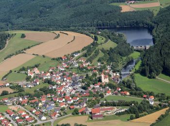
Pfreimd: Discover the best trails: 4 hiking trails. All these trails, routes and outdoor activities are available in our SityTrail applications for smartphones and tablets.
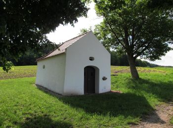
The best trails (4)
![Trail On foot Pfreimd - Wanderroute Pfeimd/Sportplatz - Stein - Photo](https://media.geolcdn.com/t/350/260/5d54c03a-c3e3-4aba-82bd-40d718b080fe.jpeg&format=jpg&maxdim=2)
![On foot On foot](https://static1.geolcdn.com/sitytour/trail-icons/100.png)
Km
On foot
![](/images/other/stat-length.png)
![](https://static1.geolcdn.com/siteimages/upload/files/1508320355ic_sort_den_pos_24dp.png)
![](https://static1.geolcdn.com/siteimages/upload/files/1508320355ic_sort_den_neg_24dp.png)
![](https://static1.geolcdn.com/siteimages/upload/files/16400158638029165_repeat_loop_refresh_sync_direction_icon.png)
• Trail created by Oberpfälzer Waldverein. Symbol: rote Kreisscheibe Website: https://www.owv-pfreimd.de/wanderwege.php
![Trail On foot Pfreimd - Eixlberg Rundweg 1 - Photo](https://media.geolcdn.com/t/350/260/8b2dadfd-02ec-4820-9278-99f3f491901f.jpeg&format=jpg&maxdim=2)
![On foot On foot](https://static1.geolcdn.com/sitytour/trail-icons/100.png)
Km
On foot
![](/images/other/stat-length.png)
![](https://static1.geolcdn.com/siteimages/upload/files/1508320355ic_sort_den_pos_24dp.png)
![](https://static1.geolcdn.com/siteimages/upload/files/1508320355ic_sort_den_neg_24dp.png)
![](https://static1.geolcdn.com/siteimages/upload/files/16400158638029165_repeat_loop_refresh_sync_direction_icon.png)
• Trail created by Oberpfälzer Waldverein. Symbol: schwarze 1 auf orangem Grund
![Trail On foot Pfreimd - Trausnitz-Stein-Hohentreßwitz - Photo](https://media.geolcdn.com/t/350/260/049068ef-ccdd-4dca-bc72-ad8d6837344b.jpeg&format=jpg&maxdim=2)
![On foot On foot](https://static1.geolcdn.com/sitytour/trail-icons/100.png)
Km
On foot
![](/images/other/stat-length.png)
![](https://static1.geolcdn.com/siteimages/upload/files/1508320355ic_sort_den_pos_24dp.png)
![](https://static1.geolcdn.com/siteimages/upload/files/1508320355ic_sort_den_neg_24dp.png)
![](https://static1.geolcdn.com/siteimages/upload/files/16400158638029165_repeat_loop_refresh_sync_direction_icon.png)
• Trail created by Oberpfälzer Wald-Verein.
![Trail On foot Pfreimd - Wanderroute Pfreimd/Sportplatz - Weihern - Photo](https://media.geolcdn.com/t/350/260/ext.jpg?maxdim=2&url=https%3A%2F%2Fstatic1.geolcdn.com%2Fsiteimages%2Fupload%2Ffiles%2F1545311037marcheuse_200dpi.jpg)
![On foot On foot](https://static1.geolcdn.com/sitytour/trail-icons/100.png)
Km
On foot
![](/images/other/stat-length.png)
![](https://static1.geolcdn.com/siteimages/upload/files/1508320355ic_sort_den_pos_24dp.png)
![](https://static1.geolcdn.com/siteimages/upload/files/1508320355ic_sort_den_neg_24dp.png)
![](https://static1.geolcdn.com/siteimages/upload/files/16400158638029165_repeat_loop_refresh_sync_direction_icon.png)
• Trail created by Oberpfälzer Wald-Verein. Website: https://www.owv-pfreimd.de/wanderwege.php
4 trails displayed on 4
FREE GPS app for hiking