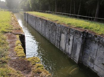
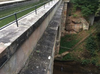
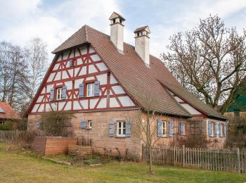
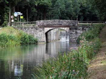
![](/images/other/stat-length.png)
- Trails
- Outdoor
- Germany
- Bavaria
- Nürnberger Land
- Schwarzenbruck
Schwarzenbruck, Nürnberger Land: Best trails, routes and walks
Schwarzenbruck: Discover the best trails: 8 hiking trails. All these trails, routes and outdoor activities are available in our SityTrail applications for smartphones and tablets.
The best trails (8)
![Trail On foot Schwarzenbruck - Wasserwirtschaftlicher Lehrpfad - Photo](https://media.geolcdn.com/t/350/260/b0319dda-20db-4be0-af00-785a7535acd1.jpeg&format=jpg&maxdim=2)
![On foot On foot](https://static1.geolcdn.com/sitytour/trail-icons/100.png)
Km
On foot
![](/images/other/stat-length.png)
![](https://static1.geolcdn.com/siteimages/upload/files/1508320355ic_sort_den_pos_24dp.png)
![](https://static1.geolcdn.com/siteimages/upload/files/1508320355ic_sort_den_neg_24dp.png)
![](https://static1.geolcdn.com/siteimages/upload/files/16400158638029165_repeat_loop_refresh_sync_direction_icon.png)
• Trail created by Gemeinde Schwarzenbruck. geprüft (März 2015, by cycling_zno) Symbol: Blaue Tafeln
![Trail On foot Schwarzenbruck - Ludwig-Donau-Main-Kanal - Photo](https://media.geolcdn.com/t/350/260/e0041d59-f977-4019-9bca-73a18aaf906d.jpeg&format=jpg&maxdim=2)
![On foot On foot](https://static1.geolcdn.com/sitytour/trail-icons/100.png)
Km
On foot
![](/images/other/stat-length.png)
![](https://static1.geolcdn.com/siteimages/upload/files/1508320355ic_sort_den_pos_24dp.png)
![](https://static1.geolcdn.com/siteimages/upload/files/1508320355ic_sort_den_neg_24dp.png)
![](https://static1.geolcdn.com/siteimages/upload/files/16400158638029165_repeat_loop_refresh_sync_direction_icon.png)
• Trail created by Markt Wendelstein. abgeschlossen (Nov. 2013 by cycling_zno) Symbol: Weiße 1 auf blauem Grund
![Trail On foot Schwarzenbruck - Schwarzenbruck Wanderweg - Photo](https://media.geolcdn.com/t/350/260/c66a9262-6620-4416-9064-1fcf57b36aff.jpeg&format=jpg&maxdim=2)
![On foot On foot](https://static1.geolcdn.com/sitytour/trail-icons/100.png)
Km
On foot
![](/images/other/stat-length.png)
![](https://static1.geolcdn.com/siteimages/upload/files/1508320355ic_sort_den_pos_24dp.png)
![](https://static1.geolcdn.com/siteimages/upload/files/1508320355ic_sort_den_neg_24dp.png)
![](https://static1.geolcdn.com/siteimages/upload/files/16400158638029165_repeat_loop_refresh_sync_direction_icon.png)
• Trail created by Gemeinde Schwarzenbruck. geprüft (März 2015, by cycling_zno) Symbol: Weisse 3 auf grünem Rechteck
![Trail On foot Schwarzenbruck - Schwarzenbruck Wanderweg No.2 - Photo](https://media.geolcdn.com/t/350/260/9aa9b9ca-025d-49e5-b86c-f7b4ef4a2da2.jpeg&format=jpg&maxdim=2)
![On foot On foot](https://static1.geolcdn.com/sitytour/trail-icons/100.png)
Km
On foot
![](/images/other/stat-length.png)
![](https://static1.geolcdn.com/siteimages/upload/files/1508320355ic_sort_den_pos_24dp.png)
![](https://static1.geolcdn.com/siteimages/upload/files/1508320355ic_sort_den_neg_24dp.png)
![](https://static1.geolcdn.com/siteimages/upload/files/16400158638029165_repeat_loop_refresh_sync_direction_icon.png)
• Trail created by Gemeinde Schwarzenbruck. geprüft (März 2015, by cycling_zno) Symbol: Weiße 2 auf grünem Rechteck
![Trail On foot Schwarzenbruck - Schwarzenbruck Wanderweg No.1 - Photo](https://media.geolcdn.com/t/350/260/a42c48b6-7d1f-478a-ae56-acf1429ac00e.jpeg&format=jpg&maxdim=2)
![On foot On foot](https://static1.geolcdn.com/sitytour/trail-icons/100.png)
Km
On foot
![](/images/other/stat-length.png)
![](https://static1.geolcdn.com/siteimages/upload/files/1508320355ic_sort_den_pos_24dp.png)
![](https://static1.geolcdn.com/siteimages/upload/files/1508320355ic_sort_den_neg_24dp.png)
![](https://static1.geolcdn.com/siteimages/upload/files/16400158638029165_repeat_loop_refresh_sync_direction_icon.png)
• Trail created by Gemeinde Schwarzenbruck. geprüft (März 2015, by cycling_zno) Symbol: Weisse 1 auf grünem Rechteck
![Trail On foot Schwarzenbruck - Burgthann Walking König-Ludwig-Runde - Photo](https://media.geolcdn.com/t/350/260/b1e07fd3-e196-449a-9fa9-1966559e3150.jpeg&format=jpg&maxdim=2)
![On foot On foot](https://static1.geolcdn.com/sitytour/trail-icons/100.png)
Km
On foot
![](/images/other/stat-length.png)
![](https://static1.geolcdn.com/siteimages/upload/files/1508320355ic_sort_den_pos_24dp.png)
![](https://static1.geolcdn.com/siteimages/upload/files/1508320355ic_sort_den_neg_24dp.png)
![](https://static1.geolcdn.com/siteimages/upload/files/16400158638029165_repeat_loop_refresh_sync_direction_icon.png)
• Trail created by Gemeinde Burgthann. geprüft (Dez. 2014 by cycling_zno) Symbol: Schwarzer Walker auf gelbem Grund
![Trail On foot Schwarzenbruck - Burgthann Walking Schwarzachrunde - Photo](https://media.geolcdn.com/t/350/260/1c1297e4-a2bd-4b45-905f-c518f06e8a2c.jpeg&format=jpg&maxdim=2)
![On foot On foot](https://static1.geolcdn.com/sitytour/trail-icons/100.png)
Km
On foot
![](/images/other/stat-length.png)
![](https://static1.geolcdn.com/siteimages/upload/files/1508320355ic_sort_den_pos_24dp.png)
![](https://static1.geolcdn.com/siteimages/upload/files/1508320355ic_sort_den_neg_24dp.png)
![](https://static1.geolcdn.com/siteimages/upload/files/16400158638029165_repeat_loop_refresh_sync_direction_icon.png)
• Trail created by Gemeinde Burgthann. geprüft (Dez. 2014 by cycling_zno) Symbol: Schwarzer Walker auf grünem Grund
![Trail On foot Schwarzenbruck - Burgthann 9 - Photo](https://media.geolcdn.com/t/350/260/c5a7f256-f061-4180-9a0a-6a7f47f11983.jpeg&format=jpg&maxdim=2)
![On foot On foot](https://static1.geolcdn.com/sitytour/trail-icons/100.png)
Km
On foot
![](/images/other/stat-length.png)
![](https://static1.geolcdn.com/siteimages/upload/files/1508320355ic_sort_den_pos_24dp.png)
![](https://static1.geolcdn.com/siteimages/upload/files/1508320355ic_sort_den_neg_24dp.png)
![](https://static1.geolcdn.com/siteimages/upload/files/16400158638029165_repeat_loop_refresh_sync_direction_icon.png)
• Trail created by Gemeinde Burgthann. geprüft (Dez. 2014 by cycling_zno) Symbol: Schwarze 9 auf gelbem Grund
8 trails displayed on 8
FREE GPS app for hiking