![](/images/other/stat-length.png)
- Trails
- Outdoor
- Germany
- Bavaria
- Nürnberger Land
- Neuhaus a.d.Pegnitz
Neuhaus a.d.Pegnitz, Nürnberger Land: Best trails, routes and walks
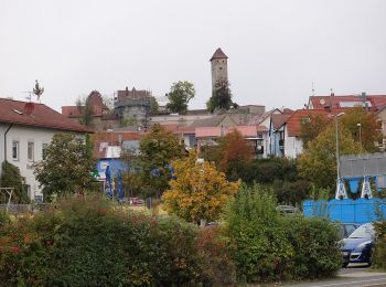
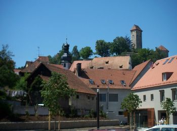
Neuhaus a.d.Pegnitz: Discover the best trails: 8 hiking trails. All these trails, routes and outdoor activities are available in our SityTrail applications for smartphones and tablets.
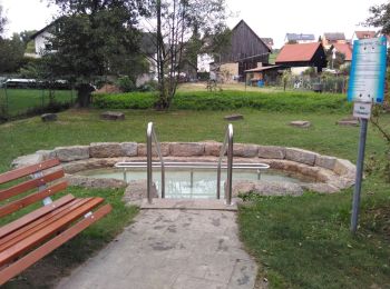
The best trails (8)
![Trail On foot Neuhaus a.d.Pegnitz - Neuhaus-Rundwanderweg No.5 - Photo](https://media.geolcdn.com/t/350/260/4461e8ef-3244-4aba-ae74-83c40aa01bd6.jpeg&format=jpg&maxdim=2)
![On foot On foot](https://static1.geolcdn.com/sitytour/trail-icons/100.png)
Km
On foot
![](/images/other/stat-length.png)
![](https://static1.geolcdn.com/siteimages/upload/files/1508320355ic_sort_den_pos_24dp.png)
![](https://static1.geolcdn.com/siteimages/upload/files/1508320355ic_sort_den_neg_24dp.png)
![](https://static1.geolcdn.com/siteimages/upload/files/16400158638029165_repeat_loop_refresh_sync_direction_icon.png)
• Trail created by Markt Neuhaus. geprüft (Jan. 2015 by cycling_zno) Symbol: Weiße 5 auf rotem Grund
![Trail On foot Neuhaus a.d.Pegnitz - Neuhaus-Rundwanderweg No.4 - Photo](https://media.geolcdn.com/t/350/260/0094bdd2-770f-412c-bba8-755c4a1d8fcc.jpeg&format=jpg&maxdim=2)
![On foot On foot](https://static1.geolcdn.com/sitytour/trail-icons/100.png)
Km
On foot
![](/images/other/stat-length.png)
![](https://static1.geolcdn.com/siteimages/upload/files/1508320355ic_sort_den_pos_24dp.png)
![](https://static1.geolcdn.com/siteimages/upload/files/1508320355ic_sort_den_neg_24dp.png)
![](https://static1.geolcdn.com/siteimages/upload/files/16400158638029165_repeat_loop_refresh_sync_direction_icon.png)
• Trail created by Markt Neuhaus. geprüft (Jan. 2015 by cycling_zno) Symbol: Weiße 4 auf rotem Grund
![Trail On foot Neuhaus a.d.Pegnitz - Neuhaus-Rundwanderweg No.1 - Photo](https://media.geolcdn.com/t/350/260/e4db9e20-5d69-4db4-8caa-4bc7bf84b8fd.jpeg&format=jpg&maxdim=2)
![On foot On foot](https://static1.geolcdn.com/sitytour/trail-icons/100.png)
Km
On foot
![](/images/other/stat-length.png)
![](https://static1.geolcdn.com/siteimages/upload/files/1508320355ic_sort_den_pos_24dp.png)
![](https://static1.geolcdn.com/siteimages/upload/files/1508320355ic_sort_den_neg_24dp.png)
![](https://static1.geolcdn.com/siteimages/upload/files/16400158638029165_repeat_loop_refresh_sync_direction_icon.png)
• Trail created by Markt Neuhaus. geprüft (Jan. 2015 by cycling_zno) Symbol: Weiße 1 auf rotem Grund
![Trail On foot Neuhaus a.d.Pegnitz - Neuhaus-Rundwanderweg No.12 - Photo](https://media.geolcdn.com/t/350/260/968d8013-9390-4628-87b0-bba362b4dc7b.jpeg&format=jpg&maxdim=2)
![On foot On foot](https://static1.geolcdn.com/sitytour/trail-icons/100.png)
Km
On foot
![](/images/other/stat-length.png)
![](https://static1.geolcdn.com/siteimages/upload/files/1508320355ic_sort_den_pos_24dp.png)
![](https://static1.geolcdn.com/siteimages/upload/files/1508320355ic_sort_den_neg_24dp.png)
![](https://static1.geolcdn.com/siteimages/upload/files/16400158638029165_repeat_loop_refresh_sync_direction_icon.png)
• Trail created by Markt Neuhaus. geprüft (Jan. 2015 by cycling_zno) Symbol: Weiße 12 auf rotem Grund
![Trail On foot Neuhaus a.d.Pegnitz - Neuhaus-Rundwanderweg No.8 - Photo](https://media.geolcdn.com/t/350/260/968d8013-9390-4628-87b0-bba362b4dc7b.jpeg&format=jpg&maxdim=2)
![On foot On foot](https://static1.geolcdn.com/sitytour/trail-icons/100.png)
Km
On foot
![](/images/other/stat-length.png)
![](https://static1.geolcdn.com/siteimages/upload/files/1508320355ic_sort_den_pos_24dp.png)
![](https://static1.geolcdn.com/siteimages/upload/files/1508320355ic_sort_den_neg_24dp.png)
![](https://static1.geolcdn.com/siteimages/upload/files/16400158638029165_repeat_loop_refresh_sync_direction_icon.png)
• Trail created by Markt Neuhaus. geprüft (Jan. 2015 by cycling_zno) Symbol: Weiße 8 auf rotem Grund
![Trail On foot Neuhaus a.d.Pegnitz - Kapellenweg 1 Neuhaus - Photo](https://media.geolcdn.com/t/350/260/4461e8ef-3244-4aba-ae74-83c40aa01bd6.jpeg&format=jpg&maxdim=2)
![On foot On foot](https://static1.geolcdn.com/sitytour/trail-icons/100.png)
Km
On foot
![](/images/other/stat-length.png)
![](https://static1.geolcdn.com/siteimages/upload/files/1508320355ic_sort_den_pos_24dp.png)
![](https://static1.geolcdn.com/siteimages/upload/files/1508320355ic_sort_den_neg_24dp.png)
![](https://static1.geolcdn.com/siteimages/upload/files/16400158638029165_repeat_loop_refresh_sync_direction_icon.png)
• Trail created by Markt Neuhaus. geprüft (Jan. 2015 by cycling_zno) Symbol: Schwarze Kapelle auf gelbem Grund
![Trail On foot Neuhaus a.d.Pegnitz - Pendolino-Wanderung - Photo](https://media.geolcdn.com/t/350/260/253fa5dd-9c24-407d-b402-7908c31add9a.jpeg&format=jpg&maxdim=2)
![On foot On foot](https://static1.geolcdn.com/sitytour/trail-icons/100.png)
Km
On foot
![](/images/other/stat-length.png)
![](https://static1.geolcdn.com/siteimages/upload/files/1508320355ic_sort_den_pos_24dp.png)
![](https://static1.geolcdn.com/siteimages/upload/files/1508320355ic_sort_den_neg_24dp.png)
![](https://static1.geolcdn.com/siteimages/upload/files/16400158638029165_repeat_loop_refresh_sync_direction_icon.png)
• Trail created by Fränkischer Albverein. Symbol: Blauer Triebwagen auf weißen Grund
![Trail On foot Neuhaus a.d.Pegnitz - Karstkundlicher Wanderpfad - Photo](https://media.geolcdn.com/t/350/260/e4db9e20-5d69-4db4-8caa-4bc7bf84b8fd.jpeg&format=jpg&maxdim=2)
![On foot On foot](https://static1.geolcdn.com/sitytour/trail-icons/100.png)
Km
On foot
![](/images/other/stat-length.png)
![](https://static1.geolcdn.com/siteimages/upload/files/1508320355ic_sort_den_pos_24dp.png)
![](https://static1.geolcdn.com/siteimages/upload/files/1508320355ic_sort_den_neg_24dp.png)
![](https://static1.geolcdn.com/siteimages/upload/files/16400158638029165_repeat_loop_refresh_sync_direction_icon.png)
• Trail created by Fränkischer Albverein. angepasst für Wanderkarte (Cycling_zno) Symbol: Grüner Punkt auf weißem Grund
8 trails displayed on 8
FREE GPS app for hiking