![](/images/other/stat-length.png)
- Trails
- Outdoor
- Germany
- Bavaria
- Landkreis Rosenheim
- Chiemsee
Chiemsee, Landkreis Rosenheim: Best trails, routes and walks
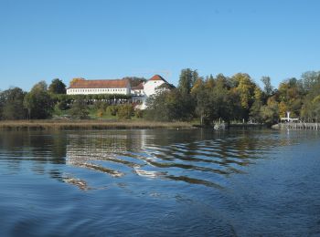
Chiemsee: Discover the best trails: 3 hiking trails. All these trails, routes and outdoor activities are available in our SityTrail applications for smartphones and tablets.
The best trails (3)
![Trail On foot Chiemsee - Rundweg - Tour 1 - Photo](https://media.geolcdn.com/t/350/260/ddfa5a3a-103c-4358-a1be-47d68e697cb0.jpeg&format=jpg&maxdim=2)
![On foot On foot](https://static1.geolcdn.com/sitytour/trail-icons/100.png)
Km
On foot
![](/images/other/stat-length.png)
![](https://static1.geolcdn.com/siteimages/upload/files/1508320355ic_sort_den_pos_24dp.png)
![](https://static1.geolcdn.com/siteimages/upload/files/1508320355ic_sort_den_neg_24dp.png)
![](https://static1.geolcdn.com/siteimages/upload/files/16400158638029165_repeat_loop_refresh_sync_direction_icon.png)
• Vor 2016 gab es einen Rundweg, der mit einem gründen "W" ausgeschildert war. Dieser Weg wurde in drei Wege aufgeteilt...
![Trail On foot Chiemsee - Rundweg - Tour 2 - Photo](https://media.geolcdn.com/t/350/260/c589e373-20ec-4a86-9891-32bd0698d01a.jpeg&format=jpg&maxdim=2)
![On foot On foot](https://static1.geolcdn.com/sitytour/trail-icons/100.png)
Km
On foot
![](/images/other/stat-length.png)
![](https://static1.geolcdn.com/siteimages/upload/files/1508320355ic_sort_den_pos_24dp.png)
![](https://static1.geolcdn.com/siteimages/upload/files/1508320355ic_sort_den_neg_24dp.png)
![](https://static1.geolcdn.com/siteimages/upload/files/16400158638029165_repeat_loop_refresh_sync_direction_icon.png)
• Vor 2016 gab es einen Rundweg, der mit einem gründen "W" ausgeschildert war. Dieser Weg wurde in drei Wege aufgeteilt...
![Trail On foot Chiemsee - Rundweg - Tour 3 - Photo](https://media.geolcdn.com/t/350/260/cef04d7e-56b0-4b14-a5b8-060fb157ffac.jpeg&format=jpg&maxdim=2)
![On foot On foot](https://static1.geolcdn.com/sitytour/trail-icons/100.png)
Km
On foot
![](/images/other/stat-length.png)
![](https://static1.geolcdn.com/siteimages/upload/files/1508320355ic_sort_den_pos_24dp.png)
![](https://static1.geolcdn.com/siteimages/upload/files/1508320355ic_sort_den_neg_24dp.png)
![](https://static1.geolcdn.com/siteimages/upload/files/16400158638029165_repeat_loop_refresh_sync_direction_icon.png)
• Vor 2016 gab es einen Rundweg, der mit einem gründen "W" ausgeschildert war. Dieser Weg wurde in drei Wege aufgeteilt...
3 trails displayed on 3
FREE GPS app for hiking