![](/images/other/stat-length.png)
- Trails
- Outdoor
- Germany
- Bavaria
- Landkreis Miltenberg
- Großheubach
Großheubach, Landkreis Miltenberg: Best trails, routes and walks
Großheubach: Discover the best trails: 17 hiking trails. All these trails, routes and outdoor activities are available in our SityTrail applications for smartphones and tablets.
The best trails (17)
![Trail On foot Großheubach - Großheubach Nordic Walking 1 - Photo](https://media.geolcdn.com/t/350/260/60747c03-761e-43d6-87be-5d32ae99cf70.jpeg&format=jpg&maxdim=2)
![On foot On foot](https://static1.geolcdn.com/sitytour/trail-icons/100.png)
Km
On foot
![](/images/other/stat-length.png)
![](https://static1.geolcdn.com/siteimages/upload/files/1508320355ic_sort_den_pos_24dp.png)
![](https://static1.geolcdn.com/siteimages/upload/files/1508320355ic_sort_den_neg_24dp.png)
![](https://static1.geolcdn.com/siteimages/upload/files/16400158638029165_repeat_loop_refresh_sync_direction_icon.png)
• Trail created by Markt Großheubach. Symbol: Schwarzes Männchen mit Stöcken auf Weißem Grund mit der Zahl 1
![Trail On foot Großheubach - Ortswanderweg Großheubach G1 - Photo](https://media.geolcdn.com/t/350/260/a42ca573-30d0-441d-870f-5922c0252889.jpeg&format=jpg&maxdim=2)
![On foot On foot](https://static1.geolcdn.com/sitytour/trail-icons/100.png)
Km
On foot
![](/images/other/stat-length.png)
![](https://static1.geolcdn.com/siteimages/upload/files/1508320355ic_sort_den_pos_24dp.png)
![](https://static1.geolcdn.com/siteimages/upload/files/1508320355ic_sort_den_neg_24dp.png)
![](https://static1.geolcdn.com/siteimages/upload/files/16400158638029165_repeat_loop_refresh_sync_direction_icon.png)
• Trail created by Spessartbund. Symbol: G1 - schwarz auf weiß
![Trail On foot Großheubach - Großheubach Engelberg - Freudenberg - Photo](https://media.geolcdn.com/t/350/260/f63e7b41-af62-46dc-8f02-a908ae31d865.jpeg&format=jpg&maxdim=2)
![On foot On foot](https://static1.geolcdn.com/sitytour/trail-icons/100.png)
Km
On foot
![](/images/other/stat-length.png)
![](https://static1.geolcdn.com/siteimages/upload/files/1508320355ic_sort_den_pos_24dp.png)
![](https://static1.geolcdn.com/siteimages/upload/files/1508320355ic_sort_den_neg_24dp.png)
![](https://static1.geolcdn.com/siteimages/upload/files/16400158638029165_repeat_loop_refresh_sync_direction_icon.png)
• Trail created by Großheubach ??. Symbol: Engelberg-Freudenberg in Linienpfeil
![Trail On foot Großheubach - W gelb, Großheubach Engelberg Rundwanderweg - Photo](https://media.geolcdn.com/t/350/260/f6fae3ee-6df4-4f9e-a6e2-08b9904b5d58.jpeg&format=jpg&maxdim=2)
![On foot On foot](https://static1.geolcdn.com/sitytour/trail-icons/100.png)
Km
On foot
![](/images/other/stat-length.png)
![](https://static1.geolcdn.com/siteimages/upload/files/1508320355ic_sort_den_pos_24dp.png)
![](https://static1.geolcdn.com/siteimages/upload/files/1508320355ic_sort_den_neg_24dp.png)
![](https://static1.geolcdn.com/siteimages/upload/files/16400158638029165_repeat_loop_refresh_sync_direction_icon.png)
• Trail created by Großheubach ??. Symbol: Gelbes W auf Khaki Grund
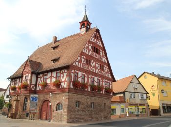
![Trail On foot Großheubach - Großheubach Rundwanderweg 8 - Photo](https://media.geolcdn.com/t/350/260/b86f9f5d-eacf-48c1-aab6-b30617cb6e97.jpeg&format=jpg&maxdim=2)
![On foot On foot](https://static1.geolcdn.com/sitytour/trail-icons/100.png)
Km
On foot
![](/images/other/stat-length.png)
![](https://static1.geolcdn.com/siteimages/upload/files/1508320355ic_sort_den_pos_24dp.png)
![](https://static1.geolcdn.com/siteimages/upload/files/1508320355ic_sort_den_neg_24dp.png)
![](https://static1.geolcdn.com/siteimages/upload/files/16400158638029165_repeat_loop_refresh_sync_direction_icon.png)
• Trail created by Großheubacher Heimat- und Verkehrsverein. Symbol: Weiße 8 auf rotem Rechteck
![Trail On foot Großheubach - Großheubach Rundwanderweg 7 - Photo](https://media.geolcdn.com/t/350/260/b86f9f5d-eacf-48c1-aab6-b30617cb6e97.jpeg&format=jpg&maxdim=2)
![On foot On foot](https://static1.geolcdn.com/sitytour/trail-icons/100.png)
Km
On foot
![](/images/other/stat-length.png)
![](https://static1.geolcdn.com/siteimages/upload/files/1508320355ic_sort_den_pos_24dp.png)
![](https://static1.geolcdn.com/siteimages/upload/files/1508320355ic_sort_den_neg_24dp.png)
![](https://static1.geolcdn.com/siteimages/upload/files/16400158638029165_repeat_loop_refresh_sync_direction_icon.png)
• Trail created by Großheubacher Heimat- und Verkehrsverein. Symbol: Weiße 7 auf rotem Rechteck
![Trail On foot Großheubach - Großheubach Weinlehrpfad - Photo](https://media.geolcdn.com/t/350/260/b86f9f5d-eacf-48c1-aab6-b30617cb6e97.jpeg&format=jpg&maxdim=2)
![On foot On foot](https://static1.geolcdn.com/sitytour/trail-icons/100.png)
Km
On foot
![](/images/other/stat-length.png)
![](https://static1.geolcdn.com/siteimages/upload/files/1508320355ic_sort_den_pos_24dp.png)
![](https://static1.geolcdn.com/siteimages/upload/files/1508320355ic_sort_den_neg_24dp.png)
![](https://static1.geolcdn.com/siteimages/upload/files/16400158638029165_repeat_loop_refresh_sync_direction_icon.png)
• Trail created by Großheubacher Weinbauverein. Symbol: Logo Weinbauverein - Weinlehrpfad
![Trail On foot Großheubach - Großheubach Rundwanderweg 1 - Photo](https://media.geolcdn.com/t/350/260/b86f9f5d-eacf-48c1-aab6-b30617cb6e97.jpeg&format=jpg&maxdim=2)
![On foot On foot](https://static1.geolcdn.com/sitytour/trail-icons/100.png)
Km
On foot
![](/images/other/stat-length.png)
![](https://static1.geolcdn.com/siteimages/upload/files/1508320355ic_sort_den_pos_24dp.png)
![](https://static1.geolcdn.com/siteimages/upload/files/1508320355ic_sort_den_neg_24dp.png)
![](https://static1.geolcdn.com/siteimages/upload/files/16400158638029165_repeat_loop_refresh_sync_direction_icon.png)
• Trail created by Großheubacher Heimat- und Verkehrsverein. Symbol: Weiße 1 auf rotem Rechteck
![Trail On foot Großheubach - Großheubach Rundwanderweg 2 - Photo](https://media.geolcdn.com/t/350/260/b86f9f5d-eacf-48c1-aab6-b30617cb6e97.jpeg&format=jpg&maxdim=2)
![On foot On foot](https://static1.geolcdn.com/sitytour/trail-icons/100.png)
Km
On foot
![](/images/other/stat-length.png)
![](https://static1.geolcdn.com/siteimages/upload/files/1508320355ic_sort_den_pos_24dp.png)
![](https://static1.geolcdn.com/siteimages/upload/files/1508320355ic_sort_den_neg_24dp.png)
![](https://static1.geolcdn.com/siteimages/upload/files/16400158638029165_repeat_loop_refresh_sync_direction_icon.png)
• Trail created by Großheubacher Heimat- und Verkehrsverein. Symbol: Weiße 2 auf rotem Rechteck
![Trail On foot Großheubach - Großheubach Rundwanderweg 3 - Photo](https://media.geolcdn.com/t/350/260/60747c03-761e-43d6-87be-5d32ae99cf70.jpeg&format=jpg&maxdim=2)
![On foot On foot](https://static1.geolcdn.com/sitytour/trail-icons/100.png)
Km
On foot
![](/images/other/stat-length.png)
![](https://static1.geolcdn.com/siteimages/upload/files/1508320355ic_sort_den_pos_24dp.png)
![](https://static1.geolcdn.com/siteimages/upload/files/1508320355ic_sort_den_neg_24dp.png)
![](https://static1.geolcdn.com/siteimages/upload/files/16400158638029165_repeat_loop_refresh_sync_direction_icon.png)
• Trail created by Großheubacher Heimat- und Verkehrsverein. Symbol: Weiße 3 auf rotem Rechteck
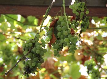
![Trail On foot Großheubach - Großheubach Rundwanderweg 4 - Photo](https://media.geolcdn.com/t/350/260/44037ac3-86fe-4aab-a225-691b98d47495.jpeg&format=jpg&maxdim=2)
![On foot On foot](https://static1.geolcdn.com/sitytour/trail-icons/100.png)
Km
On foot
![](/images/other/stat-length.png)
![](https://static1.geolcdn.com/siteimages/upload/files/1508320355ic_sort_den_pos_24dp.png)
![](https://static1.geolcdn.com/siteimages/upload/files/1508320355ic_sort_den_neg_24dp.png)
![](https://static1.geolcdn.com/siteimages/upload/files/16400158638029165_repeat_loop_refresh_sync_direction_icon.png)
• Trail created by Großheubacher Heimat- und Verkehrsverein. Symbol: Weiße 4 auf rotem Rechteck
![Trail On foot Großheubach - Großheubach Rundwanderweg 5 - Photo](https://media.geolcdn.com/t/350/260/44037ac3-86fe-4aab-a225-691b98d47495.jpeg&format=jpg&maxdim=2)
![On foot On foot](https://static1.geolcdn.com/sitytour/trail-icons/100.png)
Km
On foot
![](/images/other/stat-length.png)
![](https://static1.geolcdn.com/siteimages/upload/files/1508320355ic_sort_den_pos_24dp.png)
![](https://static1.geolcdn.com/siteimages/upload/files/1508320355ic_sort_den_neg_24dp.png)
![](https://static1.geolcdn.com/siteimages/upload/files/16400158638029165_repeat_loop_refresh_sync_direction_icon.png)
• Trail created by Großheubacher Heimat- und Verkehrsverein. Symbol: Weiße 5 auf rotem Rechteck
![Trail On foot Großheubach - Großheubach Rundwanderweg 9 - Photo](https://media.geolcdn.com/t/350/260/a42ca573-30d0-441d-870f-5922c0252889.jpeg&format=jpg&maxdim=2)
![On foot On foot](https://static1.geolcdn.com/sitytour/trail-icons/100.png)
Km
On foot
![](/images/other/stat-length.png)
![](https://static1.geolcdn.com/siteimages/upload/files/1508320355ic_sort_den_pos_24dp.png)
![](https://static1.geolcdn.com/siteimages/upload/files/1508320355ic_sort_den_neg_24dp.png)
![](https://static1.geolcdn.com/siteimages/upload/files/16400158638029165_repeat_loop_refresh_sync_direction_icon.png)
• Trail created by Großheubacher Heimat- und Verkehrsverein. Symbol: Rote 8 auf weißem Grund
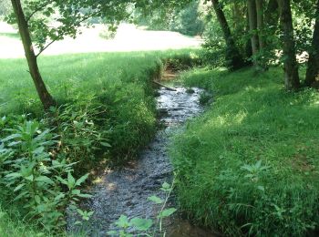
![Trail On foot Großheubach - Ortswanderweg Großheubach G3 - Photo](https://media.geolcdn.com/t/350/260/f5d5cccf-cf89-4d02-a341-831b2f111734.jpeg&format=jpg&maxdim=2)
![On foot On foot](https://static1.geolcdn.com/sitytour/trail-icons/100.png)
Km
On foot
![](/images/other/stat-length.png)
![](https://static1.geolcdn.com/siteimages/upload/files/1508320355ic_sort_den_pos_24dp.png)
![](https://static1.geolcdn.com/siteimages/upload/files/1508320355ic_sort_den_neg_24dp.png)
![](https://static1.geolcdn.com/siteimages/upload/files/16400158638029165_repeat_loop_refresh_sync_direction_icon.png)
• Trail created by Spessartbund. Symbol: G3 - schwarz auf weiß
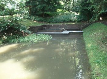
![Trail On foot Großheubach - Ortswanderweg Großheubach G2 - Photo](https://media.geolcdn.com/t/350/260/5223aa8a-3ed8-4937-8f65-70651988e0b2.jpeg&format=jpg&maxdim=2)
![On foot On foot](https://static1.geolcdn.com/sitytour/trail-icons/100.png)
Km
On foot
![](/images/other/stat-length.png)
![](https://static1.geolcdn.com/siteimages/upload/files/1508320355ic_sort_den_pos_24dp.png)
![](https://static1.geolcdn.com/siteimages/upload/files/1508320355ic_sort_den_neg_24dp.png)
![](https://static1.geolcdn.com/siteimages/upload/files/16400158638029165_repeat_loop_refresh_sync_direction_icon.png)
• Trail created by Spessartbund. Symbol: G2 - schwarz auf weiß
![Trail On foot Großheubach - Kulturweg Großheubach - Photo](https://media.geolcdn.com/t/350/260/ext.jpg?maxdim=2&url=https%3A%2F%2Fstatic1.geolcdn.com%2Fsiteimages%2Fupload%2Ffiles%2F1545311037marcheuse_200dpi.jpg)
![On foot On foot](https://static1.geolcdn.com/sitytour/trail-icons/100.png)
Km
On foot
![](/images/other/stat-length.png)
![](https://static1.geolcdn.com/siteimages/upload/files/1508320355ic_sort_den_pos_24dp.png)
![](https://static1.geolcdn.com/siteimages/upload/files/1508320355ic_sort_den_neg_24dp.png)
![](https://static1.geolcdn.com/siteimages/upload/files/16400158638029165_repeat_loop_refresh_sync_direction_icon.png)
• Trail created by Archäologisches Spessartprojekt. Symbol: Gelbes EU-Schiffchen auf blauem Grund
![Trail On foot Großheubach - Großheubach Rundwanderweg 6 - Photo](https://media.geolcdn.com/t/350/260/ext.jpg?maxdim=2&url=https%3A%2F%2Fstatic1.geolcdn.com%2Fsiteimages%2Fupload%2Ffiles%2F1545311037marcheuse_200dpi.jpg)
![On foot On foot](https://static1.geolcdn.com/sitytour/trail-icons/100.png)
Km
On foot
![](/images/other/stat-length.png)
![](https://static1.geolcdn.com/siteimages/upload/files/1508320355ic_sort_den_pos_24dp.png)
![](https://static1.geolcdn.com/siteimages/upload/files/1508320355ic_sort_den_neg_24dp.png)
![](https://static1.geolcdn.com/siteimages/upload/files/16400158638029165_repeat_loop_refresh_sync_direction_icon.png)
• Trail created by Großheubacher Heimat- und Verkehrsverein. Symbol: Weise 6 auf rotem Rechteck
17 trails displayed on 17
FREE GPS app for hiking