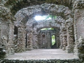
![](/images/other/stat-length.png)
- Trails
- Outdoor
- Germany
- Bavaria
- Landkreis Bayreuth
- Hollfeld
Hollfeld, Landkreis Bayreuth: Best trails, routes and walks
Hollfeld: Discover the best trails: 12 hiking trails. All these trails, routes and outdoor activities are available in our SityTrail applications for smartphones and tablets.
The best trails (12)
![Trail On foot Hollfeld - Kurat-Hollfelder-Weg - Photo](https://media.geolcdn.com/t/350/260/303aa3d8-bba5-4e75-a8b5-846fd32d750e.jpeg&format=jpg&maxdim=2)
![On foot On foot](https://static1.geolcdn.com/sitytour/trail-icons/100.png)
Km
On foot
![](/images/other/stat-length.png)
![](https://static1.geolcdn.com/siteimages/upload/files/1508320355ic_sort_den_pos_24dp.png)
![](https://static1.geolcdn.com/siteimages/upload/files/1508320355ic_sort_den_neg_24dp.png)
![](https://static1.geolcdn.com/siteimages/upload/files/16400158638029165_repeat_loop_refresh_sync_direction_icon.png)
• Trail created by Gemeinde Aufseß. Beschilderung nur in eine Richtung Symbol: Wappen auf weißem Grund
![Trail On foot Hollfeld - Aktiv-Park Roter Trail - Photo](https://media.geolcdn.com/t/350/260/4fbb2beb-fa40-4dbc-8f1d-e1c9a176d165.jpeg&format=jpg&maxdim=2)
![On foot On foot](https://static1.geolcdn.com/sitytour/trail-icons/100.png)
Km
On foot
![](/images/other/stat-length.png)
![](https://static1.geolcdn.com/siteimages/upload/files/1508320355ic_sort_den_pos_24dp.png)
![](https://static1.geolcdn.com/siteimages/upload/files/1508320355ic_sort_den_neg_24dp.png)
![](https://static1.geolcdn.com/siteimages/upload/files/16400158638029165_repeat_loop_refresh_sync_direction_icon.png)
• Trail created by Bayernwerk. Symbol: Roter Pfeil auf weißem Hintergrund
![Trail On foot Hollfeld - Aktiv-Park Schwarzer Trail - Photo](https://media.geolcdn.com/t/350/260/4fbb2beb-fa40-4dbc-8f1d-e1c9a176d165.jpeg&format=jpg&maxdim=2)
![On foot On foot](https://static1.geolcdn.com/sitytour/trail-icons/100.png)
Km
On foot
![](/images/other/stat-length.png)
![](https://static1.geolcdn.com/siteimages/upload/files/1508320355ic_sort_den_pos_24dp.png)
![](https://static1.geolcdn.com/siteimages/upload/files/1508320355ic_sort_den_neg_24dp.png)
![](https://static1.geolcdn.com/siteimages/upload/files/16400158638029165_repeat_loop_refresh_sync_direction_icon.png)
• Trail created by Bayernwerk. Symbol: Schwarzer Pfeill auf weißem Hintergrund
![Trail On foot Hollfeld - Kurat Hollfelder Gedächtnisweg - Photo](https://media.geolcdn.com/t/350/260/4fbb2beb-fa40-4dbc-8f1d-e1c9a176d165.jpeg&format=jpg&maxdim=2)
![On foot On foot](https://static1.geolcdn.com/sitytour/trail-icons/100.png)
Km
On foot
![](/images/other/stat-length.png)
![](https://static1.geolcdn.com/siteimages/upload/files/1508320355ic_sort_den_pos_24dp.png)
![](https://static1.geolcdn.com/siteimages/upload/files/1508320355ic_sort_den_neg_24dp.png)
![](https://static1.geolcdn.com/siteimages/upload/files/16400158638029165_repeat_loop_refresh_sync_direction_icon.png)
• Trail created by Stadt Hollfeld. Symbol: Schwarzer Kopf auf weißem Hintergrund
![Trail On foot Hollfeld - Wonsees Erbachtal-Wanderweg - Photo](https://media.geolcdn.com/t/350/260/54f4ddc7-7b19-4108-94f7-351eb7b67f18.jpeg&format=jpg&maxdim=2)
![On foot On foot](https://static1.geolcdn.com/sitytour/trail-icons/100.png)
Km
On foot
![](/images/other/stat-length.png)
![](https://static1.geolcdn.com/siteimages/upload/files/1508320355ic_sort_den_pos_24dp.png)
![](https://static1.geolcdn.com/siteimages/upload/files/1508320355ic_sort_den_neg_24dp.png)
![](https://static1.geolcdn.com/siteimages/upload/files/16400158638029165_repeat_loop_refresh_sync_direction_icon.png)
• Symbol: Gelbe Raute auf weißem Hintergrund
![Trail On foot Hollfeld - Hollfeld Rundweg](https://media.geolcdn.com/t/350/260/17ff9b12-24a9-448c-88e0-9143c9b3a5c9.jpeg&format=jpg&maxdim=2)
![On foot On foot](https://static1.geolcdn.com/sitytour/trail-icons/100.png)
Km
On foot
![](/images/other/stat-length.png)
![](https://static1.geolcdn.com/siteimages/upload/files/1508320355ic_sort_den_pos_24dp.png)
![](https://static1.geolcdn.com/siteimages/upload/files/1508320355ic_sort_den_neg_24dp.png)
![](https://static1.geolcdn.com/siteimages/upload/files/16400158638029165_repeat_loop_refresh_sync_direction_icon.png)
• Trail created by Stadt Hollfeld. Symbol: Gelbe Spitze auf weißem Hintergrund
![Trail On foot Hollfeld - Hollfeld Rundweg](https://media.geolcdn.com/t/350/260/4fbb2beb-fa40-4dbc-8f1d-e1c9a176d165.jpeg&format=jpg&maxdim=2)
![On foot On foot](https://static1.geolcdn.com/sitytour/trail-icons/100.png)
Km
On foot
![](/images/other/stat-length.png)
![](https://static1.geolcdn.com/siteimages/upload/files/1508320355ic_sort_den_pos_24dp.png)
![](https://static1.geolcdn.com/siteimages/upload/files/1508320355ic_sort_den_neg_24dp.png)
![](https://static1.geolcdn.com/siteimages/upload/files/16400158638029165_repeat_loop_refresh_sync_direction_icon.png)
• Trail created by Stadt Hollfeld. Symbol: Rote Raute auf weißem Hintergrund
![Trail On foot Hollfeld - Von Burg zu Burg - Photo](https://media.geolcdn.com/t/350/260/b8dfbade-9986-48d0-b2b5-4128ccc147c5.jpeg&format=jpg&maxdim=2)
![On foot On foot](https://static1.geolcdn.com/sitytour/trail-icons/100.png)
Km
On foot
![](/images/other/stat-length.png)
![](https://static1.geolcdn.com/siteimages/upload/files/1508320355ic_sort_den_pos_24dp.png)
![](https://static1.geolcdn.com/siteimages/upload/files/1508320355ic_sort_den_neg_24dp.png)
![](https://static1.geolcdn.com/siteimages/upload/files/16400158638029165_repeat_loop_refresh_sync_direction_icon.png)
• Symbol: Blauer Punkt auf weißem Grund
![Trail On foot Hollfeld - Hollfeld Rundweg Sanspareil - Photo](https://media.geolcdn.com/t/350/260/4fbb2beb-fa40-4dbc-8f1d-e1c9a176d165.jpeg&format=jpg&maxdim=2)
![On foot On foot](https://static1.geolcdn.com/sitytour/trail-icons/100.png)
Km
On foot
![](/images/other/stat-length.png)
![](https://static1.geolcdn.com/siteimages/upload/files/1508320355ic_sort_den_pos_24dp.png)
![](https://static1.geolcdn.com/siteimages/upload/files/1508320355ic_sort_den_neg_24dp.png)
![](https://static1.geolcdn.com/siteimages/upload/files/16400158638029165_repeat_loop_refresh_sync_direction_icon.png)
• Trail created by Stadt Hollfeld. Symbol: Gelber Punkt auf weißem Hintergrund
![Trail On foot Hollfeld - Kuckuckswege rund um Busbach Nr. 4 - Photo](https://media.geolcdn.com/t/350/260/13bdab08-b380-4894-9b5b-c8b6bc12dfd6.jpeg&format=jpg&maxdim=2)
![On foot On foot](https://static1.geolcdn.com/sitytour/trail-icons/100.png)
Km
On foot
![](/images/other/stat-length.png)
![](https://static1.geolcdn.com/siteimages/upload/files/1508320355ic_sort_den_pos_24dp.png)
![](https://static1.geolcdn.com/siteimages/upload/files/1508320355ic_sort_den_neg_24dp.png)
![](https://static1.geolcdn.com/siteimages/upload/files/16400158638029165_repeat_loop_refresh_sync_direction_icon.png)
• Symbol: Kuckuck + Rundweg 4
![Trail On foot Hollfeld - Obernsees Rundwanderweg Mohrensteinweg - Photo](https://media.geolcdn.com/t/350/260/13bdab08-b380-4894-9b5b-c8b6bc12dfd6.jpeg&format=jpg&maxdim=2)
![On foot On foot](https://static1.geolcdn.com/sitytour/trail-icons/100.png)
Km
On foot
![](/images/other/stat-length.png)
![](https://static1.geolcdn.com/siteimages/upload/files/1508320355ic_sort_den_pos_24dp.png)
![](https://static1.geolcdn.com/siteimages/upload/files/1508320355ic_sort_den_neg_24dp.png)
![](https://static1.geolcdn.com/siteimages/upload/files/16400158638029165_repeat_loop_refresh_sync_direction_icon.png)
• Symbol: grüner Ring
![Trail On foot Hollfeld - Obernsees Rundwanderweg](https://media.geolcdn.com/t/350/260/efcfed0e-9b76-4731-baf5-5c082f76a346.jpeg&format=jpg&maxdim=2)
![On foot On foot](https://static1.geolcdn.com/sitytour/trail-icons/100.png)
Km
On foot
![](/images/other/stat-length.png)
![](https://static1.geolcdn.com/siteimages/upload/files/1508320355ic_sort_den_pos_24dp.png)
![](https://static1.geolcdn.com/siteimages/upload/files/1508320355ic_sort_den_neg_24dp.png)
![](https://static1.geolcdn.com/siteimages/upload/files/16400158638029165_repeat_loop_refresh_sync_direction_icon.png)
• Symbol: blauer Ring
12 trails displayed on 12
FREE GPS app for hiking