


3.8 km | 4.3 km-effort
Victoria: Discover the best trails: 33 hiking trails and 1 equestrian circuits. All these trails, routes and outdoor activities are available in our SityTrail applications for smartphones and tablets.

Walking


Walking
• Telegraph Saddle to Sailer cove go and return

Walking
• Telegraph Saddle to Sailer cove go and return
Walking
• round trip
Walking
• pack flora and fauna reserve

Walking
•
Walking
• kangourou kakatou
Walking
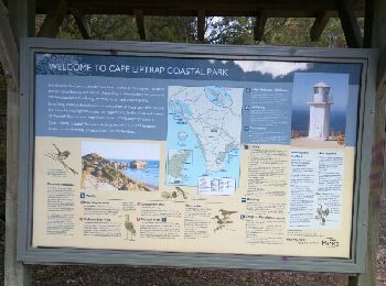
• Cape Schank
Walking
Walking
Walking
Walking
Walking
• copie sur everytrail
Walking
• Origine EveryTrail.com
Walking
•
Walking
Walking

Horseback riding
Walking
Walking
20 trails displayed on 34
FREE GPS app for hiking
 SityTrail
IGN / Geographical institutes
SityTrail World
The world is yours!