![](/images/other/stat-length.png)
- Trails
- Outdoor
- Austria
- Lower Austria
- Bezirk Wiener Neustadt
- Gemeinde Winzendorf-Muthmannsdorf
Gemeinde Winzendorf-Muthmannsdorf, Bezirk Wiener Neustadt: Best trails, routes and walks
Gemeinde Winzendorf-Muthmannsdorf: Discover the best trails: 11 hiking trails. All these trails, routes and outdoor activities are available in our SityTrail applications for smartphones and tablets.
The best trails (11)
![Trail On foot Gemeinde Winzendorf-Muthmannsdorf - Jubiläumssteig - Photo](https://media.geolcdn.com/t/350/260/a5810265-f554-4ad8-8163-be4e061eeeb1.jpeg&format=jpg&maxdim=2)
![On foot On foot](https://static1.geolcdn.com/sitytour/trail-icons/100.png)
Km
On foot
![](/images/other/stat-length.png)
![](https://static1.geolcdn.com/siteimages/upload/files/1508320355ic_sort_den_pos_24dp.png)
![](https://static1.geolcdn.com/siteimages/upload/files/1508320355ic_sort_den_neg_24dp.png)
![](https://static1.geolcdn.com/siteimages/upload/files/16400158638029165_repeat_loop_refresh_sync_direction_icon.png)
• Trail created by Dorferneuerungsverein Gemeinsam für Winzendorf. Symbol: 3 auf orangem (nominell: ockerem) Grund
![Trail On foot Gemeinde Winzendorf-Muthmannsdorf - Durch die Weinberge nach Muthmannsdorf - Photo](https://media.geolcdn.com/t/350/260/1d8b7d42-ee4d-4bff-aa43-45026472c6a9.jpeg&format=jpg&maxdim=2)
![On foot On foot](https://static1.geolcdn.com/sitytour/trail-icons/100.png)
Km
On foot
![](/images/other/stat-length.png)
![](https://static1.geolcdn.com/siteimages/upload/files/1508320355ic_sort_den_pos_24dp.png)
![](https://static1.geolcdn.com/siteimages/upload/files/1508320355ic_sort_den_neg_24dp.png)
![](https://static1.geolcdn.com/siteimages/upload/files/16400158638029165_repeat_loop_refresh_sync_direction_icon.png)
• Trail created by Dorferneuerungsverein Gemeinsam für Winzendorf. Symbol: 5 auf gelbem Grund
![Trail On foot Gemeinde Winzendorf-Muthmannsdorf - Zum Engelsberg - Photo](https://media.geolcdn.com/t/350/260/1d8b7d42-ee4d-4bff-aa43-45026472c6a9.jpeg&format=jpg&maxdim=2)
![On foot On foot](https://static1.geolcdn.com/sitytour/trail-icons/100.png)
Km
On foot
![](/images/other/stat-length.png)
![](https://static1.geolcdn.com/siteimages/upload/files/1508320355ic_sort_den_pos_24dp.png)
![](https://static1.geolcdn.com/siteimages/upload/files/1508320355ic_sort_den_neg_24dp.png)
![](https://static1.geolcdn.com/siteimages/upload/files/16400158638029165_repeat_loop_refresh_sync_direction_icon.png)
• Trail created by Dorferneuerungsverein Gemeinsam für Winzendorf. Symbol: 4 auf purpurnem Grund
![Trail On foot Gemeinde Winzendorf-Muthmannsdorf - Winzendorf - Bad Fischau - Photo](https://media.geolcdn.com/t/350/260/66bcafb5-27a9-43f3-8f95-c13fee3b9ce4.jpeg&format=jpg&maxdim=2)
![On foot On foot](https://static1.geolcdn.com/sitytour/trail-icons/100.png)
Km
On foot
![](/images/other/stat-length.png)
![](https://static1.geolcdn.com/siteimages/upload/files/1508320355ic_sort_den_pos_24dp.png)
![](https://static1.geolcdn.com/siteimages/upload/files/1508320355ic_sort_den_neg_24dp.png)
![](https://static1.geolcdn.com/siteimages/upload/files/16400158638029165_repeat_loop_refresh_sync_direction_icon.png)
• Trail created by Österreichischer Touristenklub, Sektion Wiener Neustadt. Symbol: grüner, waagrechter Balken
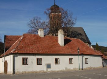
![Trail On foot Gemeinde Winzendorf-Muthmannsdorf - Brunn - Muthmannsdorf - Photo](https://media.geolcdn.com/t/350/260/38a21bbb-bfd6-41e4-816f-16f2d9d429c6.jpeg&format=jpg&maxdim=2)
![On foot On foot](https://static1.geolcdn.com/sitytour/trail-icons/100.png)
Km
On foot
![](/images/other/stat-length.png)
![](https://static1.geolcdn.com/siteimages/upload/files/1508320355ic_sort_den_pos_24dp.png)
![](https://static1.geolcdn.com/siteimages/upload/files/1508320355ic_sort_den_neg_24dp.png)
![](https://static1.geolcdn.com/siteimages/upload/files/16400158638029165_repeat_loop_refresh_sync_direction_icon.png)
• Trail created by Österreichischer Touristenklub, Sektion Wiener Neustadt. Symbol: blauer, waagrechter Balken
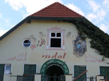
![Trail On foot Gemeinde Winzendorf-Muthmannsdorf - Winzendorf - Größenberg - Photo](https://media.geolcdn.com/t/350/260/dbb21177-eeba-4056-b813-c386fbc0c967.jpeg&format=jpg&maxdim=2)
![On foot On foot](https://static1.geolcdn.com/sitytour/trail-icons/100.png)
Km
On foot
![](/images/other/stat-length.png)
![](https://static1.geolcdn.com/siteimages/upload/files/1508320355ic_sort_den_pos_24dp.png)
![](https://static1.geolcdn.com/siteimages/upload/files/1508320355ic_sort_den_neg_24dp.png)
![](https://static1.geolcdn.com/siteimages/upload/files/16400158638029165_repeat_loop_refresh_sync_direction_icon.png)
• Trail created by Österreichischer Touristenklub, Sektion Wiener Neustadt. Symbol: roter, waagrechter Balken
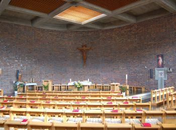
![Trail On foot Gemeinde Winzendorf-Muthmannsdorf - Eselsteig - Ruine Emmerberg - Photo](https://media.geolcdn.com/t/350/260/46f3886e-6677-40b9-8810-3b15f091de4e.jpeg&format=jpg&maxdim=2)
![On foot On foot](https://static1.geolcdn.com/sitytour/trail-icons/100.png)
Km
On foot
![](/images/other/stat-length.png)
![](https://static1.geolcdn.com/siteimages/upload/files/1508320355ic_sort_den_pos_24dp.png)
![](https://static1.geolcdn.com/siteimages/upload/files/1508320355ic_sort_den_neg_24dp.png)
![](https://static1.geolcdn.com/siteimages/upload/files/16400158638029165_repeat_loop_refresh_sync_direction_icon.png)
• Trail created by Dorferneuerungsverein Gemeinsam für Winzendorf. Symbol: 6 auf rotem Grund
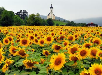
![Trail On foot Gemeinde Winzendorf-Muthmannsdorf - Winzendorf - Netting - Kienberg - Unterhöflein - Photo](https://media.geolcdn.com/t/350/260/abdbd3e9-ae9d-4de9-abfc-1c69010e86cf.jpeg&format=jpg&maxdim=2)
![On foot On foot](https://static1.geolcdn.com/sitytour/trail-icons/100.png)
Km
On foot
![](/images/other/stat-length.png)
![](https://static1.geolcdn.com/siteimages/upload/files/1508320355ic_sort_den_pos_24dp.png)
![](https://static1.geolcdn.com/siteimages/upload/files/1508320355ic_sort_den_neg_24dp.png)
![](https://static1.geolcdn.com/siteimages/upload/files/16400158638029165_repeat_loop_refresh_sync_direction_icon.png)
• Trail created by Österreichischer Touristenklub, Sektion Wiener Neustadt. Symbol: roter, waagrechter Balken
![Trail On foot Gemeinde Winzendorf-Muthmannsdorf - Größenberg - Photo](https://media.geolcdn.com/t/350/260/46f3886e-6677-40b9-8810-3b15f091de4e.jpeg&format=jpg&maxdim=2)
![On foot On foot](https://static1.geolcdn.com/sitytour/trail-icons/100.png)
Km
On foot
![](/images/other/stat-length.png)
![](https://static1.geolcdn.com/siteimages/upload/files/1508320355ic_sort_den_pos_24dp.png)
![](https://static1.geolcdn.com/siteimages/upload/files/1508320355ic_sort_den_neg_24dp.png)
![](https://static1.geolcdn.com/siteimages/upload/files/16400158638029165_repeat_loop_refresh_sync_direction_icon.png)
• Trail created by Dorferneuerungsverein Gemeinsam für Winzendorf. Symbol: 7 auf dunkelblauem Grund
![Trail On foot Gemeinde Winzendorf-Muthmannsdorf - Rundwanderweg 2 (Muthmannsdorf) - Photo](https://media.geolcdn.com/t/350/260/e6ea9afc-9cd4-4707-8659-0b2175dabd1b.jpeg&format=jpg&maxdim=2)
![On foot On foot](https://static1.geolcdn.com/sitytour/trail-icons/100.png)
Km
On foot
![](/images/other/stat-length.png)
![](https://static1.geolcdn.com/siteimages/upload/files/1508320355ic_sort_den_pos_24dp.png)
![](https://static1.geolcdn.com/siteimages/upload/files/1508320355ic_sort_den_neg_24dp.png)
![](https://static1.geolcdn.com/siteimages/upload/files/16400158638029165_repeat_loop_refresh_sync_direction_icon.png)
![Trail On foot Gemeinde Winzendorf-Muthmannsdorf - Muthmannsdorf - Brunn - Photo](https://media.geolcdn.com/t/350/260/e87acb07-8f51-45d8-9194-72127c5a622e.jpeg&format=jpg&maxdim=2)
![On foot On foot](https://static1.geolcdn.com/sitytour/trail-icons/100.png)
Km
On foot
![](/images/other/stat-length.png)
![](https://static1.geolcdn.com/siteimages/upload/files/1508320355ic_sort_den_pos_24dp.png)
![](https://static1.geolcdn.com/siteimages/upload/files/1508320355ic_sort_den_neg_24dp.png)
![](https://static1.geolcdn.com/siteimages/upload/files/16400158638029165_repeat_loop_refresh_sync_direction_icon.png)
• Trail created by Österreichischer Touristenklub, Sektion Wiener Neustadt. Symbol: gelber, waagerechter Balken
11 trails displayed on 11
FREE GPS app for hiking