![](/images/other/stat-length.png)
- Trails
- Outdoor
- Austria
- Lower Austria
- Bezirk Baden
- Gemeinde Berndorf
Gemeinde Berndorf, Bezirk Baden: Best trails, routes and walks
Gemeinde Berndorf: Discover the best trails: 17 hiking trails. All these trails, routes and outdoor activities are available in our SityTrail applications for smartphones and tablets.
The best trails (17)
![Trail On foot Gemeinde Berndorf - St.Veit/Triesting (Hst.ÖBB) - Hirtenberg - Großau - Photo](https://media.geolcdn.com/t/350/260/b2ff8fd8-3889-4de0-8f86-6deee493a5ce.jpeg&format=jpg&maxdim=2)
![On foot On foot](https://static1.geolcdn.com/sitytour/trail-icons/100.png)
Km
On foot
![](/images/other/stat-length.png)
![](https://static1.geolcdn.com/siteimages/upload/files/1508320355ic_sort_den_pos_24dp.png)
![](https://static1.geolcdn.com/siteimages/upload/files/1508320355ic_sort_den_neg_24dp.png)
![](https://static1.geolcdn.com/siteimages/upload/files/16400158638029165_repeat_loop_refresh_sync_direction_icon.png)
• Trail created by ÖTK - Österreichischer Touristenklub Sektion Triestingtal.
![Trail On foot Gemeinde Berndorf - Lindenberg - Großau - Vöslauerhütte - Photo](https://media.geolcdn.com/t/350/260/9e9e7942-699a-4508-b2d6-e5f8e665eaab.jpeg&format=jpg&maxdim=2)
![On foot On foot](https://static1.geolcdn.com/sitytour/trail-icons/100.png)
Km
On foot
![](/images/other/stat-length.png)
![](https://static1.geolcdn.com/siteimages/upload/files/1508320355ic_sort_den_pos_24dp.png)
![](https://static1.geolcdn.com/siteimages/upload/files/1508320355ic_sort_den_neg_24dp.png)
![](https://static1.geolcdn.com/siteimages/upload/files/16400158638029165_repeat_loop_refresh_sync_direction_icon.png)
• Der ÖTK gilt als Pionier des Fremdenverkehrs. Heute ist der ÖTK mit über 360 Kursen und geführten Touren in 50 Freize...
![Trail On foot Gemeinde Berndorf - Berndorf - Hoher Lindkogel - Photo](https://media.geolcdn.com/t/350/260/f28711c1-c58f-44b3-bc80-6633d2190f0e.jpeg&format=jpg&maxdim=2)
![On foot On foot](https://static1.geolcdn.com/sitytour/trail-icons/100.png)
Km
On foot
![](/images/other/stat-length.png)
![](https://static1.geolcdn.com/siteimages/upload/files/1508320355ic_sort_den_pos_24dp.png)
![](https://static1.geolcdn.com/siteimages/upload/files/1508320355ic_sort_den_neg_24dp.png)
![](https://static1.geolcdn.com/siteimages/upload/files/16400158638029165_repeat_loop_refresh_sync_direction_icon.png)
• Trail created by ÖTK Österreichischer Touristenklub, Sektion Triestingtal und Sektion Baden ab Vereinigung mit Pott. ...
![Trail On foot Gemeinde Berndorf - Berndorf Runde - Photo](https://media.geolcdn.com/t/350/260/6a62f1c4-b11c-465b-959f-5b4bb61832ea.jpeg&format=jpg&maxdim=2)
![On foot On foot](https://static1.geolcdn.com/sitytour/trail-icons/100.png)
Km
On foot
![](/images/other/stat-length.png)
![](https://static1.geolcdn.com/siteimages/upload/files/1508320355ic_sort_den_pos_24dp.png)
![](https://static1.geolcdn.com/siteimages/upload/files/1508320355ic_sort_den_neg_24dp.png)
![](https://static1.geolcdn.com/siteimages/upload/files/16400158638029165_repeat_loop_refresh_sync_direction_icon.png)
• Trail created by runnersfun. Symbol: dunkelblauer Pfeil, B7
![Trail On foot Gemeinde Berndorf - Arthur Krupp Runde (Berndorf) - Photo](https://media.geolcdn.com/t/350/260/16dd14be-fc53-49db-8e00-2a3ab7b7a7f0.jpeg&format=jpg&maxdim=2)
![On foot On foot](https://static1.geolcdn.com/sitytour/trail-icons/100.png)
Km
On foot
![](/images/other/stat-length.png)
![](https://static1.geolcdn.com/siteimages/upload/files/1508320355ic_sort_den_pos_24dp.png)
![](https://static1.geolcdn.com/siteimages/upload/files/1508320355ic_sort_den_neg_24dp.png)
![](https://static1.geolcdn.com/siteimages/upload/files/16400158638029165_repeat_loop_refresh_sync_direction_icon.png)
• Trail created by runnersfun. Symbol: grüner Pfeil, B8
![Trail On foot Gemeinde Berndorf - KIA Sportage Runde (Berndorf) - Photo](https://media.geolcdn.com/t/350/260/6724980b-3ba2-48b6-9051-373decbedab0.jpeg&format=jpg&maxdim=2)
![On foot On foot](https://static1.geolcdn.com/sitytour/trail-icons/100.png)
Km
On foot
![](/images/other/stat-length.png)
![](https://static1.geolcdn.com/siteimages/upload/files/1508320355ic_sort_den_pos_24dp.png)
![](https://static1.geolcdn.com/siteimages/upload/files/1508320355ic_sort_den_neg_24dp.png)
![](https://static1.geolcdn.com/siteimages/upload/files/16400158638029165_repeat_loop_refresh_sync_direction_icon.png)
• Trail created by runnersfun. Symbol: roter Pfeil, B6
![Trail On foot Gemeinde Berndorf - Hotel Kaiservilla Runde (Berndorf) - Photo](https://media.geolcdn.com/t/350/260/96b73107-5b87-4b28-aa57-7d1ad0444015.jpeg&format=jpg&maxdim=2)
![On foot On foot](https://static1.geolcdn.com/sitytour/trail-icons/100.png)
Km
On foot
![](/images/other/stat-length.png)
![](https://static1.geolcdn.com/siteimages/upload/files/1508320355ic_sort_den_pos_24dp.png)
![](https://static1.geolcdn.com/siteimages/upload/files/1508320355ic_sort_den_neg_24dp.png)
![](https://static1.geolcdn.com/siteimages/upload/files/16400158638029165_repeat_loop_refresh_sync_direction_icon.png)
• Trail created by runnersfun. Symbol: grüner Pfeil, B4
![Trail On foot Gemeinde Berndorf - Bike Doktor Runde (Berndorf) - Photo](https://media.geolcdn.com/t/350/260/aaaf8fb7-70b9-44b3-9c10-52fedaf574b8.jpeg&format=jpg&maxdim=2)
![On foot On foot](https://static1.geolcdn.com/sitytour/trail-icons/100.png)
Km
On foot
![](/images/other/stat-length.png)
![](https://static1.geolcdn.com/siteimages/upload/files/1508320355ic_sort_den_pos_24dp.png)
![](https://static1.geolcdn.com/siteimages/upload/files/1508320355ic_sort_den_neg_24dp.png)
![](https://static1.geolcdn.com/siteimages/upload/files/16400158638029165_repeat_loop_refresh_sync_direction_icon.png)
• Trail created by runnersfun. Symbol: hellblauer Pfeil, B1
![Trail On foot Gemeinde Berndorf - Aigner-Hauke Runde (Berndorf) - Photo](https://media.geolcdn.com/t/350/260/a366a0c5-ac3c-401b-858d-bd2546375afa.jpeg&format=jpg&maxdim=2)
![On foot On foot](https://static1.geolcdn.com/sitytour/trail-icons/100.png)
Km
On foot
![](/images/other/stat-length.png)
![](https://static1.geolcdn.com/siteimages/upload/files/1508320355ic_sort_den_pos_24dp.png)
![](https://static1.geolcdn.com/siteimages/upload/files/1508320355ic_sort_den_neg_24dp.png)
![](https://static1.geolcdn.com/siteimages/upload/files/16400158638029165_repeat_loop_refresh_sync_direction_icon.png)
• Trail created by runnersfun. Symbol: gelber Pfeil, B5
![Trail On foot Gemeinde Berndorf - St. Veit (Berndorf) - Merkenstein - Photo](https://media.geolcdn.com/t/350/260/b2ff8fd8-3889-4de0-8f86-6deee493a5ce.jpeg&format=jpg&maxdim=2)
![On foot On foot](https://static1.geolcdn.com/sitytour/trail-icons/100.png)
Km
On foot
![](/images/other/stat-length.png)
![](https://static1.geolcdn.com/siteimages/upload/files/1508320355ic_sort_den_pos_24dp.png)
![](https://static1.geolcdn.com/siteimages/upload/files/1508320355ic_sort_den_neg_24dp.png)
![](https://static1.geolcdn.com/siteimages/upload/files/16400158638029165_repeat_loop_refresh_sync_direction_icon.png)
• Trail created by Österreichischer Touristenklub, Sektion Baden. Symbol: gelber, waagerechter Balken
![Trail On foot Gemeinde Berndorf - Berndorf - Grillenberg - Fotzeben - Hoher Mandling - Photo](https://media.geolcdn.com/t/350/260/0b0d10b2-85b9-457e-8933-2947892a9d94.jpeg&format=jpg&maxdim=2)
![On foot On foot](https://static1.geolcdn.com/sitytour/trail-icons/100.png)
Km
On foot
![](/images/other/stat-length.png)
![](https://static1.geolcdn.com/siteimages/upload/files/1508320355ic_sort_den_pos_24dp.png)
![](https://static1.geolcdn.com/siteimages/upload/files/1508320355ic_sort_den_neg_24dp.png)
![](https://static1.geolcdn.com/siteimages/upload/files/16400158638029165_repeat_loop_refresh_sync_direction_icon.png)
• Trail created by Österreichischer Touristenklub, Sektion Triestingtal. Symbol: roter, waagrechter Balken
![Trail On foot Gemeinde Berndorf - Sankt Veit - Guglzipf - Photo](https://media.geolcdn.com/t/350/260/6724980b-3ba2-48b6-9051-373decbedab0.jpeg&format=jpg&maxdim=2)
![On foot On foot](https://static1.geolcdn.com/sitytour/trail-icons/100.png)
Km
On foot
![](/images/other/stat-length.png)
![](https://static1.geolcdn.com/siteimages/upload/files/1508320355ic_sort_den_pos_24dp.png)
![](https://static1.geolcdn.com/siteimages/upload/files/1508320355ic_sort_den_neg_24dp.png)
![](https://static1.geolcdn.com/siteimages/upload/files/16400158638029165_repeat_loop_refresh_sync_direction_icon.png)
• Trail created by Österreichischer Touristenklub. Symbol: grüner, waagrechter Balken
![Trail On foot Gemeinde Berndorf - Veitsau - Aigen - Photo](https://media.geolcdn.com/t/350/260/df5a5532-d071-4d9a-98f3-63c925334116.jpeg&format=jpg&maxdim=2)
![On foot On foot](https://static1.geolcdn.com/sitytour/trail-icons/100.png)
Km
On foot
![](/images/other/stat-length.png)
![](https://static1.geolcdn.com/siteimages/upload/files/1508320355ic_sort_den_pos_24dp.png)
![](https://static1.geolcdn.com/siteimages/upload/files/1508320355ic_sort_den_neg_24dp.png)
![](https://static1.geolcdn.com/siteimages/upload/files/16400158638029165_repeat_loop_refresh_sync_direction_icon.png)
• Trail created by Österreichischer Touristenklub. Symbol: grüner, waagrechter Balken
![Trail On foot Gemeinde Berndorf - Sankt Veit - Aigen - Stadtkreuz - Photo](https://media.geolcdn.com/t/350/260/9624ee27-5bae-4098-852d-e9907ffa71b0.jpeg&format=jpg&maxdim=2)
![On foot On foot](https://static1.geolcdn.com/sitytour/trail-icons/100.png)
Km
On foot
![](/images/other/stat-length.png)
![](https://static1.geolcdn.com/siteimages/upload/files/1508320355ic_sort_den_pos_24dp.png)
![](https://static1.geolcdn.com/siteimages/upload/files/1508320355ic_sort_den_neg_24dp.png)
![](https://static1.geolcdn.com/siteimages/upload/files/16400158638029165_repeat_loop_refresh_sync_direction_icon.png)
• Trail created by Österreichischer Touristenklub, Sektion Triestingtal. Symbol: blauer, waagrechter Balken
![Trail On foot Gemeinde Berndorf - Berndorf - Steinhof - Alter Brunnen - Geyersattel - Feichtenbach - Photo](https://media.geolcdn.com/t/350/260/aaaf8fb7-70b9-44b3-9c10-52fedaf574b8.jpeg&format=jpg&maxdim=2)
![On foot On foot](https://static1.geolcdn.com/sitytour/trail-icons/100.png)
Km
On foot
![](/images/other/stat-length.png)
![](https://static1.geolcdn.com/siteimages/upload/files/1508320355ic_sort_den_pos_24dp.png)
![](https://static1.geolcdn.com/siteimages/upload/files/1508320355ic_sort_den_neg_24dp.png)
![](https://static1.geolcdn.com/siteimages/upload/files/16400158638029165_repeat_loop_refresh_sync_direction_icon.png)
• Trail created by Österreichischer Touristenklub, Sektion Triestingtal. Symbol: gelber, waagerechter Balken
![Trail On foot Gemeinde Berndorf - Berndorf - Waxeneck - Naturfreundehaus - Hals - Steinwandklamm - Photo](https://media.geolcdn.com/t/350/260/b9b8c711-b4a0-4989-8b51-1d6b0d1525af.jpeg&format=jpg&maxdim=2)
![On foot On foot](https://static1.geolcdn.com/sitytour/trail-icons/100.png)
Km
On foot
![](/images/other/stat-length.png)
![](https://static1.geolcdn.com/siteimages/upload/files/1508320355ic_sort_den_pos_24dp.png)
![](https://static1.geolcdn.com/siteimages/upload/files/1508320355ic_sort_den_neg_24dp.png)
![](https://static1.geolcdn.com/siteimages/upload/files/16400158638029165_repeat_loop_refresh_sync_direction_icon.png)
• Trail created by Österreichischer Touristenklub, Sektion Triestingtal. Symbol: blauer, waagrechter Balken
![Trail On foot Gemeinde Berndorf - Kreuz Wanderung (St. Veit) - Photo](https://media.geolcdn.com/t/350/260/ext.jpg?maxdim=2&url=https%3A%2F%2Fstatic1.geolcdn.com%2Fsiteimages%2Fupload%2Ffiles%2F1545311037marcheuse_200dpi.jpg)
![On foot On foot](https://static1.geolcdn.com/sitytour/trail-icons/100.png)
Km
On foot
![](/images/other/stat-length.png)
![](https://static1.geolcdn.com/siteimages/upload/files/1508320355ic_sort_den_pos_24dp.png)
![](https://static1.geolcdn.com/siteimages/upload/files/1508320355ic_sort_den_neg_24dp.png)
![](https://static1.geolcdn.com/siteimages/upload/files/16400158638029165_repeat_loop_refresh_sync_direction_icon.png)
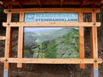
• Symbol: bräunliche Holztafel, grüner Zahlen 1-11
17 trails displayed on 17
FREE GPS app for hiking