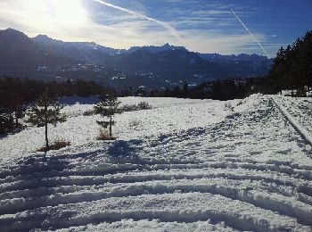
Châteauroux-les-Alpes, Hautes-Alpes, Winter sports: Best trails, routes and walks

5 comments

Châteauroux-les-Alpes: Discover the best trails: 4 touring skiing and 3 snowshoes. All these trails, routes and outdoor activities are available in our SityTrail applications for smartphones and tablets.


The best trails (7)

Trail Touring skiing Châteauroux-les-Alpes - Tête de Clotinaille - Photo
Touring skiing 8.873
Km
GUIDE

Touring skiing

Medium
Châteauroux-les-Alpes, Provence-Alpes-Côte d'Azur, Hautes-Alpes, France
8.9 km | 22 km-effort
4h 50min
966 m
1064 m
No
orsel

Trail Snowshoes Châteauroux-les-Alpes - ROCHE ROUSSE, Au dessus de Châteauroux-les-Alpes  - Photo
Snowshoes 4.206
Km

Snowshoes

Very easy
Châteauroux-les-Alpes, Provence-Alpes-Côte d'Azur, Hautes-Alpes, France
4.2 km | 7 km-effort
57min
172 m
308 m
No
BLANCHET

Trail Snowshoes Châteauroux-les-Alpes - Oratoire de Clos Jaunier - Photo
Snowshoes 11.168
Km

Snowshoes

Easy
Châteauroux-les-Alpes, Provence-Alpes-Côte d'Azur, Hautes-Alpes, France
11.2 km | 19.1 km-effort
5h 0min
590 m
602 m
Yes
BLANCHET

Trail Touring skiing Châteauroux-les-Alpes - tête de Chante perdrix  - Photo
Touring skiing 13.397
Km
GUIDE

Touring skiing

Medium
Châteauroux-les-Alpes, Provence-Alpes-Côte d'Azur, Hautes-Alpes, France
13.4 km | 29 km-effort
6h 12min
1153 m
1176 m
No
orsel

Trail Snowshoes Châteauroux-les-Alpes - Le hameau de La reste Châteauroux Guillaine - Photo
Snowshoes 7.319
Km

Snowshoes

Easy
Châteauroux-les-Alpes, Provence-Alpes-Côte d'Azur, Hautes-Alpes, France
7.3 km | 12 km-effort
1h 56min
353 m
350 m
Yes
damlou

Trail Touring skiing Châteauroux-les-Alpes - Tête de l'Hivernet versant est  - Photo
Touring skiing 7.646
Km
GUIDE

Touring skiing

Medium
Châteauroux-les-Alpes, Provence-Alpes-Côte d'Azur, Hautes-Alpes, France
7.6 km | 22 km-effort
4h 17min
1157 m
854 m
No
orsel

Trail Touring skiing Châteauroux-les-Alpes - Tête de l'Hivernet  - Photo
Touring skiing 17.818
Km
GUIDE

Touring skiing

Medium
Châteauroux-les-Alpes, Provence-Alpes-Côte d'Azur, Hautes-Alpes, France
17.8 km | 36 km-effort
6h 17min
1389 m
1397 m
Yes
orsel

7 trails displayed on 7

FREE GPS app for hiking

Logo SityTrail SityTrail

IGN / Geographical institutes

Download SityTrail from the App Store Download SityTrail from Google Play

Logo SityTrail SityTrail World

The world is yours!

Download SityTrail from the App Store Download SityTrail from Google Play Download SityTrail on Huawei AppGallery

Activities

Close
My subscriptions