![](/images/other/stat-length.png)
- Trails
- Winter sports
- France
- Auvergne-Rhône-Alpes
- Upper Savoy
- Demi-Quartier
Demi-Quartier, Upper Savoy, Winter sports: Best trails, routes and walks
Demi-Quartier: Discover the best trails: 1 touring skiing and 4 snowshoes. All these trails, routes and outdoor activities are available in our SityTrail applications for smartphones and tablets.
The best trails (5)
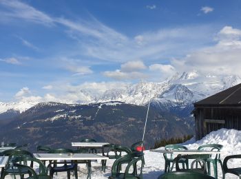
![Trail Snowshoes Demi-Quartier - Combafort Combloux vers Mt d'Arbois - Photo](https://media.geolcdn.com/t/350/260/74bf44a2-2c7a-4b36-b0f8-e9a94ca994aa.jpg&format=jpg&maxdim=2)
![Snowshoes Snowshoes](https://static1.geolcdn.com/sitytour/trail-icons/504.png)
Km
#1 - Combafort Combloux vers Mt d'Arbois
Snowshoes
Difficult
Demi-Quartier,
Auvergne-Rhône-Alpes,
Upper Savoy,
France
![](/images/other/stat-length.png)
9.6 km | 17.6 km-effort
3h 7min
![](https://static1.geolcdn.com/siteimages/upload/files/1508320355ic_sort_den_pos_24dp.png)
601 m
![](https://static1.geolcdn.com/siteimages/upload/files/1508320355ic_sort_den_neg_24dp.png)
605 m
![](https://static1.geolcdn.com/siteimages/upload/files/16400158638029165_repeat_loop_refresh_sync_direction_icon.png)
Yes
janussity
![Trail Snowshoes Demi-Quartier - Montée chalet de la Vielle-Beauregard-la Ravine. Descente Fouettaz - Photo](https://media.geolcdn.com/t/350/260/c56a9198-88b5-4b39-bf5a-28ea59d435b6.jpg&format=jpg&maxdim=2)
![Snowshoes Snowshoes](https://static1.geolcdn.com/sitytour/trail-icons/504.png)
Km
#2 - Montée chalet de la Vielle-Beauregard-la Ravine. Descente Fouettaz
Snowshoes
Medium
Demi-Quartier,
Auvergne-Rhône-Alpes,
Upper Savoy,
France
![](/images/other/stat-length.png)
6.7 km | 12 km-effort
2h 19min
![](https://static1.geolcdn.com/siteimages/upload/files/1508320355ic_sort_den_pos_24dp.png)
401 m
![](https://static1.geolcdn.com/siteimages/upload/files/1508320355ic_sort_den_neg_24dp.png)
398 m
![](https://static1.geolcdn.com/siteimages/upload/files/16400158638029165_repeat_loop_refresh_sync_direction_icon.png)
Yes
janussity
![Trail Snowshoes Demi-Quartier - Darbelets(Choseaux) Prapacot - Photo](https://media.geolcdn.com/t/350/260/be14135a-112d-4951-b17f-51d7e32decc3.jpg&format=jpg&maxdim=2)
![Snowshoes Snowshoes](https://static1.geolcdn.com/sitytour/trail-icons/504.png)
Km
#3 - Darbelets(Choseaux) Prapacot
Snowshoes
Medium
Demi-Quartier,
Auvergne-Rhône-Alpes,
Upper Savoy,
France
![](/images/other/stat-length.png)
7.2 km | 10.7 km-effort
2h 8min
![](https://static1.geolcdn.com/siteimages/upload/files/1508320355ic_sort_den_pos_24dp.png)
266 m
![](https://static1.geolcdn.com/siteimages/upload/files/1508320355ic_sort_den_neg_24dp.png)
270 m
![](https://static1.geolcdn.com/siteimages/upload/files/16400158638029165_repeat_loop_refresh_sync_direction_icon.png)
Yes
janussity
![Trail Touring skiing Demi-Quartier - salles plus camera - Photo](https://media.geolcdn.com/t/350/260/ext.jpg?maxdim=2&url=https%3A%2F%2Fstatic1.geolcdn.com%2Fsiteimages%2Fupload%2Ffiles%2F1524743154ski_fond.jpg)
![Touring skiing Touring skiing](https://static1.geolcdn.com/sitytour/trail-icons/503.png)
Km
#4 - salles plus camera
Touring skiing
Easy
Demi-Quartier,
Auvergne-Rhône-Alpes,
Upper Savoy,
France
![](/images/other/stat-length.png)
30 km | 47 km-effort
6h 52min
![](https://static1.geolcdn.com/siteimages/upload/files/1508320355ic_sort_den_pos_24dp.png)
1200 m
![](https://static1.geolcdn.com/siteimages/upload/files/1508320355ic_sort_den_neg_24dp.png)
1627 m
![](https://static1.geolcdn.com/siteimages/upload/files/16400158638029165_repeat_loop_refresh_sync_direction_icon.png)
No
ermont
![Trail Snowshoes Demi-Quartier - col de jaillet - Photo](https://media.geolcdn.com/t/350/260/ext.jpg?maxdim=2&url=https%3A%2F%2Fstatic1.geolcdn.com%2Fsiteimages%2Fupload%2Ffiles%2F1524743153raquette.jpg)
![Snowshoes Snowshoes](https://static1.geolcdn.com/sitytour/trail-icons/504.png)
Km
#5 - col de jaillet
Snowshoes
Very easy
Demi-Quartier,
Auvergne-Rhône-Alpes,
Upper Savoy,
France
![](/images/other/stat-length.png)
14.6 km | 23 km-effort
6h 10min
![](https://static1.geolcdn.com/siteimages/upload/files/1508320355ic_sort_den_pos_24dp.png)
588 m
![](https://static1.geolcdn.com/siteimages/upload/files/1508320355ic_sort_den_neg_24dp.png)
669 m
![](https://static1.geolcdn.com/siteimages/upload/files/16400158638029165_repeat_loop_refresh_sync_direction_icon.png)
No
christian4
5 trails displayed on 5
FREE GPS app for hiking