![](/images/other/stat-length.png)
- Trails
- Winter sports
- France
- Auvergne-Rhône-Alpes
- Savoy
- Les Belleville
- Saint-Jean-de-Belleville
Saint-Jean-de-Belleville, Les Belleville, Winter sports: Best trails, routes and walks
1 comments
Saint-Jean-de-Belleville: Discover the best trails: 5 touring skiing. All these trails, routes and outdoor activities are available in our SityTrail applications for smartphones and tablets.
The best trails (5)
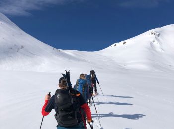
![Trail Touring skiing Les Belleville - Pointe - Photo](https://media.geolcdn.com/t/350/260/719b8822-aaaa-4814-a211-6ecf7951bb38.jpg&format=jpg&maxdim=2)
![Touring skiing Touring skiing](https://static1.geolcdn.com/sitytour/trail-icons/503.png)
Km
#1 - Pointe
Touring skiing
Medium
Les Belleville,
Auvergne-Rhône-Alpes,
Savoy,
France
![](/images/other/stat-length.png)
12 km | 27 km-effort
3h 3min
![](https://static1.geolcdn.com/siteimages/upload/files/1508320355ic_sort_den_pos_24dp.png)
1119 m
![](https://static1.geolcdn.com/siteimages/upload/files/1508320355ic_sort_den_neg_24dp.png)
1118 m
![](https://static1.geolcdn.com/siteimages/upload/files/16400158638029165_repeat_loop_refresh_sync_direction_icon.png)
Yes
redfire73
![Trail Touring skiing Les Belleville - col du cheval noir - Photo](https://media.geolcdn.com/t/350/260/ext.jpg?maxdim=2&url=https%3A%2F%2Fstatic1.geolcdn.com%2Fsiteimages%2Fupload%2Ffiles%2F1524743154ski_fond.jpg)
![Touring skiing Touring skiing](https://static1.geolcdn.com/sitytour/trail-icons/503.png)
Km
#2 - col du cheval noir
Touring skiing
Medium
Les Belleville,
Auvergne-Rhône-Alpes,
Savoy,
France
![](/images/other/stat-length.png)
18.5 km | 37 km-effort
7h 56min
![](https://static1.geolcdn.com/siteimages/upload/files/1508320355ic_sort_den_pos_24dp.png)
1364 m
![](https://static1.geolcdn.com/siteimages/upload/files/1508320355ic_sort_den_neg_24dp.png)
1360 m
![](https://static1.geolcdn.com/siteimages/upload/files/16400158638029165_repeat_loop_refresh_sync_direction_icon.png)
Yes
franquen
![Trail Touring skiing Les Belleville - combe Barral - Photo](https://media.geolcdn.com/t/350/260/ext.jpg?maxdim=2&url=https%3A%2F%2Fstatic1.geolcdn.com%2Fsiteimages%2Fupload%2Ffiles%2F1524743154ski_fond.jpg)
![Touring skiing Touring skiing](https://static1.geolcdn.com/sitytour/trail-icons/503.png)
Km
#3 - combe Barral
Touring skiing
Very easy
Les Belleville,
Auvergne-Rhône-Alpes,
Savoy,
France
![](/images/other/stat-length.png)
8.4 km | 21 km-effort
6h 30min
![](https://static1.geolcdn.com/siteimages/upload/files/1508320355ic_sort_den_pos_24dp.png)
906 m
![](https://static1.geolcdn.com/siteimages/upload/files/1508320355ic_sort_den_neg_24dp.png)
932 m
![](https://static1.geolcdn.com/siteimages/upload/files/16400158638029165_repeat_loop_refresh_sync_direction_icon.png)
No
franquen
![Trail Touring skiing Les Belleville - Cheval Noir - Photo](https://media.geolcdn.com/t/350/260/ext.jpg?maxdim=2&url=https%3A%2F%2Fstatic1.geolcdn.com%2Fsiteimages%2Fupload%2Ffiles%2F1524743154ski_fond.jpg)
![Touring skiing Touring skiing](https://static1.geolcdn.com/sitytour/trail-icons/503.png)
Km
#4 - Cheval Noir
Touring skiing
Very easy
Les Belleville,
Auvergne-Rhône-Alpes,
Savoy,
France
![](/images/other/stat-length.png)
18.9 km | 39 km-effort
7h 54min
![](https://static1.geolcdn.com/siteimages/upload/files/1508320355ic_sort_den_pos_24dp.png)
1495 m
![](https://static1.geolcdn.com/siteimages/upload/files/1508320355ic_sort_den_neg_24dp.png)
1486 m
![](https://static1.geolcdn.com/siteimages/upload/files/16400158638029165_repeat_loop_refresh_sync_direction_icon.png)
Yes
jcolonnadelega
![Trail Touring skiing Les Belleville - Le plan du qx10 - Photo](https://media.geolcdn.com/t/350/260/ext.jpg?maxdim=2&url=https%3A%2F%2Fstatic1.geolcdn.com%2Fsiteimages%2Fupload%2Ffiles%2F1524743154ski_fond.jpg)
![Touring skiing Touring skiing](https://static1.geolcdn.com/sitytour/trail-icons/503.png)
Km
#5 - Le plan du qx10
Touring skiing
Very easy
Les Belleville,
Auvergne-Rhône-Alpes,
Savoy,
France
![](/images/other/stat-length.png)
1.4 km | 2.1 km-effort
11min
![](https://static1.geolcdn.com/siteimages/upload/files/1508320355ic_sort_den_pos_24dp.png)
12 m
![](https://static1.geolcdn.com/siteimages/upload/files/1508320355ic_sort_den_neg_24dp.png)
150 m
![](https://static1.geolcdn.com/siteimages/upload/files/16400158638029165_repeat_loop_refresh_sync_direction_icon.png)
No
melsacri
5 trails displayed on 5
FREE GPS app for hiking