Saint-Véran, Hautes-Alpes, Miscellaneous: Best trails, routes and walks

11 comments

Saint-Véran: Discover the best trails: 1 fishing. All these trails, routes and outdoor activities are available in our SityTrail applications for smartphones and tablets.


The best trails (14)
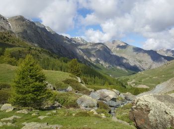
Trail Fishing Saint-Véran - st  Veran - refuge Agnel col à 2880  - Photo
Fishing 13.417
Km

Fishing

Medium
Saint-Véran, Provence-Alpes-Côte d'Azur, Hautes-Alpes, France
13.4 km | 25 km-effort
5h 27min
1028 m
385 m
No
jeff2

Trail Other activity Saint-Véran - Saint véranda grand serre - Photo
Other activity 8.07
Km

Other activity

Very easy
Saint-Véran, Provence-Alpes-Côte d'Azur, Hautes-Alpes, France
8.1 km | 18.5 km-effort
4h 3min
783 m
781 m
Yes
mitty

Trail Other activity Saint-Véran - SR Pic de Caramantran - Photo
Other activity 8.53
Km

Other activity

Medium
Saint-Véran, Provence-Alpes-Côte d'Azur, Hautes-Alpes, France
8.5 km | 19 km-effort
3h 20min
1027 m
53 m
No
david.santune

Trail Other activity Saint-Véran - SK Pic de Chateau Renard - Photo
Other activity 3.14
Km

Other activity

Medium
(1)
Saint-Véran, Provence-Alpes-Côte d'Azur, Hautes-Alpes, France
3.1 km | 12.2 km-effort
3h 20min
902 m
0 m
No
david.santune

Trail Other activity Saint-Véran - SR col de Longet - Photo
Other activity 5.115
Km

Other activity

Medium
Saint-Véran, Provence-Alpes-Côte d'Azur, Hautes-Alpes, France
5.1 km | 12 km-effort
3h 20min
688 m
2 m
No
david.santune

Trail Other activity Saint-Véran - GR58 - étape5 - Photo
Other activity 11.966
Km

Other activity

Very easy
Saint-Véran, Provence-Alpes-Côte d'Azur, Hautes-Alpes, France
12 km | 22 km-effort
6h 30min
925 m
361 m
No
poussin18

Trail Other activity Saint-Véran - Queyras 2 : Saint-Véran -> Agnel - Photo
Other activity 17.732
Km

Other activity

Very easy
Saint-Véran, Provence-Alpes-Côte d'Azur, Hautes-Alpes, France
17.7 km | 32 km-effort
Unknown
1191 m
639 m
No
goedz

Trail Other activity Saint-Véran - lac de la blanche - Photo
Other activity 7.37
Km

Other activity

Very easy
Saint-Véran, Provence-Alpes-Côte d'Azur, Hautes-Alpes, France
7.4 km | 13.1 km-effort
Unknown
555 m
56 m
No
giselou

Trail Other activity Saint-Véran - lac de la blanche - Photo
Other activity 5.401
Km

Other activity

Very easy
Saint-Véran, Provence-Alpes-Côte d'Azur, Hautes-Alpes, France
5.4 km | 9.8 km-effort
Unknown
419 m
56 m
No
giselou

Trail Other activity Saint-Véran - lac de la blanche - Photo
Other activity 7.42
Km

Other activity

Very easy
Saint-Véran, Provence-Alpes-Côte d'Azur, Hautes-Alpes, France
7.4 km | 13.2 km-effort
Unknown
554 m
57 m
No
giselou

Trail Other activity Saint-Véran - queyars J2 abries OK - Photo
Other activity 22.981
Km

Other activity

Very easy
Saint-Véran, Provence-Alpes-Côte d'Azur, Hautes-Alpes, France
23 km | 37 km-effort
Unknown
842 m
1790 m
No
lol63

Trail Other activity Saint-Véran - Nouveau guide - Photo
Other activity 6.09
Km

Other activity

Very easy
Saint-Véran, Provence-Alpes-Côte d'Azur, Hautes-Alpes, France
6.1 km | 18 km-effort
Unknown
1164 m
69 m
No
abdou.martin

Trail Other activity Saint-Véran - tete de longet - Photo
Other activity 6.09
Km

Other activity

Very easy
Saint-Véran, Provence-Alpes-Côte d'Azur, Hautes-Alpes, France
6.1 km | 18 km-effort
Unknown
1164 m
69 m
No
abdou.martin

Trail Other activity Saint-Véran - Nouveau guide - Photo
Other activity 6.09
Km

Other activity

Very easy
Saint-Véran, Provence-Alpes-Côte d'Azur, Hautes-Alpes, France
6.1 km | 18 km-effort
Unknown
1164 m
69 m
No
abdou.martin

14 trails displayed on 14

FREE GPS app for hiking

Logo SityTrail SityTrail

IGN / Geographical institutes

Download SityTrail from the App Store Download SityTrail from Google Play

Logo SityTrail SityTrail World

The world is yours!

Download SityTrail from the App Store Download SityTrail from Google Play Download SityTrail on Huawei AppGallery

Activities

Close
My subscriptions