Austria, Miscellaneous: Best trails, routes and walks

17 comments

Austria: Discover the 20 best hiking and cycling trail ideas. Our catalogue, manually prepared by our hikers, contains lots of beautiful landscapes to explore. Download these trails in SityTrail, our free hiking GPS application available on Android and iOS.


The best trails (20)
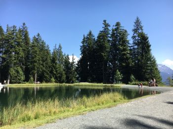
Trail Other activity Gemeinde Längenfeld - Oostenrijk Längenfeld camping Ötzal - Teufelskanzel - Photo
Other activity 7.229
Km

Other activity

Easy
(1)
Gemeinde Längenfeld, Tyrol, Bezirk Imst, Austria
7.2 km | 12.1 km-effort
4h 43min
365 m
368 m
Yes
ErikC

Trail Other activity Marktgemeinde Fieberbrunn - Fieberbrunn 2 - Photo
Other activity 10.639
Km

Other activity

Easy
Marktgemeinde Fieberbrunn, Tyrol, Bezirk Kitzbühel, Austria
10.6 km | 16.4 km-effort
3h 20min
433 m
433 m
Yes
manubeno

• Prommenade emmanuel et berenice

Trail Other activity Großarl - grondfeld - Photo
Other activity 9.665
Km

Other activity

Difficult
Großarl, Salzburg, Bezirk St. Johann im Pongau, Austria
9.7 km | 20 km-effort
4h 19min
755 m
847 m
No
mebond

• First hike

Trail Other activity Gemeinde Obsteig - point de vue de Lake - Photo
Other activity 9.865
Km

Other activity

Medium
Gemeinde Obsteig, Tyrol, Bezirk Imst, Austria
9.9 km | 17.8 km-effort
4h 23min
594 m
595 m
Yes
daniel34

Trail Other activity Treffen am Ossiacher See - Afritz - Photo
Other activity 9.838
Km

Other activity

Easy
Treffen am Ossiacher See, Carinthia, Bezirk Villach-Land, Austria
9.8 km | 15.1 km-effort
3h 29min
393 m
395 m
Yes
rigroy

• nice walk on snowed paths

Trail Other activity Gemeinde Längenfeld - Lehner wasserfall - Photo
Other activity 1.438
Km

Other activity

Easy
Gemeinde Längenfeld, Tyrol, Bezirk Imst, Austria
1.4 km | 4.1 km-effort
2h 6min
198 m
196 m
Yes
ErikC

Trail Other activity Marktgemeinde Fieberbrunn - vers le lac - Photo
Other activity 4.712
Km

Other activity

Very easy
Marktgemeinde Fieberbrunn, Tyrol, Bezirk Kitzbühel, Austria
4.7 km | 10.2 km-effort
2h 30min
542 m
21 m
No
manubeno

Trail Other activity  - tour de Salzbourg  - Photo
Other activity 5.83
Km

Other activity

Easy
, Salzburg, Salzburg, Austria
5.8 km | 8.5 km-effort
5h 22min
202 m
202 m
Yes
Domdomii

• Visite de la ville et du château

Trail Other activity Gemeinde Sankt Gallenkirch - Gaschurn - Photo
Other activity 3.895
Km

Other activity

Very easy
Gemeinde Sankt Gallenkirch, Vorarlberg, Bezirk Bludenz, Austria
3.9 km | 6 km-effort
Unknown
25 m
557 m
No
Mangold

Trail Other activity Gemeinde Tschagguns - Drusator - Photo
Other activity 12.199
Km

Other activity

Very easy
Gemeinde Tschagguns, Vorarlberg, Bezirk Bludenz, Austria
12.2 km | 23 km-effort
Unknown
693 m
1017 m
No
Mangold

Trail Other activity Stadt Bregenz - bregenz - Pfänder b - Photo
Other activity 4.37
Km

Other activity

Very easy
Stadt Bregenz, Vorarlberg, Bezirk Bregenz, Austria
4.4 km | 10.6 km-effort
Unknown
627 m
0 m
No
gust

Trail Other activity Stadt Bregenz - Bregenz - Pfänder - Photo
Other activity 4.24
Km

Other activity

Very easy
Stadt Bregenz, Vorarlberg, Bezirk Bregenz, Austria
4.2 km | 10.5 km-effort
Unknown
630 m
2 m
No
gust

Trail Other activity Marktgemeinde Rankweil - Rankweil  - Eggerstanden - Photo
Other activity 19.091
Km

Other activity

Very easy
Marktgemeinde Rankweil, Vorarlberg, Bezirk Feldkirch, Austria
19.1 km | 27 km-effort
Unknown
694 m
263 m
No
hallauer

Trail Other activity Stadt Feldkirch - Feldkirch - Gams - Photo
Other activity 16.846
Km

Other activity

Very easy
Stadt Feldkirch, Vorarlberg, Bezirk Feldkirch, Austria
16.8 km | 20 km-effort
Unknown
245 m
225 m
No
hallauer

Trail Other activity Stadt Feldkirch - Feldkirch - Wattwil - Photo
Other activity 55.627
Km

Other activity

Very easy
Stadt Feldkirch, Vorarlberg, Bezirk Feldkirch, Austria
56 km | 72 km-effort
Unknown
1257 m
1105 m
No
hallauer

Trail Other activity Marktgemeinde Rankweil - Rankweil - St. Peterszell  - Photo
Other activity 45.653
Km

Other activity

Very easy
Marktgemeinde Rankweil, Vorarlberg, Bezirk Feldkirch, Austria
46 km | 64 km-effort
Unknown
1470 m
1204 m
No
hallauer

Trail Other activity Gemeinde Silz - ochsengarten2018j4 - Photo
Other activity 17.14
Km

Other activity

Very difficult
Gemeinde Silz, Tyrol, Bezirk Imst, Austria
17.1 km | 39 km-effort
2h 46min
1471 m
2090 m
No
leon40

Trail Other activity Gemeinde Nauders - 3-wege-variante-1 - Photo
Other activity 10.147
Km

Other activity

Very easy
Gemeinde Nauders, Tyrol, Bezirk Landeck, Austria
10.1 km | 16.2 km-effort
Unknown
453 m
460 m
Yes
jpcattin

Trail Other activity Gemeinde Nauders - Rundwanderung Kaiserschützenweg Variante Festung - Photo
Other activity 9.208
Km

Other activity

Very easy
Gemeinde Nauders, Tyrol, Bezirk Landeck, Austria
9.2 km | 17.5 km-effort
Unknown
620 m
620 m
Yes
jpcattin

Trail Other activity Gemeinde Nauders - Rundwanderung Kaiserschützenweg Variante Zettleralm - Photo
Other activity 8.708
Km

Other activity

Very easy
Gemeinde Nauders, Tyrol, Bezirk Landeck, Austria
8.7 km | 15.4 km-effort
Unknown
505 m
505 m
Yes
jpcattin

20 trails displayed on 20

FREE GPS app for hiking

Logo SityTrail SityTrail

IGN / Geographical institutes

Download SityTrail from the App Store Download SityTrail from Google Play

Logo SityTrail SityTrail World

The world is yours!

Download SityTrail from the App Store Download SityTrail from Google Play Download SityTrail on Huawei AppGallery

Activities

Nearby regions

Close
My subscriptions