![](/images/other/stat-length.png)
Subcarpathian Voivodeship, Poland, On foot: Best trails, routes and walks
Subcarpathian Voivodeship: Discover the best trails: 70 on foot, 1 walking, 2 running and 1 trail. All these trails, routes and outdoor activities are available in our SityTrail applications for smartphones and tablets.
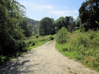
The best trails (74)
![Trail On foot Stara Wieś - Ścieżka przyrodniczo-dydaktyczna Brzozów-Zdrój - Photo](https://media.geolcdn.com/t/350/260/0d03a64f-232e-4148-a1e5-af9a20a99c1a.jpeg&format=jpg&maxdim=2)
![On foot On foot](https://static1.geolcdn.com/sitytour/trail-icons/100.png)
Km
On foot
![](/images/other/stat-length.png)
![](https://static1.geolcdn.com/siteimages/upload/files/1508320355ic_sort_den_pos_24dp.png)
![](https://static1.geolcdn.com/siteimages/upload/files/1508320355ic_sort_den_neg_24dp.png)
![](https://static1.geolcdn.com/siteimages/upload/files/16400158638029165_repeat_loop_refresh_sync_direction_icon.png)
• Trail created by Nadleśnictwo Brzozów.
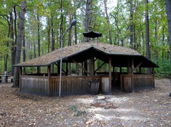
![Trail On foot Baligród - Ścieżka przyrodnicza na Chryszczatą - Photo](https://media.geolcdn.com/t/350/260/dd4476bf-8a35-418b-89d8-785b9bdf9ec5.jpeg&format=jpg&maxdim=2)
![On foot On foot](https://static1.geolcdn.com/sitytour/trail-icons/100.png)
Km
On foot
![](/images/other/stat-length.png)
![](https://static1.geolcdn.com/siteimages/upload/files/1508320355ic_sort_den_pos_24dp.png)
![](https://static1.geolcdn.com/siteimages/upload/files/1508320355ic_sort_den_neg_24dp.png)
![](https://static1.geolcdn.com/siteimages/upload/files/16400158638029165_repeat_loop_refresh_sync_direction_icon.png)
• Trail created by Nadleśnictwo Baligród. Website: http://www.czaswlas.pl/obiekty/?p=4&id_obiekt=8166
![Trail On foot Huczwice - Ścieżka przyrodnicza na Przełęcz Żebrak - Photo](https://media.geolcdn.com/t/350/260/9ec30fcc-077b-4531-b205-1d58908195cf.jpeg&format=jpg&maxdim=2)
![On foot On foot](https://static1.geolcdn.com/sitytour/trail-icons/100.png)
Km
On foot
![](/images/other/stat-length.png)
![](https://static1.geolcdn.com/siteimages/upload/files/1508320355ic_sort_den_pos_24dp.png)
![](https://static1.geolcdn.com/siteimages/upload/files/1508320355ic_sort_den_neg_24dp.png)
![](https://static1.geolcdn.com/siteimages/upload/files/16400158638029165_repeat_loop_refresh_sync_direction_icon.png)
• Trail created by Nadleśnictwo Baligród. Website: http://www.czaswlas.pl/obiekty/?p=4&id_obiekt=8168
![Trail On foot Ustrzyki Dolne - Ustrzyki Dolne (PKS)-Gromadzyń - Photo](https://media.geolcdn.com/t/350/260/682f3e54-5b9d-4c70-a7e4-e22d73c037e6.jpeg&format=jpg&maxdim=2)
![On foot On foot](https://static1.geolcdn.com/sitytour/trail-icons/100.png)
Km
On foot
![](/images/other/stat-length.png)
![](https://static1.geolcdn.com/siteimages/upload/files/1508320355ic_sort_den_pos_24dp.png)
![](https://static1.geolcdn.com/siteimages/upload/files/1508320355ic_sort_den_neg_24dp.png)
![](https://static1.geolcdn.com/siteimages/upload/files/16400158638029165_repeat_loop_refresh_sync_direction_icon.png)
• Trail created by Urząd Miasta Ustrzyki Dolne. Symbol: yellow corner
![Trail On foot Rymanów-Zdrój - Trasa Fitness - Photo](https://media.geolcdn.com/t/350/260/dbff1d05-3902-4857-bca6-222a0b51bd9d.jpeg&format=jpg&maxdim=2)
![On foot On foot](https://static1.geolcdn.com/sitytour/trail-icons/100.png)
Km
On foot
![](/images/other/stat-length.png)
![](https://static1.geolcdn.com/siteimages/upload/files/1508320355ic_sort_den_pos_24dp.png)
![](https://static1.geolcdn.com/siteimages/upload/files/1508320355ic_sort_den_neg_24dp.png)
![](https://static1.geolcdn.com/siteimages/upload/files/16400158638029165_repeat_loop_refresh_sync_direction_icon.png)
• Trail created by Gmina Rymanów.
![Trail On foot Ustrzyki Dolne - Ustrzyki Dolne-Kamienna Laworta-źródła Strwiąża-Mały Król - Photo](https://media.geolcdn.com/t/350/260/c23205b6-391f-4295-9c3e-51b81522ac7b.jpeg&format=jpg&maxdim=2)
![On foot On foot](https://static1.geolcdn.com/sitytour/trail-icons/100.png)
Km
On foot
![](/images/other/stat-length.png)
![](https://static1.geolcdn.com/siteimages/upload/files/1508320355ic_sort_den_pos_24dp.png)
![](https://static1.geolcdn.com/siteimages/upload/files/1508320355ic_sort_den_neg_24dp.png)
![](https://static1.geolcdn.com/siteimages/upload/files/16400158638029165_repeat_loop_refresh_sync_direction_icon.png)
• Trail created by Urząd Miasta Ustrzyki Dolne. Symbol: red corner
![Trail On foot Unknown - Ścieżka przyrodnicza im. prof. Władysława Szafera - Photo](https://media.geolcdn.com/t/350/260/4f4c4622-6741-4195-ae82-872e15666ec6.jpeg&format=jpg&maxdim=2)
![On foot On foot](https://static1.geolcdn.com/sitytour/trail-icons/100.png)
Km
On foot
![](/images/other/stat-length.png)
![](https://static1.geolcdn.com/siteimages/upload/files/1508320355ic_sort_den_pos_24dp.png)
![](https://static1.geolcdn.com/siteimages/upload/files/1508320355ic_sort_den_neg_24dp.png)
![](https://static1.geolcdn.com/siteimages/upload/files/16400158638029165_repeat_loop_refresh_sync_direction_icon.png)
• Trail created by Stowarzyszenie na rzecz promocji i rozwoju Podkarpacia "Pro Carpathia".
![Trail On foot Cieszyna - Ścieżka turystyczno-historyczna „Schrony](https://media.geolcdn.com/t/350/260/076642fa-19de-4e1d-8eeb-c0c1f61404ce.jpeg&format=jpg&maxdim=2)
![On foot On foot](https://static1.geolcdn.com/sitytour/trail-icons/100.png)
Km
On foot
![](/images/other/stat-length.png)
![](https://static1.geolcdn.com/siteimages/upload/files/1508320355ic_sort_den_pos_24dp.png)
![](https://static1.geolcdn.com/siteimages/upload/files/1508320355ic_sort_den_neg_24dp.png)
![](https://static1.geolcdn.com/siteimages/upload/files/16400158638029165_repeat_loop_refresh_sync_direction_icon.png)
• Trail created by Gmina Frysztak.
![Trail On foot Jaszczurowa - Szlak Edukacji Ekologicznej - Photo](https://media.geolcdn.com/t/350/260/076642fa-19de-4e1d-8eeb-c0c1f61404ce.jpeg&format=jpg&maxdim=2)
![On foot On foot](https://static1.geolcdn.com/sitytour/trail-icons/100.png)
Km
On foot
![](/images/other/stat-length.png)
![](https://static1.geolcdn.com/siteimages/upload/files/1508320355ic_sort_den_pos_24dp.png)
![](https://static1.geolcdn.com/siteimages/upload/files/1508320355ic_sort_den_neg_24dp.png)
![](https://static1.geolcdn.com/siteimages/upload/files/16400158638029165_repeat_loop_refresh_sync_direction_icon.png)
• Trail created by Nadleśnictwo Strzyzów.
![Trail On foot Kąkolówka - Mójka Szlak Jelenia - Photo](https://media.geolcdn.com/t/350/260/f3cc7be7-a8de-4110-b09e-fec8ab0dfb6c.jpeg&format=jpg&maxdim=2)
![On foot On foot](https://static1.geolcdn.com/sitytour/trail-icons/100.png)
Km
On foot
![](/images/other/stat-length.png)
![](https://static1.geolcdn.com/siteimages/upload/files/1508320355ic_sort_den_pos_24dp.png)
![](https://static1.geolcdn.com/siteimages/upload/files/1508320355ic_sort_den_neg_24dp.png)
![](https://static1.geolcdn.com/siteimages/upload/files/16400158638029165_repeat_loop_refresh_sync_direction_icon.png)
• Trail created by Nadleśnictwo Strzyżów.
![Trail On foot Kąkolówka - Mójka Szlak Bobra - Photo](https://media.geolcdn.com/t/350/260/f3cc7be7-a8de-4110-b09e-fec8ab0dfb6c.jpeg&format=jpg&maxdim=2)
![On foot On foot](https://static1.geolcdn.com/sitytour/trail-icons/100.png)
Km
On foot
![](/images/other/stat-length.png)
![](https://static1.geolcdn.com/siteimages/upload/files/1508320355ic_sort_den_pos_24dp.png)
![](https://static1.geolcdn.com/siteimages/upload/files/1508320355ic_sort_den_neg_24dp.png)
![](https://static1.geolcdn.com/siteimages/upload/files/16400158638029165_repeat_loop_refresh_sync_direction_icon.png)
• Trail created by Nadleśnictwo Strzyżów.
![Trail On foot Bukowiec - Ścieżka przyrodnicza na Korbanię - Photo](https://media.geolcdn.com/t/350/260/5c0a784b-15be-422b-9623-8db3069b4395.jpeg&format=jpg&maxdim=2)
![On foot On foot](https://static1.geolcdn.com/sitytour/trail-icons/100.png)
Km
On foot
![](/images/other/stat-length.png)
![](https://static1.geolcdn.com/siteimages/upload/files/1508320355ic_sort_den_pos_24dp.png)
![](https://static1.geolcdn.com/siteimages/upload/files/1508320355ic_sort_den_neg_24dp.png)
![](https://static1.geolcdn.com/siteimages/upload/files/16400158638029165_repeat_loop_refresh_sync_direction_icon.png)
• Trail created by Gmina Solina.
![Trail On foot Rudawka Jaśliska - Beskidzka Trasa Kurierska „Jaga–Kora” - Photo](https://media.geolcdn.com/t/350/260/f90df1f1-6996-4792-9b83-1d523c59fa51.jpeg&format=jpg&maxdim=2)
![On foot On foot](https://static1.geolcdn.com/sitytour/trail-icons/100.png)
Km
On foot
![](/images/other/stat-length.png)
![](https://static1.geolcdn.com/siteimages/upload/files/1508320355ic_sort_den_pos_24dp.png)
![](https://static1.geolcdn.com/siteimages/upload/files/1508320355ic_sort_den_neg_24dp.png)
![](https://static1.geolcdn.com/siteimages/upload/files/16400158638029165_repeat_loop_refresh_sync_direction_icon.png)
• Zmieniłem kolor szlaku na czarny w celu poprawienia czytelności na mapach. W pewnym momencie równolegle przebiegały t...
![Trail On foot Iwonicz-Zdrój - Rymanów Zdrój - Iwonicz Zdrój - Photo](https://media.geolcdn.com/t/350/260/8eb1bf63-71fa-4f20-8bb7-82b0468656b1.jpeg&format=jpg&maxdim=2)
![On foot On foot](https://static1.geolcdn.com/sitytour/trail-icons/100.png)
Km
On foot
![](/images/other/stat-length.png)
![](https://static1.geolcdn.com/siteimages/upload/files/1508320355ic_sort_den_pos_24dp.png)
![](https://static1.geolcdn.com/siteimages/upload/files/1508320355ic_sort_den_neg_24dp.png)
![](https://static1.geolcdn.com/siteimages/upload/files/16400158638029165_repeat_loop_refresh_sync_direction_icon.png)
• Website: http://www.szlaki-beskid.klikklik.pl/szlaki/szlaki_gminne_inne/szlak_rymanow_przymiarki_iwonicz.php
![Trail On foot Słonne - Trzy ścieżki tożsamości - środowisko, historia, kultura - Photo](https://media.geolcdn.com/t/350/260/cc6a9f47-6f70-45cd-84a4-f04480779435.jpeg&format=jpg&maxdim=2)
![On foot On foot](https://static1.geolcdn.com/sitytour/trail-icons/100.png)
Km
On foot
![](/images/other/stat-length.png)
![](https://static1.geolcdn.com/siteimages/upload/files/1508320355ic_sort_den_pos_24dp.png)
![](https://static1.geolcdn.com/siteimages/upload/files/1508320355ic_sort_den_neg_24dp.png)
![](https://static1.geolcdn.com/siteimages/upload/files/16400158638029165_repeat_loop_refresh_sync_direction_icon.png)
• Symbol: red
![Trail On foot Krasiczyn - Ścieżka przyrodniczo-kulturowa](https://media.geolcdn.com/t/350/260/dde18688-c185-40e8-a195-68d9fdc9d20f.jpeg&format=jpg&maxdim=2)
![On foot On foot](https://static1.geolcdn.com/sitytour/trail-icons/100.png)
Km
On foot
![](/images/other/stat-length.png)
![](https://static1.geolcdn.com/siteimages/upload/files/1508320355ic_sort_den_pos_24dp.png)
![](https://static1.geolcdn.com/siteimages/upload/files/1508320355ic_sort_den_neg_24dp.png)
![](https://static1.geolcdn.com/siteimages/upload/files/16400158638029165_repeat_loop_refresh_sync_direction_icon.png)
• Symbol: red
![Trail On foot - Szlak do bazy namiotowej Rabe - Photo](https://media.geolcdn.com/t/350/260/635a03c1-5325-4aee-8d04-d60afd0134d7.jpeg&format=jpg&maxdim=2)
![On foot On foot](https://static1.geolcdn.com/sitytour/trail-icons/100.png)
Km
On foot
![](/images/other/stat-length.png)
![](https://static1.geolcdn.com/siteimages/upload/files/1508320355ic_sort_den_pos_24dp.png)
![](https://static1.geolcdn.com/siteimages/upload/files/1508320355ic_sort_den_neg_24dp.png)
![](https://static1.geolcdn.com/siteimages/upload/files/16400158638029165_repeat_loop_refresh_sync_direction_icon.png)
• Trail created by PTTK.
![Trail On foot Zatwarnica - Ścieżka przyrodniczo-historyczna Hylaty - Photo](https://media.geolcdn.com/t/350/260/bbc1d9ff-11d7-4c66-98d2-7008565469c0.jpeg&format=jpg&maxdim=2)
![On foot On foot](https://static1.geolcdn.com/sitytour/trail-icons/100.png)
Km
On foot
![](/images/other/stat-length.png)
![](https://static1.geolcdn.com/siteimages/upload/files/1508320355ic_sort_den_pos_24dp.png)
![](https://static1.geolcdn.com/siteimages/upload/files/1508320355ic_sort_den_neg_24dp.png)
![](https://static1.geolcdn.com/siteimages/upload/files/16400158638029165_repeat_loop_refresh_sync_direction_icon.png)
• Trail created by W krainie Bojków.
![Trail On foot Krywe - Ścieżka przyrodniczo - historyczna](https://media.geolcdn.com/t/350/260/bf12fbfd-c2ee-4e3c-9f80-a5fb652580f0.jpeg&format=jpg&maxdim=2)
![On foot On foot](https://static1.geolcdn.com/sitytour/trail-icons/100.png)
Km
On foot
![](/images/other/stat-length.png)
![](https://static1.geolcdn.com/siteimages/upload/files/1508320355ic_sort_den_pos_24dp.png)
![](https://static1.geolcdn.com/siteimages/upload/files/1508320355ic_sort_den_neg_24dp.png)
![](https://static1.geolcdn.com/siteimages/upload/files/16400158638029165_repeat_loop_refresh_sync_direction_icon.png)
• Trail created by Gmina Lutowiska.
![Trail On foot Nisko - Ścieżka dydaktyczna - Photo](https://media.geolcdn.com/t/350/260/56d9be99-02b2-4250-8185-46f477545606.jpeg&format=jpg&maxdim=2)
![On foot On foot](https://static1.geolcdn.com/sitytour/trail-icons/100.png)
Km
On foot
![](/images/other/stat-length.png)
![](https://static1.geolcdn.com/siteimages/upload/files/1508320355ic_sort_den_pos_24dp.png)
![](https://static1.geolcdn.com/siteimages/upload/files/1508320355ic_sort_den_neg_24dp.png)
![](https://static1.geolcdn.com/siteimages/upload/files/16400158638029165_repeat_loop_refresh_sync_direction_icon.png)
• Trail created by Nadleśnictwo Rudnik.
20 trails displayed on 74
FREE GPS app for hiking