


19 km | 31 km-effort
Southland: Discover the best trails: 11 on foot and 1 walking. All these trails, routes and outdoor activities are available in our SityTrail applications for smartphones and tablets.
On foot


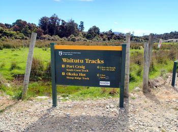
• Website: https://en.wikipedia.org/wiki/Hump_Ridge_Track

On foot
• Website: https://en.wikipedia.org/wiki/Hump_Ridge_Track
On foot
• Website: https://en.wikipedia.org/wiki/Hump_Ridge_Track
On foot
• Trail created by Department of Conservation.
On foot
• Trail created by Department of Conservation.

On foot
• Trail created by Department of Conservation.
On foot
• Trail created by Department of Conservation.
On foot
• Trail created by Department of Conservation.
On foot
On foot
• Trail created by Department of Conservation.

On foot
• Trail created by Department of Conservation.

Walking
12 trails displayed on 12
FREE GPS app for hiking
 SityTrail
IGN / Geographical institutes
SityTrail World
The world is yours!