![](/images/other/stat-length.png)
- Trails
- On foot
- Netherlands
- South Holland
South Holland, Netherlands, On foot: Best trails, routes and walks
South Holland: Discover the best trails: 63 on foot, 106 walking, 1 nordic walking and 1 running. All these trails, routes and outdoor activities are available in our SityTrail applications for smartphones and tablets.
The best trails (171)
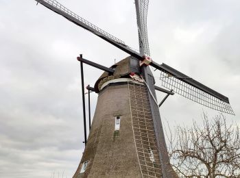
![Trail Walking Molenlanden - Les moulins de Kinderdijk (8,6km) - Photo](https://media.geolcdn.com/t/350/260/9478bc0b-4711-41fe-9e2a-e8b4bd503f5e.jpg&format=jpg&maxdim=2)
![Walking Walking](https://static1.geolcdn.com/sitytour/trail-icons/101.png)
Km
Walking
![](/images/other/stat-length.png)
![](https://static1.geolcdn.com/siteimages/upload/files/1508320355ic_sort_den_pos_24dp.png)
![](https://static1.geolcdn.com/siteimages/upload/files/1508320355ic_sort_den_neg_24dp.png)
![](https://static1.geolcdn.com/siteimages/upload/files/16400158638029165_repeat_loop_refresh_sync_direction_icon.png)
![Trail On foot Noordwijk - AWD-Zilk-Paars - Photo](https://media.geolcdn.com/t/350/260/e3090b42-64ae-4910-ba8a-c74680623623.jpeg&format=jpg&maxdim=2)
![On foot On foot](https://static1.geolcdn.com/sitytour/trail-icons/100.png)
Km
On foot
![](/images/other/stat-length.png)
![](https://static1.geolcdn.com/siteimages/upload/files/1508320355ic_sort_den_pos_24dp.png)
![](https://static1.geolcdn.com/siteimages/upload/files/1508320355ic_sort_den_neg_24dp.png)
![](https://static1.geolcdn.com/siteimages/upload/files/16400158638029165_repeat_loop_refresh_sync_direction_icon.png)
• Symbol: yellow
![Trail On foot Noordwijk - AWD-Zilk-Zwart - Photo](https://media.geolcdn.com/t/350/260/e3090b42-64ae-4910-ba8a-c74680623623.jpeg&format=jpg&maxdim=2)
![On foot On foot](https://static1.geolcdn.com/sitytour/trail-icons/100.png)
Km
On foot
![](/images/other/stat-length.png)
![](https://static1.geolcdn.com/siteimages/upload/files/1508320355ic_sort_den_pos_24dp.png)
![](https://static1.geolcdn.com/siteimages/upload/files/1508320355ic_sort_den_neg_24dp.png)
![](https://static1.geolcdn.com/siteimages/upload/files/16400158638029165_repeat_loop_refresh_sync_direction_icon.png)
• Symbol: blue
![Trail On foot Noordwijk - Zandhagedisroute - Photo](https://media.geolcdn.com/t/350/260/1a3bba1d-a9ba-43b3-a795-5e7639e981d6.jpeg&format=jpg&maxdim=2)
![On foot On foot](https://static1.geolcdn.com/sitytour/trail-icons/100.png)
Km
On foot
![](/images/other/stat-length.png)
![](https://static1.geolcdn.com/siteimages/upload/files/1508320355ic_sort_den_pos_24dp.png)
![](https://static1.geolcdn.com/siteimages/upload/files/1508320355ic_sort_den_neg_24dp.png)
![](https://static1.geolcdn.com/siteimages/upload/files/16400158638029165_repeat_loop_refresh_sync_direction_icon.png)
• Bollenvelden, bloemrijke graslanden, bossen, duinen en strand – de Zandhagedisroute, door de duinen bij Noordwijk, bi...
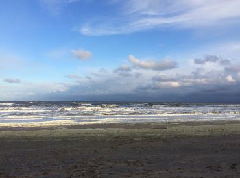
![Trail On foot Noordwijk - Langeveldwandeling - Photo](https://media.geolcdn.com/t/350/260/b3165bed-e345-441d-a394-9d5653dcd4ab.jpeg&format=jpg&maxdim=2)
![On foot On foot](https://static1.geolcdn.com/sitytour/trail-icons/100.png)
Km
On foot
![](/images/other/stat-length.png)
![](https://static1.geolcdn.com/siteimages/upload/files/1508320355ic_sort_den_pos_24dp.png)
![](https://static1.geolcdn.com/siteimages/upload/files/1508320355ic_sort_den_neg_24dp.png)
![](https://static1.geolcdn.com/siteimages/upload/files/16400158638029165_repeat_loop_refresh_sync_direction_icon.png)
• Bollenvelden, bloemrijke graslanden, bossen, duinen en strand – de Zandhagedisroute, door de duinen bij Noordwijk, bi...
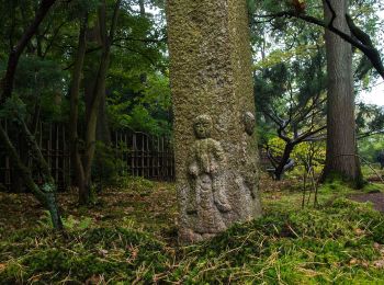
![Trail On foot The Hague - NS-wandeling Meijendel - Photo](https://media.geolcdn.com/t/350/260/6c24e446-94f5-490a-afd2-d15b11b6a22d.jpeg&format=jpg&maxdim=2)
![On foot On foot](https://static1.geolcdn.com/sitytour/trail-icons/100.png)
Km
On foot
![](/images/other/stat-length.png)
![](https://static1.geolcdn.com/siteimages/upload/files/1508320355ic_sort_den_pos_24dp.png)
![](https://static1.geolcdn.com/siteimages/upload/files/1508320355ic_sort_den_neg_24dp.png)
![](https://static1.geolcdn.com/siteimages/upload/files/16400158638029165_repeat_loop_refresh_sync_direction_icon.png)
• Wandel vanaf Den Haag Centraal door de bossen en de duinen. Website: https://www.ns.nl/dagje-uit/wandelen/meijendel....
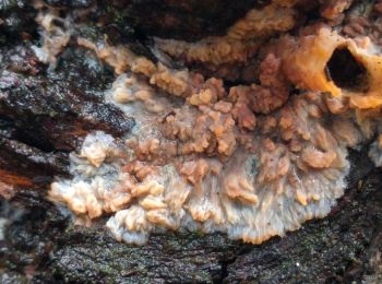
![Trail On foot Noordwijk - Kachelduinroute - Photo](https://media.geolcdn.com/t/350/260/eb07b931-a8f0-48ce-bb5c-ced1c26d976f.jpeg&format=jpg&maxdim=2)
![On foot On foot](https://static1.geolcdn.com/sitytour/trail-icons/100.png)
Km
On foot
![](/images/other/stat-length.png)
![](https://static1.geolcdn.com/siteimages/upload/files/1508320355ic_sort_den_pos_24dp.png)
![](https://static1.geolcdn.com/siteimages/upload/files/1508320355ic_sort_den_neg_24dp.png)
![](https://static1.geolcdn.com/siteimages/upload/files/16400158638029165_repeat_loop_refresh_sync_direction_icon.png)
• Trail created by Staatsbosbeheer. Symbol: deels groene band ronde paal, deels groen bordkje op vierkante paal (bij s...
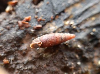
![Trail On foot Noordwijk - Maloteroute - Photo](https://media.geolcdn.com/t/350/260/8368ff9f-25ae-4bf4-898b-a94c832a3675.jpeg&format=jpg&maxdim=2)
![On foot On foot](https://static1.geolcdn.com/sitytour/trail-icons/100.png)
Km
On foot
![](/images/other/stat-length.png)
![](https://static1.geolcdn.com/siteimages/upload/files/1508320355ic_sort_den_pos_24dp.png)
![](https://static1.geolcdn.com/siteimages/upload/files/1508320355ic_sort_den_neg_24dp.png)
![](https://static1.geolcdn.com/siteimages/upload/files/16400158638029165_repeat_loop_refresh_sync_direction_icon.png)
• Trail created by Staatsbosbeheer. Symbol: ronde palen met blauwe kop
![Trail On foot Noordwijk - Kunst in duinpad - Photo](https://media.geolcdn.com/t/350/260/eb07b931-a8f0-48ce-bb5c-ced1c26d976f.jpeg&format=jpg&maxdim=2)
![On foot On foot](https://static1.geolcdn.com/sitytour/trail-icons/100.png)
Km
On foot
![](/images/other/stat-length.png)
![](https://static1.geolcdn.com/siteimages/upload/files/1508320355ic_sort_den_pos_24dp.png)
![](https://static1.geolcdn.com/siteimages/upload/files/1508320355ic_sort_den_neg_24dp.png)
![](https://static1.geolcdn.com/siteimages/upload/files/16400158638029165_repeat_loop_refresh_sync_direction_icon.png)
• Trail created by Staatsbosbeheer.
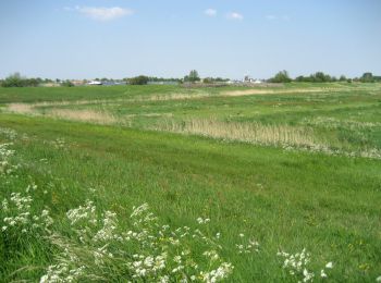
![Trail On foot Kaag en Braassem - Zwetpolderroute - Photo](https://media.geolcdn.com/t/350/260/dev_ed6f332e-fbb4-42fd-b47f-82e36acde99d.jpeg&format=jpg&maxdim=2)
![On foot On foot](https://static1.geolcdn.com/sitytour/trail-icons/100.png)
Km
On foot
![](/images/other/stat-length.png)
![](https://static1.geolcdn.com/siteimages/upload/files/1508320355ic_sort_den_pos_24dp.png)
![](https://static1.geolcdn.com/siteimages/upload/files/1508320355ic_sort_den_neg_24dp.png)
![](https://static1.geolcdn.com/siteimages/upload/files/16400158638029165_repeat_loop_refresh_sync_direction_icon.png)
• Trail created by Boerenlandwandelen.
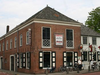
![Trail On foot Alphen aan den Rijn - Hondsdijkroute - Photo](https://media.geolcdn.com/t/350/260/7b4ce279-ce04-4e4f-9e8a-01b14ad71ea7.jpeg&format=jpg&maxdim=2)
![On foot On foot](https://static1.geolcdn.com/sitytour/trail-icons/100.png)
Km
On foot
![](/images/other/stat-length.png)
![](https://static1.geolcdn.com/siteimages/upload/files/1508320355ic_sort_den_pos_24dp.png)
![](https://static1.geolcdn.com/siteimages/upload/files/1508320355ic_sort_den_neg_24dp.png)
![](https://static1.geolcdn.com/siteimages/upload/files/16400158638029165_repeat_loop_refresh_sync_direction_icon.png)
• Trail created by Land van Wijk en Wouden. Boerenlandpad, deel van route gesloten in broedseizoen / access: permissiv...
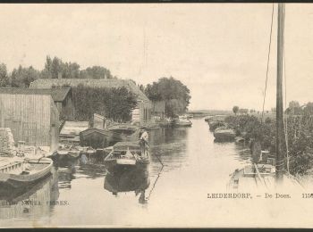
![Trail On foot Leiderdorp - Achthovenroute - Photo](https://media.geolcdn.com/t/350/260/5c595953-d977-4948-8d10-72b0b4ee153c.jpeg&format=jpg&maxdim=2)
![On foot On foot](https://static1.geolcdn.com/sitytour/trail-icons/100.png)
Km
On foot
![](/images/other/stat-length.png)
![](https://static1.geolcdn.com/siteimages/upload/files/1508320355ic_sort_den_pos_24dp.png)
![](https://static1.geolcdn.com/siteimages/upload/files/1508320355ic_sort_den_neg_24dp.png)
![](https://static1.geolcdn.com/siteimages/upload/files/16400158638029165_repeat_loop_refresh_sync_direction_icon.png)
• Trail created by Land van Wijk en Wouden. Boerenlandpad, deel van route gesloten in broedseizoen / access: permissiv...
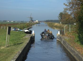
![Trail On foot Alphen aan den Rijn - Oostvaartroute - Photo](https://media.geolcdn.com/t/350/260/0cfd549a-6851-44d8-a972-2c9fe6455ffe.jpeg&format=jpg&maxdim=2)
![On foot On foot](https://static1.geolcdn.com/sitytour/trail-icons/100.png)
Km
On foot
![](/images/other/stat-length.png)
![](https://static1.geolcdn.com/siteimages/upload/files/1508320355ic_sort_den_pos_24dp.png)
![](https://static1.geolcdn.com/siteimages/upload/files/1508320355ic_sort_den_neg_24dp.png)
![](https://static1.geolcdn.com/siteimages/upload/files/16400158638029165_repeat_loop_refresh_sync_direction_icon.png)
• Trail created by Land van Wijk en Wouden. Boerenlandpad, deel van route gesloten in broedseizoen / access: permissiv...
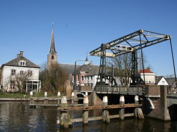
![Trail On foot Alphen aan den Rijn - Westvaartroute - Photo](https://media.geolcdn.com/t/350/260/83b01cb4-71a1-4090-b773-a5e4dbe18c54.jpeg&format=jpg&maxdim=2)
![On foot On foot](https://static1.geolcdn.com/sitytour/trail-icons/100.png)
Km
On foot
![](/images/other/stat-length.png)
![](https://static1.geolcdn.com/siteimages/upload/files/1508320355ic_sort_den_pos_24dp.png)
![](https://static1.geolcdn.com/siteimages/upload/files/1508320355ic_sort_den_neg_24dp.png)
![](https://static1.geolcdn.com/siteimages/upload/files/16400158638029165_repeat_loop_refresh_sync_direction_icon.png)
• Trail created by Land van Wijk en Wouden. Boerenlandpad, deel van route gesloten in broedseizoen / access: permissiv...
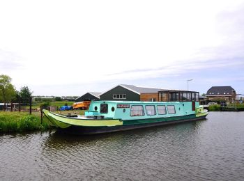
![Trail On foot Alphen aan den Rijn - Steilrandroute - Photo](https://media.geolcdn.com/t/350/260/a45a468b-c84b-4880-802b-01189f20a0f8.jpeg&format=jpg&maxdim=2)
![On foot On foot](https://static1.geolcdn.com/sitytour/trail-icons/100.png)
Km
On foot
![](/images/other/stat-length.png)
![](https://static1.geolcdn.com/siteimages/upload/files/1508320355ic_sort_den_pos_24dp.png)
![](https://static1.geolcdn.com/siteimages/upload/files/1508320355ic_sort_den_neg_24dp.png)
![](https://static1.geolcdn.com/siteimages/upload/files/16400158638029165_repeat_loop_refresh_sync_direction_icon.png)
• Trail created by Land van Wijk en Wouden. Boerenlandpad, deel van route gesloten in broedseizoen / access: permissiv...
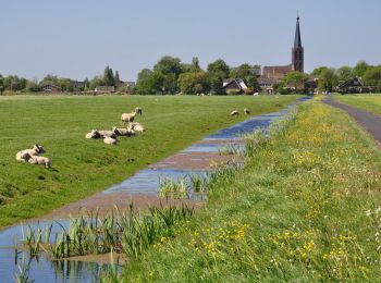
![Trail On foot Zoeterwoude - Balkengatroute - Photo](https://media.geolcdn.com/t/350/260/9fb7734f-82b4-496f-8223-77db8a32ced7.jpeg&format=jpg&maxdim=2)
![On foot On foot](https://static1.geolcdn.com/sitytour/trail-icons/100.png)
Km
On foot
![](/images/other/stat-length.png)
![](https://static1.geolcdn.com/siteimages/upload/files/1508320355ic_sort_den_pos_24dp.png)
![](https://static1.geolcdn.com/siteimages/upload/files/1508320355ic_sort_den_neg_24dp.png)
![](https://static1.geolcdn.com/siteimages/upload/files/16400158638029165_repeat_loop_refresh_sync_direction_icon.png)
• Trail created by Land van Wijk en Wouden. Boerenlandpad, deel van route gesloten in broedseizoen / access: permissiv...
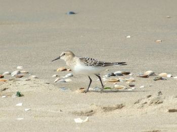
![Trail On foot Wassenaar - Strandroute - Photo](https://media.geolcdn.com/t/350/260/bce7ac1a-69c9-475d-acfb-1682c903b3b1.jpeg&format=jpg&maxdim=2)
![On foot On foot](https://static1.geolcdn.com/sitytour/trail-icons/100.png)
Km
On foot
![](/images/other/stat-length.png)
![](https://static1.geolcdn.com/siteimages/upload/files/1508320355ic_sort_den_pos_24dp.png)
![](https://static1.geolcdn.com/siteimages/upload/files/1508320355ic_sort_den_neg_24dp.png)
![](https://static1.geolcdn.com/siteimages/upload/files/16400158638029165_repeat_loop_refresh_sync_direction_icon.png)
• Trail created by Dunea.
![Trail On foot Goeree-Overflakkee - Kwade Hoek (green) - Photo](https://media.geolcdn.com/t/350/260/34a3d39a-c85b-4b4c-ab02-e01ab4de6124.jpeg&format=jpg&maxdim=2)
![On foot On foot](https://static1.geolcdn.com/sitytour/trail-icons/100.png)
Km
On foot
![](/images/other/stat-length.png)
![](https://static1.geolcdn.com/siteimages/upload/files/1508320355ic_sort_den_pos_24dp.png)
![](https://static1.geolcdn.com/siteimages/upload/files/1508320355ic_sort_den_neg_24dp.png)
![](https://static1.geolcdn.com/siteimages/upload/files/16400158638029165_repeat_loop_refresh_sync_direction_icon.png)
• Trail created by Natuurmonumenten. Symbol: green bar
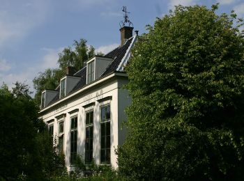
![Trail On foot Zoeterwoude - Weipoortroute - Photo](https://media.geolcdn.com/t/350/260/09bc46b3-ab09-41d2-8ef6-382b271a7acb.jpeg&format=jpg&maxdim=2)
![On foot On foot](https://static1.geolcdn.com/sitytour/trail-icons/100.png)
Km
On foot
![](/images/other/stat-length.png)
![](https://static1.geolcdn.com/siteimages/upload/files/1508320355ic_sort_den_pos_24dp.png)
![](https://static1.geolcdn.com/siteimages/upload/files/1508320355ic_sort_den_neg_24dp.png)
![](https://static1.geolcdn.com/siteimages/upload/files/16400158638029165_repeat_loop_refresh_sync_direction_icon.png)
• Trail created by Land van Wijk en Wouden. Boerenlandpad, deel van route gesloten in broedseizoen / access: permissiv...
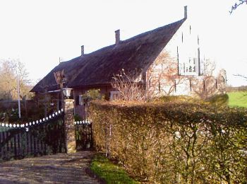
![Trail On foot Hoeksche Waard - Sint Anthoniepolderroute - Photo](https://media.geolcdn.com/t/350/260/d64ab71c-7396-40ea-9aa9-310fd0504641.jpeg&format=jpg&maxdim=2)
![On foot On foot](https://static1.geolcdn.com/sitytour/trail-icons/100.png)
Km
On foot
![](/images/other/stat-length.png)
![](https://static1.geolcdn.com/siteimages/upload/files/1508320355ic_sort_den_pos_24dp.png)
![](https://static1.geolcdn.com/siteimages/upload/files/1508320355ic_sort_den_neg_24dp.png)
![](https://static1.geolcdn.com/siteimages/upload/files/16400158638029165_repeat_loop_refresh_sync_direction_icon.png)
• Hier leef je het gezonde leven, op je eigen tempo, in alle rust en vrijheid en met alle ruimte, en toch op steenworp ...
20 trails displayed on 171
FREE GPS app for hiking