![](/images/other/stat-length.png)
Lozio, Brescia, On foot: Best trails, routes and walks
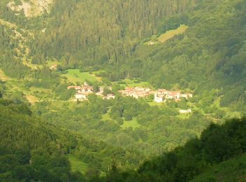
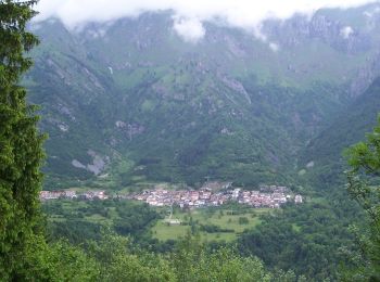
Lozio: Discover the best trails: 5 on foot. All these trails, routes and outdoor activities are available in our SityTrail applications for smartphones and tablets.
The best trails (5)
![Trail On foot Lozio - Trekking tra malghe e menhir anello 7: Dosso della Sella - Malga Rò - Photo](https://media.geolcdn.com/t/350/260/147aa4f6-49a6-42db-91cc-527fd88592c9.jpeg&format=jpg&maxdim=2)
![On foot On foot](https://static1.geolcdn.com/sitytour/trail-icons/100.png)
Km
On foot
![](/images/other/stat-length.png)
![](https://static1.geolcdn.com/siteimages/upload/files/1508320355ic_sort_den_pos_24dp.png)
![](https://static1.geolcdn.com/siteimages/upload/files/1508320355ic_sort_den_neg_24dp.png)
![](https://static1.geolcdn.com/siteimages/upload/files/16400158638029165_repeat_loop_refresh_sync_direction_icon.png)
• Trail created by Consorzio Forestale Pizzo Camino. Symbol: unmarked
![Trail On foot Lozio - Brigata Fiamme Verdi Giacomo Cappellini - Photo](https://media.geolcdn.com/t/350/260/bc709bbb-34b3-4f38-abd5-16d0218cfdbd.jpeg&format=jpg&maxdim=2)
![On foot On foot](https://static1.geolcdn.com/sitytour/trail-icons/100.png)
Km
On foot
![](/images/other/stat-length.png)
![](https://static1.geolcdn.com/siteimages/upload/files/1508320355ic_sort_den_pos_24dp.png)
![](https://static1.geolcdn.com/siteimages/upload/files/1508320355ic_sort_den_neg_24dp.png)
![](https://static1.geolcdn.com/siteimages/upload/files/16400158638029165_repeat_loop_refresh_sync_direction_icon.png)
• Trail created by Gruppo Operativo Volontario Sentieri della Resistenza Bresciana. DA COMPLETARE Symbol: 20 on green...
![Trail On foot Lozio - Lozio (Sommaprada) - Rifugio Gualtiero Laeng - Photo](https://media.geolcdn.com/t/350/260/999b953c-144e-4131-9cff-cf1912d6b4df.jpeg&format=jpg&maxdim=2)
![On foot On foot](https://static1.geolcdn.com/sitytour/trail-icons/100.png)
Km
On foot
![](/images/other/stat-length.png)
![](https://static1.geolcdn.com/siteimages/upload/files/1508320355ic_sort_den_pos_24dp.png)
![](https://static1.geolcdn.com/siteimages/upload/files/1508320355ic_sort_den_neg_24dp.png)
![](https://static1.geolcdn.com/siteimages/upload/files/16400158638029165_repeat_loop_refresh_sync_direction_icon.png)
• Trail created by Club Alpino Italiano. Symbol: 136 on white red flag
![Trail On foot Lozio - Lozio - Passo di Baione - Photo](https://media.geolcdn.com/t/350/260/1b3e3337-8d40-4cb3-8492-c9957f0e2cf6.jpeg&format=jpg&maxdim=2)
![On foot On foot](https://static1.geolcdn.com/sitytour/trail-icons/100.png)
Km
On foot
![](/images/other/stat-length.png)
![](https://static1.geolcdn.com/siteimages/upload/files/1508320355ic_sort_den_pos_24dp.png)
![](https://static1.geolcdn.com/siteimages/upload/files/1508320355ic_sort_den_neg_24dp.png)
![](https://static1.geolcdn.com/siteimages/upload/files/16400158638029165_repeat_loop_refresh_sync_direction_icon.png)
• Trail created by Club Alpino Italiano. Symbol: 81 on white red flag
![Trail On foot Lozio - Sentiero della ciaspolata - Photo](https://media.geolcdn.com/t/350/260/6a7b0a62-ee18-40d8-b875-b87e3e667081.jpeg&format=jpg&maxdim=2)
![On foot On foot](https://static1.geolcdn.com/sitytour/trail-icons/100.png)
Km
On foot
![](/images/other/stat-length.png)
![](https://static1.geolcdn.com/siteimages/upload/files/1508320355ic_sort_den_pos_24dp.png)
![](https://static1.geolcdn.com/siteimages/upload/files/1508320355ic_sort_den_neg_24dp.png)
![](https://static1.geolcdn.com/siteimages/upload/files/16400158638029165_repeat_loop_refresh_sync_direction_icon.png)
• Trail created by Valle di Lozio in ciaspole. Symbol: unmarked
5 trails displayed on 5
FREE GPS app for hiking