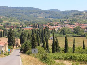
![](/images/other/stat-length.png)
Metropolitan City of Florence, Tuscany, On foot: Best trails, routes and walks
Metropolitan City of Florence: Discover the best trails: 374 on foot and 13 walking. All these trails, routes and outdoor activities are available in our SityTrail applications for smartphones and tablets.
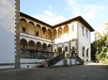
The best trails (387)
![Trail On foot Londa - IT-52 - Photo](https://media.geolcdn.com/t/350/260/caa52aba-d6f4-4c46-85a0-d9ffb2bfab58.jpeg&format=jpg&maxdim=2)
![On foot On foot](https://static1.geolcdn.com/sitytour/trail-icons/100.png)
Km
On foot
![](/images/other/stat-length.png)
![](https://static1.geolcdn.com/siteimages/upload/files/1508320355ic_sort_den_pos_24dp.png)
![](https://static1.geolcdn.com/siteimages/upload/files/1508320355ic_sort_den_neg_24dp.png)
![](https://static1.geolcdn.com/siteimages/upload/files/16400158638029165_repeat_loop_refresh_sync_direction_icon.png)
• Trail created by CAI.
![Trail On foot Pontassieve - Sentiero della Memoria - Photo](https://media.geolcdn.com/t/350/260/7e74e0eb-867a-44f7-87d8-5b34d906ee95.jpeg&format=jpg&maxdim=2)
![On foot On foot](https://static1.geolcdn.com/sitytour/trail-icons/100.png)
Km
On foot
![](/images/other/stat-length.png)
![](https://static1.geolcdn.com/siteimages/upload/files/1508320355ic_sort_den_pos_24dp.png)
![](https://static1.geolcdn.com/siteimages/upload/files/1508320355ic_sort_den_neg_24dp.png)
![](https://static1.geolcdn.com/siteimages/upload/files/16400158638029165_repeat_loop_refresh_sync_direction_icon.png)
• Trail created by CAI.
![Trail On foot Firenzuola - Sorgenti di Firenze Trekking - Anello 15: Sui monti di Moscheta - Photo](https://media.geolcdn.com/t/350/260/933cc0d5-e5eb-4971-b1fe-de6532420af3.jpeg&format=jpg&maxdim=2)
![On foot On foot](https://static1.geolcdn.com/sitytour/trail-icons/100.png)
Km
On foot
![](/images/other/stat-length.png)
![](https://static1.geolcdn.com/siteimages/upload/files/1508320355ic_sort_den_pos_24dp.png)
![](https://static1.geolcdn.com/siteimages/upload/files/1508320355ic_sort_den_neg_24dp.png)
![](https://static1.geolcdn.com/siteimages/upload/files/16400158638029165_repeat_loop_refresh_sync_direction_icon.png)
• Trail created by Comunità Montana del Mugello.
![Trail On foot Greve in Chianti - IT-25 - Photo](https://media.geolcdn.com/t/350/260/ce4623b2-f598-4b57-82d6-e1805b0f938b.jpeg&format=jpg&maxdim=2)
![On foot On foot](https://static1.geolcdn.com/sitytour/trail-icons/100.png)
Km
On foot
![](/images/other/stat-length.png)
![](https://static1.geolcdn.com/siteimages/upload/files/1508320355ic_sort_den_pos_24dp.png)
![](https://static1.geolcdn.com/siteimages/upload/files/1508320355ic_sort_den_neg_24dp.png)
![](https://static1.geolcdn.com/siteimages/upload/files/16400158638029165_repeat_loop_refresh_sync_direction_icon.png)
• Trail created by CAI.
![Trail On foot San Godenzo - Sogenti di Firenze Trekking - Anello Principale - Photo](https://media.geolcdn.com/t/350/260/130d3e21-ebaa-4aab-ad63-5ee7456f7c76.jpeg&format=jpg&maxdim=2)
![On foot On foot](https://static1.geolcdn.com/sitytour/trail-icons/100.png)
Km
On foot
![](/images/other/stat-length.png)
![](https://static1.geolcdn.com/siteimages/upload/files/1508320355ic_sort_den_pos_24dp.png)
![](https://static1.geolcdn.com/siteimages/upload/files/1508320355ic_sort_den_neg_24dp.png)
![](https://static1.geolcdn.com/siteimages/upload/files/16400158638029165_repeat_loop_refresh_sync_direction_icon.png)
• Trail created by Comunità Montana del Mugello.
![Trail On foot - Sorgenti di Firenze Trekking – Anello Principale: Tappa 10 - Photo](https://media.geolcdn.com/t/350/260/87676b3a-1e4f-4995-9ee9-db964e15b7f2.jpeg&format=jpg&maxdim=2)
![On foot On foot](https://static1.geolcdn.com/sitytour/trail-icons/100.png)
Km
On foot
![](/images/other/stat-length.png)
![](https://static1.geolcdn.com/siteimages/upload/files/1508320355ic_sort_den_pos_24dp.png)
![](https://static1.geolcdn.com/siteimages/upload/files/1508320355ic_sort_den_neg_24dp.png)
![](https://static1.geolcdn.com/siteimages/upload/files/16400158638029165_repeat_loop_refresh_sync_direction_icon.png)
• Trail created by Comunità Montana del Mugello.
![Trail On foot - Sorgenti di Firenze Trekking – Anello Principale: Tappa 9 - Photo](https://media.geolcdn.com/t/350/260/435133d9-55ed-40ba-b7d3-61ca89b1941d.jpeg&format=jpg&maxdim=2)
![On foot On foot](https://static1.geolcdn.com/sitytour/trail-icons/100.png)
Km
On foot
![](/images/other/stat-length.png)
![](https://static1.geolcdn.com/siteimages/upload/files/1508320355ic_sort_den_pos_24dp.png)
![](https://static1.geolcdn.com/siteimages/upload/files/1508320355ic_sort_den_neg_24dp.png)
![](https://static1.geolcdn.com/siteimages/upload/files/16400158638029165_repeat_loop_refresh_sync_direction_icon.png)
• Trail created by Comunità Montana del Mugello.
![Trail On foot Borgo San Lorenzo - Sorgenti di Firenze Trekking – Anello Principale: Tappa 8 - Photo](https://media.geolcdn.com/t/350/260/435133d9-55ed-40ba-b7d3-61ca89b1941d.jpeg&format=jpg&maxdim=2)
![On foot On foot](https://static1.geolcdn.com/sitytour/trail-icons/100.png)
Km
On foot
![](/images/other/stat-length.png)
![](https://static1.geolcdn.com/siteimages/upload/files/1508320355ic_sort_den_pos_24dp.png)
![](https://static1.geolcdn.com/siteimages/upload/files/1508320355ic_sort_den_neg_24dp.png)
![](https://static1.geolcdn.com/siteimages/upload/files/16400158638029165_repeat_loop_refresh_sync_direction_icon.png)
• Trail created by Comunità Montana del Mugello.
![Trail On foot Pontassieve - Sorgenti di Firenze Trekking – Anello Principale: Tappa 7 - Photo](https://media.geolcdn.com/t/350/260/7fb01651-1f01-4497-b437-b45f81449377.jpeg&format=jpg&maxdim=2)
![On foot On foot](https://static1.geolcdn.com/sitytour/trail-icons/100.png)
Km
On foot
![](/images/other/stat-length.png)
![](https://static1.geolcdn.com/siteimages/upload/files/1508320355ic_sort_den_pos_24dp.png)
![](https://static1.geolcdn.com/siteimages/upload/files/1508320355ic_sort_den_neg_24dp.png)
![](https://static1.geolcdn.com/siteimages/upload/files/16400158638029165_repeat_loop_refresh_sync_direction_icon.png)
• Trail created by Comunità Montana del Mugello.
![Trail On foot Pelago - Sorgenti di Firenze Trekking – Anello Principale: Tappa 6 - Photo](https://media.geolcdn.com/t/350/260/e7371f7d-11f3-442e-a4fb-7ccdfb832cf7.jpeg&format=jpg&maxdim=2)
![On foot On foot](https://static1.geolcdn.com/sitytour/trail-icons/100.png)
Km
On foot
![](/images/other/stat-length.png)
![](https://static1.geolcdn.com/siteimages/upload/files/1508320355ic_sort_den_pos_24dp.png)
![](https://static1.geolcdn.com/siteimages/upload/files/1508320355ic_sort_den_neg_24dp.png)
![](https://static1.geolcdn.com/siteimages/upload/files/16400158638029165_repeat_loop_refresh_sync_direction_icon.png)
• Trail created by Comunità Montana del Mugello.
![Trail On foot San Godenzo - Sorgenti di Firenze Trekking – Anello Principale: Tappa 3 - Photo](https://media.geolcdn.com/t/350/260/9cb41ace-b4d3-4e53-b2a8-2ef3b3fa315c.jpeg&format=jpg&maxdim=2)
![On foot On foot](https://static1.geolcdn.com/sitytour/trail-icons/100.png)
Km
On foot
![](/images/other/stat-length.png)
![](https://static1.geolcdn.com/siteimages/upload/files/1508320355ic_sort_den_pos_24dp.png)
![](https://static1.geolcdn.com/siteimages/upload/files/1508320355ic_sort_den_neg_24dp.png)
![](https://static1.geolcdn.com/siteimages/upload/files/16400158638029165_repeat_loop_refresh_sync_direction_icon.png)
• Trail created by Comunità Montana del Mugello.
![Trail On foot Borgo San Lorenzo - Sorgenti di Firenze Trekking – Anello Principale: Tappa 2 - Photo](https://media.geolcdn.com/t/350/260/e9201934-1504-4de1-90ca-58ff0ff3313b.jpeg&format=jpg&maxdim=2)
![On foot On foot](https://static1.geolcdn.com/sitytour/trail-icons/100.png)
Km
On foot
![](/images/other/stat-length.png)
![](https://static1.geolcdn.com/siteimages/upload/files/1508320355ic_sort_den_pos_24dp.png)
![](https://static1.geolcdn.com/siteimages/upload/files/1508320355ic_sort_den_neg_24dp.png)
![](https://static1.geolcdn.com/siteimages/upload/files/16400158638029165_repeat_loop_refresh_sync_direction_icon.png)
• Trail created by Comunità Montana del Mugello.
![Trail On foot Firenzuola - Sorgenti di Firenze Trekking – Anello Principale: Tappa 1 - Photo](https://media.geolcdn.com/t/350/260/484a73ee-a64f-4bc5-b576-0dd44087b5af.jpeg&format=jpg&maxdim=2)
![On foot On foot](https://static1.geolcdn.com/sitytour/trail-icons/100.png)
Km
On foot
![](/images/other/stat-length.png)
![](https://static1.geolcdn.com/siteimages/upload/files/1508320355ic_sort_den_pos_24dp.png)
![](https://static1.geolcdn.com/siteimages/upload/files/1508320355ic_sort_den_neg_24dp.png)
![](https://static1.geolcdn.com/siteimages/upload/files/16400158638029165_repeat_loop_refresh_sync_direction_icon.png)
• Trail created by Comunità Montana del Mugello.
![Trail On foot Barberino di Mugello - Sorgenti di Firenze Trekking – Anello Principale: Tappa 11 - Photo](https://media.geolcdn.com/t/350/260/04e33d0c-226f-4b00-9046-28fb0c249e7e.jpeg&format=jpg&maxdim=2)
![On foot On foot](https://static1.geolcdn.com/sitytour/trail-icons/100.png)
Km
On foot
![](/images/other/stat-length.png)
![](https://static1.geolcdn.com/siteimages/upload/files/1508320355ic_sort_den_pos_24dp.png)
![](https://static1.geolcdn.com/siteimages/upload/files/1508320355ic_sort_den_neg_24dp.png)
![](https://static1.geolcdn.com/siteimages/upload/files/16400158638029165_repeat_loop_refresh_sync_direction_icon.png)
• Trail created by Comunità Montana del Mugello.
![Trail On foot Scarperia e San Piero - IT-SOFT 07 - Photo](https://media.geolcdn.com/t/350/260/435133d9-55ed-40ba-b7d3-61ca89b1941d.jpeg&format=jpg&maxdim=2)
![On foot On foot](https://static1.geolcdn.com/sitytour/trail-icons/100.png)
Km
On foot
![](/images/other/stat-length.png)
![](https://static1.geolcdn.com/siteimages/upload/files/1508320355ic_sort_den_pos_24dp.png)
![](https://static1.geolcdn.com/siteimages/upload/files/1508320355ic_sort_den_neg_24dp.png)
![](https://static1.geolcdn.com/siteimages/upload/files/16400158638029165_repeat_loop_refresh_sync_direction_icon.png)
• Trail created by Comunità Montana del Mugello.
![Trail On foot Scandicci - IT-738 - Photo](https://media.geolcdn.com/t/350/260/0ed1d64b-d619-4f82-83af-965e86951284.jpeg&format=jpg&maxdim=2)
![On foot On foot](https://static1.geolcdn.com/sitytour/trail-icons/100.png)
Km
On foot
![](/images/other/stat-length.png)
![](https://static1.geolcdn.com/siteimages/upload/files/1508320355ic_sort_den_pos_24dp.png)
![](https://static1.geolcdn.com/siteimages/upload/files/1508320355ic_sort_den_neg_24dp.png)
![](https://static1.geolcdn.com/siteimages/upload/files/16400158638029165_repeat_loop_refresh_sync_direction_icon.png)
• Trail created by CAI.
![Trail On foot Lastra a Signa - IT-730 - Photo](https://media.geolcdn.com/t/350/260/f246e0fb-9833-4f7f-be2e-3048c0a8d962.jpeg&format=jpg&maxdim=2)
![On foot On foot](https://static1.geolcdn.com/sitytour/trail-icons/100.png)
Km
On foot
![](/images/other/stat-length.png)
![](https://static1.geolcdn.com/siteimages/upload/files/1508320355ic_sort_den_pos_24dp.png)
![](https://static1.geolcdn.com/siteimages/upload/files/1508320355ic_sort_den_neg_24dp.png)
![](https://static1.geolcdn.com/siteimages/upload/files/16400158638029165_repeat_loop_refresh_sync_direction_icon.png)
• Trail created by CAI.
![Trail On foot Fiesole - IT-60 - Photo](https://media.geolcdn.com/t/350/260/4ae73887-f3a4-47b3-a505-8bc06e1d2895.jpeg&format=jpg&maxdim=2)
![On foot On foot](https://static1.geolcdn.com/sitytour/trail-icons/100.png)
Km
On foot
![](/images/other/stat-length.png)
![](https://static1.geolcdn.com/siteimages/upload/files/1508320355ic_sort_den_pos_24dp.png)
![](https://static1.geolcdn.com/siteimages/upload/files/1508320355ic_sort_den_neg_24dp.png)
![](https://static1.geolcdn.com/siteimages/upload/files/16400158638029165_repeat_loop_refresh_sync_direction_icon.png)
• Trail created by CAI.
![Trail On foot Barberino Tavarnelle - IT-360 - Photo](https://media.geolcdn.com/t/350/260/4cfc3795-8983-427d-9408-26d6c7ddb808.jpeg&format=jpg&maxdim=2)
![On foot On foot](https://static1.geolcdn.com/sitytour/trail-icons/100.png)
Km
On foot
![](/images/other/stat-length.png)
![](https://static1.geolcdn.com/siteimages/upload/files/1508320355ic_sort_den_pos_24dp.png)
![](https://static1.geolcdn.com/siteimages/upload/files/1508320355ic_sort_den_neg_24dp.png)
![](https://static1.geolcdn.com/siteimages/upload/files/16400158638029165_repeat_loop_refresh_sync_direction_icon.png)
• Trail created by CAI.
![Trail On foot Fiesole - IT-10 - Photo](https://media.geolcdn.com/t/350/260/99aea3c1-938d-4da7-9462-71c60e7d601e.jpeg&format=jpg&maxdim=2)
![On foot On foot](https://static1.geolcdn.com/sitytour/trail-icons/100.png)
Km
On foot
![](/images/other/stat-length.png)
![](https://static1.geolcdn.com/siteimages/upload/files/1508320355ic_sort_den_pos_24dp.png)
![](https://static1.geolcdn.com/siteimages/upload/files/1508320355ic_sort_den_neg_24dp.png)
![](https://static1.geolcdn.com/siteimages/upload/files/16400158638029165_repeat_loop_refresh_sync_direction_icon.png)
• Trail created by Club Alpino Italiano.
20 trails displayed on 387
FREE GPS app for hiking
Activities
Nearby regions
- Bagno a Ripoli
- Barberino Tavarnelle
- Barberino di Mugello
- Borgo San Lorenzo
- Calenzano
- Campi Bisenzio
- Castelfiorentino
- Certaldo
- Dicomano
- Empoli
- Fiesole
- Figline e Incisa Valdarno
- Firenzuola
- Florence
- Fucecchio
- Gambassi Terme
- Greve in Chianti
- Impruneta
- Lastra a Signa
- Londa
- Marradi
- Montaione
- Montespertoli
- Palazzuolo sul Senio
- Pelago
- Pontassieve
- Reggello
- Rignano sull'Arno
- Rufina
- San Casciano in Val di Pesa
- San Godenzo
- Scandicci
- Scarperia e San Piero
- Sesto Fiorentino
- Vaglia
- Vicchio
- Vinci