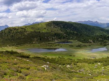
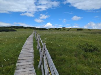
![](/images/other/stat-length.png)
- Trails
- On foot
- Italy
- Trentino-Alto Adige/Südtirol
- South Tyrol
- Villanders - Villandro
Villanders - Villandro, South Tyrol, On foot: Best trails, routes and walks
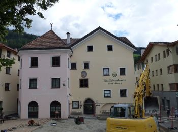
Villanders - Villandro: Discover the best trails: 2 on foot and 3 walking. All these trails, routes and outdoor activities are available in our SityTrail applications for smartphones and tablets.
The best trails (5)
![Trail On foot Villanders - Villandro - AVS 3 - Sarnthein - Gasteiger Sattel - Photo](https://media.geolcdn.com/t/350/260/7a56c884-2148-49a5-a8e6-1071292762e5.jpeg&format=jpg&maxdim=2)
![On foot On foot](https://static1.geolcdn.com/sitytour/trail-icons/100.png)
Km
On foot
![](/images/other/stat-length.png)
![](https://static1.geolcdn.com/siteimages/upload/files/1508320355ic_sort_den_pos_24dp.png)
![](https://static1.geolcdn.com/siteimages/upload/files/1508320355ic_sort_den_neg_24dp.png)
![](https://static1.geolcdn.com/siteimages/upload/files/16400158638029165_repeat_loop_refresh_sync_direction_icon.png)
• Trail created by Alpenverein Südtirol AVS.
![Trail On foot Villanders - Villandro - AVS 6 - Gasserhütte - Schloss Reinegg - Photo](https://media.geolcdn.com/t/350/260/8ccd039a-c2e5-4264-855a-76467199b255.jpeg&format=jpg&maxdim=2)
![On foot On foot](https://static1.geolcdn.com/sitytour/trail-icons/100.png)
Km
On foot
![](/images/other/stat-length.png)
![](https://static1.geolcdn.com/siteimages/upload/files/1508320355ic_sort_den_pos_24dp.png)
![](https://static1.geolcdn.com/siteimages/upload/files/1508320355ic_sort_den_neg_24dp.png)
![](https://static1.geolcdn.com/siteimages/upload/files/16400158638029165_repeat_loop_refresh_sync_direction_icon.png)
• Trail created by Alpenverein Südtirol (AVS). Symbol: roter Strich auf weißem Grund
![Trail Walking Villanders - Villandro - Villanderer Alm - Stöfflhütte et prairies marécageuses - Photo](https://media.geolcdn.com/t/350/260/f4cfb224-6033-401b-93cf-b575e7aa3743.jpg&format=jpg&maxdim=2)
![Walking Walking](https://static1.geolcdn.com/sitytour/trail-icons/101.png)
Km
Walking
![](/images/other/stat-length.png)
![](https://static1.geolcdn.com/siteimages/upload/files/1508320355ic_sort_den_pos_24dp.png)
![](https://static1.geolcdn.com/siteimages/upload/files/1508320355ic_sort_den_neg_24dp.png)
![](https://static1.geolcdn.com/siteimages/upload/files/16400158638029165_repeat_loop_refresh_sync_direction_icon.png)
![Trail Walking Villanders - Villandro - Villanderer Alm - Photo](https://media.geolcdn.com/t/350/260/ext.jpg?maxdim=2&url=https%3A%2F%2Fservices.sitytrail.com%2FGeolivesWS%2FDownloadMedia.ashx%3FTrailID%3D1010396%26Media%3Dfix__20180722143429.jpg)
![Walking Walking](https://static1.geolcdn.com/sitytour/trail-icons/101.png)
Km
Walking
![](/images/other/stat-length.png)
![](https://static1.geolcdn.com/siteimages/upload/files/1508320355ic_sort_den_pos_24dp.png)
![](https://static1.geolcdn.com/siteimages/upload/files/1508320355ic_sort_den_neg_24dp.png)
![](https://static1.geolcdn.com/siteimages/upload/files/16400158638029165_repeat_loop_refresh_sync_direction_icon.png)
• Faite le 22/07/2018 avec notre fils Théo de 13 ans. D'après "Wanderung zum Totensee" du site www.sentres.com. Durée i...
![Trail Walking Villanders - Villandro - villander - Photo](https://media.geolcdn.com/t/350/260/5d906dbc-1938-4164-ba7e-67500184f50a.jpg&format=jpg&maxdim=2)
![Walking Walking](https://static1.geolcdn.com/sitytour/trail-icons/101.png)
Km
Walking
![](/images/other/stat-length.png)
![](https://static1.geolcdn.com/siteimages/upload/files/1508320355ic_sort_den_pos_24dp.png)
![](https://static1.geolcdn.com/siteimages/upload/files/1508320355ic_sort_den_neg_24dp.png)
![](https://static1.geolcdn.com/siteimages/upload/files/16400158638029165_repeat_loop_refresh_sync_direction_icon.png)
5 trails displayed on 5
FREE GPS app for hiking