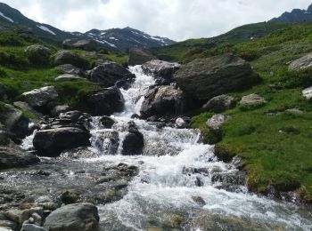
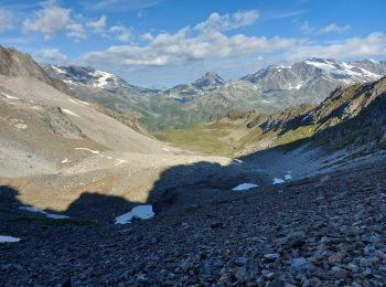
Valgrisenche, Unknown, On foot: Best trails, routes and walks

1 comments

Valgrisenche: Discover the best trails: 8 on foot and 23 walking. All these trails, routes and outdoor activities are available in our SityTrail applications for smartphones and tablets.


The best trails (31)
Trail On foot Valgrisenche - Alta Via n. 2 della Valle d'Aosta - Tappa 6 - Photo
On foot 7.331
Km
GUIDE+

On foot

Easy
Valgrisenche, Aosta Valley, Unknown, Italy
7.3 km | 15.9 km-effort
3h 36min
481 m
1129 m
No
SityTrail - itinéraires balisés pédestres

• Rifugio Chalet de l'Epée - Rhêmes-Notre-Dame Alte Vie Website: http://www.lovevda.it/it/banca-dati/7/alte-vie/valle...
Trail On foot Valgrisenche - (SI F03) Rifugio Chalet de l'Epée - Planaval - Photo
On foot 12.121
Km
GUIDE+

On foot

Easy
Valgrisenche, Aosta Valley, Unknown, Italy
12.1 km | 17.7 km-effort
4h 1min
218 m
1031 m
No
SityTrail - itinéraires balisés pédestres

• Sentiero Italia CAI 2019

Trail On foot Valgrisenche - 16, Rif. degli Angeli Dall'Arp Vieille - Photo
On foot 5.518
Km
GUIDE+

On foot

Easy
Valgrisenche, Aosta Valley, Unknown, Italy
5.5 km | 16.1 km-effort
3h 39min
1057 m
4 m
No
SityTrail - itinéraires balisés pédestres

Trail On foot Valgrisenche - 11, Rif. Bezzi - Rif. Chalet de l'Epée - Photo
On foot 9.691
Km
GUIDE+

On foot

Easy
Valgrisenche, Aosta Valley, Unknown, Italy
9.7 km | 18.4 km-effort
4h 10min
670 m
588 m
No
SityTrail - itinéraires balisés pédestres

Trail On foot Valgrisenche - 12, Saxe Savoie-Rif. Bezzi - Photo
On foot 4.935
Km
GUIDE+

On foot

Easy
Valgrisenche, Aosta Valley, Unknown, Italy
4.9 km | 6.5 km-effort
1h 28min
11 m
429 m
No
SityTrail - itinéraires balisés pédestres

Trail On foot Valgrisenche - 12C, Rif. Bezzi-Col Bassac Deré - Photo
On foot 5.297
Km
GUIDE+

On foot

Easy
(1)
Valgrisenche, Aosta Valley, Unknown, Italy
5.3 km | 13.4 km-effort
3h 2min
809 m
5 m
No
SityTrail - itinéraires balisés pédestres

Trail Walking Valgrisenche - 180720 aoste . valgrisenche bonne . meillares .A-R - Photo
Walking 8.587
Km
GUIDE

Walking

Medium
Valgrisenche, Aosta Valley, Unknown, Italy
8.6 km | 15.8 km-effort
4h 36min
543 m
542 m
Yes
stef789

Trail Walking Valgrisenche - trace - Photo
Walking 7.011
Km

Walking

Medium
Valgrisenche, Aosta Valley, Unknown, Italy
7 km | 15.5 km-effort
3h 31min
474 m
1121 m
No
GAPIAN43

• Grand Paradis 2024 - Jour 6 - Ref de l'Epée -> Rhemes Notre Dame par col de la Fenetre

Trail Walking Valgrisenche - refuge Mario Bezzi Italie/ Ste Foy en Tarentaise parking Bon conseil  - Photo
Walking 14.029
Km

Walking

Very difficult
Valgrisenche, Aosta Valley, Unknown, Italy
14 km | 24 km-effort
5h 20min
601 m
1072 m
No
GAPIED

Trail Walking Valgrisenche - Étape 2 : Refuge Degli Angeli - Col du Mont - Refuge de l'Archeboc - Photo
Walking 14.785
Km

Walking

Difficult
Valgrisenche, Aosta Valley, Unknown, Italy
14.8 km | 28 km-effort
8h 12min
757 m
1627 m
No
i20

Trail Walking Valgrisenche - Jour 2 - Refuge degli Angeli - Refuge de l'Archeboc - Photo
Walking 14.199
Km

Walking

Very difficult
Valgrisenche, Aosta Valley, Unknown, Italy
14.2 km | 27 km-effort
6h 13min
772 m
1643 m
No
i20

Trail On foot Valgrisenche - 9A, Surrier Rifugio Chalet De L'Epée - Photo
On foot 4.583
Km
GUIDE+

On foot

Easy
Valgrisenche, Aosta Valley, Unknown, Italy
4.6 km | 10.4 km-effort
2h 21min
577 m
1 m
No
SityTrail - itinéraires balisés pédestres

Trail Walking Valgrisenche - Rifugio Epee - Rhemes notre dame - Photo
Walking 8.096
Km

Walking

Easy
Valgrisenche, Aosta Valley, Unknown, Italy
8.1 km | 16.7 km-effort
2h 50min
481 m
1140 m
No
dewasseigean

Trail Walking Valgrisenche - Grand Paradis - J5 - Photo
Walking 7.371
Km

Walking

Difficult
Valgrisenche, Aosta Valley, Unknown, Italy
7.4 km | 16 km-effort
2h 48min
482 m
1129 m
No
saphile

Trail Walking Valgrisenche - Grand Paradis - J4 - Photo
Walking 14.141
Km

Walking

Very difficult
Valgrisenche, Aosta Valley, Unknown, Italy
14.1 km | 29 km-effort
5h 52min
1108 m
1027 m
No
saphile

Trail Walking Valgrisenche - 2015-GranParadiso Jour2 - Photo
Walking 10.25
Km

Walking

Very easy
Valgrisenche, Aosta Valley, Unknown, Italy
10.2 km | 21 km-effort
4h 16min
828 m
821 m
No
i20

Trail Walking Valgrisenche - trace - Photo
Walking 9.571
Km

Walking

Difficult
Valgrisenche, Aosta Valley, Unknown, Italy
9.6 km | 18.3 km-effort
4h 8min
672 m
590 m
No
GAPIAN43

Trail On foot Valgrisenche - Refuge degli Angeli - Refuge de l'Archeboc - Photo
On foot 17.793
Km

On foot

Difficult
Valgrisenche, Aosta Valley, Unknown, Italy
17.8 km | 37 km-effort
8h 18min
1194 m
2057 m
No
i20

Trail Walking Valgrisenche - Refuge des anges vers refuge de l'archeboc - Photo
Walking 12.367
Km

Walking

Very difficult
Valgrisenche, Aosta Valley, Unknown, Italy
12.4 km | 24 km-effort
5h 32min
693 m
1533 m
No
Stéphane Ruchet

Trail Walking Valgrisenche - Refuge des anges vers l'archeboc - Photo
Walking 12.438
Km

Walking

Very difficult
Valgrisenche, Aosta Valley, Unknown, Italy
12.4 km | 25 km-effort
5h 34min
695 m
1551 m
No
Stéphane Ruchet

20 trails displayed on 31

FREE GPS app for hiking

Logo SityTrail SityTrail

IGN / Geographical institutes

Download SityTrail from the App Store Download SityTrail from Google Play

Logo SityTrail SityTrail World

The world is yours!

Download SityTrail from the App Store Download SityTrail from Google Play Download SityTrail on Huawei AppGallery

Activities

Close
My subscriptions