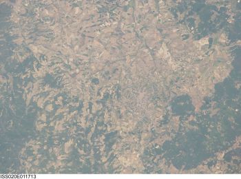
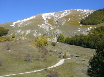
Scanno, L'Aquila, On foot: Best trails, routes and walks

Scanno: Discover the best trails: 23 on foot. All these trails, routes and outdoor activities are available in our SityTrail applications for smartphones and tablets.


The best trails (23)
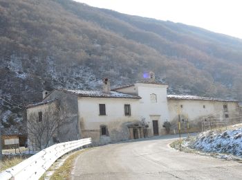
Trail On foot Scanno - San Liborio - Stazzo di Preccia - Photo
On foot 3.266
Km
GUIDE+

On foot

Easy
Scanno, Abruzzo, L'Aquila, Italy
3.3 km | 8.3 km-effort
1h 53min
500 m
18 m
No
SityTrail - itinéraires balisés pédestres

• Symbol: 44 on white red flags

Trail On foot Scanno - Scanno - Collerotondo - Photo
On foot 3.213
Km
GUIDE+

On foot

Easy
Scanno, Abruzzo, L'Aquila, Italy
3.2 km | 8.4 km-effort
1h 53min
513 m
5 m
No
SityTrail - itinéraires balisés pédestres

• Symbol: 40 on white red flags

Trail On foot Scanno - Stazzo Mandrucce - Imposto di Chiarano - Photo
On foot 4.622
Km
GUIDE+

On foot

Easy
Scanno, Abruzzo, L'Aquila, Italy
4.6 km | 6.6 km-effort
1h 29min
78 m
354 m
No
SityTrail - itinéraires balisés pédestres

• Symbol: 36 on white red flags

Trail On foot Scanno - Vallone delle Croci - Fonte Sparvera - Photo
On foot 6.716
Km
GUIDE+

On foot

Easy
Scanno, Abruzzo, L'Aquila, Italy
6.7 km | 16.9 km-effort
3h 49min
942 m
218 m
No
SityTrail - itinéraires balisés pédestres

• Symbol: 30 on white red flags

Trail On foot Scanno - San Liborio - Cantoniera Mimola - Photo
On foot 5.899
Km
GUIDE+

On foot

Easy
Scanno, Abruzzo, L'Aquila, Italy
5.9 km | 11.7 km-effort
2h 39min
501 m
226 m
No
SityTrail - itinéraires balisés pédestres

• Symbol: 26 on white red flags

Trail On foot Scanno - Scanno - Serra di Zio Mas - Photo
On foot 11.657
Km
GUIDE+

On foot

Easy
Scanno, Abruzzo, L'Aquila, Italy
11.7 km | 18.5 km-effort
4h 12min
639 m
140 m
No
SityTrail - itinéraires balisés pédestres

• Symbol: Y7 on white red flags

Trail On foot Scanno - Scanno - Valico del Carapale - Monte Terraegna - Photo
On foot 6.529
Km
GUIDE+

On foot

Easy
Scanno, Abruzzo, L'Aquila, Italy
6.5 km | 17.1 km-effort
3h 53min
954 m
306 m
No
SityTrail - itinéraires balisés pédestres

• Symbol: A3 on white red flags

Trail On foot Scanno - Passo Godi - Stazzo Mandrucce - Photo
On foot 7.263
Km
GUIDE+

On foot

Easy
Scanno, Abruzzo, L'Aquila, Italy
7.3 km | 11.7 km-effort
2h 39min
380 m
197 m
No
SityTrail - itinéraires balisés pédestres

• Symbol: 46 on white red flags

Trail On foot Scanno - Vallone dei Romani - Photo
On foot 3.139
Km
GUIDE+

On foot

Easy
Scanno, Abruzzo, L'Aquila, Italy
3.1 km | 9 km-effort
2h 3min
590 m
0 m
No
SityTrail - itinéraires balisés pédestres

• Symbol: 30A on white red flags

Trail On foot Scanno - Rifugio Passo Godi - Lago Pantaniello - Photo
On foot 9.365
Km
GUIDE+

On foot

Easy
Scanno, Abruzzo, L'Aquila, Italy
9.4 km | 15.9 km-effort
3h 37min
559 m
290 m
No
SityTrail - itinéraires balisés pédestres

• Trail created by PNALM. Symbol: Y2 on white red flags
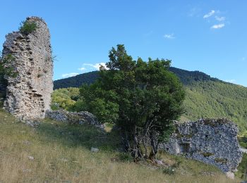
Trail On foot Scanno - Scanno - Le Tre Croci - Photo
On foot 8.35
Km
GUIDE+

On foot

Easy
Scanno, Abruzzo, L'Aquila, Italy
8.3 km | 16.2 km-effort
3h 41min
756 m
98 m
No
SityTrail - itinéraires balisés pédestres

Trail On foot Scanno - Frattura - Ovile Genzana - Photo
On foot 4.843
Km
GUIDE+

On foot

Easy
Scanno, Abruzzo, L'Aquila, Italy
4.8 km | 10.8 km-effort
2h 27min
594 m
5 m
No
SityTrail - itinéraires balisés pédestres

• Symbol: 38 on white red flags

Trail On foot Scanno - Fonte Malvascione - I Giardini - Photo
On foot 4.575
Km
GUIDE+

On foot

Easy
Scanno, Abruzzo, L'Aquila, Italy
4.6 km | 6.7 km-effort
1h 31min
119 m
273 m
No
SityTrail - itinéraires balisés pédestres

• Symbol: 31 on white red flags

Trail On foot Scanno - Passo Godi - Monte Godi - Photo
On foot 3.018
Km
GUIDE+

On foot

Easy
Scanno, Abruzzo, L'Aquila, Italy
3 km | 7 km-effort
1h 35min
397 m
0 m
No
SityTrail - itinéraires balisés pédestres

• Symbol: 24 on white red flags

Trail On foot Scanno - Serra di Ferroio - Monte Godi - Photo
On foot 3.286
Km
GUIDE+

On foot

Easy
Scanno, Abruzzo, L'Aquila, Italy
3.3 km | 6.7 km-effort
1h 31min
332 m
22 m
No
SityTrail - itinéraires balisés pédestres

• Symbol: 23 on white red flags

Trail On foot Scanno - Le Prata di San Liborio - Valico del Campitello - Photo
On foot 6.03
Km
GUIDE+

On foot

Easy
Scanno, Abruzzo, L'Aquila, Italy
6 km | 13.8 km-effort
3h 8min
743 m
103 m
No
SityTrail - itinéraires balisés pédestres

• Symbol: Y9 on white red flags

Trail On foot Scanno - Masseria Parenti - Valico del Campitello - Photo
On foot 4.34
Km
GUIDE+

On foot

Easy
Scanno, Abruzzo, L'Aquila, Italy
4.3 km | 10.3 km-effort
2h 20min
600 m
0 m
No
SityTrail - itinéraires balisés pédestres

• Symbol: Y8 on white red flags

Trail On foot Scanno - Serra di Zio Mas - Valico del Campitello - Photo
On foot 3.394
Km
GUIDE+

On foot

Easy
Scanno, Abruzzo, L'Aquila, Italy
3.4 km | 6.3 km-effort
1h 25min
284 m
14 m
No
SityTrail - itinéraires balisés pédestres

• Symbol: Y6 on white red flags

Trail On foot Scanno - Serra di Zio Mas - Valico della Corte - Photo
On foot 5.133
Km
GUIDE+

On foot

Easy
Scanno, Abruzzo, L'Aquila, Italy
5.1 km | 9 km-effort
2h 2min
360 m
76 m
No
SityTrail - itinéraires balisés pédestres

• Symbol: Y1 on white red flags

Trail On foot Scanno - Valle di Iovana - Sentiero 11 - Photo
On foot 5.784
Km
GUIDE+

On foot

Easy
Scanno, Abruzzo, L'Aquila, Italy
5.8 km | 14.1 km-effort
3h 11min
805 m
72 m
No
SityTrail - itinéraires balisés pédestres

20 trails displayed on 23

FREE GPS app for hiking

Logo SityTrail SityTrail

IGN / Geographical institutes

Download SityTrail from the App Store Download SityTrail from Google Play

Logo SityTrail SityTrail World

The world is yours!

Download SityTrail from the App Store Download SityTrail from Google Play Download SityTrail on Huawei AppGallery

Activities

Close
My subscriptions