


4.4 km | 5.8 km-effort
County Tipperary: Discover the best trails: 1 on foot, 25 walking and 3 running. All these trails, routes and outdoor activities are available in our SityTrail applications for smartphones and tablets.
On foot


Walking
• Hard walk
Walking
Walking
Walking
Walking
•

Walking
• MORONEYS BAR LISVERNANE CO TIPPERARY Moroneys is a family run bar in the family with over 150 yrs. It is a old style ...

Running
• A-B. From the mapboard in the green area at Christ the King statue follow downhill to enter the Nature Park. This loo...
Running
• A-B. From the mapboard in the green area at Christ the King statue follow downhill to enter the Nature Park. This loo...
Running
• A-B. From the mapboard in the green area climb onto the road and go to the Christ the King statue. Follow the blue ar...
Walking
• This very successful walking marathon, held annually on Palm Sunday and now in its fourth year, provides a unique opp...
Walking
• Slievenamuck Walking Marathon Sunday March 24th 2013This very successful walking marathon, held annually on Palm Sund...
Walking
• Walk
Walking
•
Walking
• A-B. From the mapboard in the green area climb onto the road and go to the Christ the King statue. Follow the red arr...
Walking
• OPEN MOORE LAND
Walking
•
Walking
•
Walking
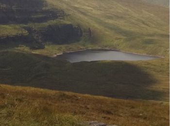
• 5 Lakes view on 6 Mountain peaks in the galtees
Walking
• 5 Lakes view on 6 Mountain peaks in the galtees
20 trails displayed on 29
FREE GPS app for hiking
 SityTrail
IGN / Geographical institutes
SityTrail World
The world is yours!