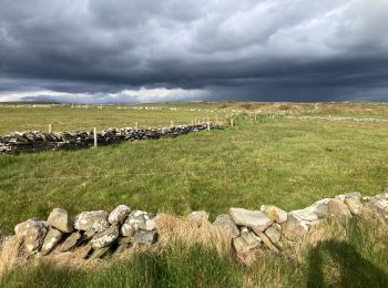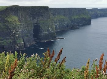
Ballysteen, West Clare Municipal District, On foot: Best trails, routes and walks
2 comments
Ballysteen: Discover the best trails: 5 walking. All these trails, routes and outdoor activities are available in our SityTrail applications for smartphones and tablets.
The best trails (5)

Km
#1 - Cliffs of Moher


Walking
Medium
West Clare Municipal District,
Unknown,
County Clare,
Ireland

12 km | 21 km-effort
2h 52min

659 m

660 m
Yes
Lobin

Km
#2 - Centre visiteurs Falaises de Moher - 3 km


Walking
Medium
West Clare Municipal District,
Unknown,
County Clare,
Ireland

3.3 km | 7.1 km-effort
1h 36min

283 m

283 m
Yes
jeanmarcMasson

Km
#3 - Mon parcours


Walking
Difficult
(1)
West Clare Municipal District,
Unknown,
County Clare,
Ireland

9.8 km | 18.6 km-effort
3h 42min

660 m

660 m
Yes
BureauChris

Km
#4 - Cliffs of Moher


Walking
Medium
(1)
West Clare Municipal District,
Unknown,
County Clare,
Ireland

12.4 km | 22 km-effort
3h 43min

738 m

740 m
Yes
FabienneD
• Moher walk

Km
#5 - falaise moher


Walking
Medium
West Clare Municipal District,
Unknown,
County Clare,
Ireland

7.5 km | 11.9 km-effort
2h 5min

326 m

334 m
No
Laurent Verrecchia
5 trails displayed on 5
FREE GPS app for hiking


 SityTrail


