![](/images/other/stat-length.png)
- Trails
- On foot
- Hungary
- Transdanubia
- Vas
- Szalafő
Szalafő, Vas, On foot: Best trails, routes and walks
Szalafő: Discover the best trails: 4 on foot. All these trails, routes and outdoor activities are available in our SityTrail applications for smartphones and tablets.
The best trails (4)
![Trail On foot Szalafő - Körtike tanösvény - Photo](https://media.geolcdn.com/t/350/260/ed833c24-5118-4153-af2a-764c31b72e96.jpeg&format=jpg&maxdim=2)
![On foot On foot](https://static1.geolcdn.com/sitytour/trail-icons/100.png)
Km
On foot
![](/images/other/stat-length.png)
![](https://static1.geolcdn.com/siteimages/upload/files/1508320355ic_sort_den_pos_24dp.png)
![](https://static1.geolcdn.com/siteimages/upload/files/1508320355ic_sort_den_neg_24dp.png)
![](https://static1.geolcdn.com/siteimages/upload/files/16400158638029165_repeat_loop_refresh_sync_direction_icon.png)
• Symbol: red T
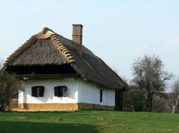
![Trail On foot Szalafő - P ♥ Szerről szerre Szalafőn (Szalafő [Templomszer - Alsószer - Csörgőszer - Pityerszer - Felsőszer - Papszer - Templomszer]) - Photo](https://media.geolcdn.com/t/350/260/eec4ed76-2e26-431f-8f73-8c2bed6e136b.jpeg&format=jpg&maxdim=2)
![On foot On foot](https://static1.geolcdn.com/sitytour/trail-icons/100.png)
Km
On foot
![](/images/other/stat-length.png)
![](https://static1.geolcdn.com/siteimages/upload/files/1508320355ic_sort_den_pos_24dp.png)
![](https://static1.geolcdn.com/siteimages/upload/files/1508320355ic_sort_den_neg_24dp.png)
![](https://static1.geolcdn.com/siteimages/upload/files/16400158638029165_repeat_loop_refresh_sync_direction_icon.png)
![Trail On foot Szalafő - Szala menti tanösvény - Photo](https://media.geolcdn.com/t/350/260/9bf5f34a-179a-43f3-a7aa-b7d0d8d62958.jpeg&format=jpg&maxdim=2)
![On foot On foot](https://static1.geolcdn.com/sitytour/trail-icons/100.png)
Km
On foot
![](/images/other/stat-length.png)
![](https://static1.geolcdn.com/siteimages/upload/files/1508320355ic_sort_den_pos_24dp.png)
![](https://static1.geolcdn.com/siteimages/upload/files/1508320355ic_sort_den_neg_24dp.png)
![](https://static1.geolcdn.com/siteimages/upload/files/16400158638029165_repeat_loop_refresh_sync_direction_icon.png)
• Symbol: red T
![Trail On foot Szalafő - K■ (Szalafő, Templomszer - Csörgőszer - Pityerszeri erdészeti út) - Photo](https://media.geolcdn.com/t/350/260/9bf5f34a-179a-43f3-a7aa-b7d0d8d62958.jpeg&format=jpg&maxdim=2)
![On foot On foot](https://static1.geolcdn.com/sitytour/trail-icons/100.png)
Km
On foot
![](/images/other/stat-length.png)
![](https://static1.geolcdn.com/siteimages/upload/files/1508320355ic_sort_den_pos_24dp.png)
![](https://static1.geolcdn.com/siteimages/upload/files/1508320355ic_sort_den_neg_24dp.png)
![](https://static1.geolcdn.com/siteimages/upload/files/16400158638029165_repeat_loop_refresh_sync_direction_icon.png)
• Symbol: blue square
4 trails displayed on 4
FREE GPS app for hiking