Scotland, United Kingdom, On foot: Best trails, routes and walks

1 comments

Scotland: Discover the best trails: 184 on foot, 93 walking and 6 trail. All these trails, routes and outdoor activities are available in our SityTrail applications for smartphones and tablets.


The best trails (283)

Trail Walking  - Glencoe - Photo
Walking 9.951
Km

Walking

Easy
(1)
, Scotland, Highland, United Kingdom
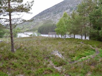
10 km | 14.2 km-effort
2h 30min
316 m
317 m
Yes
docfil

Trail On foot  - The Old North Road - Photo
On foot 3.471
Km
GUIDE+

On foot

Easy
, Scotland, Fife, United Kingdom
3.5 km | 4.7 km-effort
1h 4min
103 m
58 m
No
SityTrail - itinéraires balisés pédestres

• Website: http://www.heritagepaths.co.uk/pathdetails.php?path=23

Trail On foot  - Rum Cuillin traverse - Photo
On foot 21.704
Km
GUIDE+

On foot

Very difficult
, Scotland, Highland, United Kingdom
22 km | 44 km-effort
10h 5min
1702 m
1701 m
Yes
SityTrail - itinéraires balisés pédestres

• The Rum Cuillin provide one of the finest but most demanding hill circuits in all Scotland; an unsurpassed combinatio...

Trail On foot  - Orval, return via Harris - Photo
On foot 18.481
Km
GUIDE+

On foot

Medium
, Scotland, Highland, United Kingdom
18.5 km | 29 km-effort
6h 33min
822 m
654 m
No
SityTrail - itinéraires balisés pédestres

• Orval is the highest of the hills in the northern half of Rum, a superb viewpoint for both the Rum and Skye Cuillin a...

Trail On foot  - Out-and-back walk to Harris from Kinloch - Photo
On foot 12.183
Km
GUIDE+

On foot

Easy
, Scotland, Highland, United Kingdom
12.2 km | 15.7 km-effort
3h 34min
266 m
268 m
No
SityTrail - itinéraires balisés pédestres

• This long walk follows an excellent track right through the wild and bleak heart of Rum to reach beautiful Harris and...

Trail On foot  - Hallival and Barkeval - Photo
On foot 5.574
Km
GUIDE+

On foot

Easy
, Scotland, Highland, United Kingdom
5.6 km | 12.5 km-effort
2h 50min
686 m
13 m
No
SityTrail - itinéraires balisés pédestres

• These two most northerly summits in the Rum Cuillin are the closest to Kinloch and give a magnificent hillwalk. The t...

Trail On foot  - Kilmory Bay - Photo
On foot 7.897
Km
GUIDE+

On foot

Easy
, Scotland, Highland, United Kingdom
7.9 km | 9.4 km-effort
2h 8min
114 m
119 m
No
SityTrail - itinéraires balisés pédestres

• Kilmory Bay is a stunning sandy beach on Rum's northern coastline, with an unmatched outlook across the water to the ...

Trail On foot  - Cornish Hill Trail - Photo
On foot 5.505
Km
GUIDE+

On foot

Easy
, Scotland, South Ayrshire, United Kingdom
5.5 km | 7.4 km-effort
1h 41min
144 m
143 m
Yes
SityTrail - itinéraires balisés pédestres

• Trail created by Forestry & Land Scotland.

Trail On foot  - Bute Pilgrimage Route - St Blane - Photo
On foot 3.017
Km
GUIDE+

On foot

Easy
, Scotland, Argyll and Bute, United Kingdom
3 km | 3.9 km-effort
53min
77 m
48 m
No
SityTrail - itinéraires balisés pédestres

• Trail created by United Church of Bute.

Trail On foot  - Bunzeach Trail - Photo
On foot 5.868
Km
GUIDE+

On foot

Easy
, Scotland, Aberdeenshire, United Kingdom
5.9 km | 8.5 km-effort
1h 55min
201 m
187 m
Yes
SityTrail - itinéraires balisés pédestres

• Trail created by Forestry Commission Scotland. Symbol: blue marked post

Trail On foot  - Laird's Trail - Photo
On foot 3.005
Km
GUIDE+

On foot

Easy
, Scotland, Argyll and Bute, United Kingdom
3 km | 3.9 km-effort
52min
64 m
64 m
No
SityTrail - itinéraires balisés pédestres

• Trail created by Argyll Forest Park.

Trail On foot  - Ley Way - Photo
On foot 5.892
Km
GUIDE+

On foot

Easy
, Scotland, Aberdeenshire, United Kingdom
5.9 km | 7.3 km-effort
1h 39min
108 m
102 m
Yes
SityTrail - itinéraires balisés pédestres

• Symbol: red square

Trail On foot  - Scorrybreac - Photo
On foot 3.096
Km
GUIDE+

On foot

Easy
, Scotland, Highland, United Kingdom
3.1 km | 4.3 km-effort
58min
90 m
94 m
Yes
SityTrail - itinéraires balisés pédestres

• Website: https://www.isleofskye.com/skye-guide/top-ten-skye-walks/scorrybreac

Trail On foot  - Kinnordy Loch - Photo
On foot 4.58
Km
GUIDE+

On foot

Easy
, Scotland, Angus, United Kingdom
4.6 km | 5.1 km-effort
1h 10min
44 m
37 m
Yes
SityTrail - itinéraires balisés pédestres

• Trail created by Kirriemuir Path Network.

Trail On foot  - Westmuir Loop - Photo
On foot 5.755
Km
GUIDE+

On foot

Easy
, Scotland, Angus, United Kingdom
5.8 km | 6.4 km-effort
1h 27min
56 m
36 m
No
SityTrail - itinéraires balisés pédestres

• Trail created by Kirriemuir Path Network.

Trail On foot  - Forfar Path Circuit - Photo
On foot 4.542
Km
GUIDE+

On foot

Easy
, Scotland, Angus, United Kingdom
4.5 km | 4.9 km-effort
1h 6min
23 m
25 m
No
SityTrail - itinéraires balisés pédestres

• Trail created by Forfar Path Network.

Trail On foot  - Burntisland Outer Heritage Trail - Photo
On foot 4.916
Km
GUIDE+

On foot

Easy
, Scotland, Fife, United Kingdom
4.9 km | 7.4 km-effort
1h 40min
187 m
186 m
No
SityTrail - itinéraires balisés pédestres

• Trail created by Burntisland Heritage Trust.

Trail On foot  - Golf Course Circular - Photo
On foot 4.069
Km
GUIDE+

On foot

Easy
, Scotland, Highland, United Kingdom
4.1 km | 5.4 km-effort
1h 13min
109 m
78 m
No
SityTrail - itinéraires balisés pédestres

• Symbol: Orange arrows & golf flag

Trail On foot  - Curlew Trail - Photo
On foot 4.57
Km
GUIDE+

On foot

Easy
, Scotland, Highland, United Kingdom
4.6 km | 5.3 km-effort
1h 11min
40 m
92 m
No
SityTrail - itinéraires balisés pédestres

• Symbol: Green arrows & Curlew head silhouette

Trail On foot  - Creag Bheag Trail - Photo
On foot 5.384
Km
GUIDE+

On foot

Easy
, Scotland, Highland, United Kingdom
5.4 km | 8.7 km-effort
1h 58min
246 m
245 m
Yes
SityTrail - itinéraires balisés pédestres

• Symbol: Light purple arrows & Buzzard wings symbol

20 trails displayed on 283

Close
My subscriptions