![](/images/other/stat-length.png)
- Trails
- On foot
- France
- Centre-Loire Valley
- Indre-et-Loire
Indre-et-Loire, Centre-Loire Valley, On foot: Best trails, routes and walks
Indre-et-Loire: Discover the best trails: 20 on foot, 1064 walking, 42 nordic walking, 17 running and 5 trail. All these trails, routes and outdoor activities are available in our SityTrail applications for smartphones and tablets.
The best trails (1146)
![Trail Walking Saint-Benoît-la-Forêt - Saint-Benoît-la-Forêt - GR3 PR - 15.1km 205m 3h50 - 2022 07 14 - Photo](https://media.geolcdn.com/t/350/260/61ff6cf6-562d-4306-8540-da4739c253ed.jpg&format=jpg&maxdim=2)
![Walking Walking](https://static1.geolcdn.com/sitytour/trail-icons/101.png)
Km
Walking
![](/images/other/stat-length.png)
![](https://static1.geolcdn.com/siteimages/upload/files/1508320355ic_sort_den_pos_24dp.png)
![](https://static1.geolcdn.com/siteimages/upload/files/1508320355ic_sort_den_neg_24dp.png)
![](https://static1.geolcdn.com/siteimages/upload/files/16400158638029165_repeat_loop_refresh_sync_direction_icon.png)
![Trail Walking Tours - Tours - Marmoutier GR3 GR655 Rochecorbon - 8.2km 105m 1h50 - 2021 10 09 - Photo](https://media.geolcdn.com/t/350/260/8eec29df-bf69-4696-8607-c35bff826c99.jpg&format=jpg&maxdim=2)
![Walking Walking](https://static1.geolcdn.com/sitytour/trail-icons/101.png)
Km
Walking
![](/images/other/stat-length.png)
![](https://static1.geolcdn.com/siteimages/upload/files/1508320355ic_sort_den_pos_24dp.png)
![](https://static1.geolcdn.com/siteimages/upload/files/1508320355ic_sort_den_neg_24dp.png)
![](https://static1.geolcdn.com/siteimages/upload/files/16400158638029165_repeat_loop_refresh_sync_direction_icon.png)
![Trail Walking Rivière - Rivière (s Chinon) - 13km 115m 3h10 - 2017 07 14 - Photo](https://media.geolcdn.com/t/350/260/3257858e-a22b-438d-bbd4-cdccba4b7589.jpg&format=jpg&maxdim=2)
![Walking Walking](https://static1.geolcdn.com/sitytour/trail-icons/101.png)
Km
Walking
![](/images/other/stat-length.png)
![](https://static1.geolcdn.com/siteimages/upload/files/1508320355ic_sort_den_pos_24dp.png)
![](https://static1.geolcdn.com/siteimages/upload/files/1508320355ic_sort_den_neg_24dp.png)
![](https://static1.geolcdn.com/siteimages/upload/files/16400158638029165_repeat_loop_refresh_sync_direction_icon.png)
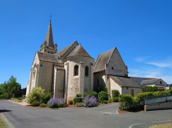
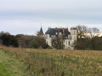
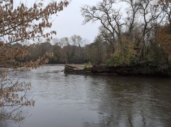
• Rivière (s Chinon) - 13km 115m 3h10 dej35mn - 2017 07 14
![Walking Walking](https://static1.geolcdn.com/sitytour/trail-icons/101.png)
Km
Walking
![](/images/other/stat-length.png)
![](https://static1.geolcdn.com/siteimages/upload/files/1508320355ic_sort_den_pos_24dp.png)
![](https://static1.geolcdn.com/siteimages/upload/files/1508320355ic_sort_den_neg_24dp.png)
![](https://static1.geolcdn.com/siteimages/upload/files/16400158638029165_repeat_loop_refresh_sync_direction_icon.png)
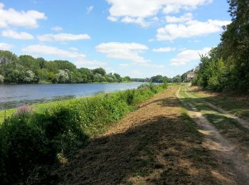
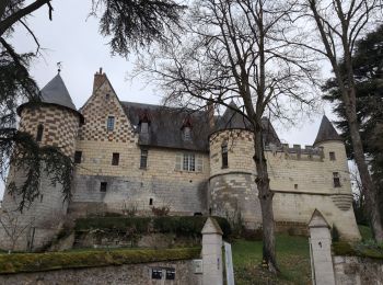
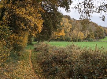
• Boucle Villandry - 2015 05 24
![Trail Walking Montbazon - Montbazon - 6.5km 90m 1h40 - 2017 07 23 - Photo](https://media.geolcdn.com/t/350/260/bb42c6a2-228c-4bb0-af88-fcf6e75cd959.jpg&format=jpg&maxdim=2)
![Walking Walking](https://static1.geolcdn.com/sitytour/trail-icons/101.png)
Km
Walking
![](/images/other/stat-length.png)
![](https://static1.geolcdn.com/siteimages/upload/files/1508320355ic_sort_den_pos_24dp.png)
![](https://static1.geolcdn.com/siteimages/upload/files/1508320355ic_sort_den_neg_24dp.png)
![](https://static1.geolcdn.com/siteimages/upload/files/16400158638029165_repeat_loop_refresh_sync_direction_icon.png)
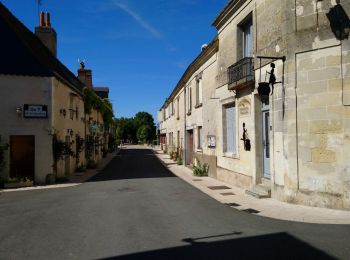
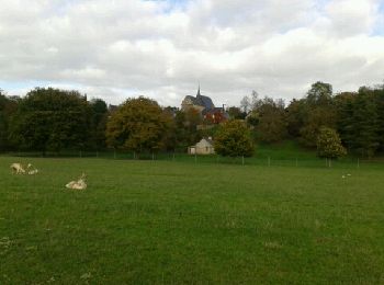
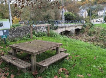
• Montbazon - 6.5km 90m 1h40 - 2017 07 23
![Trail Walking Épeigné-les-Bois - Epeigné-les-Bois - Montpoupon - 11,5km 160m 2h15mn - 2016 12 29 - Photo](https://media.geolcdn.com/t/350/260/22b359e3-6d6b-40c2-85c5-21ba9f35e3e3.jpg&format=jpg&maxdim=2)
![Walking Walking](https://static1.geolcdn.com/sitytour/trail-icons/101.png)
Km
Walking
![](/images/other/stat-length.png)
![](https://static1.geolcdn.com/siteimages/upload/files/1508320355ic_sort_den_pos_24dp.png)
![](https://static1.geolcdn.com/siteimages/upload/files/1508320355ic_sort_den_neg_24dp.png)
![](https://static1.geolcdn.com/siteimages/upload/files/16400158638029165_repeat_loop_refresh_sync_direction_icon.png)
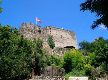
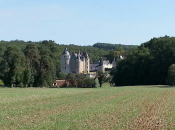
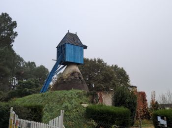
• Epeigné-les-Bois - Montpoupon - 11,5km 160m 2h15mn - 2016 12 29
![Trail Walking Cerelles - Cerelles - Photo](https://media.geolcdn.com/t/350/260/ext.jpg?maxdim=2&url=https%3A%2F%2Fservices.sitytrail.com%2FGeolivesWS%2FDownloadMedia.ashx%3FTrailID%3D231250%26Media%3Dfix__20131106141542.jpg)
![Walking Walking](https://static1.geolcdn.com/sitytour/trail-icons/101.png)
Km
Walking
![](/images/other/stat-length.png)
![](https://static1.geolcdn.com/siteimages/upload/files/1508320355ic_sort_den_pos_24dp.png)
![](https://static1.geolcdn.com/siteimages/upload/files/1508320355ic_sort_den_neg_24dp.png)
![](https://static1.geolcdn.com/siteimages/upload/files/16400158638029165_repeat_loop_refresh_sync_direction_icon.png)
• Départ place de la mairie.
![Trail Walking Luzillé - les petits gars - Photo](https://media.geolcdn.com/t/350/260/ext.jpg?maxdim=2&url=https%3A%2F%2Fservices.sitytrail.com%2FGeolivesWS%2FDownloadMedia.ashx%3FTrailID%3D740867%26Media%3Dfix__20170427113816.jpg)
![Walking Walking](https://static1.geolcdn.com/sitytour/trail-icons/101.png)
Km
Walking
![](/images/other/stat-length.png)
![](https://static1.geolcdn.com/siteimages/upload/files/1508320355ic_sort_den_pos_24dp.png)
![](https://static1.geolcdn.com/siteimages/upload/files/1508320355ic_sort_den_neg_24dp.png)
![](https://static1.geolcdn.com/siteimages/upload/files/16400158638029165_repeat_loop_refresh_sync_direction_icon.png)
![Trail Walking Fondettes - Fondettes Vallières - Luynes Le Vieux-Bourg - 26.1km 360m 5h30 (45mn) - 2024 12 11 - Photo](https://media.geolcdn.com/t/350/260/7ea9ad8d-3a09-4814-97d4-258e1355629e.jpg&format=jpg&maxdim=2)
![Walking Walking](https://static1.geolcdn.com/sitytour/trail-icons/101.png)
Km
Walking
![](/images/other/stat-length.png)
![](https://static1.geolcdn.com/siteimages/upload/files/1508320355ic_sort_den_pos_24dp.png)
![](https://static1.geolcdn.com/siteimages/upload/files/1508320355ic_sort_den_neg_24dp.png)
![](https://static1.geolcdn.com/siteimages/upload/files/16400158638029165_repeat_loop_refresh_sync_direction_icon.png)
![Trail Walking Esvres - Esvres-sur-Indre - Veneuil Rouillers Hardellière - 24.5km 245m 5h20 (50mn) - 2024 11 23 - Photo](https://media.geolcdn.com/t/350/260/1c4d0998-df48-4940-9f89-ba0d2ada291f.jpg&format=jpg&maxdim=2)
![Walking Walking](https://static1.geolcdn.com/sitytour/trail-icons/101.png)
Km
Walking
![](/images/other/stat-length.png)
![](https://static1.geolcdn.com/siteimages/upload/files/1508320355ic_sort_den_pos_24dp.png)
![](https://static1.geolcdn.com/siteimages/upload/files/1508320355ic_sort_den_neg_24dp.png)
![](https://static1.geolcdn.com/siteimages/upload/files/16400158638029165_repeat_loop_refresh_sync_direction_icon.png)
![Trail Walking Souvigné - Souvigné - Brèches GRP Castelvalérie - 26.5km 280m 6h05 (55mn) - 2024 11 20 - Photo](https://media.geolcdn.com/t/350/260/e34a3749-9afe-4774-bd66-67627b7f3803.jpg&format=jpg&maxdim=2)
![Walking Walking](https://static1.geolcdn.com/sitytour/trail-icons/101.png)
Km
Walking
![](/images/other/stat-length.png)
![](https://static1.geolcdn.com/siteimages/upload/files/1508320355ic_sort_den_pos_24dp.png)
![](https://static1.geolcdn.com/siteimages/upload/files/1508320355ic_sort_den_neg_24dp.png)
![](https://static1.geolcdn.com/siteimages/upload/files/16400158638029165_repeat_loop_refresh_sync_direction_icon.png)
![Trail Walking Civray-de-Touraine - Civray-de-Touraine - Zig Zag Chenonceaux Chisseaux - 26.2km 380m 6h10 (40mn) - 2024 11 16 - Photo](https://media.geolcdn.com/t/350/260/b928cfcf-95b5-4db7-9805-1e2be5eb479d.jpg&format=jpg&maxdim=2)
![Walking Walking](https://static1.geolcdn.com/sitytour/trail-icons/101.png)
Km
Walking
![](/images/other/stat-length.png)
![](https://static1.geolcdn.com/siteimages/upload/files/1508320355ic_sort_den_pos_24dp.png)
![](https://static1.geolcdn.com/siteimages/upload/files/1508320355ic_sort_den_neg_24dp.png)
![](https://static1.geolcdn.com/siteimages/upload/files/16400158638029165_repeat_loop_refresh_sync_direction_icon.png)
![Trail Walking Couesmes - Couesmes Château-la-Vallière la Gare - PR GRP Castelvalérie Marcilly Braye Villiers - 27km 280m 6h05 (40mn) - 2024 11 13 - Photo](https://media.geolcdn.com/t/350/260/a6ed14d6-cf1f-4346-965d-10cf16b9f80b.jpg&format=jpg&maxdim=2)
![Walking Walking](https://static1.geolcdn.com/sitytour/trail-icons/101.png)
Km
Walking
![](/images/other/stat-length.png)
![](https://static1.geolcdn.com/siteimages/upload/files/1508320355ic_sort_den_pos_24dp.png)
![](https://static1.geolcdn.com/siteimages/upload/files/1508320355ic_sort_den_neg_24dp.png)
![](https://static1.geolcdn.com/siteimages/upload/files/16400158638029165_repeat_loop_refresh_sync_direction_icon.png)
![Trail Walking Villaines-les-Rochers - Villaines-les-Rochers le Pont de Pierre - Zig Zag - 22.6km 355m 5h10 (1h) - 2024 11 09 - Photo](https://media.geolcdn.com/t/350/260/261ef021-f164-43b7-aae5-df36ad12465c.jpg&format=jpg&maxdim=2)
![Walking Walking](https://static1.geolcdn.com/sitytour/trail-icons/101.png)
Km
Walking
![](/images/other/stat-length.png)
![](https://static1.geolcdn.com/siteimages/upload/files/1508320355ic_sort_den_pos_24dp.png)
![](https://static1.geolcdn.com/siteimages/upload/files/1508320355ic_sort_den_neg_24dp.png)
![](https://static1.geolcdn.com/siteimages/upload/files/16400158638029165_repeat_loop_refresh_sync_direction_icon.png)
![Trail Walking Cravant-les-Côteaux - Cravant-les-Coteaux - Zig zag les Vallées de Basse - 27.8km 400m 6h10 (55mn) - 2024 11 06 - Photo](https://media.geolcdn.com/t/350/260/d111a0a0-e95c-4cfa-8ae7-34b0de29ea70.jpg&format=jpg&maxdim=2)
![Walking Walking](https://static1.geolcdn.com/sitytour/trail-icons/101.png)
Km
Walking
![](/images/other/stat-length.png)
![](https://static1.geolcdn.com/siteimages/upload/files/1508320355ic_sort_den_pos_24dp.png)
![](https://static1.geolcdn.com/siteimages/upload/files/1508320355ic_sort_den_neg_24dp.png)
![](https://static1.geolcdn.com/siteimages/upload/files/16400158638029165_repeat_loop_refresh_sync_direction_icon.png)
![Trail Walking Vernou-sur-Brenne - Vernou-sur-Brenne la Coudraie - Zig Zag Vaubrault Noizay - 27.1km 385m 5h55 (55mn) - 2024 11 03 - Photo](https://media.geolcdn.com/t/350/260/9c945cd3-c4f0-44b2-b00c-aa0430042429.jpg&format=jpg&maxdim=2)
![Walking Walking](https://static1.geolcdn.com/sitytour/trail-icons/101.png)
Km
Walking
![](/images/other/stat-length.png)
![](https://static1.geolcdn.com/siteimages/upload/files/1508320355ic_sort_den_pos_24dp.png)
![](https://static1.geolcdn.com/siteimages/upload/files/1508320355ic_sort_den_neg_24dp.png)
![](https://static1.geolcdn.com/siteimages/upload/files/16400158638029165_repeat_loop_refresh_sync_direction_icon.png)
![Trail Walking Bourgueil - Bourgueil le Picard - GRP Coteaux de Bourgueil - 24.3km 325m 5h25 (45mn) - 2024 10 30 - Photo](https://media.geolcdn.com/t/350/260/0c109f62-569c-4024-8d89-44f5e325207c.jpg&format=jpg&maxdim=2)
![Walking Walking](https://static1.geolcdn.com/sitytour/trail-icons/101.png)
Km
Walking
![](/images/other/stat-length.png)
![](https://static1.geolcdn.com/siteimages/upload/files/1508320355ic_sort_den_pos_24dp.png)
![](https://static1.geolcdn.com/siteimages/upload/files/1508320355ic_sort_den_neg_24dp.png)
![](https://static1.geolcdn.com/siteimages/upload/files/16400158638029165_repeat_loop_refresh_sync_direction_icon.png)
![Trail Walking Fondettes - Fondettes Gare - Saint-Cyr-sur-Loire Tours - 23.4km 345m 5h10 (40mn) - 2024 10 27 - Photo](https://media.geolcdn.com/t/350/260/8177205d-60d4-4a9b-baf6-cca40bb2f1c5.jpg&format=jpg&maxdim=2)
![Walking Walking](https://static1.geolcdn.com/sitytour/trail-icons/101.png)
Km
Walking
![](/images/other/stat-length.png)
![](https://static1.geolcdn.com/siteimages/upload/files/1508320355ic_sort_den_pos_24dp.png)
![](https://static1.geolcdn.com/siteimages/upload/files/1508320355ic_sort_den_neg_24dp.png)
![](https://static1.geolcdn.com/siteimages/upload/files/16400158638029165_repeat_loop_refresh_sync_direction_icon.png)
![Trail Walking Saint-Cyr-sur-Loire - Saint-Cyr-sur-Loire la Gagnerie - la Membrolle-sur-Choisille Mettray - 24km 405m 5h15 (50mn) - 2024 10 20 - Photo](https://media.geolcdn.com/t/350/260/21cd2b46-14f0-4eaa-a3c8-0e5f8e58cc4a.jpg&format=jpg&maxdim=2)
![Walking Walking](https://static1.geolcdn.com/sitytour/trail-icons/101.png)
Km
Walking
![](/images/other/stat-length.png)
![](https://static1.geolcdn.com/siteimages/upload/files/1508320355ic_sort_den_pos_24dp.png)
![](https://static1.geolcdn.com/siteimages/upload/files/1508320355ic_sort_den_neg_24dp.png)
![](https://static1.geolcdn.com/siteimages/upload/files/16400158638029165_repeat_loop_refresh_sync_direction_icon.png)
![Trail Walking Chambray-lès-Tours - Chambray-lès-Tours - Sentier au travers des landes avec variantes - GR46 - 26.2km 170m 5h35 (1h) - 2024 10 16 - Photo](https://media.geolcdn.com/t/350/260/76f8d73c-b1be-428b-9345-2e17578c7a0c.jpg&format=jpg&maxdim=2)
![Walking Walking](https://static1.geolcdn.com/sitytour/trail-icons/101.png)
Km
Walking
![](/images/other/stat-length.png)
![](https://static1.geolcdn.com/siteimages/upload/files/1508320355ic_sort_den_pos_24dp.png)
![](https://static1.geolcdn.com/siteimages/upload/files/1508320355ic_sort_den_neg_24dp.png)
![](https://static1.geolcdn.com/siteimages/upload/files/16400158638029165_repeat_loop_refresh_sync_direction_icon.png)
20 trails displayed on 1146
FREE GPS app for hiking
Activities
Nearby regions
- Abilly
- Ambillou
- Amboise
- Anché
- Antogny-le-Tillac
- Artannes-sur-Indre
- Assay
- Athée-sur-Cher
- Autrèche
- Auzouer-en-Touraine
- Avoine
- Avon-les-Roches
- Avrillé-les-Ponceaux
- Azay-le-Rideau
- Azay-sur-Cher
- Azay-sur-Indre
- Ballan-Miré
- Barrou
- Beaulieu-lès-Loches
- Beaumont-Louestault
- Beaumont-Village
- Beaumont-en-Véron
- Benais
- Berthenay
- Betz-le-Château
- Bléré
- Bossay-sur-Claise
- Bossée
- Bourgueil
- Bournan
- Boussay
- Braslou
- Braye-sous-Faye
- Brèches
- Bréhémont
- Brizay
- Bueil-en-Touraine
- Candes-Saint-Martin
- Cangey
- Céré-la-Ronde
- Cerelles
- Chambon
- Chambourg-sur-Indre
- Chambray-lès-Tours
- Champigny-sur-Veude
- Chançay
- Chanceaux-près-Loches
- Chanceaux-sur-Choisille
- Channay-sur-Lathan
- Charentilly
- Chargé
- Charnizay
- Château-Renault
- Château-la-Vallière
- Chaumussay
- Chaveignes
- Chédigny
- Cheillé
- Chemillé-sur-Indrois
- Chenonceaux
- Chinon
- Chisseaux
- Chouzé-sur-Loire
- Cigogné
- Cinais
- Cinq-Mars-la-Pile
- Civray-de-Touraine
- Cléré-les-Pins
- Continvoir
- Cormery
- Coteaux-sur-Loire
- Couesmes
- Courçay
- Courcelles-de-Touraine
- Courcoué
- Couziers
- Cravant-les-Côteaux
- Crissay-sur-Manse
- Crotelles
- Crouzilles
- Cussay
- Dame-Marie-les-Bois
- Descartes
- Dierre
- Dolus-le-Sec
- Draché
- Épeigné-les-Bois
- Esves-le-Moutier
- Esvres
- Faye-la-Vineuse
- Ferrière-Larçon
- Ferrière-sur-Beaulieu
- Fondettes
- Francueil
- Genillé
- Gizeux
- Hommes
- Huismes
- Jaulnay
- Joué-lès-Tours
- L'Île-Bouchard
- La Celle-Guenand
- La Celle-Saint-Avant
- La Chapelle-Blanche-Saint-Martin
- La Chapelle-aux-Naux
- La Chapelle-sur-Loire
- La Croix-en-Touraine
- La Ferrière
- La Membrolle-sur-Choisille
- La Riche
- La Roche-Clermault
- La Tour-Saint-Gelin
- La Ville-aux-Dames
- Langeais
- Larçay
- Le Boulay
- Le Grand-Pressigny
- Le Liège
- Le Louroux
- Le Petit-Pressigny
- Lémeré
- Lerné
- Les Hermites
- Lignières-de-Touraine
- Ligré
- Ligueil
- Limeray
- Loché-sur-Indrois
- Loches
- Louans
- Lublé
- Lussault-sur-Loire
- Luynes
- Luzé
- Luzillé
- Maillé
- Manthelan
- Marcé-sur-Esves
- Marcilly-sur-Maulne
- Marcilly-sur-Vienne
- Marigny-Marmande
- Marray
- Mazières-de-Touraine
- Mettray
- Monnaie
- Montbazon
- Monthodon
- Montlouis-sur-Loire
- Montrésor
- Montreuil-en-Touraine
- Monts
- Morand
- Mosnes
- Nazelles-Négron
- Neuil
- Neuillé-Pont-Pierre
- Neuillé-le-Lierre
- Neuilly-le-Brignon
- Neuville-sur-Brenne
- Neuvy-le-Roi
- Noizay
- Notre-Dame-d'Oé
- Nouans-les-Fontaines
- Nouâtre
- Nouzilly
- Noyant-de-Touraine
- Orbigny
- Panzoult
- Parçay-Meslay
- Parçay-sur-Vienne
- Paulmy
- Pernay
- Perrusson
- Pocé-sur-Cisse
- Pont-de-Ruan
- Ports-sur-Vienne
- Pouzay
- Preuilly-sur-Claise
- Pussigny
- Razines
- Reignac-sur-Indre
- Restigné
- Reugny
- Richelieu
- Rigny-Ussé
- Rillé
- Rilly-sur-Vienne
- Rivarennes
- Rivière
- Rochecorbon
- Rouziers-de-Touraine
- Saché
- Saint-Antoine-du-Rocher
- Saint-Avertin
- Saint-Benoît-la-Forêt
- Saint-Branchs
- Saint-Christophe-sur-le-Nais
- Saint-Cyr-sur-Loire
- Saint-Épain
- Saint-Étienne-de-Chigny
- Saint-Flovier
- Saint-Genouph
- Saint-Germain-sur-Vienne
- Saint-Hippolyte
- Saint-Jean-Saint-Germain
- Saint-Laurent-de-Lin
- Saint-Laurent-en-Gâtines
- Saint-Martin-le-Beau
- Saint-Nicolas-de-Bourgueil
- Saint-Nicolas-des-Motets
- Saint-Ouen-les-Vignes
- Saint-Paterne-Racan
- Saint-Pierre-des-Corps
- Saint-Quentin-sur-Indrois
- Saint-Règle
- Saint-Roch
- Saint-Senoch
- Sainte-Catherine-de-Fierbois
- Sainte-Maure-de-Touraine
- Saunay
- Savigné-sur-Lathan
- Savigny-en-Véron
- Savonnières
- Sazilly
- Semblançay
- Sennevières
- Sepmes
- Seuilly
- Sonzay
- Sorigny
- Souvigné
- Souvigny-de-Touraine
- Sublaines
- Tauxigny-Saint-Bauld
- Tavant
- Theneuil
- Thilouze
- Thizay
- Tournon-Saint-Pierre
- Tours
- Trogues
- Truyes
- Vallères
- Varennes
- Veigné
- Véretz
- Verneuil-sur-Indre
- Vernou-sur-Brenne
- Villaines-les-Rochers
- Villandry
- Villebourg
- Villedômer
- Villeloin-Coulangé
- Villeperdue
- Villiers-au-Bouin
- Vouvray
- Yzeures-sur-Creuse