![](/images/other/stat-length.png)
Passa, Pyrénées-Orientales, On foot: Best trails, routes and walks
1 comments
Passa: Discover the best trails: 6 walking. All these trails, routes and outdoor activities are available in our SityTrail applications for smartphones and tablets.
The best trails (6)
![Trail Walking Passa - prieuré du monastir del camp - Photo](https://media.geolcdn.com/t/350/260/2f11251e-2581-4e40-bd8c-78a770a8d6dd.jpg&format=jpg&maxdim=2)
![Walking Walking](https://static1.geolcdn.com/sitytour/trail-icons/101.png)
Km
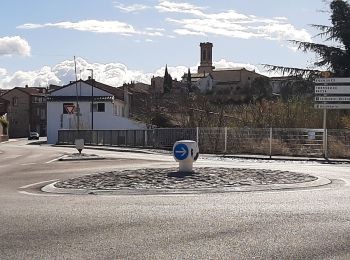
#1 - prieuré du monastir del camp
Walking
Medium
(1)
Passa,
Occitania,
Pyrénées-Orientales,
France
![](/images/other/stat-length.png)
9.7 km | 10.8 km-effort
3h 20min
![](https://static1.geolcdn.com/siteimages/upload/files/1508320355ic_sort_den_pos_24dp.png)
85 m
![](https://static1.geolcdn.com/siteimages/upload/files/1508320355ic_sort_den_neg_24dp.png)
84 m
![](https://static1.geolcdn.com/siteimages/upload/files/16400158638029165_repeat_loop_refresh_sync_direction_icon.png)
Yes
66Gribouille83
![Trail Walking Passa - monastur del camp different - Photo](https://media.geolcdn.com/t/350/260/ac13774c-cacb-49c7-a139-82bd309e4ca6.jpg&format=jpg&maxdim=2)
![Walking Walking](https://static1.geolcdn.com/sitytour/trail-icons/101.png)
Km
#2 - monastur del camp different
Walking
Difficult
Passa,
Occitania,
Pyrénées-Orientales,
France
![](/images/other/stat-length.png)
11.1 km | 12.4 km-effort
2h 50min
![](https://static1.geolcdn.com/siteimages/upload/files/1508320355ic_sort_den_pos_24dp.png)
98 m
![](https://static1.geolcdn.com/siteimages/upload/files/1508320355ic_sort_den_neg_24dp.png)
97 m
![](https://static1.geolcdn.com/siteimages/upload/files/16400158638029165_repeat_loop_refresh_sync_direction_icon.png)
Yes
66Gribouille83
![Trail Walking Passa - monaste - Photo](https://media.geolcdn.com/t/350/260/cb34c75c-2264-40dd-b817-fb467da4febe.jpg&format=jpg&maxdim=2)
![Walking Walking](https://static1.geolcdn.com/sitytour/trail-icons/101.png)
Km
#3 - monaste
Walking
Medium
Passa,
Occitania,
Pyrénées-Orientales,
France
![](/images/other/stat-length.png)
10.2 km | 11.5 km-effort
4h 1min
![](https://static1.geolcdn.com/siteimages/upload/files/1508320355ic_sort_den_pos_24dp.png)
95 m
![](https://static1.geolcdn.com/siteimages/upload/files/1508320355ic_sort_den_neg_24dp.png)
93 m
![](https://static1.geolcdn.com/siteimages/upload/files/16400158638029165_repeat_loop_refresh_sync_direction_icon.png)
Yes
66Gribouille83
![Trail Walking Passa - 66 VILLEMOLAQUE - TRESSERRE - PASSA - Photo](https://media.geolcdn.com/t/350/260/ext.jpg?maxdim=2&url=https%3A%2F%2Fservices.sitytrail.com%2FGeolivesWS%2FDownloadMedia.ashx%3FTrailID%3D458167%26Media%3D20150812161600.jpg)
![Walking Walking](https://static1.geolcdn.com/sitytour/trail-icons/101.png)
Km
#4 - 66 VILLEMOLAQUE - TRESSERRE - PASSA
Walking
Medium
Passa,
Occitania,
Pyrénées-Orientales,
France
![](/images/other/stat-length.png)
11.4 km | 13.1 km-effort
1h 50min
![](https://static1.geolcdn.com/siteimages/upload/files/1508320355ic_sort_den_pos_24dp.png)
129 m
![](https://static1.geolcdn.com/siteimages/upload/files/1508320355ic_sort_den_neg_24dp.png)
128 m
![](https://static1.geolcdn.com/siteimages/upload/files/16400158638029165_repeat_loop_refresh_sync_direction_icon.png)
Yes
jeff66
![Trail Walking Passa - passa mde - Photo](https://media.geolcdn.com/t/350/260/ext.jpg?maxdim=2&url=https%3A%2F%2Fstatic1.geolcdn.com%2Fsiteimages%2Fupload%2Ffiles%2F1553511878bg_sport_marche.png)
![Walking Walking](https://static1.geolcdn.com/sitytour/trail-icons/101.png)
Km
#5 - passa mde
Walking
Difficult
Passa,
Occitania,
Pyrénées-Orientales,
France
![](/images/other/stat-length.png)
11.9 km | 13.8 km-effort
3h 59min
![](https://static1.geolcdn.com/siteimages/upload/files/1508320355ic_sort_den_pos_24dp.png)
143 m
![](https://static1.geolcdn.com/siteimages/upload/files/1508320355ic_sort_den_neg_24dp.png)
144 m
![](https://static1.geolcdn.com/siteimages/upload/files/16400158638029165_repeat_loop_refresh_sync_direction_icon.png)
Yes
Phidel66
![Trail Walking Passa - Chapelle st luc - Photo](https://media.geolcdn.com/t/350/260/ext.jpg?maxdim=2&url=https%3A%2F%2Fstatic1.geolcdn.com%2Fsiteimages%2Fupload%2Ffiles%2F1553511878bg_sport_marche.png)
![Walking Walking](https://static1.geolcdn.com/sitytour/trail-icons/101.png)
Km
#6 - Chapelle st luc
Walking
Passa,
Occitania,
Pyrénées-Orientales,
France
![](/images/other/stat-length.png)
9.2 km | 10.9 km-effort
2h 34min
![](https://static1.geolcdn.com/siteimages/upload/files/1508320355ic_sort_den_pos_24dp.png)
128 m
![](https://static1.geolcdn.com/siteimages/upload/files/1508320355ic_sort_den_neg_24dp.png)
126 m
![](https://static1.geolcdn.com/siteimages/upload/files/16400158638029165_repeat_loop_refresh_sync_direction_icon.png)
Yes
mijojo
6 trails displayed on 6
FREE GPS app for hiking