Ongles, Alpes-de-Haute-Provence, On foot: Best trails, routes and walks

Ongles: Discover the best trails: 1 on foot and 14 walking. All these trails, routes and outdoor activities are available in our SityTrail applications for smartphones and tablets.


The best trails (15)
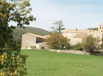
Trail Walking Ongles - Le r0 h - Photo
Walking 10.04
Km

Walking

Medium
Ongles, Provence-Alpes-Côte d'Azur, Alpes-de-Haute-Provence, France
10 km | 13.3 km-effort
4h 27min
242 m
242 m
Yes
Roger

Trail Walking Ongles - Le rocher d ongles. lardiers par le collet de champon  - Photo
Walking 7.771
Km

Walking

Medium
Ongles, Provence-Alpes-Côte d'Azur, Alpes-de-Haute-Provence, France
7.8 km | 10.3 km-effort
2h 36min
193 m
191 m
Yes
Roger

Trail Walking Ongles - ONGLES  CASTELARD DE LARDIER7 - Photo
Walking 15.098
Km

Walking

Medium
Ongles, Provence-Alpes-Côte d'Azur, Alpes-de-Haute-Provence, France
15.1 km | 21 km-effort
7h 10min
419 m
419 m
Yes
Claude Caméléon

Trail Walking Ongles - ONGLES Sentier de Seignes Lardiers Ongles o n  - Photo
Walking 17.588
Km

Walking

Medium
Ongles, Provence-Alpes-Côte d'Azur, Alpes-de-Haute-Provence, France
17.6 km | 22 km-effort
4h 6min
366 m
366 m
Yes
RobinMicheline

Trail Walking Ongles - 200310ongles - Photo
Walking 13.307
Km

Walking

Very easy
Ongles, Provence-Alpes-Côte d'Azur, Alpes-de-Haute-Provence, France
13.3 km | 17.3 km-effort
5h 39min
300 m
300 m
Yes
michelfehrenbach

Trail Walking Ongles - d'ongles à Lardiers - Photo
Walking 13.427
Km

Walking

Easy
Ongles, Provence-Alpes-Côte d'Azur, Alpes-de-Haute-Provence, France
13.4 km | 17.4 km-effort
5h 42min
301 m
301 m
Yes
PITOUSSAINT

Trail Walking Ongles - tour village par viere - Photo
Walking 3.385
Km

Walking

Very easy
Ongles, Provence-Alpes-Côte d'Azur, Alpes-de-Haute-Provence, France
3.4 km | 4.5 km-effort
54min
84 m
83 m
Yes
gcauvain

Trail Walking Ongles - 20220416seigne1 - Photo
Walking 7.012
Km

Walking

Medium
Ongles, Provence-Alpes-Côte d'Azur, Alpes-de-Haute-Provence, France
7 km | 9.7 km-effort
3h 5min
187 m
242 m
No
michelfehrenbach

Trail Walking Ongles - Entre Ongles et Lardiers depart Ongles  276 + - Photo
Walking 11.628
Km

Walking

Difficult
Ongles, Provence-Alpes-Côte d'Azur, Alpes-de-Haute-Provence, France
11.6 km | 15.3 km-effort
3h 28min
276 m
276 m
Yes
claude nier

Trail Walking Ongles - AUTOUR DE ONGLES - Photo
Walking 12.12
Km

Walking

Easy
Ongles, Provence-Alpes-Côte d'Azur, Alpes-de-Haute-Provence, France
12.1 km | 16.4 km-effort
4h 57min
318 m
318 m
Yes
PATRICK8455

Trail On foot Ongles - Rocher Bizotte Rocher - Photo
On foot 17.262
Km

On foot

Medium
Ongles, Provence-Alpes-Côte d'Azur, Alpes-de-Haute-Provence, France
17.3 km | 26 km-effort
5h 57min
671 m
671 m
Yes
AnsBR

Trail Walking Ongles - utrz - Photo
Walking 15.9
Km

Walking

Very difficult
Ongles, Provence-Alpes-Côte d'Azur, Alpes-de-Haute-Provence, France
15.9 km | 21 km-effort
4h 22min
416 m
417 m
Yes
Clo0413

Trail Walking Ongles - Vière par le rocher d'Ongles - Photo
Walking 8.558
Km

Walking

Medium
Ongles, Provence-Alpes-Côte d'Azur, Alpes-de-Haute-Provence, France
8.6 km | 11 km-effort
4h 27min
185 m
185 m
Yes
PITOUSSAINT

Trail Walking Ongles - Limans et voix romaine - Photo
Walking 20.795
Km

Walking

Very easy
Ongles, Provence-Alpes-Côte d'Azur, Alpes-de-Haute-Provence, France
21 km | 27 km-effort
5h 30min
489 m
490 m
Yes
gcauvain

Trail Walking Ongles - ongles - Photo
Walking 21.606
Km

Walking

Medium
Ongles, Provence-Alpes-Côte d'Azur, Alpes-de-Haute-Provence, France
22 km | 29 km-effort
6h 53min
544 m
543 m
Yes
ARPF

15 trails displayed on 15

FREE GPS app for hiking

Logo SityTrail SityTrail

IGN / Geographical institutes

Download SityTrail from the App Store Download SityTrail from Google Play

Logo SityTrail SityTrail World

The world is yours!

Download SityTrail from the App Store Download SityTrail from Google Play Download SityTrail on Huawei AppGallery

Activities

Close
My subscriptions