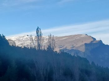
Clamensane, Alpes-de-Haute-Provence, On foot: Best trails, routes and walks

4 comments

Clamensane: Discover the best trails: 13 walking. All these trails, routes and outdoor activities are available in our SityTrail applications for smartphones and tablets.


The best trails (13)
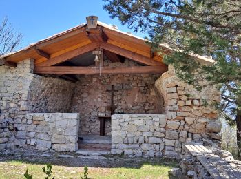
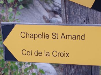
Trail Walking Clamensane - Clamensane - Col de la Croix - Chapelle St-Amand - Photo
Walking 12.747
Km
GUIDE

Walking

Medium
(1)
Clamensane, Provence-Alpes-Côte d'Azur, Alpes-de-Haute-Provence, France
12.7 km | 22 km-effort
5h 0min
695 m
696 m
Yes
Marco05

Trail Walking Clamensane - CLAMENSANE.  TROU DU DIABLR  . CHAPELLE S AMAND . COL LA CROIX . O L M S. IX  - Photo
Walking 12.523
Km

Walking

Difficult
Clamensane, Provence-Alpes-Côte d'Azur, Alpes-de-Haute-Provence, France
12.5 km | 21 km-effort
3h 27min
611 m
612 m
Yes
RobinMicheline

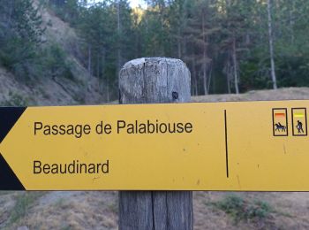
Trail Walking Clamensane - VALAVOIRE  Pas de Palabiouse , bergerie de Premarche o l s  - Photo
Walking 11.673
Km

Walking

Difficult
Clamensane, Provence-Alpes-Côte d'Azur, Alpes-de-Haute-Provence, France
11.7 km | 22 km-effort
3h 53min
739 m
738 m
Yes
RobinMicheline

Trail Walking Clamensane - VALAVOIRE.  Pas de Palabrouse.  Fontaine de  Pouille o l s - Photo
Walking 11.942
Km

Walking

Medium
Clamensane, Provence-Alpes-Côte d'Azur, Alpes-de-Haute-Provence, France
11.9 km | 19.8 km-effort
3h 50min
590 m
588 m
Yes
RobinMicheline

Trail Walking Clamensane - La chapelle St Amand - Clamensane  - Photo
Walking 12.664
Km

Walking

Very difficult
Clamensane, Provence-Alpes-Côte d'Azur, Alpes-de-Haute-Provence, France
12.7 km | 22 km-effort
4h 30min
673 m
679 m
Yes
tracegps

Trail Walking Clamensane - L'Aqueduc des Sagniéres - Clamensane - Photo
Walking 5.93
Km

Walking

Medium
(2)
Clamensane, Provence-Alpes-Côte d'Azur, Alpes-de-Haute-Provence, France
5.9 km | 8.7 km-effort
2h 0min
206 m
206 m
Yes
tracegps

Trail Walking Clamensane - CLAMENSANE BERGERIE BERGIE ROCHER CHABRIER  O S L  - Photo
Walking 10.035
Km

Walking

Medium
Clamensane, Provence-Alpes-Côte d'Azur, Alpes-de-Haute-Provence, France
10 km | 17.3 km-effort
3h 25min
547 m
548 m
Yes
RobinMicheline

Trail Walking Clamensane - clamencane 700 m dénivelé 14 km - Photo
Walking 13.88
Km

Walking

Very difficult
Clamensane, Provence-Alpes-Côte d'Azur, Alpes-de-Haute-Provence, France
13.9 km | 23 km-effort
4h 20min
692 m
699 m
Yes
jean pierre 04

Trail Walking Clamensane - 04 Clamensane, chapelle St Amand - Photo
Walking 13.866
Km

Walking

Medium
Clamensane, Provence-Alpes-Côte d'Azur, Alpes-de-Haute-Provence, France
13.9 km | 23 km-effort
5h 0min
702 m
702 m
Yes
Cosmos

Trail Walking Clamensane - Trou du Diable depart Clastre 658 + - Photo
Walking 11.306
Km

Walking

Very difficult
(1)
Clamensane, Provence-Alpes-Côte d'Azur, Alpes-de-Haute-Provence, France
11.3 km | 20 km-effort
4h 34min
658 m
664 m
Yes
claude nier

Trail Walking Clamensane - CLAMENSANNE . Bergerie de Bane , Parustre , Col de la Baisse , aqueduc de  o  s Sanieres  - Photo
Walking 13.965
Km

Walking

Difficult
Clamensane, Provence-Alpes-Côte d'Azur, Alpes-de-Haute-Provence, France
14 km | 25 km-effort
7h 4min
843 m
849 m
Yes
RobinMicheline

Trail Walking Clamensane - Le parustre, bramefan, ruinon - Photo
Walking 15.77
Km

Walking

Difficult
Clamensane, Provence-Alpes-Côte d'Azur, Alpes-de-Haute-Provence, France
15.8 km | 31 km-effort
7h 28min
1169 m
1127 m
No
radisnoir

Trail Walking Clamensane - NoDe Clamensane aux crêtes de la montagne de Jouèreuveau guide - Photo
Walking 9.784
Km

Walking

Difficult
Clamensane, Provence-Alpes-Côte d'Azur, Alpes-de-Haute-Provence, France
9.8 km | 22 km-effort
5h 6min
1207 m
3 m
No
dumotier

13 trails displayed on 13

FREE GPS app for hiking

Logo SityTrail SityTrail

IGN / Geographical institutes

Download SityTrail from the App Store Download SityTrail from Google Play

Logo SityTrail SityTrail World

The world is yours!

Download SityTrail from the App Store Download SityTrail from Google Play Download SityTrail on Huawei AppGallery

Activities

Close
My subscriptions