Chaudon-Norante, Alpes-de-Haute-Provence, On foot: Best trails, routes and walks

4 comments

Chaudon-Norante: Discover the best trails: 3 on foot, 19 walking and 1 running. All these trails, routes and outdoor activities are available in our SityTrail applications for smartphones and tablets.


The best trails (23)

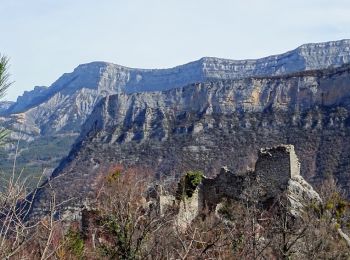
Trail Walking Chaudon-Norante - 2024-12-06 Col des Chandres  - Photo
Walking 11.908
Km
GUIDE

Walking

Medium
Chaudon-Norante, Provence-Alpes-Côte d'Azur, Alpes-de-Haute-Provence, France
11.9 km | 19 km-effort
4h 19min
532 m
534 m
Yes
Kargil

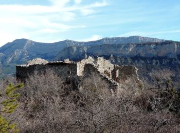
Trail Walking Chaudon-Norante - ENTRAGES la Clappe départ ancienne carrière Gozzi - Photo
Walking 12.771
Km

Walking

Medium
(1)
Chaudon-Norante, Provence-Alpes-Côte d'Azur, Alpes-de-Haute-Provence, France
12.8 km | 19.9 km-effort
4h 7min
534 m
537 m
Yes
RobinMicheline

• Belle randonnée de 5 h de marché plein de sentiers ombragés de l eau de partout très agréable à refaire 280 mns 13 ...
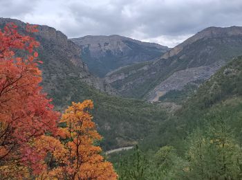
Trail Walking Chaudon-Norante - Le poil valbonnette - Photo
Walking 24.033
Km
GUIDE

Walking

Medium
Chaudon-Norante, Provence-Alpes-Côte d'Azur, Alpes-de-Haute-Provence, France
24 km | 38 km-effort
8h 56min
1040 m
1037 m
Yes
Danielba

Trail Walking Chaudon-Norante - Ruines hameau Creisset par Passerelle Asse - Photo
Walking 8.799
Km

Walking

Easy
Chaudon-Norante, Provence-Alpes-Côte d'Azur, Alpes-de-Haute-Provence, France
8.8 km | 15.2 km-effort
4h 14min
575 m
192 m
No
GrouGary

Trail Walking Chaudon-Norante - Hameau de Creisset - Photo
Walking 9.455
Km

Walking

Very easy
(1)
Chaudon-Norante, Provence-Alpes-Côte d'Azur, Alpes-de-Haute-Provence, France
9.5 km | 15.6 km-effort
3h 39min
464 m
461 m
Yes
Nicomontagnes

Trail Walking Chaudon-Norante - La Voie Impériale (Etape 3 : Chaudon-Norante (La Clappe) - Digne-les-Bains) - Photo
Walking 14.038
Km

Walking

Difficult
Chaudon-Norante, Provence-Alpes-Côte d'Azur, Alpes-de-Haute-Provence, France
14 km | 21 km-effort
4h 30min
428 m
866 m
No
tracegps

Trail On foot Chaudon-Norante - Château plus Haut - Photo
On foot 9.473
Km
GUIDE+

On foot

Easy
Chaudon-Norante, Provence-Alpes-Côte d'Azur, Alpes-de-Haute-Provence, France
9.5 km | 13.7 km-effort
3h 6min
314 m
314 m
Yes
SityTrail - itinéraires balisés pédestres

• Trail created by Département des Alpes-de-Haute-Provence. Website: https://www.rando-alpes-haute-provence.fr/rando...
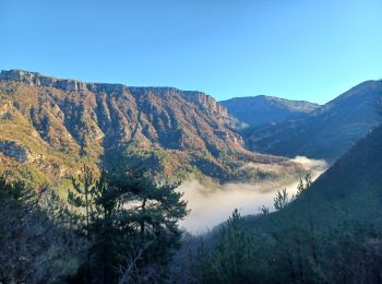
Trail Walking Chaudon-Norante - BEYNES .  chapelle S Étienne,  Creisset o l  - Photo
Walking 13.096
Km

Walking

Medium
(1)
Chaudon-Norante, Provence-Alpes-Côte d'Azur, Alpes-de-Haute-Provence, France
13.1 km | 22 km-effort
6h 28min
635 m
632 m
Yes
RobinMicheline

Trail Walking Chaudon-Norante - Village abandonné de Creisset - Photo
Walking 11.717
Km

Walking

Medium
Chaudon-Norante, Provence-Alpes-Côte d'Azur, Alpes-de-Haute-Provence, France
11.7 km | 19.4 km-effort
4h 57min
572 m
575 m
Yes
domi06

Trail Walking Chaudon-Norante - les dourbettes au col de pierre basse  - Photo
Walking 10.176
Km

Walking

Difficult
Chaudon-Norante, Provence-Alpes-Côte d'Azur, Alpes-de-Haute-Provence, France
10.2 km | 14.7 km-effort
3h 20min
342 m
339 m
Yes
ejacky

Trail Walking Chaudon-Norante - des Dourbettes au col de pierre basse  - Photo
Walking 5.68
Km

Walking

Medium
Chaudon-Norante, Provence-Alpes-Côte d'Azur, Alpes-de-Haute-Provence, France
5.7 km | 8.3 km-effort
1h 53min
197 m
195 m
Yes
ejacky

Trail On foot Chaudon-Norante - boucle de Chabrieres à Creisset 8.4 km et 450m déniv - Photo
On foot 8.436
Km

On foot

Medium
Chaudon-Norante, Provence-Alpes-Côte d'Azur, Alpes-de-Haute-Provence, France
8.4 km | 14.4 km-effort
4h 0min
449 m
449 m
Yes
eaea7charles

Trail Walking Chaudon-Norante - Rando709 - Photo
Walking 20.911
Km

Walking

Difficult
Chaudon-Norante, Provence-Alpes-Côte d'Azur, Alpes-de-Haute-Provence, France
21 km | 35 km-effort
5h 11min
1071 m
1072 m
Yes
Escondido

Trail Walking Chaudon-Norante - BEYNES    creisset haut et bas villard  o l s  - Photo
Walking 12.613
Km

Walking

Medium
Chaudon-Norante, Provence-Alpes-Côte d'Azur, Alpes-de-Haute-Provence, France
12.6 km | 20 km-effort
7h 50min
569 m
571 m
Yes
RobinMicheline

Trail Walking Chaudon-Norante - Le Haut Villar  - Photo
Walking 11.287
Km

Walking

Medium
Chaudon-Norante, Provence-Alpes-Côte d'Azur, Alpes-de-Haute-Provence, France
11.3 km | 20 km-effort
3h 31min
658 m
658 m
Yes
PITOUSSAINT

Trail Walking Chaudon-Norante - marche matinale  - Photo
Walking 10.022
Km

Walking

Difficult
Chaudon-Norante, Provence-Alpes-Côte d'Azur, Alpes-de-Haute-Provence, France
10 km | 14.8 km-effort
2h 4min
357 m
356 m
Yes
Den's06

Trail Walking Chaudon-Norante - Creisset - Chapelle St-Etienne - Photo
Walking 15.221
Km

Walking

Medium
Chaudon-Norante, Provence-Alpes-Côte d'Azur, Alpes-de-Haute-Provence, France
15.2 km | 25 km-effort
4h 50min
716 m
715 m
Yes
Clo0413

Trail Walking Chaudon-Norante - CREISSET - Photo
Walking 15.415
Km

Walking

Difficult
Chaudon-Norante, Provence-Alpes-Côte d'Azur, Alpes-de-Haute-Provence, France
15.4 km | 25 km-effort
4h 26min
688 m
681 m
Yes
RobinMicheline

Trail Walking Chaudon-Norante - Le Poil - Photo
Walking 14.771
Km

Walking

Medium
Chaudon-Norante, Provence-Alpes-Côte d'Azur, Alpes-de-Haute-Provence, France
14.8 km | 25 km-effort
5h 42min
850 m
556 m
No
Clo0413

Trail Running Chaudon-Norante - footing Norante  - Photo
Running 9.996
Km

Running

Very easy
Chaudon-Norante, Provence-Alpes-Côte d'Azur, Alpes-de-Haute-Provence, France
10 km | 13.7 km-effort
1h 2min
272 m
284 m
Yes
Den's06

20 trails displayed on 23

FREE GPS app for hiking

Logo SityTrail SityTrail

IGN / Geographical institutes

Download SityTrail from the App Store Download SityTrail from Google Play

Logo SityTrail SityTrail World

The world is yours!

Download SityTrail from the App Store Download SityTrail from Google Play Download SityTrail on Huawei AppGallery

Activities

Close
My subscriptions