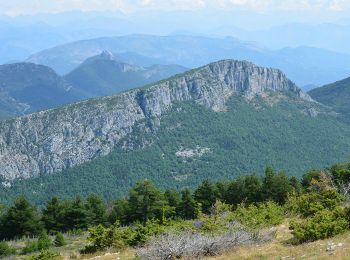
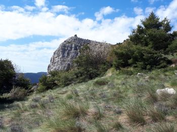
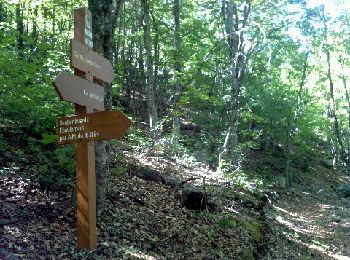
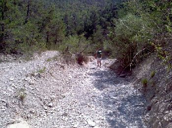
Saint-Auban, Maritime Alps, On foot: Best trails, routes and walks

3 comments

Saint-Auban: Discover the best trails: 7 on foot, 28 walking, 1 nordic walking and 1 running. All these trails, routes and outdoor activities are available in our SityTrail applications for smartphones and tablets.


The best trails (37)

Trail On foot Saint-Auban - Grand tour du haut Estéron - Etape 1 - Photo
On foot 11.476
Km
GUIDE+

On foot

Easy
Saint-Auban, Provence-Alpes-Côte d'Azur, Maritime Alps, France
11.5 km | 17.8 km-effort
4h 3min
388 m
746 m
No
SityTrail - itinéraires balisés pédestres

• Randonnée pédestre - Au départ de Saint-Auban (1 100 m) Website: https://randoxygene.departement06.fr/traversees/gra...

Trail Walking Saint-Auban - Le Beausset - St Auban - Clue de St Auban - Photo
Walking 3.726
Km

Walking

Medium
Saint-Auban, Provence-Alpes-Côte d'Azur, Maritime Alps, France
3.7 km | 7.5 km-effort
1h 23min
285 m
283 m
Yes
LtZIP

Trail Walking Saint-Auban - Les Lattes - Chauvet - Pensiers Occidental et Oriental - Photo
Walking 11.366
Km

Walking

Medium
Saint-Auban, Provence-Alpes-Côte d'Azur, Maritime Alps, France
11.4 km | 18.6 km-effort
3h 39min
544 m
548 m
Yes
LtZIP

Trail Walking Saint-Auban - L'arpille près de Sausses - Photo
Walking 12.857
Km

Walking

Medium
Saint-Auban, Provence-Alpes-Côte d'Azur, Maritime Alps, France
12.9 km | 20 km-effort
3h 55min
570 m
569 m
Yes
GrouGary

Trail Walking Saint-Auban - Col de l'Escouissier - Photo
Walking 9.106
Km

Walking

Medium
Saint-Auban, Provence-Alpes-Côte d'Azur, Maritime Alps, France
9.1 km | 13.7 km-effort
2h 47min
341 m
344 m
Yes
cswilly

Trail Walking Saint-Auban - Saint Auban - Photo
Walking 17.185
Km

Walking

Medium
Saint-Auban, Provence-Alpes-Côte d'Azur, Maritime Alps, France
17.2 km | 26 km-effort
4h 53min
656 m
701 m
Yes
cswilly

Trail On foot Saint-Auban - Grand tour du haut Estéron - Photo
On foot 79.672
Km
GUIDE+

On foot

Very difficult
Saint-Auban, Provence-Alpes-Côte d'Azur, Maritime Alps, France
80 km | 136 km-effort
30h 57min
4240 m
4240 m
Yes
SityTrail - itinéraires balisés pédestres

• Randonnée pédestre - Au départ de Saint-Auban (1 100 m) Website: https://randoxygene.departement06.fr/traversees/gra...
Trail Walking Saint-Auban - Tous les 4 à St Auban - Photo
Walking 10.65
Km

Walking

Difficult
Saint-Auban, Provence-Alpes-Côte d'Azur, Maritime Alps, France
10.7 km | 18.8 km-effort
6h 1min
612 m
611 m
Yes
verotrail

Trail Walking Saint-Auban - st-auban lu 22-07-24 - Photo
Walking 16.498
Km

Walking

Very difficult
Saint-Auban, Provence-Alpes-Côte d'Azur, Maritime Alps, France
16.5 km | 24 km-effort
4h 34min
595 m
595 m
Yes
annehc

Trail Walking Saint-Auban - 2cols di sem1 - Photo
Walking 10.309
Km

Walking

Difficult
Saint-Auban, Provence-Alpes-Côte d'Azur, Maritime Alps, France
10.3 km | 15.2 km-effort
2h 58min
365 m
361 m
Yes
annehc

Trail Walking Saint-Auban - Colette st auban  - Photo
Walking 12.321
Km

Walking

Difficult
Saint-Auban, Provence-Alpes-Côte d'Azur, Maritime Alps, France
12.3 km | 17.1 km-effort
6h 8min
360 m
363 m
Yes
adetotto

Trail Walking Saint-Auban - Porte du ciel grand circuit du tracastel  - Photo
Walking 1.172
Km

Walking

Medium
(1)
Saint-Auban, Provence-Alpes-Côte d'Azur, Maritime Alps, France
1.2 km | 2.3 km-effort
1h 0min
94 m
44 m
No
56jj

Trail Walking Saint-Auban - Baou Mouriou - Photo
Walking 13.442
Km

Walking

Difficult
Saint-Auban, Provence-Alpes-Côte d'Azur, Maritime Alps, France
13.4 km | 19.1 km-effort
5h 51min
421 m
421 m
Yes
Lemarchand06

Trail Nordic walking Saint-Auban - colle de bleine  - Photo
Nordic walking 6.631
Km

Nordic walking

Very easy
Saint-Auban, Provence-Alpes-Côte d'Azur, Maritime Alps, France
6.6 km | 9.8 km-effort
2h 55min
238 m
242 m
Yes
17jc06

Trail On foot Saint-Auban - Les Pensiers de Saint Auban 3542 ET - Photo
On foot 10.196
Km

On foot

Difficult
Saint-Auban, Provence-Alpes-Côte d'Azur, Maritime Alps, France
10.2 km | 17.8 km-effort
Unknown
570 m
570 m
Yes
verotrail

Trail Walking Saint-Auban - RL L'Arpille - Photo
Walking 10.415
Km

Walking

Difficult
Saint-Auban, Provence-Alpes-Côte d'Azur, Maritime Alps, France
10.4 km | 18.1 km-effort
3h 40min
576 m
576 m
Yes
Les Animateurs de l'ANRAM

Trail Walking Saint-Auban - Col de Bleine et pic de l'Aiglo - Photo
Walking 7.513
Km

Walking

Very easy
Saint-Auban, Provence-Alpes-Côte d'Azur, Maritime Alps, France
7.5 km | 11.9 km-effort
2h 26min
327 m
325 m
Yes
Palimpseste

Trail Running Saint-Auban - Trail de l'Escouissier - Photo
Running 20.795
Km

Running

Difficult
Saint-Auban, Provence-Alpes-Côte d'Azur, Maritime Alps, France
21 km | 38 km-effort
3h 23min
1302 m
1302 m
Yes
chrisrando

Trail Walking Saint-Auban - Saint Auban tracastel  - Photo
Walking 11.084
Km

Walking

Medium
Saint-Auban, Provence-Alpes-Côte d'Azur, Maritime Alps, France
11.1 km | 20 km-effort
3h 47min
695 m
696 m
Yes
SaintEloi4

Trail On foot Saint-Auban - 000🥾St Auban pique-nique 20-Sep-2022 - Photo
On foot 5.48
Km

On foot

Easy
Saint-Auban, Provence-Alpes-Côte d'Azur, Maritime Alps, France
5.5 km | 7.9 km-effort
1h 48min
183 m
187 m
Yes
VagabondTOP25

20 trails displayed on 37

FREE GPS app for hiking

Logo SityTrail SityTrail

IGN / Geographical institutes

Download SityTrail from the App Store Download SityTrail from Google Play

Logo SityTrail SityTrail World

The world is yours!

Download SityTrail from the App Store Download SityTrail from Google Play Download SityTrail on Huawei AppGallery

Activities

Close
My subscriptions