Andon, Maritime Alps, On foot: Best trails, routes and walks

5 comments

Andon: Discover the best trails: 8 on foot, 80 walking, 1 nordic walking and 1 trail. All these trails, routes and outdoor activities are available in our SityTrail applications for smartphones and tablets.


The best trails (90)

Trail Walking Andon - L'Audibergue du Pont du Loup - Photo
Walking 9.968
Km

Walking

Easy
Andon, Provence-Alpes-Côte d'Azur, Maritime Alps, France
10 km | 16.2 km-effort
5h 21min
470 m
470 m
Yes
GrouGary

Trail Walking Andon - Lac de Thorenc - Photo
Walking 11.548
Km

Walking

Difficult
Andon, Provence-Alpes-Côte d'Azur, Maritime Alps, France
11.5 km | 17.7 km-effort
6h 12min
462 m
463 m
Yes
Pascal-83

Trail Walking Andon - Andon - Pk Pont du Loup - Le Castellaras - Château des 4 Tours - Photo
Walking 15.6
Km

Walking

Medium
Andon, Provence-Alpes-Côte d'Azur, Maritime Alps, France
15.6 km | 25 km-effort
5h 37min
684 m
683 m
Yes
LtZIP

Trail Walking Andon - Pont du loup, Andon Castellaras - Photo
Walking 12.522
Km

Walking

Medium
Andon, Provence-Alpes-Côte d'Azur, Maritime Alps, France
12.5 km | 21 km-effort
4h 44min
625 m
624 m
Yes
GrouGary

Trail Walking Andon - Les Canaux, Caussols Andon - Photo
Walking 14.491
Km

Walking

Medium
(1)
Andon, Provence-Alpes-Côte d'Azur, Maritime Alps, France
14.5 km | 19.1 km-effort
4h 20min
349 m
349 m
Yes
GrouGary

Trail Walking Andon - CASTELLARS - Photo
Walking 11.928
Km

Walking

Easy
Andon, Provence-Alpes-Côte d'Azur, Maritime Alps, France
11.9 km | 17 km-effort
3h 55min
384 m
384 m
Yes
Daniel Benteux

Trail Walking Andon - THORENC-ANDON - Photo
Walking 11.847
Km

Walking

Medium
Andon, Provence-Alpes-Côte d'Azur, Maritime Alps, France
11.8 km | 17.9 km-effort
3h 42min
452 m
452 m
Yes
Daniel Benteux

Trail On foot Andon - Montagne du Thiey sens des aiguilles d'une montre 3542 ET - Photo
On foot 12.343
Km

On foot

Medium
(1)
Andon, Provence-Alpes-Côte d'Azur, Maritime Alps, France
12.3 km | 19.5 km-effort
Unknown
534 m
534 m
Yes
verotrail

Trail Walking Andon - Les  Lys Pomponne de la montagne de Thiey - Photo
Walking 10.158
Km

Walking

Difficult
Andon, Provence-Alpes-Côte d'Azur, Maritime Alps, France
10.2 km | 16.7 km-effort
6h 18min
497 m
483 m
Yes
boulinevelyne

Trail Walking Andon - 2023-05-09_21h14m37_SityTrail - 3653139 - andon-x-lac-de-thorenc-et-pivoines-2023x05x09-xrecox - Photo
Walking 12.048
Km

Walking

Difficult
Andon, Provence-Alpes-Côte d'Azur, Maritime Alps, France
12 km | 18.2 km-effort
4h 8min
462 m
462 m
Yes
boulinevelyne

• P au Lac de Thorenc. Belle montée de 30' le matin. Après le col de Baïsse (1320 m), nombreuses Pivoines en fleurs en...

Trail Walking Andon -
Walking 11.122
Km

Walking

Difficult
Andon, Provence-Alpes-Côte d'Azur, Maritime Alps, France
11.1 km | 17.4 km-effort
3h 57min
472 m
472 m
Yes
boulinevelyne

Trail On foot Andon - Grand tour du haut Estéron - Etape 4 - Photo
On foot 20.556
Km
GUIDE+

On foot

Difficult
Andon, Provence-Alpes-Côte d'Azur, Maritime Alps, France
21 km | 33 km-effort
7h 29min
916 m
977 m
No
SityTrail - itinéraires balisés pédestres

• Randonnée pédestre - Au départ de Saint-Auban (1 100 m) Website: https://randoxygene.departement06.fr/traversees/gra...
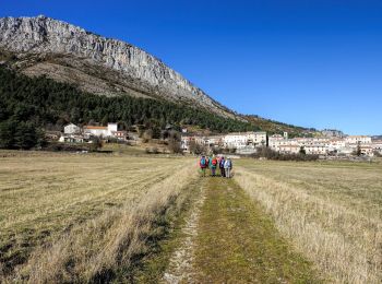
Trail Walking Andon - La Plaine de Caille - Photo
Walking 10.982
Km

Walking

Easy
Andon, Provence-Alpes-Côte d'Azur, Maritime Alps, France
11 km | 14 km-effort
5h 43min
225 m
228 m
Yes
jlrayon

Trail Walking Andon - canaux - Photo
Walking 8.3
Km

Walking

Difficult
Andon, Provence-Alpes-Côte d'Azur, Maritime Alps, France
8.3 km | 12.1 km-effort
2h 16min
286 m
286 m
Yes
Palimpseste

Trail Walking Andon - andon/castelaras - Photo
Walking 16.458
Km

Walking

Difficult
Andon, Provence-Alpes-Côte d'Azur, Maritime Alps, France
16.5 km | 26 km-effort
4h 34min
708 m
708 m
Yes
yolaine saulnier

Trail Walking Andon - Canaux  - Photo
Walking 13.424
Km

Walking

Very difficult
Andon, Provence-Alpes-Côte d'Azur, Maritime Alps, France
13.4 km | 20 km-effort
5h 36min
502 m
502 m
Yes
adetotto

Trail Walking Andon - L aiglo - Photo
Walking 12.071
Km

Walking

Difficult
Andon, Provence-Alpes-Côte d'Azur, Maritime Alps, France
12.1 km | 18.6 km-effort
4h 53min
489 m
488 m
Yes
adetotto

Trail Walking Andon - Sur la piste des Pivoines - Photo
Walking 10.221
Km

Walking

Medium
Andon, Provence-Alpes-Côte d'Azur, Maritime Alps, France
10.2 km | 15.2 km-effort
3h 27min
375 m
376 m
Yes
boulinevelyne

Trail Walking Andon - Thorenc - Photo
Walking 8.737
Km

Walking

Medium
Andon, Provence-Alpes-Côte d'Azur, Maritime Alps, France
8.7 km | 11.9 km-effort
4h 5min
207 m
315 m
No
GRANGETTEPHILIPPE

Trail Walking Andon - Thorenc  - Photo
Walking 10.712
Km

Walking

Difficult
Andon, Provence-Alpes-Côte d'Azur, Maritime Alps, France
10.7 km | 15.2 km-effort
4h 4min
338 m
337 m
Yes
adetotto

20 trails displayed on 90

FREE GPS app for hiking

Logo SityTrail SityTrail

IGN / Geographical institutes

Download SityTrail from the App Store Download SityTrail from Google Play

Logo SityTrail SityTrail World

The world is yours!

Download SityTrail from the App Store Download SityTrail from Google Play Download SityTrail on Huawei AppGallery

Activities

Close
My subscriptions