- Trails
- On foot
- France
- Provence-Alpes-Côte d'Azur
- Hautes-Alpes
- Mont-Dauphin
Mont-Dauphin, Hautes-Alpes, On foot: Best trails, routes and walks
Mont-Dauphin: Discover the best trails: 4 walking and 1 running. All these trails, routes and outdoor activities are available in our SityTrail applications for smartphones and tablets.
The best trails (5)

Km
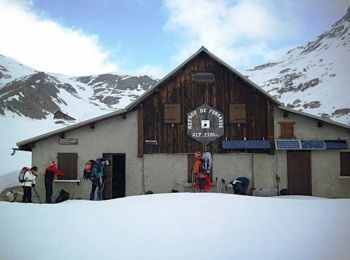
#1 - Via Alpina - R131: Mont-Dauphin (Guillestre) > Refuge de Furfande


Walking
Very difficult
Mont-Dauphin,
Provence-Alpes-Côte d'Azur,
Hautes-Alpes,
France

17.5 km | 34 km-effort
5h 45min

1534 m

284 m
No
tracegps

Km
#2 - 3 - Compostelle/Mont-Dauphin - Chateauroux les Alpes 030719


Walking
Very difficult
Mont-Dauphin,
Provence-Alpes-Côte d'Azur,
Hautes-Alpes,
France

21 km | 31 km-effort
6h 29min

709 m

744 m
No
R@ph

Km
#3 - Egliers 23km 1100D+


Running
Easy
Mont-Dauphin,
Provence-Alpes-Côte d'Azur,
Hautes-Alpes,
France

23 km | 38 km-effort
Unknown

1110 m

1116 m
Yes
laet

Km
#4 - tour guillestre


Walking
Very easy
Mont-Dauphin,
Provence-Alpes-Côte d'Azur,
Hautes-Alpes,
France

5.1 km | 7.9 km-effort
2h 19min

217 m

197 m
No
RIPPERY

Km
#5 - Tour de Mont Dauphin


Walking
Very easy
Mont-Dauphin,
Provence-Alpes-Côte d'Azur,
Hautes-Alpes,
France

8.2 km | 11.8 km-effort
2h 26min

267 m

264 m
Yes
lrezzo
5 trails displayed on 5
FREE GPS app for hiking


 SityTrail


