Veynes, Hautes-Alpes, On foot: Best trails, routes and walks

61 comments

Veynes: Discover the best trails: 2 on foot, 55 walking, 3 running and 2 trail. All these trails, routes and outdoor activities are available in our SityTrail applications for smartphones and tablets.


The best trails (62)
Trail Walking Veynes - Charajaille - Photo
Walking 8.143
Km
GUIDE

Walking

Difficult
(1)
Veynes, Provence-Alpes-Côte d'Azur, Hautes-Alpes, France
8.1 km | 16.2 km-effort
3h 41min
606 m
605 m
Yes
Marco05

Trail Walking Veynes - R10   Le tour des Eygaux - Photo
Walking 7.823
Km
GUIDE+

Walking

Very easy
(4)
Veynes, Provence-Alpes-Côte d'Azur, Hautes-Alpes, France
7.8 km | 11.3 km-effort
2h 24min
263 m
263 m
Yes
Camping Les Rives du Lac

• Pleasant hike mostly in the woods, which crosses the 2 trays of Eygaux. Beautiful view of Dévoluy, the Longeagne moun...

Trail Walking Veynes - R09   Le tour de Veynes - Photo
Walking 9.516
Km
GUIDE+

Walking

Very easy
(3)
Veynes, Provence-Alpes-Côte d'Azur, Hautes-Alpes, France
9.5 km | 12.3 km-effort
2h 40min
206 m
206 m
Yes
Camping Les Rives du Lac

• Small family hike that will allow you to discover the old town of Veynes, the Roman road. Nice view of the valley fro...
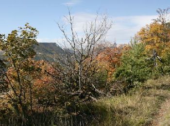
Trail Walking Veynes - R06   glaise - Photo
Walking 9.065
Km
GUIDE+

Walking

Easy
(1)
Veynes, Provence-Alpes-Côte d'Azur, Hautes-Alpes, France
9.1 km | 14.9 km-effort
3h 4min
440 m
444 m
Yes
Camping Les Rives du Lac

• Balade très agréable dans les alpages et en sous bois. Nous vous conseillons de monter en direction du col de la Sell...
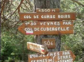
Trail Walking Veynes - R52   Le col de Cuberselle - Photo
Walking 10.766
Km
GUIDE+

Walking

Medium
(3)
Veynes, Provence-Alpes-Côte d'Azur, Hautes-Alpes, France
10.8 km | 17.2 km-effort
3h 31min
480 m
476 m
Yes
Camping Les Rives du Lac

• A varied hike between the plateau and mountain pastures Egarets contained. The start is located at the pool Veynes. I...
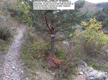
Trail Walking Veynes - R03  oule depuis veynes - Photo
Walking 7.122
Km
GUIDE+

Walking

Difficult
(4)
Veynes, Provence-Alpes-Côte d'Azur, Hautes-Alpes, France
7.1 km | 17.2 km-effort
3h 24min
759 m
759 m
Yes
Camping Les Rives du Lac

• Longer than south side (R02), this hike can be done from the campsite. Beautiful climb in the forest in the shade to ...
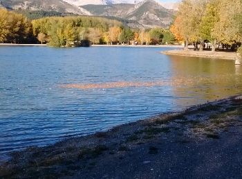
Trail Running Veynes - Trail 05 - Le Défi des Argouses - Photo
Running 8.969
Km
GUIDE+

Running

Difficult
(3)
Veynes, Provence-Alpes-Côte d'Azur, Hautes-Alpes, France
9 km | 11.9 km-effort
48min
222 m
222 m
Yes
Camping Les Rives du Lac

• Trail emprunté lors du Cross Triathlon de Juin à Veynes. Très roulant avec juste une petite montée et surtout la trav...
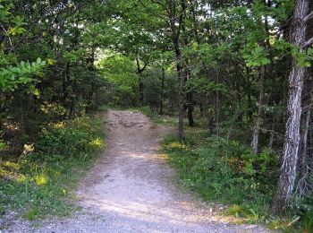
Trail Running Veynes - Trail 11 - Les Eygaux - Photo
Running 12.94
Km
GUIDE+

Running

Medium
(3)
Veynes, Provence-Alpes-Côte d'Azur, Hautes-Alpes, France
12.9 km | 17.3 km-effort
1h 30min
328 m
328 m
Yes
Camping Les Rives du Lac

Trail Walking Veynes - R01 les Eygaux - Photo
Walking 5.544
Km
GUIDE+

Walking

Very easy
(7)
Veynes, Provence-Alpes-Côte d'Azur, Hautes-Alpes, France
5.5 km | 7.9 km-effort
1h 40min
178 m
178 m
Yes
Camping Les Rives du Lac

• Test in English

Trail Walking Veynes - Champérus-Oriol - Photo
Walking 7.979
Km
GUIDE

Walking

Difficult
Veynes, Provence-Alpes-Côte d'Azur, Hautes-Alpes, France
8 km | 16.6 km-effort
3h 45min
665 m
577 m
No
Marco05

Trail Walking Veynes - Col de Combe noire-Veynes - Photo
Walking 9.725
Km
GUIDE

Walking

Medium
Veynes, Provence-Alpes-Côte d'Azur, Hautes-Alpes, France
9.7 km | 17.6 km-effort
4h 0min
590 m
593 m
Yes
Marco05

Trail Walking Veynes - Champérus - Photo
Walking 5.041
Km
GUIDE

Walking

Medium
Veynes, Provence-Alpes-Côte d'Azur, Hautes-Alpes, France
5 km | 10.5 km-effort
2h 23min
409 m
408 m
Yes
Marco05

Trail Walking Veynes - col de la selle  Glaise  - Photo
Walking 8.43
Km

Walking

Medium
Veynes, Provence-Alpes-Côte d'Azur, Hautes-Alpes, France
8.4 km | 14.1 km-effort
2h 42min
418 m
435 m
Yes
Magali 83

Trail Running Veynes - Trail 08 - Col de Combe noire par les crêtes - Photo
Running 14.394
Km
GUIDE+

Running

Difficult
Veynes, Provence-Alpes-Côte d'Azur, Hautes-Alpes, France
14.4 km | 24 km-effort
2h 30min
733 m
733 m
Yes
Camping Les Rives du Lac

Trail Walking Veynes - Les 8 cols et Tête de Tombereau via Veynes - Photo
Walking 19.568
Km

Walking

Very difficult
Veynes, Provence-Alpes-Côte d'Azur, Hautes-Alpes, France
19.6 km | 34 km-effort
7h 45min
1094 m
1098 m
Yes
PapouBertrand

Trail Walking Veynes - boucle petit vaux - Photo
Walking 7.986
Km

Walking

Medium
(2)
Veynes, Provence-Alpes-Côte d'Azur, Hautes-Alpes, France
8 km | 14.2 km-effort
2h 40min
463 m
467 m
Yes
Magali 83

Trail Walking Veynes - Veynes Les 3 cols - Photo
Walking 10.694
Km

Walking

Medium
Veynes, Provence-Alpes-Côte d'Azur, Hautes-Alpes, France
10.7 km | 18.7 km-effort
3h 30min
602 m
604 m
Yes
pcugnod

Trail Walking Veynes - Champi - Photo
Walking 10.767
Km

Walking

Very easy
Veynes, Provence-Alpes-Côte d'Azur, Hautes-Alpes, France
10.8 km | 13.7 km-effort
1h 54min
235 m
182 m
No
jlv05

Trail Walking Veynes - R01 Les Rives du Lac - Photo
Walking 5.493
Km

Walking

Easy
Veynes, Provence-Alpes-Côte d'Azur, Hautes-Alpes, France
5.5 km | 8.1 km-effort
1h 33min
192 m
198 m
No
Elisa Andreotti

Trail Walking Veynes - Glaise - Charajaille - Photo
Walking 7.714
Km

Walking

Difficult
Veynes, Provence-Alpes-Côte d'Azur, Hautes-Alpes, France
7.7 km | 15.2 km-effort
3h 13min
562 m
562 m
Yes
jlv05

20 trails displayed on 62

FREE GPS app for hiking

Logo SityTrail SityTrail

IGN / Geographical institutes

Download SityTrail from the App Store Download SityTrail from Google Play

Logo SityTrail SityTrail World

The world is yours!

Download SityTrail from the App Store Download SityTrail from Google Play Download SityTrail on Huawei AppGallery

Activities

Close
My subscriptions