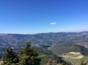
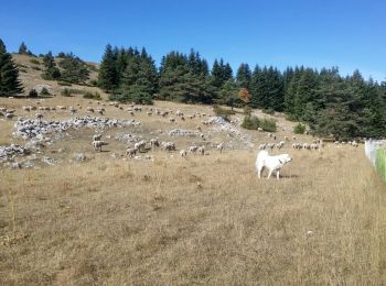
La Beaume, Hautes-Alpes, On foot: Best trails, routes and walks

La Beaume: Discover the best trails: 13 walking and 1 nordic walking. All these trails, routes and outdoor activities are available in our SityTrail applications for smartphones and tablets.


The best trails (14)

Trail Walking La Beaume - Banne depuis le col de Cabre - Photo
Walking 10.048
Km

Walking

Medium
La Beaume, Provence-Alpes-Côte d'Azur, Hautes-Alpes, France
10 km | 16.8 km-effort
3h 30min
509 m
508 m
Yes
pcugnod

Trail Walking La Beaume - Ranc de Chamoussière - Crête de la Longeagne Via Le villard - Photo
Walking 12.867
Km

Walking

Very difficult
La Beaume, Provence-Alpes-Côte d'Azur, Hautes-Alpes, France
12.9 km | 23 km-effort
5h 17min
724 m
725 m
Yes
PapouBertrand

Trail Walking La Beaume - Boucle par Le Villard - Photo
Walking 10.494
Km

Walking

Difficult
La Beaume, Provence-Alpes-Côte d'Azur, Hautes-Alpes, France
10.5 km | 15.8 km-effort
3h 35min
396 m
400 m
Yes
rigol05

Trail Nordic walking La Beaume - banne col de cabre - Photo
Nordic walking 11.299
Km

Nordic walking

Very easy
La Beaume, Provence-Alpes-Côte d'Azur, Hautes-Alpes, France
11.3 km | 18.4 km-effort
4h 54min
528 m
560 m
No
Berrangerannick

Trail Walking La Beaume - banne col de cabre - Photo
Walking 11.502
Km

Walking

Very easy
La Beaume, Provence-Alpes-Côte d'Azur, Hautes-Alpes, France
11.5 km | 18.4 km-effort
4h 30min
519 m
519 m
Yes
Berrangerannick

Trail Walking La Beaume - beaume3 - Photo
Walking 75.398
Km

Walking

Very difficult
La Beaume, Provence-Alpes-Côte d'Azur, Hautes-Alpes, France
75 km | 89 km-effort
3h 41min
854 m
1430 m
No
afab05

Trail Walking La Beaume - sapins beaume2 - Photo
Walking 50.326
Km

Walking

Very difficult
La Beaume, Provence-Alpes-Côte d'Azur, Hautes-Alpes, France
50 km | 60 km-effort
4h 38min
577 m
1151 m
No
afab05

Trail Walking La Beaume - beaume sapins - Photo
Walking 3.396
Km

Walking

Easy
La Beaume, Provence-Alpes-Côte d'Azur, Hautes-Alpes, France
3.4 km | 5.3 km-effort
1h 35min
145 m
137 m
Yes
afab05

Trail Walking La Beaume - Sommet de Banne (Col de Cabre) - Photo
Walking 10.079
Km

Walking

Medium
La Beaume, Provence-Alpes-Côte d'Azur, Hautes-Alpes, France
10.1 km | 16.9 km-effort
3h 5min
509 m
510 m
Yes
Clo0413

Trail Walking La Beaume - cabré banne banillon  - Photo
Walking 10.486
Km

Walking

Very easy
La Beaume, Provence-Alpes-Côte d'Azur, Hautes-Alpes, France
10.5 km | 17.5 km-effort
4h 30min
528 m
529 m
Yes
Marche256

Trail Walking La Beaume - F26310_col_de_Cabres_Luzet_Beaurières_LT_LCV_N3 - Photo
Walking 19.519
Km

Walking

Medium
La Beaume, Provence-Alpes-Côte d'Azur, Hautes-Alpes, France
19.5 km | 34 km-effort
6h 30min
986 m
1414 m
No
ageo

Trail Walking La Beaume - Buëch - La Haute Baume - Photo
Walking 7.226
Km

Walking

Medium
La Beaume, Provence-Alpes-Côte d'Azur, Hautes-Alpes, France
7.2 km | 13.6 km-effort
2h 48min
478 m
480 m
Yes
Aruj

Trail Walking La Beaume - 10 - Photo
Walking 0.3
Km

Walking

Easy
La Beaume, Provence-Alpes-Côte d'Azur, Hautes-Alpes, France
300 m | 800 m-effort
14min
50 m
0 m
No
afab05

Trail Walking La Beaume - Emery beaume 1 - Photo
Walking 0.709
Km

Walking

Very easy
La Beaume, Provence-Alpes-Côte d'Azur, Hautes-Alpes, France
709 m | 952 m-effort
32min
16 m
25 m
Yes
afab05

14 trails displayed on 14

FREE GPS app for hiking

Logo SityTrail SityTrail

IGN / Geographical institutes

Download SityTrail from the App Store Download SityTrail from Google Play

Logo SityTrail SityTrail World

The world is yours!

Download SityTrail from the App Store Download SityTrail from Google Play Download SityTrail on Huawei AppGallery

Activities

Close
My subscriptions