![](/images/other/stat-length.png)
Unknown, Finland, On foot: Best trails, routes and walks
Unknown: Discover the best trails: 190 on foot and 12 walking. All these trails, routes and outdoor activities are available in our SityTrail applications for smartphones and tablets.
The best trails (202)
![Trail On foot - Harjunkierros - Photo](https://media.geolcdn.com/t/350/260/b6be5568-6ab9-443d-ac6a-1f2c52710d6d.jpeg&format=jpg&maxdim=2)
![On foot On foot](https://static1.geolcdn.com/sitytour/trail-icons/100.png)
Km
On foot
![](/images/other/stat-length.png)
![](https://static1.geolcdn.com/siteimages/upload/files/1508320355ic_sort_den_pos_24dp.png)
![](https://static1.geolcdn.com/siteimages/upload/files/1508320355ic_sort_den_neg_24dp.png)
![](https://static1.geolcdn.com/siteimages/upload/files/16400158638029165_repeat_loop_refresh_sync_direction_icon.png)
• Trail created by Metsähallitus.
![Trail On foot Joutsa - Mäyränkierros - Photo](https://media.geolcdn.com/t/350/260/a85609d0-ae83-4169-b43f-e04061488c47.jpeg&format=jpg&maxdim=2)
![On foot On foot](https://static1.geolcdn.com/sitytour/trail-icons/100.png)
Km
On foot
![](/images/other/stat-length.png)
![](https://static1.geolcdn.com/siteimages/upload/files/1508320355ic_sort_den_pos_24dp.png)
![](https://static1.geolcdn.com/siteimages/upload/files/1508320355ic_sort_den_neg_24dp.png)
![](https://static1.geolcdn.com/siteimages/upload/files/16400158638029165_repeat_loop_refresh_sync_direction_icon.png)
• Trail created by Metsähallitus.
![Trail On foot Viitasaari - Savivuoren luontopolku - Metsän tuulahdus - Photo](https://media.geolcdn.com/t/350/260/a0252841-44b9-4bc9-b706-e01ee2861c11.jpeg&format=jpg&maxdim=2)
![On foot On foot](https://static1.geolcdn.com/sitytour/trail-icons/100.png)
Km
On foot
![](/images/other/stat-length.png)
![](https://static1.geolcdn.com/siteimages/upload/files/1508320355ic_sort_den_pos_24dp.png)
![](https://static1.geolcdn.com/siteimages/upload/files/1508320355ic_sort_den_neg_24dp.png)
![](https://static1.geolcdn.com/siteimages/upload/files/16400158638029165_repeat_loop_refresh_sync_direction_icon.png)
• Trail created by Viitasaaren kaupunki.
![Trail On foot Hyvinkää - Mustan kiven kierros - Photo](https://media.geolcdn.com/t/350/260/e08ade8c-95a6-4eb3-88c4-a8ea009b0cd6.jpeg&format=jpg&maxdim=2)
![On foot On foot](https://static1.geolcdn.com/sitytour/trail-icons/100.png)
Km
On foot
![](/images/other/stat-length.png)
![](https://static1.geolcdn.com/siteimages/upload/files/1508320355ic_sort_den_pos_24dp.png)
![](https://static1.geolcdn.com/siteimages/upload/files/1508320355ic_sort_den_neg_24dp.png)
![](https://static1.geolcdn.com/siteimages/upload/files/16400158638029165_repeat_loop_refresh_sync_direction_icon.png)
• Website: https://www.hyvinkaa.fi/kulttuuri-ja-vapaa-aika/liikunta/virkistys-ja-ulkoilu1/opastetut-reitit/kytaja-usm...
![Trail On foot Salla - Kanjonin kurkkaus - Photo](https://media.geolcdn.com/t/350/260/029f939d-eb90-43a0-8fb5-e693b7dda8b3.jpeg&format=jpg&maxdim=2)
![On foot On foot](https://static1.geolcdn.com/sitytour/trail-icons/100.png)
Km
On foot
![](/images/other/stat-length.png)
![](https://static1.geolcdn.com/siteimages/upload/files/1508320355ic_sort_den_pos_24dp.png)
![](https://static1.geolcdn.com/siteimages/upload/files/1508320355ic_sort_den_neg_24dp.png)
![](https://static1.geolcdn.com/siteimages/upload/files/16400158638029165_repeat_loop_refresh_sync_direction_icon.png)
• Trail created by Metsähallitus.
![Trail On foot Suomussalmi - Kokalmuksen Kierros - Photo](https://media.geolcdn.com/t/350/260/89e1f94d-77ad-4fec-bcd5-988d5242c5b4.jpeg&format=jpg&maxdim=2)
![On foot On foot](https://static1.geolcdn.com/sitytour/trail-icons/100.png)
Km
On foot
![](/images/other/stat-length.png)
![](https://static1.geolcdn.com/siteimages/upload/files/1508320355ic_sort_den_pos_24dp.png)
![](https://static1.geolcdn.com/siteimages/upload/files/1508320355ic_sort_den_neg_24dp.png)
![](https://static1.geolcdn.com/siteimages/upload/files/16400158638029165_repeat_loop_refresh_sync_direction_icon.png)
• Hossan patikointireitit, reittien lähtöpisteet, reittiesittelyt ja retkeilyrakenteet. Website: https://www.luontoon....
![Trail On foot Suomussalmi - Huosiuksen Huikoinen - Photo](https://media.geolcdn.com/t/350/260/5c02a311-625d-49de-94b3-0bdd29948312.jpeg&format=jpg&maxdim=2)
![On foot On foot](https://static1.geolcdn.com/sitytour/trail-icons/100.png)
Km
On foot
![](/images/other/stat-length.png)
![](https://static1.geolcdn.com/siteimages/upload/files/1508320355ic_sort_den_pos_24dp.png)
![](https://static1.geolcdn.com/siteimages/upload/files/1508320355ic_sort_den_neg_24dp.png)
![](https://static1.geolcdn.com/siteimages/upload/files/16400158638029165_repeat_loop_refresh_sync_direction_icon.png)
• Hossan patikointireitit, reittien lähtöpisteet, reittiesittelyt ja retkeilyrakenteet. Website: https://www.luontoon....
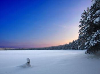
![Trail On foot Suomussalmi - Hakokosken Hujaus - Photo](https://media.geolcdn.com/t/350/260/5a1d67e9-3b6d-4d4f-9321-2bba62d55abc.jpeg&format=jpg&maxdim=2)
![On foot On foot](https://static1.geolcdn.com/sitytour/trail-icons/100.png)
Km
On foot
![](/images/other/stat-length.png)
![](https://static1.geolcdn.com/siteimages/upload/files/1508320355ic_sort_den_pos_24dp.png)
![](https://static1.geolcdn.com/siteimages/upload/files/1508320355ic_sort_den_neg_24dp.png)
![](https://static1.geolcdn.com/siteimages/upload/files/16400158638029165_repeat_loop_refresh_sync_direction_icon.png)
• Hossan patikointireitit, reittien lähtöpisteet, reittiesittelyt ja retkeilyrakenteet. Website: https://www.luontoon....
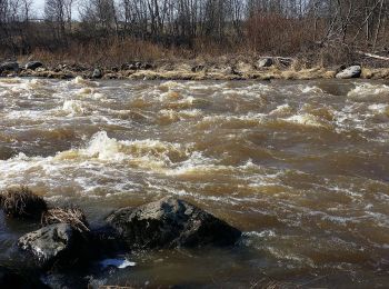
![Trail On foot Helsinki - Torpparintaival - Photo](https://media.geolcdn.com/t/350/260/002d0b9d-a2dd-4e69-ac0e-dc758ad4121d.jpeg&format=jpg&maxdim=2)
![On foot On foot](https://static1.geolcdn.com/sitytour/trail-icons/100.png)
Km
On foot
![](/images/other/stat-length.png)
![](https://static1.geolcdn.com/siteimages/upload/files/1508320355ic_sort_den_pos_24dp.png)
![](https://static1.geolcdn.com/siteimages/upload/files/1508320355ic_sort_den_neg_24dp.png)
![](https://static1.geolcdn.com/siteimages/upload/files/16400158638029165_repeat_loop_refresh_sync_direction_icon.png)
• Trail created by Torpparinmäen peruskoulu. https://www.hs.fi/lastenuutiset/art-2000006115708.html Website: https:...
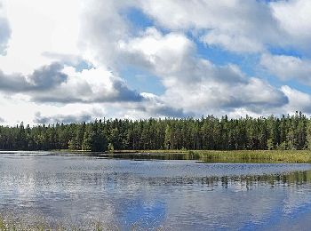
![Trail On foot Saarijärvi - Tulijärvi trail - Photo](https://media.geolcdn.com/t/350/260/683f7b65-e7c3-4951-8092-8a9308ad5467.jpeg&format=jpg&maxdim=2)
![On foot On foot](https://static1.geolcdn.com/sitytour/trail-icons/100.png)
Km
On foot
![](/images/other/stat-length.png)
![](https://static1.geolcdn.com/siteimages/upload/files/1508320355ic_sort_den_pos_24dp.png)
![](https://static1.geolcdn.com/siteimages/upload/files/1508320355ic_sort_den_neg_24dp.png)
![](https://static1.geolcdn.com/siteimages/upload/files/16400158638029165_repeat_loop_refresh_sync_direction_icon.png)
• Trail created by Metsähallitus.
![Trail On foot Saarijärvi - Kotajärvi Trail - Photo](https://media.geolcdn.com/t/350/260/dd055e6b-9c54-4441-9b8f-4633432f4f38.jpeg&format=jpg&maxdim=2)
![On foot On foot](https://static1.geolcdn.com/sitytour/trail-icons/100.png)
Km
On foot
![](/images/other/stat-length.png)
![](https://static1.geolcdn.com/siteimages/upload/files/1508320355ic_sort_den_pos_24dp.png)
![](https://static1.geolcdn.com/siteimages/upload/files/1508320355ic_sort_den_neg_24dp.png)
![](https://static1.geolcdn.com/siteimages/upload/files/16400158638029165_repeat_loop_refresh_sync_direction_icon.png)
• Reitit Website: https://www.luontoon.fi/pyha-hakki/reitit
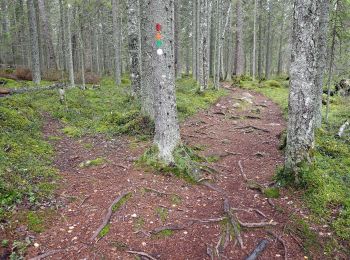
![Trail On foot Saarijärvi - Mastomäki Trail - Photo](https://media.geolcdn.com/t/350/260/01d67d04-43d7-4348-824a-1d5c0e081dd2.jpeg&format=jpg&maxdim=2)
![On foot On foot](https://static1.geolcdn.com/sitytour/trail-icons/100.png)
Km
On foot
![](/images/other/stat-length.png)
![](https://static1.geolcdn.com/siteimages/upload/files/1508320355ic_sort_den_pos_24dp.png)
![](https://static1.geolcdn.com/siteimages/upload/files/1508320355ic_sort_den_neg_24dp.png)
![](https://static1.geolcdn.com/siteimages/upload/files/16400158638029165_repeat_loop_refresh_sync_direction_icon.png)
• Reitit Website: https://www.luontoon.fi/pyha-hakki/reitit
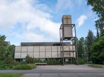
![Trail On foot Kouvola - Kymijoen ulkoilureitti - Photo](https://media.geolcdn.com/t/350/260/0f545207-5f3c-49fd-839c-a8d1bd175a5a.jpeg&format=jpg&maxdim=2)
![On foot On foot](https://static1.geolcdn.com/sitytour/trail-icons/100.png)
Km
On foot
![](/images/other/stat-length.png)
![](https://static1.geolcdn.com/siteimages/upload/files/1508320355ic_sort_den_pos_24dp.png)
![](https://static1.geolcdn.com/siteimages/upload/files/1508320355ic_sort_den_neg_24dp.png)
![](https://static1.geolcdn.com/siteimages/upload/files/16400158638029165_repeat_loop_refresh_sync_direction_icon.png)
• Trail created by Kouvolan kaupunki.
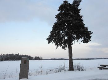
![Trail On foot Kouvola - Alakylän luontopolku - Photo](https://media.geolcdn.com/t/350/260/b358065d-f197-4008-9003-b6a3e053ff31.jpeg&format=jpg&maxdim=2)
![On foot On foot](https://static1.geolcdn.com/sitytour/trail-icons/100.png)
Km
On foot
![](/images/other/stat-length.png)
![](https://static1.geolcdn.com/siteimages/upload/files/1508320355ic_sort_den_pos_24dp.png)
![](https://static1.geolcdn.com/siteimages/upload/files/1508320355ic_sort_den_neg_24dp.png)
![](https://static1.geolcdn.com/siteimages/upload/files/16400158638029165_repeat_loop_refresh_sync_direction_icon.png)
• Korian sillalta lähtee reitti, joka myötäilee Kymijokea melko luonnontilaisena säilyneessä kapeassa metsikössä. Webs...
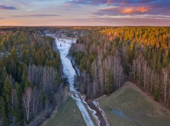
![Trail On foot Sipoo - Kalkkiruukki - Fiskträsk - Photo](https://media.geolcdn.com/t/350/260/76646939-8998-4a43-a7af-b0af5712ff6a.jpeg&format=jpg&maxdim=2)
![On foot On foot](https://static1.geolcdn.com/sitytour/trail-icons/100.png)
Km
On foot
![](/images/other/stat-length.png)
![](https://static1.geolcdn.com/siteimages/upload/files/1508320355ic_sort_den_pos_24dp.png)
![](https://static1.geolcdn.com/siteimages/upload/files/1508320355ic_sort_den_neg_24dp.png)
![](https://static1.geolcdn.com/siteimages/upload/files/16400158638029165_repeat_loop_refresh_sync_direction_icon.png)
• Trail created by Metsähallitus. Symbol: yellow diamond
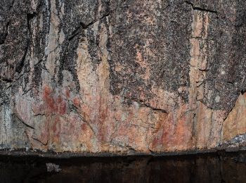
![Trail On foot Suomussalmi - Värikallion kaarros - Photo](https://media.geolcdn.com/t/350/260/f2c633dc-b318-49ca-a6f1-98a2c85c9244.jpeg&format=jpg&maxdim=2)
![On foot On foot](https://static1.geolcdn.com/sitytour/trail-icons/100.png)
Km
On foot
![](/images/other/stat-length.png)
![](https://static1.geolcdn.com/siteimages/upload/files/1508320355ic_sort_den_pos_24dp.png)
![](https://static1.geolcdn.com/siteimages/upload/files/1508320355ic_sort_den_neg_24dp.png)
![](https://static1.geolcdn.com/siteimages/upload/files/16400158638029165_repeat_loop_refresh_sync_direction_icon.png)
• Hossan patikointireitit, reittien lähtöpisteet, reittiesittelyt ja retkeilyrakenteet. Website: https://www.luontoon....
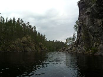
![Trail On foot Kuusamo - Ölökyn ylitys - Photo](https://media.geolcdn.com/t/350/260/a8f5e1bc-69be-4283-8381-a3e770e876a7.jpeg&format=jpg&maxdim=2)
![On foot On foot](https://static1.geolcdn.com/sitytour/trail-icons/100.png)
Km
On foot
![](/images/other/stat-length.png)
![](https://static1.geolcdn.com/siteimages/upload/files/1508320355ic_sort_den_pos_24dp.png)
![](https://static1.geolcdn.com/siteimages/upload/files/1508320355ic_sort_den_neg_24dp.png)
![](https://static1.geolcdn.com/siteimages/upload/files/16400158638029165_repeat_loop_refresh_sync_direction_icon.png)
• Hossan patikointireitit, reittien lähtöpisteet, reittiesittelyt ja retkeilyrakenteet. Website: https://www.luontoon....
![Trail On foot Kuusamo - Ölökyn ähkäsy - Photo](https://media.geolcdn.com/t/350/260/a8f5e1bc-69be-4283-8381-a3e770e876a7.jpeg&format=jpg&maxdim=2)
![On foot On foot](https://static1.geolcdn.com/sitytour/trail-icons/100.png)
Km
On foot
![](/images/other/stat-length.png)
![](https://static1.geolcdn.com/siteimages/upload/files/1508320355ic_sort_den_pos_24dp.png)
![](https://static1.geolcdn.com/siteimages/upload/files/1508320355ic_sort_den_neg_24dp.png)
![](https://static1.geolcdn.com/siteimages/upload/files/16400158638029165_repeat_loop_refresh_sync_direction_icon.png)
• Hossan patikointireitit, reittien lähtöpisteet, reittiesittelyt ja retkeilyrakenteet. Website: https://www.luontoon....
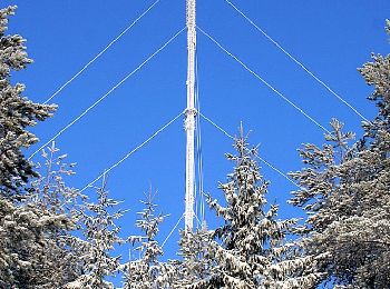
![Trail On foot Hollola - Tiirismaan kierros - Photo](https://media.geolcdn.com/t/350/260/065da3d7-6ca2-4475-81b0-bc4ba2ff43b6.jpeg&format=jpg&maxdim=2)
![On foot On foot](https://static1.geolcdn.com/sitytour/trail-icons/100.png)
Km
On foot
![](/images/other/stat-length.png)
![](https://static1.geolcdn.com/siteimages/upload/files/1508320355ic_sort_den_pos_24dp.png)
![](https://static1.geolcdn.com/siteimages/upload/files/1508320355ic_sort_den_neg_24dp.png)
![](https://static1.geolcdn.com/siteimages/upload/files/16400158638029165_repeat_loop_refresh_sync_direction_icon.png)
• Tiirismaan kierros on 4,5 km:n pituinen ympyräreitti Hollolassa. Vaihtelevassa ja paikoin kivikkoisessa maastossa kul...
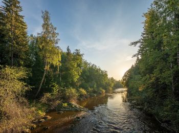
![Trail On foot Helsinki - Haltiavuoren luontopolku - Photo](https://media.geolcdn.com/t/350/260/4b6dad3d-94f4-4221-9fd4-d09a14822f0b.jpeg&format=jpg&maxdim=2)
![On foot On foot](https://static1.geolcdn.com/sitytour/trail-icons/100.png)
Km
On foot
![](/images/other/stat-length.png)
![](https://static1.geolcdn.com/siteimages/upload/files/1508320355ic_sort_den_pos_24dp.png)
![](https://static1.geolcdn.com/siteimages/upload/files/1508320355ic_sort_den_neg_24dp.png)
![](https://static1.geolcdn.com/siteimages/upload/files/16400158638029165_repeat_loop_refresh_sync_direction_icon.png)
• Pohjois-Helsingin Haltialassa on kolme luontopolkua ja lisäksi Niskalassa puulajipuisto. Website: https://www.hel.fi...
20 trails displayed on 202
FREE GPS app for hiking