![](/images/other/stat-length.png)
Asturias, Asturias, On foot: Best trails, routes and walks
Asturias: Discover the best trails: 49 on foot and 203 walking. All these trails, routes and outdoor activities are available in our SityTrail applications for smartphones and tablets.
The best trails (252)
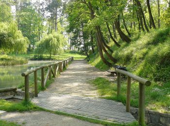
![Trail On foot Cangas de Onís - [TRC-002 R3] Ruta del Rey Pelayo - Photo](https://media.geolcdn.com/t/350/260/f65b4fbb-0b71-47f6-9620-4d57c9854fa2.jpeg&format=jpg&maxdim=2)
![On foot On foot](https://static1.geolcdn.com/sitytour/trail-icons/100.png)
Km
On foot
![](/images/other/stat-length.png)
![](https://static1.geolcdn.com/siteimages/upload/files/1508320355ic_sort_den_pos_24dp.png)
![](https://static1.geolcdn.com/siteimages/upload/files/1508320355ic_sort_den_neg_24dp.png)
![](https://static1.geolcdn.com/siteimages/upload/files/16400158638029165_repeat_loop_refresh_sync_direction_icon.png)
• Website: https://www.cangasdeonis.es/centro-permanente-de-trail-running
![Trail On foot Cabrales - Ruta de la Canal del Texu - Photo](https://media.geolcdn.com/t/350/260/1d36674c-8105-4293-83be-97734784bb8a.jpeg&format=jpg&maxdim=2)
![On foot On foot](https://static1.geolcdn.com/sitytour/trail-icons/100.png)
Km
On foot
![](/images/other/stat-length.png)
![](https://static1.geolcdn.com/siteimages/upload/files/1508320355ic_sort_den_pos_24dp.png)
![](https://static1.geolcdn.com/siteimages/upload/files/1508320355ic_sort_den_neg_24dp.png)
![](https://static1.geolcdn.com/siteimages/upload/files/16400158638029165_repeat_loop_refresh_sync_direction_icon.png)
• Website: https://www.turismoasturias.es/descubre/naturaleza/rutas/senderismo/subida-a-bulnes
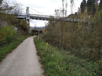
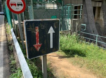
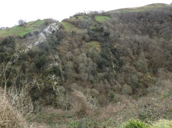
![Trail On foot Cangas de Onís - [TRC-002 R2] Ruta del Rey Favila - Photo](https://media.geolcdn.com/t/350/260/ba158dcb-dfe0-4b5b-a168-1a9b2d3f986a.jpeg&format=jpg&maxdim=2)
![On foot On foot](https://static1.geolcdn.com/sitytour/trail-icons/100.png)
Km
On foot
![](/images/other/stat-length.png)
![](https://static1.geolcdn.com/siteimages/upload/files/1508320355ic_sort_den_pos_24dp.png)
![](https://static1.geolcdn.com/siteimages/upload/files/1508320355ic_sort_den_neg_24dp.png)
![](https://static1.geolcdn.com/siteimages/upload/files/16400158638029165_repeat_loop_refresh_sync_direction_icon.png)
• Website: https://www.cangasdeonis.es/centro-permanente-de-trail-running
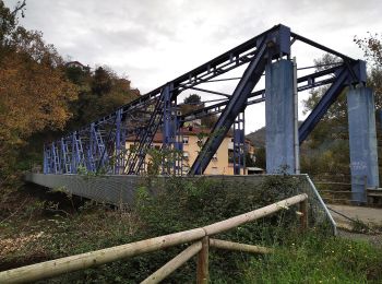
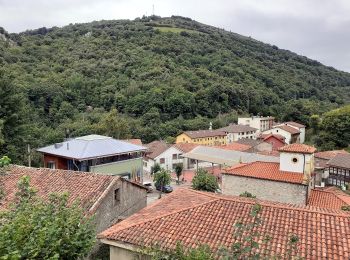
![Trail On foot Cangas de Onís - [TRC-002 R1] Ruta del Puentón - Photo](https://media.geolcdn.com/t/350/260/1f0fd472-7a6b-4c8c-8c36-b5bd5597f427.jpeg&format=jpg&maxdim=2)
![On foot On foot](https://static1.geolcdn.com/sitytour/trail-icons/100.png)
Km
On foot
![](/images/other/stat-length.png)
![](https://static1.geolcdn.com/siteimages/upload/files/1508320355ic_sort_den_pos_24dp.png)
![](https://static1.geolcdn.com/siteimages/upload/files/1508320355ic_sort_den_neg_24dp.png)
![](https://static1.geolcdn.com/siteimages/upload/files/16400158638029165_repeat_loop_refresh_sync_direction_icon.png)
• Website: https://www.cangasdeonis.es/centro-permanente-de-trail-running
![Trail On foot Riosa - Sendero Valle de Cuna - Photo](https://media.geolcdn.com/t/350/260/124e4136-2591-40a5-9e11-c9cba758b1ab.jpeg&format=jpg&maxdim=2)
![On foot On foot](https://static1.geolcdn.com/sitytour/trail-icons/100.png)
Km
On foot
![](/images/other/stat-length.png)
![](https://static1.geolcdn.com/siteimages/upload/files/1508320355ic_sort_den_pos_24dp.png)
![](https://static1.geolcdn.com/siteimages/upload/files/1508320355ic_sort_den_neg_24dp.png)
![](https://static1.geolcdn.com/siteimages/upload/files/16400158638029165_repeat_loop_refresh_sync_direction_icon.png)
• Trail created by Principado de Asturias.
![Trail On foot Oviedo - Ruta de la Salamandra (Circular) - Photo](https://media.geolcdn.com/t/350/260/e671e7e7-ac50-49a4-ad1e-8b451013bab5.jpeg&format=jpg&maxdim=2)
![On foot On foot](https://static1.geolcdn.com/sitytour/trail-icons/100.png)
Km
On foot
![](/images/other/stat-length.png)
![](https://static1.geolcdn.com/siteimages/upload/files/1508320355ic_sort_den_pos_24dp.png)
![](https://static1.geolcdn.com/siteimages/upload/files/1508320355ic_sort_den_neg_24dp.png)
![](https://static1.geolcdn.com/siteimages/upload/files/16400158638029165_repeat_loop_refresh_sync_direction_icon.png)
• Trail created by Ayuntamiento de Oviedo. Symbol: Baldosas con una salamandra sobre fondo blanco
![Trail On foot Oviedo - Ruta de la Salamandra I (Caces-Siones-La Arquera) - Photo](https://media.geolcdn.com/t/350/260/d3ea829e-aad7-4131-b4c2-fb2caf4d0568.jpeg&format=jpg&maxdim=2)
![On foot On foot](https://static1.geolcdn.com/sitytour/trail-icons/100.png)
Km
On foot
![](/images/other/stat-length.png)
![](https://static1.geolcdn.com/siteimages/upload/files/1508320355ic_sort_den_pos_24dp.png)
![](https://static1.geolcdn.com/siteimages/upload/files/1508320355ic_sort_den_neg_24dp.png)
![](https://static1.geolcdn.com/siteimages/upload/files/16400158638029165_repeat_loop_refresh_sync_direction_icon.png)
• Trail created by Ayuntamiento de Oviedo. Symbol: Baldosas con una salamandra sobre fondo blanco
![Trail On foot Samartín del Rei Aurelio - Paséu fluvial del Nalón - Photo](https://media.geolcdn.com/t/350/260/35326beb-76b8-4e86-a2a2-1b0ad43d0d16.jpeg&format=jpg&maxdim=2)
![On foot On foot](https://static1.geolcdn.com/sitytour/trail-icons/100.png)
Km
On foot
![](/images/other/stat-length.png)
![](https://static1.geolcdn.com/siteimages/upload/files/1508320355ic_sort_den_pos_24dp.png)
![](https://static1.geolcdn.com/siteimages/upload/files/1508320355ic_sort_den_neg_24dp.png)
![](https://static1.geolcdn.com/siteimages/upload/files/16400158638029165_repeat_loop_refresh_sync_direction_icon.png)
• Trail created by Ayuntamientu de Llaviana.
![Trail On foot Llangréu/Langreo - Paséu fluvial del Nalón - Photo](https://media.geolcdn.com/t/350/260/eca8e2f7-7e08-4c75-9312-0176b2bc0d4b.jpeg&format=jpg&maxdim=2)
![On foot On foot](https://static1.geolcdn.com/sitytour/trail-icons/100.png)
Km
On foot
![](/images/other/stat-length.png)
![](https://static1.geolcdn.com/siteimages/upload/files/1508320355ic_sort_den_pos_24dp.png)
![](https://static1.geolcdn.com/siteimages/upload/files/1508320355ic_sort_den_neg_24dp.png)
![](https://static1.geolcdn.com/siteimages/upload/files/16400158638029165_repeat_loop_refresh_sync_direction_icon.png)
• Trail created by Ayuntamientu de Samartín del Rei Aurelio.
![Trail On foot Llangréu/Langreo - Paséu fluvial del Nalón - Photo](https://media.geolcdn.com/t/350/260/05ff28a6-191a-43b2-985a-6364d6bf3238.jpeg&format=jpg&maxdim=2)
![On foot On foot](https://static1.geolcdn.com/sitytour/trail-icons/100.png)
Km
On foot
![](/images/other/stat-length.png)
![](https://static1.geolcdn.com/siteimages/upload/files/1508320355ic_sort_den_pos_24dp.png)
![](https://static1.geolcdn.com/siteimages/upload/files/1508320355ic_sort_den_neg_24dp.png)
![](https://static1.geolcdn.com/siteimages/upload/files/16400158638029165_repeat_loop_refresh_sync_direction_icon.png)
• Trail created by Ayuntamientu de Llangréu.
![Trail On foot Oviedo - Vía Verde Oviedo - Fuso de la Reina (peatonal) - Photo](https://media.geolcdn.com/t/350/260/3fd0c26d-6f1d-4e9b-96ce-7c97a880168f.jpeg&format=jpg&maxdim=2)
![On foot On foot](https://static1.geolcdn.com/sitytour/trail-icons/100.png)
Km
On foot
![](/images/other/stat-length.png)
![](https://static1.geolcdn.com/siteimages/upload/files/1508320355ic_sort_den_pos_24dp.png)
![](https://static1.geolcdn.com/siteimages/upload/files/1508320355ic_sort_den_neg_24dp.png)
![](https://static1.geolcdn.com/siteimages/upload/files/16400158638029165_repeat_loop_refresh_sync_direction_icon.png)
• The bicycle relation has the same members as this one. A base relation with all the ways and then two super-relations...
![Trail On foot Oviedo - Ruta de la Salamandra II (La Arquera-Caces) - Photo](https://media.geolcdn.com/t/350/260/c171f50a-6eca-4b8a-a436-a64bcdc0a495.jpeg&format=jpg&maxdim=2)
![On foot On foot](https://static1.geolcdn.com/sitytour/trail-icons/100.png)
Km
On foot
![](/images/other/stat-length.png)
![](https://static1.geolcdn.com/siteimages/upload/files/1508320355ic_sort_den_pos_24dp.png)
![](https://static1.geolcdn.com/siteimages/upload/files/1508320355ic_sort_den_neg_24dp.png)
![](https://static1.geolcdn.com/siteimages/upload/files/16400158638029165_repeat_loop_refresh_sync_direction_icon.png)
• Trail created by Ayuntamiento de Oviedo. Symbol: Baldosas con una salamandra sobre fondo blanco
![Trail Walking Cangas de Onís - Covadonga tour des lacs - Photo](https://media.geolcdn.com/t/350/260/6ba2f432-cb69-4259-835c-1492db0269fa.jpg&format=jpg&maxdim=2)
![Walking Walking](https://static1.geolcdn.com/sitytour/trail-icons/101.png)
Km
Walking
![](/images/other/stat-length.png)
![](https://static1.geolcdn.com/siteimages/upload/files/1508320355ic_sort_den_pos_24dp.png)
![](https://static1.geolcdn.com/siteimages/upload/files/1508320355ic_sort_den_neg_24dp.png)
![](https://static1.geolcdn.com/siteimages/upload/files/16400158638029165_repeat_loop_refresh_sync_direction_icon.png)
![Trail On foot Ponga - PR AS-213 Ruta del Valle de Ponga - Photo](https://media.geolcdn.com/t/350/260/f89bc6fb-68ef-4e2f-a082-d4f6773102aa.jpeg&format=jpg&maxdim=2)
![On foot On foot](https://static1.geolcdn.com/sitytour/trail-icons/100.png)
Km
On foot
![](/images/other/stat-length.png)
![](https://static1.geolcdn.com/siteimages/upload/files/1508320355ic_sort_den_pos_24dp.png)
![](https://static1.geolcdn.com/siteimages/upload/files/1508320355ic_sort_den_neg_24dp.png)
![](https://static1.geolcdn.com/siteimages/upload/files/16400158638029165_repeat_loop_refresh_sync_direction_icon.png)
![Trail On foot Valdés - Ruta Turística Severo Ochoa - Photo](https://media.geolcdn.com/t/350/260/3f3da585-82b4-48c8-b186-e6f856310d4b.jpeg&format=jpg&maxdim=2)
![On foot On foot](https://static1.geolcdn.com/sitytour/trail-icons/100.png)
Km
On foot
![](/images/other/stat-length.png)
![](https://static1.geolcdn.com/siteimages/upload/files/1508320355ic_sort_den_pos_24dp.png)
![](https://static1.geolcdn.com/siteimages/upload/files/1508320355ic_sort_den_neg_24dp.png)
![](https://static1.geolcdn.com/siteimages/upload/files/16400158638029165_repeat_loop_refresh_sync_direction_icon.png)
![Trail On foot Siero - Senda de La Acebera - Photo](https://media.geolcdn.com/t/350/260/552c3cc3-a643-4db7-9f03-b8fec1d4fbcb.jpeg&format=jpg&maxdim=2)
![On foot On foot](https://static1.geolcdn.com/sitytour/trail-icons/100.png)
Km
On foot
![](/images/other/stat-length.png)
![](https://static1.geolcdn.com/siteimages/upload/files/1508320355ic_sort_den_pos_24dp.png)
![](https://static1.geolcdn.com/siteimages/upload/files/1508320355ic_sort_den_neg_24dp.png)
![](https://static1.geolcdn.com/siteimages/upload/files/16400158638029165_repeat_loop_refresh_sync_direction_icon.png)
![Trail On foot Cabrales - Poo - Camarmeña - Poncebos - Photo](https://media.geolcdn.com/t/350/260/8583b8bb-44c4-49a5-af60-93fa2c876d75.jpeg&format=jpg&maxdim=2)
![On foot On foot](https://static1.geolcdn.com/sitytour/trail-icons/100.png)
Km
On foot
![](/images/other/stat-length.png)
![](https://static1.geolcdn.com/siteimages/upload/files/1508320355ic_sort_den_pos_24dp.png)
![](https://static1.geolcdn.com/siteimages/upload/files/1508320355ic_sort_den_neg_24dp.png)
![](https://static1.geolcdn.com/siteimages/upload/files/16400158638029165_repeat_loop_refresh_sync_direction_icon.png)
![Trail On foot Cabrales - Arangas - Carreña - Photo](https://media.geolcdn.com/t/350/260/1939d4d5-dcd8-458e-869a-39a4a4116a85.jpeg&format=jpg&maxdim=2)
![On foot On foot](https://static1.geolcdn.com/sitytour/trail-icons/100.png)
Km
On foot
![](/images/other/stat-length.png)
![](https://static1.geolcdn.com/siteimages/upload/files/1508320355ic_sort_den_pos_24dp.png)
![](https://static1.geolcdn.com/siteimages/upload/files/1508320355ic_sort_den_neg_24dp.png)
![](https://static1.geolcdn.com/siteimages/upload/files/16400158638029165_repeat_loop_refresh_sync_direction_icon.png)
![Trail On foot Cabrales - Poncebos - Bulnes - Sotres - Tielve - Photo](https://media.geolcdn.com/t/350/260/dadf3c04-4134-4a0e-9ef8-2cfb565c352c.jpeg&format=jpg&maxdim=2)
![On foot On foot](https://static1.geolcdn.com/sitytour/trail-icons/100.png)
Km
On foot
![](/images/other/stat-length.png)
![](https://static1.geolcdn.com/siteimages/upload/files/1508320355ic_sort_den_pos_24dp.png)
![](https://static1.geolcdn.com/siteimages/upload/files/1508320355ic_sort_den_neg_24dp.png)
![](https://static1.geolcdn.com/siteimages/upload/files/16400158638029165_repeat_loop_refresh_sync_direction_icon.png)
![Trail On foot Cabrales - Cinturón verde de Cabrales - Photo](https://media.geolcdn.com/t/350/260/d096daff-b040-4e91-b000-651e2c7e92e3.jpeg&format=jpg&maxdim=2)
![On foot On foot](https://static1.geolcdn.com/sitytour/trail-icons/100.png)
Km
On foot
![](/images/other/stat-length.png)
![](https://static1.geolcdn.com/siteimages/upload/files/1508320355ic_sort_den_pos_24dp.png)
![](https://static1.geolcdn.com/siteimages/upload/files/1508320355ic_sort_den_neg_24dp.png)
![](https://static1.geolcdn.com/siteimages/upload/files/16400158638029165_repeat_loop_refresh_sync_direction_icon.png)
20 trails displayed on 252
FREE GPS app for hiking
Activities
Nearby regions
- Allande
- Aller
- Amieva
- Avilés
- Belmonte de Miranda
- Bimenes
- Boal
- Cabrales
- Cangas de Onís
- Cangas del Narcea
- Caravia
- Carreño
- Caso
- Castrillón
- Castropol
- Coaña
- Colunga
- Corvera de Asturias
- Cudillero
- El Franco
- Gijón
- Gozón
- Grandas de Salime
- Grau/Grado
- Las Regueras
- Laviana
- Lena
- Llanes
- Llangréu/Langreo
- Mieres
- Morcín
- Muros de Nalón
- Nava
- Navia
- Onís
- Oviedo
- Parres
- Peñamellera Alta
- Peñamellera Baja
- Piloña
- Ponga
- Pravia
- Proaza
- Quirós
- Ribadedeva
- Ribadesella
- Riosa
- Salas
- Samartín del Rei Aurelio
- Sames
- San Tirso de Abres
- Santo Adriano
- Sariego
- Siero
- Sobrescobio
- Somiedo
- Soto del Barco
- Tapia de Casariego
- Taramundi
- Teverga
- Tineo
- Valdés
- Vegadeo
- Villanueva de Oscos
- Villaviciosa
- Villayón
- Yernes y Tameza