![](/images/other/stat-length.png)
- Trails
- On foot
- Germany
- Lower Saxony
- Heidekreis
Heidekreis, Lower Saxony, On foot: Best trails, routes and walks
Heidekreis: Discover the best trails: 57 on foot. All these trails, routes and outdoor activities are available in our SityTrail applications for smartphones and tablets.
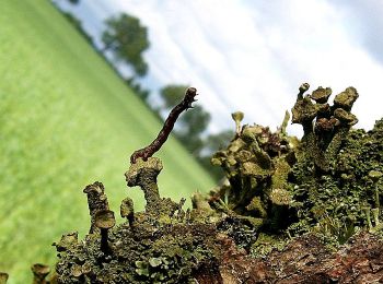
The best trails (57)
![Trail On foot Munster - Örtzeweg - Photo](https://media.geolcdn.com/t/350/260/25b42615-0518-4ae3-a43c-5dff790a005a.jpeg&format=jpg&maxdim=2)
![On foot On foot](https://static1.geolcdn.com/sitytour/trail-icons/100.png)
Km
On foot
![](/images/other/stat-length.png)
![](https://static1.geolcdn.com/siteimages/upload/files/1508320355ic_sort_den_pos_24dp.png)
![](https://static1.geolcdn.com/siteimages/upload/files/1508320355ic_sort_den_neg_24dp.png)
![](https://static1.geolcdn.com/siteimages/upload/files/16400158638029165_repeat_loop_refresh_sync_direction_icon.png)
• Trail created by Munster Touristik. Symbol: Drei weiße Wellen auf blauem Grund
![Trail On foot Munster - Fischeweg - Photo](https://media.geolcdn.com/t/350/260/a16896c5-938e-411c-bcef-447906b5f820.jpeg&format=jpg&maxdim=2)
![On foot On foot](https://static1.geolcdn.com/sitytour/trail-icons/100.png)
Km
On foot
![](/images/other/stat-length.png)
![](https://static1.geolcdn.com/siteimages/upload/files/1508320355ic_sort_den_pos_24dp.png)
![](https://static1.geolcdn.com/siteimages/upload/files/1508320355ic_sort_den_neg_24dp.png)
![](https://static1.geolcdn.com/siteimages/upload/files/16400158638029165_repeat_loop_refresh_sync_direction_icon.png)
• Trail created by Munster Touristik. Symbol: Weisser Fisch auf grünem Grund
![Trail On foot Munster - Kartoffelweg - Photo](https://media.geolcdn.com/t/350/260/f36a72c8-90a0-4b20-af32-a7401c392de2.jpeg&format=jpg&maxdim=2)
![On foot On foot](https://static1.geolcdn.com/sitytour/trail-icons/100.png)
Km
On foot
![](/images/other/stat-length.png)
![](https://static1.geolcdn.com/siteimages/upload/files/1508320355ic_sort_den_pos_24dp.png)
![](https://static1.geolcdn.com/siteimages/upload/files/1508320355ic_sort_den_neg_24dp.png)
![](https://static1.geolcdn.com/siteimages/upload/files/16400158638029165_repeat_loop_refresh_sync_direction_icon.png)
• Trail created by Munster Touristik. Symbol: Braun-Gelbe Kartoffel auf weißem Grund
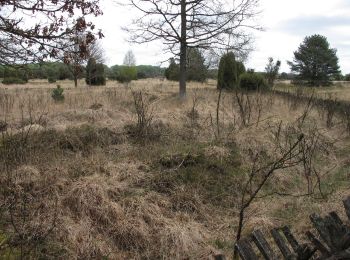
![Trail On foot Munster - Zapfenweg - Photo](https://media.geolcdn.com/t/350/260/387b2ae0-23f5-41ff-abe0-0efdb6d86ee8.jpeg&format=jpg&maxdim=2)
![On foot On foot](https://static1.geolcdn.com/sitytour/trail-icons/100.png)
Km
On foot
![](/images/other/stat-length.png)
![](https://static1.geolcdn.com/siteimages/upload/files/1508320355ic_sort_den_pos_24dp.png)
![](https://static1.geolcdn.com/siteimages/upload/files/1508320355ic_sort_den_neg_24dp.png)
![](https://static1.geolcdn.com/siteimages/upload/files/16400158638029165_repeat_loop_refresh_sync_direction_icon.png)
• Trail created by Kulturraum Oberes Örzetal. Symbol: Weisser Zapfen auf braunem Grund
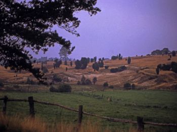
![Trail On foot Bispingen - Rundwanderweg Bispingen Bi3 - Photo](https://media.geolcdn.com/t/350/260/681fa153-7901-440b-a121-447c856fd8df.jpeg&format=jpg&maxdim=2)
![On foot On foot](https://static1.geolcdn.com/sitytour/trail-icons/100.png)
Km
On foot
![](/images/other/stat-length.png)
![](https://static1.geolcdn.com/siteimages/upload/files/1508320355ic_sort_den_pos_24dp.png)
![](https://static1.geolcdn.com/siteimages/upload/files/1508320355ic_sort_den_neg_24dp.png)
![](https://static1.geolcdn.com/siteimages/upload/files/16400158638029165_repeat_loop_refresh_sync_direction_icon.png)
• Trail created by Bispingen Touristik e.V..
![Trail On foot Bispingen - Rundwanderweg Steinbeck/Luhe St1 - Photo](https://media.geolcdn.com/t/350/260/100aac50-72f5-449b-806d-e961cd1c3a3d.jpeg&format=jpg&maxdim=2)
![On foot On foot](https://static1.geolcdn.com/sitytour/trail-icons/100.png)
Km
On foot
![](/images/other/stat-length.png)
![](https://static1.geolcdn.com/siteimages/upload/files/1508320355ic_sort_den_pos_24dp.png)
![](https://static1.geolcdn.com/siteimages/upload/files/1508320355ic_sort_den_neg_24dp.png)
![](https://static1.geolcdn.com/siteimages/upload/files/16400158638029165_repeat_loop_refresh_sync_direction_icon.png)
• Trail created by Bispingen Touristik e.V..
![Trail On foot Bispingen - Rundwanderweg Hörpel H1 - Photo](https://media.geolcdn.com/t/350/260/d9876fc9-534c-4f6b-b18e-4cfdef32902f.jpeg&format=jpg&maxdim=2)
![On foot On foot](https://static1.geolcdn.com/sitytour/trail-icons/100.png)
Km
On foot
![](/images/other/stat-length.png)
![](https://static1.geolcdn.com/siteimages/upload/files/1508320355ic_sort_den_pos_24dp.png)
![](https://static1.geolcdn.com/siteimages/upload/files/1508320355ic_sort_den_neg_24dp.png)
![](https://static1.geolcdn.com/siteimages/upload/files/16400158638029165_repeat_loop_refresh_sync_direction_icon.png)
• Trail created by Bispingen Touristik e.V..
![Trail On foot Bispingen - Rundwanderweg Hörpel H2 - Photo](https://media.geolcdn.com/t/350/260/d9876fc9-534c-4f6b-b18e-4cfdef32902f.jpeg&format=jpg&maxdim=2)
![On foot On foot](https://static1.geolcdn.com/sitytour/trail-icons/100.png)
Km
On foot
![](/images/other/stat-length.png)
![](https://static1.geolcdn.com/siteimages/upload/files/1508320355ic_sort_den_pos_24dp.png)
![](https://static1.geolcdn.com/siteimages/upload/files/1508320355ic_sort_den_neg_24dp.png)
![](https://static1.geolcdn.com/siteimages/upload/files/16400158638029165_repeat_loop_refresh_sync_direction_icon.png)
• Trail created by Bispingen Touristik e.V..
![Trail On foot Bispingen - Rundwanderweg Volkwardingen V2 - Photo](https://media.geolcdn.com/t/350/260/91bd4765-675a-4523-89d4-af50544b7f94.jpeg&format=jpg&maxdim=2)
![On foot On foot](https://static1.geolcdn.com/sitytour/trail-icons/100.png)
Km
On foot
![](/images/other/stat-length.png)
![](https://static1.geolcdn.com/siteimages/upload/files/1508320355ic_sort_den_pos_24dp.png)
![](https://static1.geolcdn.com/siteimages/upload/files/1508320355ic_sort_den_neg_24dp.png)
![](https://static1.geolcdn.com/siteimages/upload/files/16400158638029165_repeat_loop_refresh_sync_direction_icon.png)
• Trail created by Bispingen Touristik e.V.. Symbol: brown V2 in brown solid circle
![Trail On foot Soltau - Wanderweg Weihe - Photo](https://media.geolcdn.com/t/350/260/254aeb48-c8a6-4b94-b5ad-ff0b5edce457.jpeg&format=jpg&maxdim=2)
![On foot On foot](https://static1.geolcdn.com/sitytour/trail-icons/100.png)
Km
On foot
![](/images/other/stat-length.png)
![](https://static1.geolcdn.com/siteimages/upload/files/1508320355ic_sort_den_pos_24dp.png)
![](https://static1.geolcdn.com/siteimages/upload/files/1508320355ic_sort_den_neg_24dp.png)
![](https://static1.geolcdn.com/siteimages/upload/files/16400158638029165_repeat_loop_refresh_sync_direction_icon.png)
• Trail created by Soltau. Symbol: Weihe (Vogel) - neuere Schilder in braun, ältere (Alternativ-Strecken) in hellgrau
![Trail On foot Soltau - Wanderweg Schmetterling - Photo](https://media.geolcdn.com/t/350/260/4856ac0e-4f68-42a2-af94-3b4f0a52d81b.jpeg&format=jpg&maxdim=2)
![On foot On foot](https://static1.geolcdn.com/sitytour/trail-icons/100.png)
Km
On foot
![](/images/other/stat-length.png)
![](https://static1.geolcdn.com/siteimages/upload/files/1508320355ic_sort_den_pos_24dp.png)
![](https://static1.geolcdn.com/siteimages/upload/files/1508320355ic_sort_den_neg_24dp.png)
![](https://static1.geolcdn.com/siteimages/upload/files/16400158638029165_repeat_loop_refresh_sync_direction_icon.png)
• Trail created by Soltau. Symbol: butterfly; Gelbes Schmetterling auf weißem Schild
![Trail On foot Soltau - Wanderweg Tanne - Photo](https://media.geolcdn.com/t/350/260/8abfcc0b-1b21-4307-b202-6f66f9345120.jpeg&format=jpg&maxdim=2)
![On foot On foot](https://static1.geolcdn.com/sitytour/trail-icons/100.png)
Km
On foot
![](/images/other/stat-length.png)
![](https://static1.geolcdn.com/siteimages/upload/files/1508320355ic_sort_den_pos_24dp.png)
![](https://static1.geolcdn.com/siteimages/upload/files/1508320355ic_sort_den_neg_24dp.png)
![](https://static1.geolcdn.com/siteimages/upload/files/16400158638029165_repeat_loop_refresh_sync_direction_icon.png)
• Trail created by Soltau. Symbol: Tanne
![Trail On foot Bispingen - Rundwanderweg Wilsede W2 - Photo](https://media.geolcdn.com/t/350/260/481eae8e-6971-4b86-bf06-c56edfde3a86.jpeg&format=jpg&maxdim=2)
![On foot On foot](https://static1.geolcdn.com/sitytour/trail-icons/100.png)
Km
On foot
![](/images/other/stat-length.png)
![](https://static1.geolcdn.com/siteimages/upload/files/1508320355ic_sort_den_pos_24dp.png)
![](https://static1.geolcdn.com/siteimages/upload/files/1508320355ic_sort_den_neg_24dp.png)
![](https://static1.geolcdn.com/siteimages/upload/files/16400158638029165_repeat_loop_refresh_sync_direction_icon.png)
• Trail created by Bispingen Touristik e.V.. Symbol: orange W2 in orange dashed circle
![Trail On foot Bispingen - Rundwanderweg Wilsede W1 - Photo](https://media.geolcdn.com/t/350/260/091b0282-9b2e-4708-ad04-244efa3a168b.jpeg&format=jpg&maxdim=2)
![On foot On foot](https://static1.geolcdn.com/sitytour/trail-icons/100.png)
Km
On foot
![](/images/other/stat-length.png)
![](https://static1.geolcdn.com/siteimages/upload/files/1508320355ic_sort_den_pos_24dp.png)
![](https://static1.geolcdn.com/siteimages/upload/files/1508320355ic_sort_den_neg_24dp.png)
![](https://static1.geolcdn.com/siteimages/upload/files/16400158638029165_repeat_loop_refresh_sync_direction_icon.png)
• Trail created by Bispingen Touristik e.V.. Symbol: orange W1 in orange solid circle
![Trail On foot Bispingen - Rundwanderweg Volkwardingen V1 - Photo](https://media.geolcdn.com/t/350/260/91bd4765-675a-4523-89d4-af50544b7f94.jpeg&format=jpg&maxdim=2)
![On foot On foot](https://static1.geolcdn.com/sitytour/trail-icons/100.png)
Km
On foot
![](/images/other/stat-length.png)
![](https://static1.geolcdn.com/siteimages/upload/files/1508320355ic_sort_den_pos_24dp.png)
![](https://static1.geolcdn.com/siteimages/upload/files/1508320355ic_sort_den_neg_24dp.png)
![](https://static1.geolcdn.com/siteimages/upload/files/16400158638029165_repeat_loop_refresh_sync_direction_icon.png)
• Trail created by Bispingen Touristik e.V.. Symbol: brown V1 in brown solid circle
![Trail On foot Bispingen - Rundwanderweg Behringen B1 - Photo](https://media.geolcdn.com/t/350/260/91bd4765-675a-4523-89d4-af50544b7f94.jpeg&format=jpg&maxdim=2)
![On foot On foot](https://static1.geolcdn.com/sitytour/trail-icons/100.png)
Km
On foot
![](/images/other/stat-length.png)
![](https://static1.geolcdn.com/siteimages/upload/files/1508320355ic_sort_den_pos_24dp.png)
![](https://static1.geolcdn.com/siteimages/upload/files/1508320355ic_sort_den_neg_24dp.png)
![](https://static1.geolcdn.com/siteimages/upload/files/16400158638029165_repeat_loop_refresh_sync_direction_icon.png)
• Trail created by Bispingen Touristik e.V.. Symbol: red B1 in red solid circle
![Trail On foot Bispingen - Rundwanderweg Behringen B2 - Photo](https://media.geolcdn.com/t/350/260/00bc88a2-46af-4b0c-9a93-9df22247262c.jpeg&format=jpg&maxdim=2)
![On foot On foot](https://static1.geolcdn.com/sitytour/trail-icons/100.png)
Km
On foot
![](/images/other/stat-length.png)
![](https://static1.geolcdn.com/siteimages/upload/files/1508320355ic_sort_den_pos_24dp.png)
![](https://static1.geolcdn.com/siteimages/upload/files/1508320355ic_sort_den_neg_24dp.png)
![](https://static1.geolcdn.com/siteimages/upload/files/16400158638029165_repeat_loop_refresh_sync_direction_icon.png)
• Trail created by Bispingen Touristik e.V.. Symbol: red B2 in red dashed circle
![Trail On foot Bispingen - Rundwanderweg Niederhaverbeck N3 - Photo](https://media.geolcdn.com/t/350/260/1cd2d58f-e216-4ace-86b4-73edb5a21d78.jpeg&format=jpg&maxdim=2)
![On foot On foot](https://static1.geolcdn.com/sitytour/trail-icons/100.png)
Km
On foot
![](/images/other/stat-length.png)
![](https://static1.geolcdn.com/siteimages/upload/files/1508320355ic_sort_den_pos_24dp.png)
![](https://static1.geolcdn.com/siteimages/upload/files/1508320355ic_sort_den_neg_24dp.png)
![](https://static1.geolcdn.com/siteimages/upload/files/16400158638029165_repeat_loop_refresh_sync_direction_icon.png)
• Trail created by Bispingen Touristik e.V.. Symbol: red N3 in red dotted circle
![Trail On foot Bispingen - Rundwanderweg Niederhaverbeck N2 - Photo](https://media.geolcdn.com/t/350/260/4cf8be34-63a2-45d8-b800-a3394796df73.jpeg&format=jpg&maxdim=2)
![On foot On foot](https://static1.geolcdn.com/sitytour/trail-icons/100.png)
Km
On foot
![](/images/other/stat-length.png)
![](https://static1.geolcdn.com/siteimages/upload/files/1508320355ic_sort_den_pos_24dp.png)
![](https://static1.geolcdn.com/siteimages/upload/files/1508320355ic_sort_den_neg_24dp.png)
![](https://static1.geolcdn.com/siteimages/upload/files/16400158638029165_repeat_loop_refresh_sync_direction_icon.png)
• Trail created by Bispingen Touristik e.V.. Symbol: red N2 in red dashed circle
![Trail On foot Bispingen - Rundwanderweg Niederhaverbeck N1 - Photo](https://media.geolcdn.com/t/350/260/1cd2d58f-e216-4ace-86b4-73edb5a21d78.jpeg&format=jpg&maxdim=2)
![On foot On foot](https://static1.geolcdn.com/sitytour/trail-icons/100.png)
Km
On foot
![](/images/other/stat-length.png)
![](https://static1.geolcdn.com/siteimages/upload/files/1508320355ic_sort_den_pos_24dp.png)
![](https://static1.geolcdn.com/siteimages/upload/files/1508320355ic_sort_den_neg_24dp.png)
![](https://static1.geolcdn.com/siteimages/upload/files/16400158638029165_repeat_loop_refresh_sync_direction_icon.png)
• Trail created by Bispingen Touristik e.V.. Symbol: red N1 in red solid circle
20 trails displayed on 57
FREE GPS app for hiking