![](/images/other/stat-length.png)
- Trails
- On foot
- Germany
- Lower Saxony
- Harburg
- Buchholz in der Nordheide
Buchholz in der Nordheide, Harburg, On foot: Best trails, routes and walks
Buchholz in der Nordheide: Discover the best trails: 8 on foot. All these trails, routes and outdoor activities are available in our SityTrail applications for smartphones and tablets.
The best trails (8)
![Trail On foot Buchholz in der Nordheide - Wander-Tour Buchholz - Photo](https://media.geolcdn.com/t/350/260/6051b6ab-e6b0-492c-a525-895239c0195a.jpeg&format=jpg&maxdim=2)
![On foot On foot](https://static1.geolcdn.com/sitytour/trail-icons/100.png)
Km
On foot
![](/images/other/stat-length.png)
![](https://static1.geolcdn.com/siteimages/upload/files/1508320355ic_sort_den_pos_24dp.png)
![](https://static1.geolcdn.com/siteimages/upload/files/1508320355ic_sort_den_neg_24dp.png)
![](https://static1.geolcdn.com/siteimages/upload/files/16400158638029165_repeat_loop_refresh_sync_direction_icon.png)
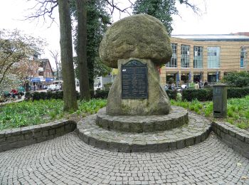
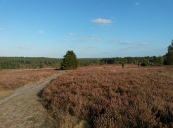
• Ausflugsziele, Freizeit und Übernachten in der Nordheide, dem nördlichen Teil der Lüneburger Heide, verkehrsgünstig i...
![Trail On foot Buchholz in der Nordheide - Wanderweg 1 Buchholz - Photo](https://media.geolcdn.com/t/350/260/dc717e4c-352c-4b82-a12f-f978b6868904.jpeg&format=jpg&maxdim=2)
![On foot On foot](https://static1.geolcdn.com/sitytour/trail-icons/100.png)
Km
On foot
![](/images/other/stat-length.png)
![](https://static1.geolcdn.com/siteimages/upload/files/1508320355ic_sort_den_pos_24dp.png)
![](https://static1.geolcdn.com/siteimages/upload/files/1508320355ic_sort_den_neg_24dp.png)
![](https://static1.geolcdn.com/siteimages/upload/files/16400158638029165_repeat_loop_refresh_sync_direction_icon.png)
• Trail created by Stadt Buchholz in der Nordheide. Symbol: weisse 1 in grünem Kreis auf weissem Grund
![Trail On foot Buchholz in der Nordheide - Buchholzer Rundwanderweg 3 - Photo](https://media.geolcdn.com/t/350/260/28e5ed77-e949-44e9-a047-fc9c80696c7c.jpeg&format=jpg&maxdim=2)
![On foot On foot](https://static1.geolcdn.com/sitytour/trail-icons/100.png)
Km
On foot
![](/images/other/stat-length.png)
![](https://static1.geolcdn.com/siteimages/upload/files/1508320355ic_sort_den_pos_24dp.png)
![](https://static1.geolcdn.com/siteimages/upload/files/1508320355ic_sort_den_neg_24dp.png)
![](https://static1.geolcdn.com/siteimages/upload/files/16400158638029165_repeat_loop_refresh_sync_direction_icon.png)
• Trail created by Stadt Buchholz in der Nordheide. Symbol: weisse 3 in grünem Kreis auf weissem Grund
![Trail On foot Buchholz in der Nordheide - Ho-Se Blauer Rundwanderweg - Photo](https://media.geolcdn.com/t/350/260/0b1df7cd-3876-47c5-a88e-a4686dce1f3f.jpeg&format=jpg&maxdim=2)
![On foot On foot](https://static1.geolcdn.com/sitytour/trail-icons/100.png)
Km
On foot
![](/images/other/stat-length.png)
![](https://static1.geolcdn.com/siteimages/upload/files/1508320355ic_sort_den_pos_24dp.png)
![](https://static1.geolcdn.com/siteimages/upload/files/1508320355ic_sort_den_neg_24dp.png)
![](https://static1.geolcdn.com/siteimages/upload/files/16400158638029165_repeat_loop_refresh_sync_direction_icon.png)
![Trail On foot Buchholz in der Nordheide - Ho-Se Grüner Rundwanderweg - Photo](https://media.geolcdn.com/t/350/260/ae5dea94-e574-463b-9942-e09ffae2ceb4.jpeg&format=jpg&maxdim=2)
![On foot On foot](https://static1.geolcdn.com/sitytour/trail-icons/100.png)
Km
On foot
![](/images/other/stat-length.png)
![](https://static1.geolcdn.com/siteimages/upload/files/1508320355ic_sort_den_pos_24dp.png)
![](https://static1.geolcdn.com/siteimages/upload/files/1508320355ic_sort_den_neg_24dp.png)
![](https://static1.geolcdn.com/siteimages/upload/files/16400158638029165_repeat_loop_refresh_sync_direction_icon.png)
![Trail On foot Buchholz in der Nordheide - Ho-Se Roter Rundwanderweg - Photo](https://media.geolcdn.com/t/350/260/276b6fcb-39d4-4545-a436-c142e45b3bc3.jpeg&format=jpg&maxdim=2)
![On foot On foot](https://static1.geolcdn.com/sitytour/trail-icons/100.png)
Km
On foot
![](/images/other/stat-length.png)
![](https://static1.geolcdn.com/siteimages/upload/files/1508320355ic_sort_den_pos_24dp.png)
![](https://static1.geolcdn.com/siteimages/upload/files/1508320355ic_sort_den_neg_24dp.png)
![](https://static1.geolcdn.com/siteimages/upload/files/16400158638029165_repeat_loop_refresh_sync_direction_icon.png)
![Trail On foot Buchholz in der Nordheide - Ho-Se Grauer Rundwanderweg - Photo](https://media.geolcdn.com/t/350/260/9f797c7f-f4f6-44f6-948a-d9eee7a342c9.jpeg&format=jpg&maxdim=2)
![On foot On foot](https://static1.geolcdn.com/sitytour/trail-icons/100.png)
Km
On foot
![](/images/other/stat-length.png)
![](https://static1.geolcdn.com/siteimages/upload/files/1508320355ic_sort_den_pos_24dp.png)
![](https://static1.geolcdn.com/siteimages/upload/files/1508320355ic_sort_den_neg_24dp.png)
![](https://static1.geolcdn.com/siteimages/upload/files/16400158638029165_repeat_loop_refresh_sync_direction_icon.png)
![Trail On foot Buchholz in der Nordheide - Ho-Se Gelber Rundwanderweg - Photo](https://media.geolcdn.com/t/350/260/0b1df7cd-3876-47c5-a88e-a4686dce1f3f.jpeg&format=jpg&maxdim=2)
![On foot On foot](https://static1.geolcdn.com/sitytour/trail-icons/100.png)
Km
On foot
![](/images/other/stat-length.png)
![](https://static1.geolcdn.com/siteimages/upload/files/1508320355ic_sort_den_pos_24dp.png)
![](https://static1.geolcdn.com/siteimages/upload/files/1508320355ic_sort_den_neg_24dp.png)
![](https://static1.geolcdn.com/siteimages/upload/files/16400158638029165_repeat_loop_refresh_sync_direction_icon.png)
8 trails displayed on 8
FREE GPS app for hiking