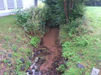
![](/images/other/stat-length.png)
- Trails
- On foot
- Germany
- Hesse
- Odenwaldkreis
- Breuberg
Breuberg, Odenwaldkreis, On foot: Best trails, routes and walks
Breuberg: Discover the best trails: 12 on foot. All these trails, routes and outdoor activities are available in our SityTrail applications for smartphones and tablets.
The best trails (12)
![Trail On foot Breuberg - Rundwanderweg Breuberg 2 : - Photo](https://media.geolcdn.com/t/350/260/e9133c84-384b-4ad2-b90e-9817ecd8547c.jpeg&format=jpg&maxdim=2)
![On foot On foot](https://static1.geolcdn.com/sitytour/trail-icons/100.png)
Km
On foot
![](/images/other/stat-length.png)
![](https://static1.geolcdn.com/siteimages/upload/files/1508320355ic_sort_den_pos_24dp.png)
![](https://static1.geolcdn.com/siteimages/upload/files/1508320355ic_sort_den_neg_24dp.png)
![](https://static1.geolcdn.com/siteimages/upload/files/16400158638029165_repeat_loop_refresh_sync_direction_icon.png)
• Trail created by Geo-Naturpark Bergstraße-Odenwald.
![Trail On foot Breuberg - Rundwanderweg Rai-Breitenbach 2 : Seestutzweg - Photo](https://media.geolcdn.com/t/350/260/5083fba5-a424-45ca-a625-5ac315542182.jpeg&format=jpg&maxdim=2)
![On foot On foot](https://static1.geolcdn.com/sitytour/trail-icons/100.png)
Km
On foot
![](/images/other/stat-length.png)
![](https://static1.geolcdn.com/siteimages/upload/files/1508320355ic_sort_den_pos_24dp.png)
![](https://static1.geolcdn.com/siteimages/upload/files/1508320355ic_sort_den_neg_24dp.png)
![](https://static1.geolcdn.com/siteimages/upload/files/16400158638029165_repeat_loop_refresh_sync_direction_icon.png)
• Trail created by Geo-Naturpark Bergstraße-Odenwald. Symbol: Weißer, oben offener Ring, darin "RB", in der Mitte eine...
![Trail On foot Breuberg - Rundwanderweg Rai-Breitenbach 1 : Pitschgrund-Weg - Photo](https://media.geolcdn.com/t/350/260/5083fba5-a424-45ca-a625-5ac315542182.jpeg&format=jpg&maxdim=2)
![On foot On foot](https://static1.geolcdn.com/sitytour/trail-icons/100.png)
Km
On foot
![](/images/other/stat-length.png)
![](https://static1.geolcdn.com/siteimages/upload/files/1508320355ic_sort_den_pos_24dp.png)
![](https://static1.geolcdn.com/siteimages/upload/files/1508320355ic_sort_den_neg_24dp.png)
![](https://static1.geolcdn.com/siteimages/upload/files/16400158638029165_repeat_loop_refresh_sync_direction_icon.png)
• Trail created by Geo-Naturpark Bergstraße-Odenwald. Symbol: Weißer, oben offener Ring, darin "RB", in der Mitte eine...
![Trail On foot Breuberg - Rundwanderweg Breuberg Pitschgrund 2: Obersberg-Weg - Photo](https://media.geolcdn.com/t/350/260/b70da194-0714-4cca-98ca-46eba2bce139.jpeg&format=jpg&maxdim=2)
![On foot On foot](https://static1.geolcdn.com/sitytour/trail-icons/100.png)
Km
On foot
![](/images/other/stat-length.png)
![](https://static1.geolcdn.com/siteimages/upload/files/1508320355ic_sort_den_pos_24dp.png)
![](https://static1.geolcdn.com/siteimages/upload/files/1508320355ic_sort_den_neg_24dp.png)
![](https://static1.geolcdn.com/siteimages/upload/files/16400158638029165_repeat_loop_refresh_sync_direction_icon.png)
• Trail created by Geo-Naturpark Bergstraße-Odenwald.
![Trail On foot Breuberg - Rundwanderweg Sparkasse-Odenwaldkreis 3 : Burg Breuberg-Weg - Photo](https://media.geolcdn.com/t/350/260/097197ec-58bd-4510-b627-d28e4588d115.jpeg&format=jpg&maxdim=2)
![On foot On foot](https://static1.geolcdn.com/sitytour/trail-icons/100.png)
Km
On foot
![](/images/other/stat-length.png)
![](https://static1.geolcdn.com/siteimages/upload/files/1508320355ic_sort_den_pos_24dp.png)
![](https://static1.geolcdn.com/siteimages/upload/files/1508320355ic_sort_den_neg_24dp.png)
![](https://static1.geolcdn.com/siteimages/upload/files/16400158638029165_repeat_loop_refresh_sync_direction_icon.png)
• Trail created by Sparkasse-Odenwaldkreis. Symbol: weiße 3 im oben offenen Kreis, darin ein 'S'
![Trail On foot Breuberg - Geo-Lehrpfad Obernburg : Eisenbacher Runde - Photo](https://media.geolcdn.com/t/350/260/071f53ff-0679-4196-9218-a0e5d5605d62.jpeg&format=jpg&maxdim=2)
![On foot On foot](https://static1.geolcdn.com/sitytour/trail-icons/100.png)
Km
On foot
![](/images/other/stat-length.png)
![](https://static1.geolcdn.com/siteimages/upload/files/1508320355ic_sort_den_pos_24dp.png)
![](https://static1.geolcdn.com/siteimages/upload/files/1508320355ic_sort_den_neg_24dp.png)
![](https://static1.geolcdn.com/siteimages/upload/files/16400158638029165_repeat_loop_refresh_sync_direction_icon.png)
• Trail created by Archäologisches Spessartprojekt. "Eisenbacher Runde" Symbol: Gelbes L im gelben Kreis
![Trail On foot Breuberg - Rundwanderweg Breuberg Burg Breuberg 3: Scheuerberg-Weg - Photo](https://media.geolcdn.com/t/350/260/097197ec-58bd-4510-b627-d28e4588d115.jpeg&format=jpg&maxdim=2)
![On foot On foot](https://static1.geolcdn.com/sitytour/trail-icons/100.png)
Km
On foot
![](/images/other/stat-length.png)
![](https://static1.geolcdn.com/siteimages/upload/files/1508320355ic_sort_den_pos_24dp.png)
![](https://static1.geolcdn.com/siteimages/upload/files/1508320355ic_sort_den_neg_24dp.png)
![](https://static1.geolcdn.com/siteimages/upload/files/16400158638029165_repeat_loop_refresh_sync_direction_icon.png)
• Trail created by Geo-Naturpark Bergstraße-Odenwald.
![Trail On foot Breuberg - Rundwanderweg Neustadt 2 : Dammberg-Weg - Photo](https://media.geolcdn.com/t/350/260/163dbb3d-3f72-46fb-b390-8143ee76f872.jpeg&format=jpg&maxdim=2)
![On foot On foot](https://static1.geolcdn.com/sitytour/trail-icons/100.png)
Km
On foot
![](/images/other/stat-length.png)
![](https://static1.geolcdn.com/siteimages/upload/files/1508320355ic_sort_den_pos_24dp.png)
![](https://static1.geolcdn.com/siteimages/upload/files/1508320355ic_sort_den_neg_24dp.png)
![](https://static1.geolcdn.com/siteimages/upload/files/16400158638029165_repeat_loop_refresh_sync_direction_icon.png)
• Trail created by Geo-Naturpark Bergstraße-Odenwald. Symbol: weiße 2 im oben offenen Kreis, darin ein 'N'
![Trail On foot Breuberg - Rundwanderweg Wald-Amorbach 1 : Goldloch-Weg - Photo](https://media.geolcdn.com/t/350/260/e9133c84-384b-4ad2-b90e-9817ecd8547c.jpeg&format=jpg&maxdim=2)
![On foot On foot](https://static1.geolcdn.com/sitytour/trail-icons/100.png)
Km
On foot
![](/images/other/stat-length.png)
![](https://static1.geolcdn.com/siteimages/upload/files/1508320355ic_sort_den_pos_24dp.png)
![](https://static1.geolcdn.com/siteimages/upload/files/1508320355ic_sort_den_neg_24dp.png)
![](https://static1.geolcdn.com/siteimages/upload/files/16400158638029165_repeat_loop_refresh_sync_direction_icon.png)
• Trail created by Geo-Naturpark Bergstraße-Odenwald. Symbol: Weißer, oben offener Ring, darin "WA", in der Mitte eine...
![Trail On foot Breuberg - Rundwanderweg Breuberg Pitschgrund 1: Pitschgrund-Weg - Photo](https://media.geolcdn.com/t/350/260/5083fba5-a424-45ca-a625-5ac315542182.jpeg&format=jpg&maxdim=2)
![On foot On foot](https://static1.geolcdn.com/sitytour/trail-icons/100.png)
Km
On foot
![](/images/other/stat-length.png)
![](https://static1.geolcdn.com/siteimages/upload/files/1508320355ic_sort_den_pos_24dp.png)
![](https://static1.geolcdn.com/siteimages/upload/files/1508320355ic_sort_den_neg_24dp.png)
![](https://static1.geolcdn.com/siteimages/upload/files/16400158638029165_repeat_loop_refresh_sync_direction_icon.png)
• Trail created by Geo-Naturpark Bergstraße-Odenwald.
![Trail On foot Breuberg - Rundwanderweg Breuberg Pitschgrund 3: Hardtwäldchen-Weg - Photo](https://media.geolcdn.com/t/350/260/5083fba5-a424-45ca-a625-5ac315542182.jpeg&format=jpg&maxdim=2)
![On foot On foot](https://static1.geolcdn.com/sitytour/trail-icons/100.png)
Km
On foot
![](/images/other/stat-length.png)
![](https://static1.geolcdn.com/siteimages/upload/files/1508320355ic_sort_den_pos_24dp.png)
![](https://static1.geolcdn.com/siteimages/upload/files/1508320355ic_sort_den_neg_24dp.png)
![](https://static1.geolcdn.com/siteimages/upload/files/16400158638029165_repeat_loop_refresh_sync_direction_icon.png)
• Trail created by Geo-Naturpark Bergstraße-Odenwald.
![Trail On foot Breuberg - Rundwanderweg Hainstadt 2 : Neustädter-Hof-Weg - Photo](https://media.geolcdn.com/t/350/260/935cdb89-c278-4ae0-9ebe-fa75b017dcc7.jpeg&format=jpg&maxdim=2)
![On foot On foot](https://static1.geolcdn.com/sitytour/trail-icons/100.png)
Km
On foot
![](/images/other/stat-length.png)
![](https://static1.geolcdn.com/siteimages/upload/files/1508320355ic_sort_den_pos_24dp.png)
![](https://static1.geolcdn.com/siteimages/upload/files/1508320355ic_sort_den_neg_24dp.png)
![](https://static1.geolcdn.com/siteimages/upload/files/16400158638029165_repeat_loop_refresh_sync_direction_icon.png)
• Trail created by Geo-Naturpark Bergstraße-Odenwald. Symbol: Weißer, oben offener Ring, darin "Ha", in der Mitte eine...
12 trails displayed on 12
FREE GPS app for hiking