![](/images/other/stat-length.png)
- Trails
- On foot
- Germany
- Hesse
- Odenwaldkreis
- Reichelsheim (Odenwald)
Reichelsheim (Odenwald), Odenwaldkreis, On foot: Best trails, routes and walks
Reichelsheim (Odenwald): Discover the best trails: 35 on foot. All these trails, routes and outdoor activities are available in our SityTrail applications for smartphones and tablets.
The best trails (35)
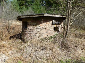
![Trail On foot Reichelsheim (Odenwald) - Geo-Lehrpfad Ober-Kainsbach : Baustein, Erz und schwerer Spat (orange) - Photo](https://media.geolcdn.com/t/350/260/494567a9-965d-45a9-a6be-97c4d96bfdba.jpeg&format=jpg&maxdim=2)
![On foot On foot](https://static1.geolcdn.com/sitytour/trail-icons/100.png)
Km
On foot
![](/images/other/stat-length.png)
![](https://static1.geolcdn.com/siteimages/upload/files/1508320355ic_sort_den_pos_24dp.png)
![](https://static1.geolcdn.com/siteimages/upload/files/1508320355ic_sort_den_neg_24dp.png)
![](https://static1.geolcdn.com/siteimages/upload/files/16400158638029165_repeat_loop_refresh_sync_direction_icon.png)
• Trail created by Geo-Naturpark Bergstraße-Odenwald.
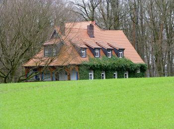
![Trail On foot Reichelsheim (Odenwald) - Rundwanderweg Vierstöck 6: Knösberg-Weg - Photo](https://media.geolcdn.com/t/350/260/83832b04-129c-42f4-8f47-3dfb605b5b7f.jpeg&format=jpg&maxdim=2)
![On foot On foot](https://static1.geolcdn.com/sitytour/trail-icons/100.png)
Km
On foot
![](/images/other/stat-length.png)
![](https://static1.geolcdn.com/siteimages/upload/files/1508320355ic_sort_den_pos_24dp.png)
![](https://static1.geolcdn.com/siteimages/upload/files/1508320355ic_sort_den_neg_24dp.png)
![](https://static1.geolcdn.com/siteimages/upload/files/16400158638029165_repeat_loop_refresh_sync_direction_icon.png)
• Trail created by Geo-Naturpark Bergstraße-Odenwald. Symbol: gelbe 6 im gelben Kreis
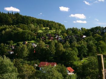
![Trail On foot Reichelsheim (Odenwald) - Geo-Lehrpfad Ober-Kainsbach : Baustein, Erz und schwerer Spat (rot) - Photo](https://media.geolcdn.com/t/350/260/65cd9644-8fb8-496d-a306-d161297ce940.jpeg&format=jpg&maxdim=2)
![On foot On foot](https://static1.geolcdn.com/sitytour/trail-icons/100.png)
Km
On foot
![](/images/other/stat-length.png)
![](https://static1.geolcdn.com/siteimages/upload/files/1508320355ic_sort_den_pos_24dp.png)
![](https://static1.geolcdn.com/siteimages/upload/files/1508320355ic_sort_den_neg_24dp.png)
![](https://static1.geolcdn.com/siteimages/upload/files/16400158638029165_repeat_loop_refresh_sync_direction_icon.png)
• Trail created by Geo-Naturpark Bergstraße-Odenwald.
![Trail On foot Reichelsheim (Odenwald) - Rundwanderweg Reichelsheim Totenkirche 4: Panorama-Weg - Photo](https://media.geolcdn.com/t/350/260/4a29ddc6-2412-4546-b755-b9a2bdce046f.jpeg&format=jpg&maxdim=2)
![On foot On foot](https://static1.geolcdn.com/sitytour/trail-icons/100.png)
Km
On foot
![](/images/other/stat-length.png)
![](https://static1.geolcdn.com/siteimages/upload/files/1508320355ic_sort_den_pos_24dp.png)
![](https://static1.geolcdn.com/siteimages/upload/files/1508320355ic_sort_den_neg_24dp.png)
![](https://static1.geolcdn.com/siteimages/upload/files/16400158638029165_repeat_loop_refresh_sync_direction_icon.png)
• Trail created by Geo-Naturpark Bergstraße-Odenwald. Symbol: gelbe 4 im gelben Kreis
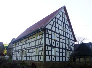
![Trail On foot Reichelsheim (Odenwald) - Rundwanderweg Reichelsheim Gebranntes Brünnchen 2: Roter-Kandel-Weg - Photo](https://media.geolcdn.com/t/350/260/19ba2bac-9d35-4071-8f44-6d11ed922ae9.jpeg&format=jpg&maxdim=2)
![On foot On foot](https://static1.geolcdn.com/sitytour/trail-icons/100.png)
Km
On foot
![](/images/other/stat-length.png)
![](https://static1.geolcdn.com/siteimages/upload/files/1508320355ic_sort_den_pos_24dp.png)
![](https://static1.geolcdn.com/siteimages/upload/files/1508320355ic_sort_den_neg_24dp.png)
![](https://static1.geolcdn.com/siteimages/upload/files/16400158638029165_repeat_loop_refresh_sync_direction_icon.png)
• Trail created by Geo-Naturpark Bergstraße-Odenwald. Symbol: Gelbe 2 im gelben Kreis
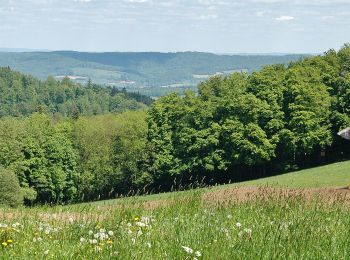
![Trail On foot Reichelsheim (Odenwald) - Rundwanderweg Reichelsheim Freiheit 5: Germannshöhen-Weg - Photo](https://media.geolcdn.com/t/350/260/fbf8de2d-6e65-4f6a-8454-3eb1f4b08c49.jpeg&format=jpg&maxdim=2)
![On foot On foot](https://static1.geolcdn.com/sitytour/trail-icons/100.png)
Km
On foot
![](/images/other/stat-length.png)
![](https://static1.geolcdn.com/siteimages/upload/files/1508320355ic_sort_den_pos_24dp.png)
![](https://static1.geolcdn.com/siteimages/upload/files/1508320355ic_sort_den_neg_24dp.png)
![](https://static1.geolcdn.com/siteimages/upload/files/16400158638029165_repeat_loop_refresh_sync_direction_icon.png)
• Trail created by Geo-Naturpark Bergstraße-Odenwald. Symbol: Gelbe 5 im gelben Kreis
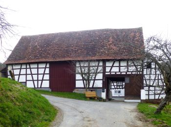
![Trail On foot Reichelsheim (Odenwald) - Rundwanderweg Reichelsheim 1: Sagenweg Wildweibchenstein - Photo](https://media.geolcdn.com/t/350/260/91045a8f-f72a-4ffd-b179-1e5e0e95bc15.jpeg&format=jpg&maxdim=2)
![On foot On foot](https://static1.geolcdn.com/sitytour/trail-icons/100.png)
Km
On foot
![](/images/other/stat-length.png)
![](https://static1.geolcdn.com/siteimages/upload/files/1508320355ic_sort_den_pos_24dp.png)
![](https://static1.geolcdn.com/siteimages/upload/files/1508320355ic_sort_den_neg_24dp.png)
![](https://static1.geolcdn.com/siteimages/upload/files/16400158638029165_repeat_loop_refresh_sync_direction_icon.png)
• Trail created by Odenwaldklub. Symbol: grünes Kreissegment, oben offen. In der Öffnung R, in der Mitte eine 1
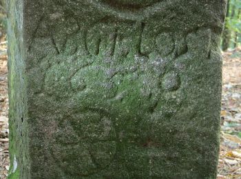
![Trail On foot Reichelsheim (Odenwald) - Rundwanderweg Gumpen 3 - Photo](https://media.geolcdn.com/t/350/260/d5f3931e-1f96-4fb5-a50b-0dd3a5bcb740.jpeg&format=jpg&maxdim=2)
![On foot On foot](https://static1.geolcdn.com/sitytour/trail-icons/100.png)
Km
On foot
![](/images/other/stat-length.png)
![](https://static1.geolcdn.com/siteimages/upload/files/1508320355ic_sort_den_pos_24dp.png)
![](https://static1.geolcdn.com/siteimages/upload/files/1508320355ic_sort_den_neg_24dp.png)
![](https://static1.geolcdn.com/siteimages/upload/files/16400158638029165_repeat_loop_refresh_sync_direction_icon.png)
• Symbol: 3 in einem oben offenen Kreis; in der Kreisöffnung ein Gu
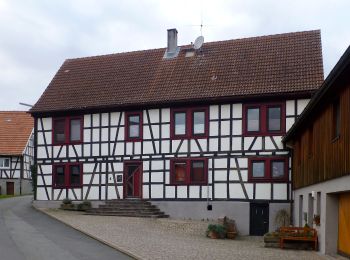
![Trail On foot Reichelsheim (Odenwald) - Rundwanderweg Gumpen 2 - Photo](https://media.geolcdn.com/t/350/260/202e58b5-5d49-4954-a136-6e4f9511408f.jpeg&format=jpg&maxdim=2)
![On foot On foot](https://static1.geolcdn.com/sitytour/trail-icons/100.png)
Km
On foot
![](/images/other/stat-length.png)
![](https://static1.geolcdn.com/siteimages/upload/files/1508320355ic_sort_den_pos_24dp.png)
![](https://static1.geolcdn.com/siteimages/upload/files/1508320355ic_sort_den_neg_24dp.png)
![](https://static1.geolcdn.com/siteimages/upload/files/16400158638029165_repeat_loop_refresh_sync_direction_icon.png)
• Symbol: 2 in einem oben offenen Kreis; in der Kreisöffnung ein Gu
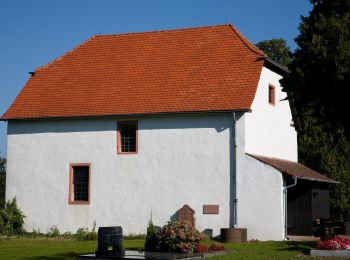
![Trail On foot Reichelsheim (Odenwald) - Rundwanderweg Reichelsheim Teufelstein 3: Klößbuckelweg - Photo](https://media.geolcdn.com/t/350/260/a4d0cff8-5f4b-401f-be1c-8dba234c9248.jpeg&format=jpg&maxdim=2)
![On foot On foot](https://static1.geolcdn.com/sitytour/trail-icons/100.png)
Km
On foot
![](/images/other/stat-length.png)
![](https://static1.geolcdn.com/siteimages/upload/files/1508320355ic_sort_den_pos_24dp.png)
![](https://static1.geolcdn.com/siteimages/upload/files/1508320355ic_sort_den_neg_24dp.png)
![](https://static1.geolcdn.com/siteimages/upload/files/16400158638029165_repeat_loop_refresh_sync_direction_icon.png)
• Trail created by Geo-Naturpark Bergstraße-Odenwald.
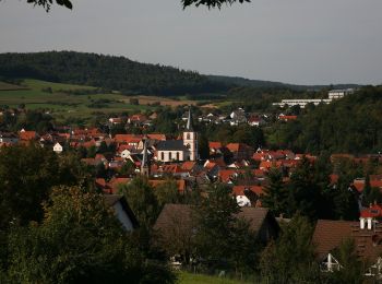
![Trail On foot Reichelsheim (Odenwald) - Rundwanderweg Reichelsheim Teufelstein 2: Panoramaweg - Photo](https://media.geolcdn.com/t/350/260/ab94b6c3-31a6-47ad-90f7-7a36139c56de.jpeg&format=jpg&maxdim=2)
![On foot On foot](https://static1.geolcdn.com/sitytour/trail-icons/100.png)
Km
On foot
![](/images/other/stat-length.png)
![](https://static1.geolcdn.com/siteimages/upload/files/1508320355ic_sort_den_pos_24dp.png)
![](https://static1.geolcdn.com/siteimages/upload/files/1508320355ic_sort_den_neg_24dp.png)
![](https://static1.geolcdn.com/siteimages/upload/files/16400158638029165_repeat_loop_refresh_sync_direction_icon.png)
• Trail created by Geo-Naturpark Bergstraße-Odenwald.
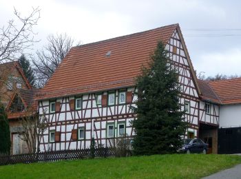
![Trail On foot Reichelsheim (Odenwald) - Rundwanderweg Laudenau 1 - Photo](https://media.geolcdn.com/t/350/260/0f6712c0-e975-48e3-a848-88c120158b68.jpeg&format=jpg&maxdim=2)
![On foot On foot](https://static1.geolcdn.com/sitytour/trail-icons/100.png)
Km
On foot
![](/images/other/stat-length.png)
![](https://static1.geolcdn.com/siteimages/upload/files/1508320355ic_sort_den_pos_24dp.png)
![](https://static1.geolcdn.com/siteimages/upload/files/1508320355ic_sort_den_neg_24dp.png)
![](https://static1.geolcdn.com/siteimages/upload/files/16400158638029165_repeat_loop_refresh_sync_direction_icon.png)
• Trail created by Geo-Naturpark Bergstraße-Odenwald. Symbol: Weißer, oben offener Kreis, in Öffnung "L", in der Mitte...
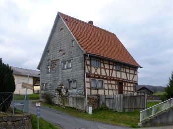
![Trail On foot Reichelsheim (Odenwald) - Rundwanderweg Reichelsheim 5 - Photo](https://media.geolcdn.com/t/350/260/cdb9dba3-db0c-413b-87eb-3c464aa7014a.jpeg&format=jpg&maxdim=2)
![On foot On foot](https://static1.geolcdn.com/sitytour/trail-icons/100.png)
Km
On foot
![](/images/other/stat-length.png)
![](https://static1.geolcdn.com/siteimages/upload/files/1508320355ic_sort_den_pos_24dp.png)
![](https://static1.geolcdn.com/siteimages/upload/files/1508320355ic_sort_den_neg_24dp.png)
![](https://static1.geolcdn.com/siteimages/upload/files/16400158638029165_repeat_loop_refresh_sync_direction_icon.png)
• Trail created by Geo-Naturpark Bergstraße-Odenwald. Symbol: Weißer, oben offener Kreis, in Öffnung "R", in der Mitte...
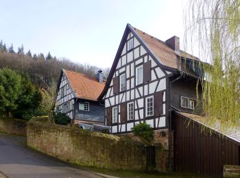
![Trail On foot Reichelsheim (Odenwald) - Rundwanderweg Reichelsheim 8: Panoramaweg zwischen Erz und Stein - Photo](https://media.geolcdn.com/t/350/260/02a9774e-fb62-4633-a70b-ec1966b16267.jpeg&format=jpg&maxdim=2)
![On foot On foot](https://static1.geolcdn.com/sitytour/trail-icons/100.png)
Km
On foot
![](/images/other/stat-length.png)
![](https://static1.geolcdn.com/siteimages/upload/files/1508320355ic_sort_den_pos_24dp.png)
![](https://static1.geolcdn.com/siteimages/upload/files/1508320355ic_sort_den_neg_24dp.png)
![](https://static1.geolcdn.com/siteimages/upload/files/16400158638029165_repeat_loop_refresh_sync_direction_icon.png)
• Trail created by Odenwaldklub. Symbol: green 8 in a green circle green R in a break at the top of the circle
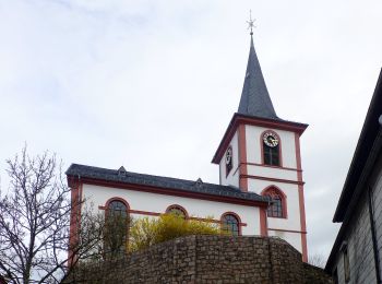
![Trail On foot Reichelsheim (Odenwald) - Rundwanderweg Reichelsheim 3 - Photo](https://media.geolcdn.com/t/350/260/c89c267f-9859-4349-8d72-3fdecb22c034.jpeg&format=jpg&maxdim=2)
![On foot On foot](https://static1.geolcdn.com/sitytour/trail-icons/100.png)
Km
On foot
![](/images/other/stat-length.png)
![](https://static1.geolcdn.com/siteimages/upload/files/1508320355ic_sort_den_pos_24dp.png)
![](https://static1.geolcdn.com/siteimages/upload/files/1508320355ic_sort_den_neg_24dp.png)
![](https://static1.geolcdn.com/siteimages/upload/files/16400158638029165_repeat_loop_refresh_sync_direction_icon.png)
• Trail created by Odenwaldklub. Symbol: weißes Kreissegment, oben offen. In der Öffnung R, in der Mitte eine 3
![Trail On foot Reichelsheim (Odenwald) - Rundwanderweg Reichelsheim Rohrbach 6: Roter Kandelweg - Photo](https://media.geolcdn.com/t/350/260/02a9774e-fb62-4633-a70b-ec1966b16267.jpeg&format=jpg&maxdim=2)
![On foot On foot](https://static1.geolcdn.com/sitytour/trail-icons/100.png)
Km
On foot
![](/images/other/stat-length.png)
![](https://static1.geolcdn.com/siteimages/upload/files/1508320355ic_sort_den_pos_24dp.png)
![](https://static1.geolcdn.com/siteimages/upload/files/1508320355ic_sort_den_neg_24dp.png)
![](https://static1.geolcdn.com/siteimages/upload/files/16400158638029165_repeat_loop_refresh_sync_direction_icon.png)
• Trail created by Odenwaldklub. Symbol: gelbe 6 im gelben Kreis
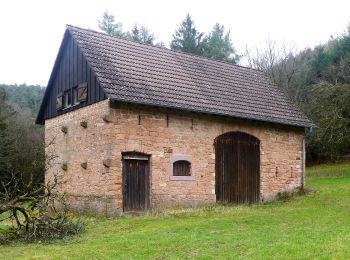
![Trail On foot Reichelsheim (Odenwald) - Rundwanderweg Bockenrod 3 - Photo](https://media.geolcdn.com/t/350/260/a876ddd2-9173-4230-a975-a6e1c802a0c9.jpeg&format=jpg&maxdim=2)
![On foot On foot](https://static1.geolcdn.com/sitytour/trail-icons/100.png)
Km
On foot
![](/images/other/stat-length.png)
![](https://static1.geolcdn.com/siteimages/upload/files/1508320355ic_sort_den_pos_24dp.png)
![](https://static1.geolcdn.com/siteimages/upload/files/1508320355ic_sort_den_neg_24dp.png)
![](https://static1.geolcdn.com/siteimages/upload/files/16400158638029165_repeat_loop_refresh_sync_direction_icon.png)
• Trail created by Geo-Naturpark Bergstraße-Odenwald. Symbol: Weißer, oben offener Kreis, in Öffnung "BO", in der Mitt...
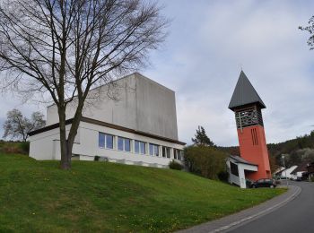
![Trail On foot Reichelsheim (Odenwald) - Rundwanderweg Bockenrod 1 - Photo](https://media.geolcdn.com/t/350/260/6d602410-a33f-41c5-9ba5-616471bd1972.jpeg&format=jpg&maxdim=2)
![On foot On foot](https://static1.geolcdn.com/sitytour/trail-icons/100.png)
Km
On foot
![](/images/other/stat-length.png)
![](https://static1.geolcdn.com/siteimages/upload/files/1508320355ic_sort_den_pos_24dp.png)
![](https://static1.geolcdn.com/siteimages/upload/files/1508320355ic_sort_den_neg_24dp.png)
![](https://static1.geolcdn.com/siteimages/upload/files/16400158638029165_repeat_loop_refresh_sync_direction_icon.png)
• Trail created by Geo-Naturpark Bergstraße-Odenwald. Symbol: Weißer, oben offener Kreis, in Öffnung "BO", in der Mitt...
![Trail On foot Reichelsheim (Odenwald) - Rundwanderweg Ober-Kainsbach 2: Eichberg-Weg - Photo](https://media.geolcdn.com/t/350/260/65cd9644-8fb8-496d-a306-d161297ce940.jpeg&format=jpg&maxdim=2)
![On foot On foot](https://static1.geolcdn.com/sitytour/trail-icons/100.png)
Km
On foot
![](/images/other/stat-length.png)
![](https://static1.geolcdn.com/siteimages/upload/files/1508320355ic_sort_den_pos_24dp.png)
![](https://static1.geolcdn.com/siteimages/upload/files/1508320355ic_sort_den_neg_24dp.png)
![](https://static1.geolcdn.com/siteimages/upload/files/16400158638029165_repeat_loop_refresh_sync_direction_icon.png)
• Trail created by Odenwaldklub. Symbol: weißes Kreissegment, oben offen. In der Öffnung OK, in der Mitte eine 2
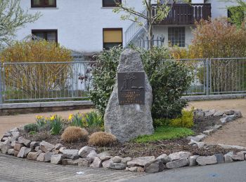
![Trail On foot Reichelsheim (Odenwald) - Rundwanderweg G 1: Schnellerts-Weg - Photo](https://media.geolcdn.com/t/350/260/8e3a0a32-1c22-408f-84a2-fdcaa6b682e8.jpeg&format=jpg&maxdim=2)
![On foot On foot](https://static1.geolcdn.com/sitytour/trail-icons/100.png)
Km
On foot
![](/images/other/stat-length.png)
![](https://static1.geolcdn.com/siteimages/upload/files/1508320355ic_sort_den_pos_24dp.png)
![](https://static1.geolcdn.com/siteimages/upload/files/1508320355ic_sort_den_neg_24dp.png)
![](https://static1.geolcdn.com/siteimages/upload/files/16400158638029165_repeat_loop_refresh_sync_direction_icon.png)
• Trail created by Odenwaldklub. Symbol: weißes Kreissegment, oben offen. In der Öffnung G, in der Mitte eine 1
20 trails displayed on 35
FREE GPS app for hiking