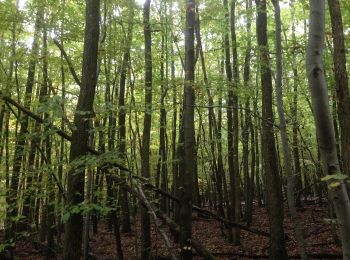
Bad König, Odenwaldkreis, On foot: Best trails, routes and walks

Bad König: Discover the best trails: 24 on foot. All these trails, routes and outdoor activities are available in our SityTrail applications for smartphones and tablets.


The best trails (24)
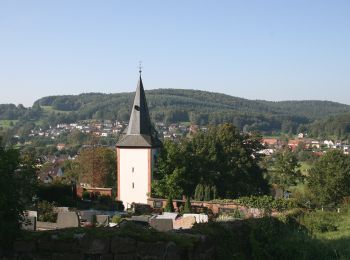
Trail On foot Bad König - Rundwanderweg Höchst 1 : H1 - Photo
On foot 9.257
Km
GUIDE+

On foot

Easy
Bad König, Hesse, Odenwaldkreis, Germany
9.3 km | 12.3 km-effort
2h 47min
198 m
308 m
No
SityTrail - itinéraires balisés pédestres

• Trail created by Geo-Naturpark Bergstraße-Odenwald.
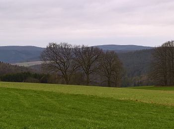
Trail On foot Bad König - Rundwanderweg S1 : Fürstengrund-Runde - Photo
On foot 11.328
Km
GUIDE+

On foot

Easy
Bad König, Hesse, Odenwaldkreis, Germany
11.3 km | 14.9 km-effort
3h 23min
270 m
267 m
Yes
SityTrail - itinéraires balisés pédestres

• Trail created by Odenwaldklub. Symbol: Grüne 1 in einem oben offenen, grünen Kreis, darüber grünes S

Trail On foot Bad König - Rundwanderweg Bad-König 2: Carl-Weyprecht-Wanderweg - Photo
On foot 10.518
Km
GUIDE+

On foot

Easy
Bad König, Hesse, Odenwaldkreis, Germany
10.5 km | 14 km-effort
3h 10min
261 m
260 m
Yes
SityTrail - itinéraires balisés pédestres

• Trail created by Geo-Naturpark Bergstraße-Odenwald.
Trail On foot Bad König - Rundwanderweg Zell 3: Panoramaweg - Photo
On foot 3.915
Km
GUIDE+

On foot

Easy
Bad König, Hesse, Odenwaldkreis, Germany
3.9 km | 6.1 km-effort
1h 22min
162 m
162 m
Yes
SityTrail - itinéraires balisés pédestres

• Trail created by Geo-Naturpark Bergstraße-Odenwald. Symbol: Weiße 3 darüber Z
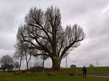
Trail On foot Bad König - Rundwanderweg Bad König Momarter Eiche 3: Alter Momart-Weg - Photo
On foot 7.88
Km
GUIDE+

On foot

Easy
Bad König, Hesse, Odenwaldkreis, Germany
7.9 km | 9.8 km-effort
2h 13min
143 m
144 m
Yes
SityTrail - itinéraires balisés pédestres

• Trail created by Geo-Naturpark Bergstraße-Odenwald. Symbol: Gelbe 3 in gelbem Kreis

Trail On foot Bad König - Rundwanderweg Bad König Momarter Eiche 1: Linnich-Weg - Photo
On foot 3.305
Km
GUIDE+

On foot

Easy
Bad König, Hesse, Odenwaldkreis, Germany
3.3 km | 4.2 km-effort
56min
66 m
63 m
Yes
SityTrail - itinéraires balisés pédestres

• Trail created by Geo-Naturpark Bergstraße-Odenwald. Symbol: yellow 1 in yellow circle

Trail On foot Bad König - Rundwanderweg Bad König 8 : Kinzigtal-Weg - Photo
On foot 6.174
Km
GUIDE+

On foot

Easy
Bad König, Hesse, Odenwaldkreis, Germany
6.2 km | 9.3 km-effort
2h 7min
234 m
240 m
No
SityTrail - itinéraires balisés pédestres

• Trail created by Geo-Naturpark Bergstraße-Odenwald. Symbol: white 8 in a white circle with BK in a break at the top ...

Trail On foot Bad König - Rundwanderweg Bad König 5: Weyprecht-Tempel-Weg - Photo
On foot 4.451
Km
GUIDE+

On foot

Easy
Bad König, Hesse, Odenwaldkreis, Germany
4.5 km | 6.7 km-effort
1h 31min
167 m
166 m
Yes
SityTrail - itinéraires balisés pédestres

• Trail created by Geo-Naturpark Bergstraße-Odenwald. Symbol: white 5 in a white circle with BK in a break at the top ...

Trail On foot Bad König - Rundwanderweg Bad König 4: Weyprecht-Tempel-Weg - Photo
On foot 3.415
Km
GUIDE+

On foot

Easy
Bad König, Hesse, Odenwaldkreis, Germany
3.4 km | 4.8 km-effort
1h 5min
100 m
106 m
Yes
SityTrail - itinéraires balisés pédestres

• Trail created by Geo-Naturpark Bergstraße-Odenwald. Symbol: white 4 in a white circle with BK in a break at the top ...

Trail On foot Bad König - Rundwanderweg Bad König 6: Momart-Weg - Photo
On foot 6.589
Km
GUIDE+

On foot

Easy
Bad König, Hesse, Odenwaldkreis, Germany
6.6 km | 9.8 km-effort
2h 13min
241 m
243 m
Yes
SityTrail - itinéraires balisés pédestres

• Trail created by Geo-Naturpark Bergstraße-Odenwald. Symbol: white 6 in a white circle with BK in a break at the top ...
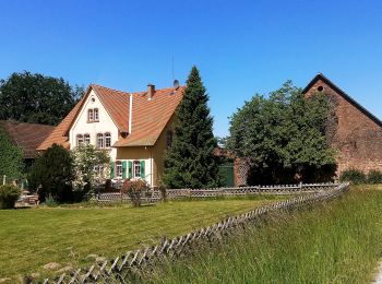
Trail On foot Bad König - Rundwanderweg Zell 1 : Heuberger-Hof-Weg - Photo
On foot 6.94
Km
GUIDE+

On foot

Easy
Bad König, Hesse, Odenwaldkreis, Germany
6.9 km | 9.9 km-effort
2h 14min
221 m
213 m
Yes
SityTrail - itinéraires balisés pédestres

• Trail created by Geo-Naturpark Bergstraße-Odenwald. Symbol: Weiße 1 in einem oben offenen Kreis, darüber weißes Z

Trail On foot Bad König - Nordic-Walking Bad König Tour 8 : Von Zell ins Brombachtal - Photo
On foot 6.343
Km
GUIDE+

On foot

Easy
Bad König, Hesse, Odenwaldkreis, Germany
6.3 km | 8.7 km-effort
1h 59min
183 m
167 m
No
SityTrail - itinéraires balisés pédestres

Trail On foot Bad König - Nordic Walking Bad König Tour 9 : Von Zell zur Russeneiche - Photo
On foot 7.122
Km
GUIDE+

On foot

Easy
Bad König, Hesse, Odenwaldkreis, Germany
7.1 km | 9.8 km-effort
2h 14min
215 m
173 m
No
SityTrail - itinéraires balisés pédestres

Trail On foot Bad König - Nordic Walking Bad König Tour 2 : Vom Kurpark um den Eichels - Photo
On foot 7.164
Km
GUIDE+

On foot

Easy
Bad König, Hesse, Odenwaldkreis, Germany
7.2 km | 9.6 km-effort
2h 11min
183 m
185 m
No
SityTrail - itinéraires balisés pédestres

Trail On foot Bad König - Nordic Walking Bad König Tour 1 : Zwischen Kurpark und Mümlingtal - Photo
On foot 4.693
Km
GUIDE+

On foot

Easy
Bad König, Hesse, Odenwaldkreis, Germany
4.7 km | 5.4 km-effort
1h 13min
50 m
55 m
No
SityTrail - itinéraires balisés pédestres

Trail On foot Bad König - Rundwanderweg Bad König Erlenbrunnen 2: Eckertsberg-Weg - Photo
On foot 4.73
Km
GUIDE+

On foot

Easy
Bad König, Hesse, Odenwaldkreis, Germany
4.7 km | 6.6 km-effort
1h 30min
142 m
142 m
Yes
SityTrail - itinéraires balisés pédestres

• Trail created by Geo-Naturpark Bergstraße-Odenwald. Symbol: Gelbe 2 in gelbem Kreis
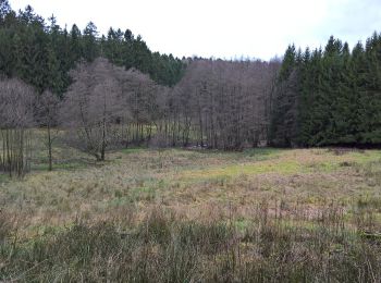
Trail On foot Bad König - Rundwanderweg Bad König Momarter Eiche 5: Momarter-Eiche-Weg - Photo
On foot 6.122
Km
GUIDE+

On foot

Easy
Bad König, Hesse, Odenwaldkreis, Germany
6.1 km | 8.3 km-effort
1h 52min
162 m
162 m
Yes
SityTrail - itinéraires balisés pédestres

• Trail created by Geo-Naturpark Bergstraße-Odenwald. Symbol: Gelbe 5 in gelbem Kreis

Trail On foot Bad König - Rundwanderweg Weiten-Gesäß 3 - Heuselsmühle-Weg - Photo
On foot 7.263
Km
GUIDE+

On foot

Easy
Bad König, Hesse, Odenwaldkreis, Germany
7.3 km | 10.2 km-effort
2h 19min
224 m
215 m
Yes
SityTrail - itinéraires balisés pédestres

• Trail created by Geo-Naturpark Bergstraße-Odenwald. Symbol: Weiße 3 in einem oben offenen Kreis, darüber weißes WG

Trail On foot Bad König - Rundwanderweg Bad König Saubusch 8: Grohberg-Weg - Photo
On foot 3.689
Km
GUIDE+

On foot

Easy
Bad König, Hesse, Odenwaldkreis, Germany
3.7 km | 4.6 km-effort
1h 2min
68 m
73 m
Yes
SityTrail - itinéraires balisés pédestres

• Trail created by Geo-Naturpark Bergstraße-Odenwald. Symbol: Gelbe 8 im Kreis

Trail On foot Bad König - Rundwanderweg Bad König Erlenbrunnen 4 :Naturlehrpfad - Photo
On foot 3.229
Km
GUIDE+

On foot

Easy
Bad König, Hesse, Odenwaldkreis, Germany
3.2 km | 4 km-effort
55min
62 m
60 m
Yes
SityTrail - itinéraires balisés pédestres

• Trail created by Geo-Naturpark Bergstraße-Odenwald. Symbol: Gelbe 4 in gelbem Kreis

20 trails displayed on 24

FREE GPS app for hiking

Logo SityTrail SityTrail

IGN / Geographical institutes

Download SityTrail from the App Store Download SityTrail from Google Play

Logo SityTrail SityTrail World

The world is yours!

Download SityTrail from the App Store Download SityTrail from Google Play Download SityTrail on Huawei AppGallery

Activities

Nearby regions

Close
My subscriptions