![](/images/other/stat-length.png)
Thuringia, Germany, On foot: Best trails, routes and walks
Thuringia: Discover the best trails: 416 on foot. All these trails, routes and outdoor activities are available in our SityTrail applications for smartphones and tablets.
The best trails (416)
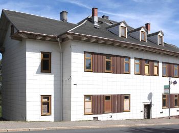
![Trail On foot Oberhof - Rundweg Oberhof - Photo](https://media.geolcdn.com/t/350/260/0897e82c-e273-46ab-8b48-9a1ec9d46659.jpeg&format=jpg&maxdim=2)
![On foot On foot](https://static1.geolcdn.com/sitytour/trail-icons/100.png)
Km
On foot
![](/images/other/stat-length.png)
![](https://static1.geolcdn.com/siteimages/upload/files/1508320355ic_sort_den_pos_24dp.png)
![](https://static1.geolcdn.com/siteimages/upload/files/1508320355ic_sort_den_neg_24dp.png)
![](https://static1.geolcdn.com/siteimages/upload/files/16400158638029165_repeat_loop_refresh_sync_direction_icon.png)
• Trail created by Oberhofer Freizeit und Tourismus GmbH. Symbol: wandernder Schneemann - Schneemann "Flocke" mit Wand...
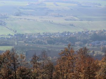
![Trail On foot Harztor - Südharzer Dampflok Steig - Photo](https://media.geolcdn.com/t/350/260/dce4f10a-9c8a-4fe3-837e-9feb42178b0d.jpeg&format=jpg&maxdim=2)
![On foot On foot](https://static1.geolcdn.com/sitytour/trail-icons/100.png)
Km
On foot
![](/images/other/stat-length.png)
![](https://static1.geolcdn.com/siteimages/upload/files/1508320355ic_sort_den_pos_24dp.png)
![](https://static1.geolcdn.com/siteimages/upload/files/1508320355ic_sort_den_neg_24dp.png)
![](https://static1.geolcdn.com/siteimages/upload/files/16400158638029165_repeat_loop_refresh_sync_direction_icon.png)
• Trail created by Tourismusverband Südharz Kyffhäuser. Symbol: rote Dampflock auf weißem Grund mit rotem Ramen Webs...
![Trail On foot Schleiz - RWW Saale - Wisenta - Plothengrund - Photo](https://media.geolcdn.com/t/350/260/fee78120-c846-4128-9f82-b7db71c0e999.jpeg&format=jpg&maxdim=2)
![On foot On foot](https://static1.geolcdn.com/sitytour/trail-icons/100.png)
Km
On foot
![](/images/other/stat-length.png)
![](https://static1.geolcdn.com/siteimages/upload/files/1508320355ic_sort_den_pos_24dp.png)
![](https://static1.geolcdn.com/siteimages/upload/files/1508320355ic_sort_den_neg_24dp.png)
![](https://static1.geolcdn.com/siteimages/upload/files/16400158638029165_repeat_loop_refresh_sync_direction_icon.png)
• Symbol: rotes Quadrat auf weißem Spiegel
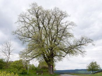
![Trail On foot Rudolstadt - Rundwanderweg 5 - Photo](https://media.geolcdn.com/t/350/260/639184e6-4bf6-47e6-bdb9-3e22f18a4486.jpeg&format=jpg&maxdim=2)
![On foot On foot](https://static1.geolcdn.com/sitytour/trail-icons/100.png)
Km
On foot
![](/images/other/stat-length.png)
![](https://static1.geolcdn.com/siteimages/upload/files/1508320355ic_sort_den_pos_24dp.png)
![](https://static1.geolcdn.com/siteimages/upload/files/1508320355ic_sort_den_neg_24dp.png)
![](https://static1.geolcdn.com/siteimages/upload/files/16400158638029165_repeat_loop_refresh_sync_direction_icon.png)
• Symbol: Schwarze 5 auf gelben Untergrund
![Trail On foot Rudolstadt - Rundwanderweg 4 - Photo](https://media.geolcdn.com/t/350/260/639184e6-4bf6-47e6-bdb9-3e22f18a4486.jpeg&format=jpg&maxdim=2)
![On foot On foot](https://static1.geolcdn.com/sitytour/trail-icons/100.png)
Km
On foot
![](/images/other/stat-length.png)
![](https://static1.geolcdn.com/siteimages/upload/files/1508320355ic_sort_den_pos_24dp.png)
![](https://static1.geolcdn.com/siteimages/upload/files/1508320355ic_sort_den_neg_24dp.png)
![](https://static1.geolcdn.com/siteimages/upload/files/16400158638029165_repeat_loop_refresh_sync_direction_icon.png)
• Symbol: Schwarze 4 auf gelben Untergrund
![Trail On foot Rudolstadt - Rundwanderweg 3 - Photo](https://media.geolcdn.com/t/350/260/639184e6-4bf6-47e6-bdb9-3e22f18a4486.jpeg&format=jpg&maxdim=2)
![On foot On foot](https://static1.geolcdn.com/sitytour/trail-icons/100.png)
Km
On foot
![](/images/other/stat-length.png)
![](https://static1.geolcdn.com/siteimages/upload/files/1508320355ic_sort_den_pos_24dp.png)
![](https://static1.geolcdn.com/siteimages/upload/files/1508320355ic_sort_den_neg_24dp.png)
![](https://static1.geolcdn.com/siteimages/upload/files/16400158638029165_repeat_loop_refresh_sync_direction_icon.png)
• Symbol: Schwarze 3 auf gelben Untergrund
![Trail On foot Rudolstadt - Rundwanderweg 2 - Photo](https://media.geolcdn.com/t/350/260/639184e6-4bf6-47e6-bdb9-3e22f18a4486.jpeg&format=jpg&maxdim=2)
![On foot On foot](https://static1.geolcdn.com/sitytour/trail-icons/100.png)
Km
On foot
![](/images/other/stat-length.png)
![](https://static1.geolcdn.com/siteimages/upload/files/1508320355ic_sort_den_pos_24dp.png)
![](https://static1.geolcdn.com/siteimages/upload/files/1508320355ic_sort_den_neg_24dp.png)
![](https://static1.geolcdn.com/siteimages/upload/files/16400158638029165_repeat_loop_refresh_sync_direction_icon.png)
• Symbol: Schwarze 2 auf gelben Untergrund
![Trail On foot Rudolstadt - Rundwanderweg 1 - Photo](https://media.geolcdn.com/t/350/260/639184e6-4bf6-47e6-bdb9-3e22f18a4486.jpeg&format=jpg&maxdim=2)
![On foot On foot](https://static1.geolcdn.com/sitytour/trail-icons/100.png)
Km
On foot
![](/images/other/stat-length.png)
![](https://static1.geolcdn.com/siteimages/upload/files/1508320355ic_sort_den_pos_24dp.png)
![](https://static1.geolcdn.com/siteimages/upload/files/1508320355ic_sort_den_neg_24dp.png)
![](https://static1.geolcdn.com/siteimages/upload/files/16400158638029165_repeat_loop_refresh_sync_direction_icon.png)
• Symbol: Schwarze 1 auf gelben Untergrund
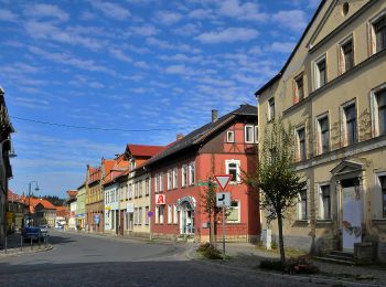
![Trail On foot Kranichfeld - Kranich-Rundwanderweg 1 - Photo](https://media.geolcdn.com/t/350/260/74097348-87d2-42b2-9218-277a755d0837.jpeg&format=jpg&maxdim=2)
![On foot On foot](https://static1.geolcdn.com/sitytour/trail-icons/100.png)
Km
On foot
![](/images/other/stat-length.png)
![](https://static1.geolcdn.com/siteimages/upload/files/1508320355ic_sort_den_pos_24dp.png)
![](https://static1.geolcdn.com/siteimages/upload/files/1508320355ic_sort_den_neg_24dp.png)
![](https://static1.geolcdn.com/siteimages/upload/files/16400158638029165_repeat_loop_refresh_sync_direction_icon.png)
• Trail created by Kranichfeld. Symbol: Weiße 1 auf schwarzem Hintergrund, drüber ein schwarzer Kranich auf weißem Gru...
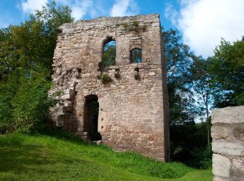
![Trail On foot Kranichfeld - Kranich-Rundwanderweg 2 - Photo](https://media.geolcdn.com/t/350/260/fcb27b38-9c0c-43d1-96b9-a5d3e499e0c6.jpeg&format=jpg&maxdim=2)
![On foot On foot](https://static1.geolcdn.com/sitytour/trail-icons/100.png)
Km
On foot
![](/images/other/stat-length.png)
![](https://static1.geolcdn.com/siteimages/upload/files/1508320355ic_sort_den_pos_24dp.png)
![](https://static1.geolcdn.com/siteimages/upload/files/1508320355ic_sort_den_neg_24dp.png)
![](https://static1.geolcdn.com/siteimages/upload/files/16400158638029165_repeat_loop_refresh_sync_direction_icon.png)
• Trail created by Kranichfeld. Symbol: Schwarze 2 auf gelbgrünem Hintergrund, drüber ein schwarzer Kranich auf weißem...
![Trail On foot Kranichfeld - Kranich-Rundwanderweg 5 - Photo](https://media.geolcdn.com/t/350/260/74097348-87d2-42b2-9218-277a755d0837.jpeg&format=jpg&maxdim=2)
![On foot On foot](https://static1.geolcdn.com/sitytour/trail-icons/100.png)
Km
On foot
![](/images/other/stat-length.png)
![](https://static1.geolcdn.com/siteimages/upload/files/1508320355ic_sort_den_pos_24dp.png)
![](https://static1.geolcdn.com/siteimages/upload/files/1508320355ic_sort_den_neg_24dp.png)
![](https://static1.geolcdn.com/siteimages/upload/files/16400158638029165_repeat_loop_refresh_sync_direction_icon.png)
• Trail created by Kranichfeld. Symbol: Weiße 5 auf dunkelgrünem Hintergrund, drüber ein schwarzer Kranich auf weißem ...
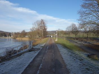
![Trail On foot Elleben - Kranich-Rundwanderweg 3 - Photo](https://media.geolcdn.com/t/350/260/107b3b36-5566-4eb2-a5f7-0596929cc96a.jpeg&format=jpg&maxdim=2)
![On foot On foot](https://static1.geolcdn.com/sitytour/trail-icons/100.png)
Km
On foot
![](/images/other/stat-length.png)
![](https://static1.geolcdn.com/siteimages/upload/files/1508320355ic_sort_den_pos_24dp.png)
![](https://static1.geolcdn.com/siteimages/upload/files/1508320355ic_sort_den_neg_24dp.png)
![](https://static1.geolcdn.com/siteimages/upload/files/16400158638029165_repeat_loop_refresh_sync_direction_icon.png)
• Trail created by Kranichfeld. Symbol: Weiße 2 auf lila Hintergrund, drüber ein schwarzer Kranich auf weißem Grund.
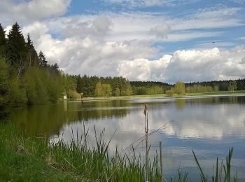
![Trail On foot Neustadt an der Orla - Naturlehrpfad Dreba - Plothen - Photo](https://media.geolcdn.com/t/350/260/ddff97bc-cfa3-4a10-a3be-f8a21df82900.jpeg&format=jpg&maxdim=2)
![On foot On foot](https://static1.geolcdn.com/sitytour/trail-icons/100.png)
Km
On foot
![](/images/other/stat-length.png)
![](https://static1.geolcdn.com/siteimages/upload/files/1508320355ic_sort_den_pos_24dp.png)
![](https://static1.geolcdn.com/siteimages/upload/files/1508320355ic_sort_den_neg_24dp.png)
![](https://static1.geolcdn.com/siteimages/upload/files/16400158638029165_repeat_loop_refresh_sync_direction_icon.png)
• Symbol: weiß mit grünem Backslash
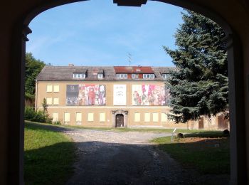
![Trail On foot - Wanderweg Ernsee-Hammelburg-Stadtwald - Photo](https://media.geolcdn.com/t/350/260/e8ec6e6a-918f-41ac-a55e-ff552a097d84.jpeg&format=jpg&maxdim=2)
![On foot On foot](https://static1.geolcdn.com/sitytour/trail-icons/100.png)
Km
On foot
![](/images/other/stat-length.png)
![](https://static1.geolcdn.com/siteimages/upload/files/1508320355ic_sort_den_pos_24dp.png)
![](https://static1.geolcdn.com/siteimages/upload/files/1508320355ic_sort_den_neg_24dp.png)
![](https://static1.geolcdn.com/siteimages/upload/files/16400158638029165_repeat_loop_refresh_sync_direction_icon.png)
• Trail created by Verschönerungsverein Ernsee e. V..
![Trail On foot Kranichfeld - Kranich-Rundwanderweg 4 - Photo](https://media.geolcdn.com/t/350/260/107b3b36-5566-4eb2-a5f7-0596929cc96a.jpeg&format=jpg&maxdim=2)
![On foot On foot](https://static1.geolcdn.com/sitytour/trail-icons/100.png)
Km
On foot
![](/images/other/stat-length.png)
![](https://static1.geolcdn.com/siteimages/upload/files/1508320355ic_sort_den_pos_24dp.png)
![](https://static1.geolcdn.com/siteimages/upload/files/1508320355ic_sort_den_neg_24dp.png)
![](https://static1.geolcdn.com/siteimages/upload/files/16400158638029165_repeat_loop_refresh_sync_direction_icon.png)
• Trail created by Kranichfeld. Symbol: Schwarze 4 auf rosa Hintergrund, drüber ein schwarzer Kranich auf weißem Grund.
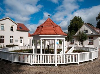
![Trail On foot Bad Berka - Ludwig-Geist-Weg - Photo](https://media.geolcdn.com/t/350/260/0e45825d-8363-42f1-8ba7-0b70861684b0.jpeg&format=jpg&maxdim=2)
![On foot On foot](https://static1.geolcdn.com/sitytour/trail-icons/100.png)
Km
On foot
![](/images/other/stat-length.png)
![](https://static1.geolcdn.com/siteimages/upload/files/1508320355ic_sort_den_pos_24dp.png)
![](https://static1.geolcdn.com/siteimages/upload/files/1508320355ic_sort_den_neg_24dp.png)
![](https://static1.geolcdn.com/siteimages/upload/files/16400158638029165_repeat_loop_refresh_sync_direction_icon.png)
• Trail created by Bad Berka. Symbol: schwarze 3 auf mittig senkrecht geteiltem, links blauen, rechts gelben Kreis
![Trail On foot Bad Berka - Heinrich-Schütz-Weg - Photo](https://media.geolcdn.com/t/350/260/0e45825d-8363-42f1-8ba7-0b70861684b0.jpeg&format=jpg&maxdim=2)
![On foot On foot](https://static1.geolcdn.com/sitytour/trail-icons/100.png)
Km
On foot
![](/images/other/stat-length.png)
![](https://static1.geolcdn.com/siteimages/upload/files/1508320355ic_sort_den_pos_24dp.png)
![](https://static1.geolcdn.com/siteimages/upload/files/1508320355ic_sort_den_neg_24dp.png)
![](https://static1.geolcdn.com/siteimages/upload/files/16400158638029165_repeat_loop_refresh_sync_direction_icon.png)
• Trail created by Bad Berka. Symbol: schwarze 1 auf mittig senkrecht geteiltem, links baluen, rechts gelben Kreis
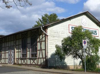
![Trail On foot Heilbad Heiligenstadt - Die Heidelbergrunde - Photo](https://media.geolcdn.com/t/350/260/d54794a1-00c5-434d-9208-0968bb150e66.jpeg&format=jpg&maxdim=2)
![On foot On foot](https://static1.geolcdn.com/sitytour/trail-icons/100.png)
Km
On foot
![](/images/other/stat-length.png)
![](https://static1.geolcdn.com/siteimages/upload/files/1508320355ic_sort_den_pos_24dp.png)
![](https://static1.geolcdn.com/siteimages/upload/files/1508320355ic_sort_den_neg_24dp.png)
![](https://static1.geolcdn.com/siteimages/upload/files/16400158638029165_repeat_loop_refresh_sync_direction_icon.png)
• Trail created by Stadt Heilbad Heiligenstadt. Website: https://www.heilbad-heiligenstadt.de/tourismus-freizeit/akt...
![Trail On foot Heilbad Heiligenstadt - Wanderweg von Heilbad Heiligenstadt zur Kapelle Steinhagen - Photo](https://media.geolcdn.com/t/350/260/1d1c05da-1f3a-4a22-9e17-5580051bc5da.jpeg&format=jpg&maxdim=2)
![On foot On foot](https://static1.geolcdn.com/sitytour/trail-icons/100.png)
Km
On foot
![](/images/other/stat-length.png)
![](https://static1.geolcdn.com/siteimages/upload/files/1508320355ic_sort_den_pos_24dp.png)
![](https://static1.geolcdn.com/siteimages/upload/files/1508320355ic_sort_den_neg_24dp.png)
![](https://static1.geolcdn.com/siteimages/upload/files/16400158638029165_repeat_loop_refresh_sync_direction_icon.png)
• Trail created by Stadt Heilbad Heiligenstadt.
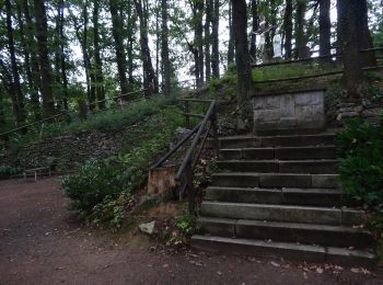
![Trail On foot Uder - Wanderweg von Uder nach Lutter (Grünes X) - Photo](https://media.geolcdn.com/t/350/260/5fd28731-1514-48b5-a34b-0d34447b1aa7.jpeg&format=jpg&maxdim=2)
![On foot On foot](https://static1.geolcdn.com/sitytour/trail-icons/100.png)
Km
On foot
![](/images/other/stat-length.png)
![](https://static1.geolcdn.com/siteimages/upload/files/1508320355ic_sort_den_pos_24dp.png)
![](https://static1.geolcdn.com/siteimages/upload/files/1508320355ic_sort_den_neg_24dp.png)
![](https://static1.geolcdn.com/siteimages/upload/files/16400158638029165_repeat_loop_refresh_sync_direction_icon.png)
• Trail created by Stadt Heilbad Heiligenstadt.
20 trails displayed on 416
FREE GPS app for hiking
Activities
Nearby regions
- Altenburger Land
- Eisenach
- Erfurt
- Gera
- Greiz
- Ilm-Kreis
- Jena
- Kyffhäuserkreis
- Landkreis Eichsfeld
- Landkreis Gotha
- Landkreis Hildburghausen
- Landkreis Nordhausen
- Landkreis Saalfeld-Rudolstadt
- Landkreis Schmalkalden-Meiningen
- Landkreis Sömmerda
- Landkreis Sonneberg
- Landkreis Weimarer Land
- Saale-Holzland-Kreis
- Saale-Orla-Kreis
- Suhl
- Unstrut-Hainich-Kreis
- Wartburgkreis
- Weimar