![](/images/other/stat-length.png)
Zülpich, Kreis Euskirchen, On foot: Best trails, routes and walks
Zülpich: Discover the best trails: 3 on foot. All these trails, routes and outdoor activities are available in our SityTrail applications for smartphones and tablets.
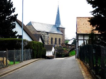
The best trails (3)
![Trail On foot Zülpich - EifelSchleife Via Agrippa - Photo](https://media.geolcdn.com/t/350/260/875ef8b2-bef5-48c5-99c8-f4f04af005df.jpeg&format=jpg&maxdim=2)
![On foot On foot](https://static1.geolcdn.com/sitytour/trail-icons/100.png)
Km
On foot
![](/images/other/stat-length.png)
![](https://static1.geolcdn.com/siteimages/upload/files/1508320355ic_sort_den_pos_24dp.png)
![](https://static1.geolcdn.com/siteimages/upload/files/1508320355ic_sort_den_neg_24dp.png)
![](https://static1.geolcdn.com/siteimages/upload/files/16400158638029165_repeat_loop_refresh_sync_direction_icon.png)
• Trail created by Nordeifel Tourismus GmbH. Symbol: quadratisches Logo oben blaue Fläche (Himmel) unten grüne Fläche ...
![Trail On foot Zülpich - EifelSchleife Berg und Tal - Photo](https://media.geolcdn.com/t/350/260/abf2ff02-d07e-4691-9e09-5d1a32857f26.jpeg&format=jpg&maxdim=2)
![On foot On foot](https://static1.geolcdn.com/sitytour/trail-icons/100.png)
Km
On foot
![](/images/other/stat-length.png)
![](https://static1.geolcdn.com/siteimages/upload/files/1508320355ic_sort_den_pos_24dp.png)
![](https://static1.geolcdn.com/siteimages/upload/files/1508320355ic_sort_den_neg_24dp.png)
![](https://static1.geolcdn.com/siteimages/upload/files/16400158638029165_repeat_loop_refresh_sync_direction_icon.png)
• Trail created by Nordeifel Tourismus GmbH. Symbol: quadratisches Logo oben blaue Fläche (Himmel) unten grüne Fläche ...
![Trail On foot Zülpich - EifelSchleife Zum Bleibach - Photo](https://media.geolcdn.com/t/350/260/ext.jpg?maxdim=2&url=https%3A%2F%2Fstatic1.geolcdn.com%2Fsiteimages%2Fupload%2Ffiles%2F1545311037marcheuse_200dpi.jpg)
![On foot On foot](https://static1.geolcdn.com/sitytour/trail-icons/100.png)
Km
On foot
![](/images/other/stat-length.png)
![](https://static1.geolcdn.com/siteimages/upload/files/1508320355ic_sort_den_pos_24dp.png)
![](https://static1.geolcdn.com/siteimages/upload/files/1508320355ic_sort_den_neg_24dp.png)
![](https://static1.geolcdn.com/siteimages/upload/files/16400158638029165_repeat_loop_refresh_sync_direction_icon.png)
• Trail created by Nordeifel Tourismus GmbH. Symbol: quadratisches Logo oben blaue Fläche (Himmel) unten grüne Fläche ...
3 trails displayed on 3
FREE GPS app for hiking