![](/images/other/stat-length.png)
- Trails
- On foot
- Germany
- North Rhine-Westphalia
- Kreis Gütersloh
- Halle (Westf.)
Halle (Westf.), Kreis Gütersloh, On foot: Best trails, routes and walks
Halle (Westf.): Discover the best trails: 10 on foot. All these trails, routes and outdoor activities are available in our SityTrail applications for smartphones and tablets.
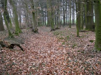
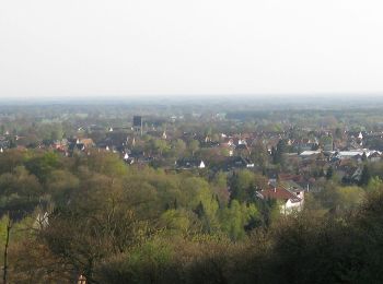
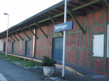
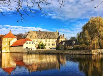
The best trails (10)
![Trail On foot Halle (Westf.) - Burgenweg - Photo](https://media.geolcdn.com/t/350/260/0f55565d-282c-4fe8-8d26-75442427b1fd.jpeg&format=jpg&maxdim=2)
![On foot On foot](https://static1.geolcdn.com/sitytour/trail-icons/100.png)
Km
On foot
![](/images/other/stat-length.png)
![](https://static1.geolcdn.com/siteimages/upload/files/1508320355ic_sort_den_pos_24dp.png)
![](https://static1.geolcdn.com/siteimages/upload/files/1508320355ic_sort_den_neg_24dp.png)
![](https://static1.geolcdn.com/siteimages/upload/files/16400158638029165_repeat_loop_refresh_sync_direction_icon.png)
• Symbol: Weiße Raute mit weißem B
![Trail On foot Halle (Westf.) - Weg für Genießer - Halle-Borgholzhausen - Photo](https://media.geolcdn.com/t/350/260/83068c2f-fc38-4ec3-9d13-c280c0f126c0.jpeg&format=jpg&maxdim=2)
![On foot On foot](https://static1.geolcdn.com/sitytour/trail-icons/100.png)
Km
On foot
![](/images/other/stat-length.png)
![](https://static1.geolcdn.com/siteimages/upload/files/1508320355ic_sort_den_pos_24dp.png)
![](https://static1.geolcdn.com/siteimages/upload/files/1508320355ic_sort_den_neg_24dp.png)
![](https://static1.geolcdn.com/siteimages/upload/files/16400158638029165_repeat_loop_refresh_sync_direction_icon.png)
• Trail created by Arbeitsgemeinschaft „Weg für Genießer“. Symbol: Weißes 'G' auf rotem Grund
![Trail On foot Halle (Westf.) - Weg für Genießer - Halle-Steinhagen - Photo](https://media.geolcdn.com/t/350/260/ext.jpg?maxdim=2&url=https%3A%2F%2Fupload.wikimedia.org%2Fwikipedia%2Fcommons%2Fthumb%2F9%2F94%2FBahnhof_Steinhagen.jpg%2F2000px-Bahnhof_Steinhagen.jpg)
![On foot On foot](https://static1.geolcdn.com/sitytour/trail-icons/100.png)
Km
On foot
![](/images/other/stat-length.png)
![](https://static1.geolcdn.com/siteimages/upload/files/1508320355ic_sort_den_pos_24dp.png)
![](https://static1.geolcdn.com/siteimages/upload/files/1508320355ic_sort_den_neg_24dp.png)
![](https://static1.geolcdn.com/siteimages/upload/files/16400158638029165_repeat_loop_refresh_sync_direction_icon.png)
• Trail created by Arbeitsgemeinschaft „Weg für Genießer“. Symbol: Weißes 'G' auf rotem Grund
![Trail On foot Halle (Westf.) - Haller Rundweg A8 - Photo](https://media.geolcdn.com/t/350/260/68889d93-efec-4180-962c-e8718888bfd1.jpeg&format=jpg&maxdim=2)
![On foot On foot](https://static1.geolcdn.com/sitytour/trail-icons/100.png)
Km
On foot
![](/images/other/stat-length.png)
![](https://static1.geolcdn.com/siteimages/upload/files/1508320355ic_sort_den_pos_24dp.png)
![](https://static1.geolcdn.com/siteimages/upload/files/1508320355ic_sort_den_neg_24dp.png)
![](https://static1.geolcdn.com/siteimages/upload/files/16400158638029165_repeat_loop_refresh_sync_direction_icon.png)
![Trail On foot Halle (Westf.) - Haller Rundweg A9 - Photo](https://media.geolcdn.com/t/350/260/7e5fcc79-bf83-4fa6-b88b-a2e31a8c79f9.jpeg&format=jpg&maxdim=2)
![On foot On foot](https://static1.geolcdn.com/sitytour/trail-icons/100.png)
Km
On foot
![](/images/other/stat-length.png)
![](https://static1.geolcdn.com/siteimages/upload/files/1508320355ic_sort_den_pos_24dp.png)
![](https://static1.geolcdn.com/siteimages/upload/files/1508320355ic_sort_den_neg_24dp.png)
![](https://static1.geolcdn.com/siteimages/upload/files/16400158638029165_repeat_loop_refresh_sync_direction_icon.png)
![Trail On foot Halle (Westf.) - Haller Rundweg A11 - Photo](https://media.geolcdn.com/t/350/260/13c4786b-d505-4b38-8b8b-0244622551f0.jpeg&format=jpg&maxdim=2)
![On foot On foot](https://static1.geolcdn.com/sitytour/trail-icons/100.png)
Km
On foot
![](/images/other/stat-length.png)
![](https://static1.geolcdn.com/siteimages/upload/files/1508320355ic_sort_den_pos_24dp.png)
![](https://static1.geolcdn.com/siteimages/upload/files/1508320355ic_sort_den_neg_24dp.png)
![](https://static1.geolcdn.com/siteimages/upload/files/16400158638029165_repeat_loop_refresh_sync_direction_icon.png)
![Trail On foot Halle (Westf.) - Haller Rundweg A12 - Photo](https://media.geolcdn.com/t/350/260/d281b393-2d5b-4e09-a196-545438b93ca5.jpeg&format=jpg&maxdim=2)
![On foot On foot](https://static1.geolcdn.com/sitytour/trail-icons/100.png)
Km
On foot
![](/images/other/stat-length.png)
![](https://static1.geolcdn.com/siteimages/upload/files/1508320355ic_sort_den_pos_24dp.png)
![](https://static1.geolcdn.com/siteimages/upload/files/1508320355ic_sort_den_neg_24dp.png)
![](https://static1.geolcdn.com/siteimages/upload/files/16400158638029165_repeat_loop_refresh_sync_direction_icon.png)
![Trail On foot Halle (Westf.) - Haller Rundweg A4 - Photo](https://media.geolcdn.com/t/350/260/83068c2f-fc38-4ec3-9d13-c280c0f126c0.jpeg&format=jpg&maxdim=2)
![On foot On foot](https://static1.geolcdn.com/sitytour/trail-icons/100.png)
Km
On foot
![](/images/other/stat-length.png)
![](https://static1.geolcdn.com/siteimages/upload/files/1508320355ic_sort_den_pos_24dp.png)
![](https://static1.geolcdn.com/siteimages/upload/files/1508320355ic_sort_den_neg_24dp.png)
![](https://static1.geolcdn.com/siteimages/upload/files/16400158638029165_repeat_loop_refresh_sync_direction_icon.png)
![Trail On foot Halle (Westf.) - Haller Rundweg A3 - Photo](https://media.geolcdn.com/t/350/260/3fe6f611-af65-49fa-b14e-3b12bf7162bd.jpeg&format=jpg&maxdim=2)
![On foot On foot](https://static1.geolcdn.com/sitytour/trail-icons/100.png)
Km
On foot
![](/images/other/stat-length.png)
![](https://static1.geolcdn.com/siteimages/upload/files/1508320355ic_sort_den_pos_24dp.png)
![](https://static1.geolcdn.com/siteimages/upload/files/1508320355ic_sort_den_neg_24dp.png)
![](https://static1.geolcdn.com/siteimages/upload/files/16400158638029165_repeat_loop_refresh_sync_direction_icon.png)
![Trail On foot Halle (Westf.) - Haller Rundweg A6 - Photo](https://media.geolcdn.com/t/350/260/ffc6a50d-6b0d-4b3e-805e-f11ed045cc17.jpeg&format=jpg&maxdim=2)
![On foot On foot](https://static1.geolcdn.com/sitytour/trail-icons/100.png)
Km
On foot
![](/images/other/stat-length.png)
![](https://static1.geolcdn.com/siteimages/upload/files/1508320355ic_sort_den_pos_24dp.png)
![](https://static1.geolcdn.com/siteimages/upload/files/1508320355ic_sort_den_neg_24dp.png)
![](https://static1.geolcdn.com/siteimages/upload/files/16400158638029165_repeat_loop_refresh_sync_direction_icon.png)
10 trails displayed on 10
FREE GPS app for hiking