![](/images/other/stat-length.png)
- Trails
- On foot
- Germany
- Saxony-Anhalt
- Mansfeld-Südharz
- Mansfeld
Mansfeld, Mansfeld-Südharz, On foot: Best trails, routes and walks
Mansfeld: Discover the best trails: 5 on foot. All these trails, routes and outdoor activities are available in our SityTrail applications for smartphones and tablets.
The best trails (5)
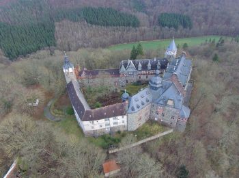
![Trail On foot Mansfeld - Kuhbeek Wanderweg - Photo](https://media.geolcdn.com/t/350/260/1b41cb91-0c94-431d-a625-c7f8eec3a142.jpeg&format=jpg&maxdim=2)
![On foot On foot](https://static1.geolcdn.com/sitytour/trail-icons/100.png)
Km
#1 - Kuhbeek Wanderweg
On foot
Easy
Mansfeld,
Saxony-Anhalt,
Mansfeld-Südharz,
Germany
![](/images/other/stat-length.png)
5.5 km | 7.2 km-effort
1h 37min
![](https://static1.geolcdn.com/siteimages/upload/files/1508320355ic_sort_den_pos_24dp.png)
117 m
![](https://static1.geolcdn.com/siteimages/upload/files/1508320355ic_sort_den_neg_24dp.png)
142 m
![](https://static1.geolcdn.com/siteimages/upload/files/16400158638029165_repeat_loop_refresh_sync_direction_icon.png)
No
SityTrail - itinéraires balisés pédestres
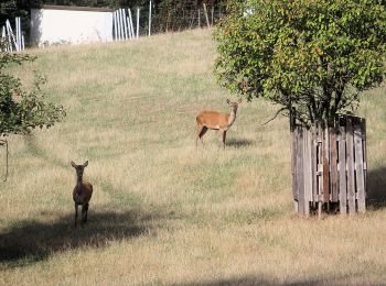
![Trail On foot Mansfeld - Gelber Balken - Photo](https://media.geolcdn.com/t/350/260/f2850d89-d54c-44b5-baea-0f21d888262e.jpeg&format=jpg&maxdim=2)
![On foot On foot](https://static1.geolcdn.com/sitytour/trail-icons/100.png)
Km
#2 - Gelber Balken
On foot
Easy
Mansfeld,
Saxony-Anhalt,
Mansfeld-Südharz,
Germany
![](/images/other/stat-length.png)
6.6 km | 7.5 km-effort
1h 42min
![](https://static1.geolcdn.com/siteimages/upload/files/1508320355ic_sort_den_pos_24dp.png)
32 m
![](https://static1.geolcdn.com/siteimages/upload/files/1508320355ic_sort_den_neg_24dp.png)
182 m
![](https://static1.geolcdn.com/siteimages/upload/files/16400158638029165_repeat_loop_refresh_sync_direction_icon.png)
No
SityTrail - itinéraires balisés pédestres
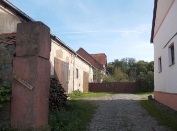
![Trail On foot Mansfeld - Schloßweg - Photo](https://media.geolcdn.com/t/350/260/61aecd0f-f076-49bb-a2ab-f0a57dee1bdf.jpeg&format=jpg&maxdim=2)
![On foot On foot](https://static1.geolcdn.com/sitytour/trail-icons/100.png)
Km
#3 - Schloßweg
On foot
Easy
Mansfeld,
Saxony-Anhalt,
Mansfeld-Südharz,
Germany
![](/images/other/stat-length.png)
4.4 km | 5.6 km-effort
1h 15min
![](https://static1.geolcdn.com/siteimages/upload/files/1508320355ic_sort_den_pos_24dp.png)
75 m
![](https://static1.geolcdn.com/siteimages/upload/files/1508320355ic_sort_den_neg_24dp.png)
112 m
![](https://static1.geolcdn.com/siteimages/upload/files/16400158638029165_repeat_loop_refresh_sync_direction_icon.png)
No
SityTrail - itinéraires balisés pédestres
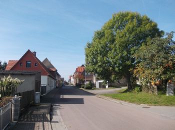
![Trail On foot Mansfeld - Münchhausenweg Wippra - Braunschwende - Photo](https://media.geolcdn.com/t/350/260/a1223f78-b5fb-41ac-b10c-8cd0c404be26.jpeg&format=jpg&maxdim=2)
![On foot On foot](https://static1.geolcdn.com/sitytour/trail-icons/100.png)
Km
#4 - Münchhausenweg Wippra - Braunschwende
On foot
Easy
Mansfeld,
Saxony-Anhalt,
Mansfeld-Südharz,
Germany
![](/images/other/stat-length.png)
5.1 km | 6.2 km-effort
1h 24min
![](https://static1.geolcdn.com/siteimages/upload/files/1508320355ic_sort_den_pos_24dp.png)
48 m
![](https://static1.geolcdn.com/siteimages/upload/files/1508320355ic_sort_den_neg_24dp.png)
166 m
![](https://static1.geolcdn.com/siteimages/upload/files/16400158638029165_repeat_loop_refresh_sync_direction_icon.png)
No
SityTrail - itinéraires balisés pédestres
![Trail On foot Mansfeld - Carl-Wentzel Wanderweg - Photo](https://media.geolcdn.com/t/350/260/ext.jpg?maxdim=2&url=https%3A%2F%2Fstatic1.geolcdn.com%2Fsiteimages%2Fupload%2Ffiles%2F1545311037marcheuse_200dpi.jpg)
![On foot On foot](https://static1.geolcdn.com/sitytour/trail-icons/100.png)
Km
#5 - Carl-Wentzel Wanderweg
On foot
Easy
Mansfeld,
Saxony-Anhalt,
Mansfeld-Südharz,
Germany
![](/images/other/stat-length.png)
4 km | 4.9 km-effort
1h 6min
![](https://static1.geolcdn.com/siteimages/upload/files/1508320355ic_sort_den_pos_24dp.png)
53 m
![](https://static1.geolcdn.com/siteimages/upload/files/1508320355ic_sort_den_neg_24dp.png)
112 m
![](https://static1.geolcdn.com/siteimages/upload/files/16400158638029165_repeat_loop_refresh_sync_direction_icon.png)
No
SityTrail - itinéraires balisés pédestres
5 trails displayed on 5
FREE GPS app for hiking