Oberharz am Brocken, Landkreis Harz, On foot: Best trails, routes and walks

Oberharz am Brocken: Discover the best trails: 8 on foot. All these trails, routes and outdoor activities are available in our SityTrail applications for smartphones and tablets.
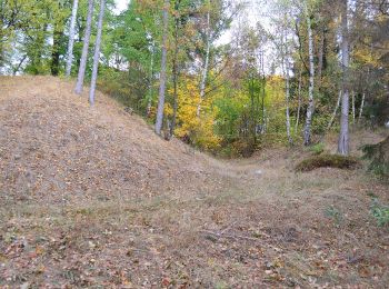
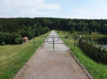

The best trails (8)

Trail On foot Oberharz am Brocken - Wanderweg grünes X - Photo
On foot 8.4
Km
PRO

On foot

Easy
Oberharz am Brocken, Saxony-Anhalt, Landkreis Harz, Germany
8.4 km | 10.3 km-effort
2h 20min
138 m
161 m
No
SityTrail - itinéraires balisés pédestres

• Symbol: grünes X auf weißem Grund

Trail On foot Oberharz am Brocken - DE-grünes Dreieck - Photo
On foot 5.725
Km
PRO

On foot

Easy
Oberharz am Brocken, Saxony-Anhalt, Landkreis Harz, Germany
5.7 km | 6.5 km-effort
1h 28min
38 m
119 m
No
SityTrail - itinéraires balisés pédestres

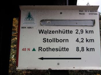
• Symbol: Grünes Dreieck auf weißem Grund

Trail On foot Oberharz am Brocken - Harzklub-Weg 24E - Photo
On foot 3.156
Km
PRO

On foot

Easy
Oberharz am Brocken, Saxony-Anhalt, Landkreis Harz, Germany
3.2 km | 4.2 km-effort
57min
101 m
15 m
No
SityTrail - itinéraires balisés pédestres

• Symbol: Grünes X auf weißem Grund

Trail On foot Oberharz am Brocken - Drei Annen Hohne-Mandelholz - Photo
On foot 9.811
Km
PRO

On foot

Easy
Oberharz am Brocken, Saxony-Anhalt, Landkreis Harz, Germany
9.8 km | 11.8 km-effort
2h 41min
152 m
151 m
Yes
SityTrail - itinéraires balisés pédestres

• Trail created by Nationalpark Harz.

Trail On foot Oberharz am Brocken - Harzklub-Weg 24B - Photo
On foot 9.567
Km
PRO

On foot

Easy
Oberharz am Brocken, Saxony-Anhalt, Landkreis Harz, Germany
9.6 km | 11.5 km-effort
2h 36min
147 m
137 m
No
SityTrail - itinéraires balisés pédestres

• Trail created by Harzklub. Symbol: Grünes Dreieck auf weißem Grund

Trail On foot Oberharz am Brocken - Wanderweg grüner Punkt - Photo
On foot 12.0
Km
PRO

On foot

Easy
Oberharz am Brocken, Saxony-Anhalt, Landkreis Harz, Germany
12 km | 15.4 km-effort
3h 30min
264 m
228 m
No
SityTrail - itinéraires balisés pédestres

• Symbol: grüner Punkt auf weißem Grund

Trail On foot Oberharz am Brocken - Hohnerundweg - Photo
On foot 4.989
Km
PRO

On foot

Easy
Oberharz am Brocken, Saxony-Anhalt, Landkreis Harz, Germany
5 km | 6.5 km-effort
1h 28min
117 m
102 m
No
SityTrail - itinéraires balisés pédestres

• Symbol: 26

Trail On foot Oberharz am Brocken - 17E - Photo
On foot 3.222
Km
PRO

On foot

Easy
Oberharz am Brocken, Saxony-Anhalt, Landkreis Harz, Germany
3.2 km | 3.9 km-effort
52min
53 m
32 m
No
SityTrail - itinéraires balisés pédestres

• Trail created by Harzklub. Symbol: grünes Dreieck auf weißem Grund

8 trails displayed on 8

FREE GPS app for hiking

Logo SityTrail SityTrail

IGN / Geographical institutes

Download SityTrail from the App Store Download SityTrail from Google Play

Logo SityTrail SityTrail World

The world is yours!

Download SityTrail from the App Store Download SityTrail from Google Play Download SityTrail on Huawei AppGallery

Activities

Nearby regions

Close
My subscriptions