![](/images/other/stat-length.png)
- Trails
- On foot
- Germany
- Brandenburg
- Dahme-Spreewald
- Märkische Heide
Märkische Heide, Dahme-Spreewald, On foot: Best trails, routes and walks
Märkische Heide: Discover the best trails: 14 on foot. All these trails, routes and outdoor activities are available in our SityTrail applications for smartphones and tablets.
The best trails (14)
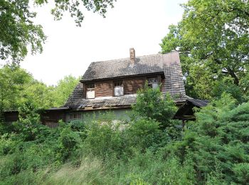
![Trail On foot Märkische Heide - Wanderweg Pretschen-Wittmannsdorf-Bückchen-Groß Leuthen - Photo](https://media.geolcdn.com/t/350/260/a99d629f-c14a-4340-8c47-202a99e9b8b7.jpeg&format=jpg&maxdim=2)
![On foot On foot](https://static1.geolcdn.com/sitytour/trail-icons/100.png)
Km
On foot
![](/images/other/stat-length.png)
![](https://static1.geolcdn.com/siteimages/upload/files/1508320355ic_sort_den_pos_24dp.png)
![](https://static1.geolcdn.com/siteimages/upload/files/1508320355ic_sort_den_neg_24dp.png)
![](https://static1.geolcdn.com/siteimages/upload/files/16400158638029165_repeat_loop_refresh_sync_direction_icon.png)
• Symbol: gelber Balken
![Trail On foot Märkische Heide - Rundwanderweg Pretschener Weinberg - Photo](https://media.geolcdn.com/t/350/260/a99d629f-c14a-4340-8c47-202a99e9b8b7.jpeg&format=jpg&maxdim=2)
![On foot On foot](https://static1.geolcdn.com/sitytour/trail-icons/100.png)
Km
On foot
![](/images/other/stat-length.png)
![](https://static1.geolcdn.com/siteimages/upload/files/1508320355ic_sort_den_pos_24dp.png)
![](https://static1.geolcdn.com/siteimages/upload/files/1508320355ic_sort_den_neg_24dp.png)
![](https://static1.geolcdn.com/siteimages/upload/files/16400158638029165_repeat_loop_refresh_sync_direction_icon.png)
• Symbol: gelber Punkt auf weißem Quadrat
![Trail On foot Märkische Heide - Wanderweg Neu Lübbenau-Neu Schadow-Pretschen - Photo](https://media.geolcdn.com/t/350/260/a99d629f-c14a-4340-8c47-202a99e9b8b7.jpeg&format=jpg&maxdim=2)
![On foot On foot](https://static1.geolcdn.com/sitytour/trail-icons/100.png)
Km
On foot
![](/images/other/stat-length.png)
![](https://static1.geolcdn.com/siteimages/upload/files/1508320355ic_sort_den_pos_24dp.png)
![](https://static1.geolcdn.com/siteimages/upload/files/1508320355ic_sort_den_neg_24dp.png)
![](https://static1.geolcdn.com/siteimages/upload/files/16400158638029165_repeat_loop_refresh_sync_direction_icon.png)
• Symbol: horizontaler grüner Balken auf weißem Grund
![Trail On foot Märkische Heide - Wanderweg Alt Schadow-Werder-Plattkow - Photo](https://media.geolcdn.com/t/350/260/a99d629f-c14a-4340-8c47-202a99e9b8b7.jpeg&format=jpg&maxdim=2)
![On foot On foot](https://static1.geolcdn.com/sitytour/trail-icons/100.png)
Km
On foot
![](/images/other/stat-length.png)
![](https://static1.geolcdn.com/siteimages/upload/files/1508320355ic_sort_den_pos_24dp.png)
![](https://static1.geolcdn.com/siteimages/upload/files/1508320355ic_sort_den_neg_24dp.png)
![](https://static1.geolcdn.com/siteimages/upload/files/16400158638029165_repeat_loop_refresh_sync_direction_icon.png)
• Symbol: horizontaler grüner Balken auf weißem Grund
![Trail On foot Märkische Heide - Wanderweg Alt Schadow-Pretschen - Photo](https://media.geolcdn.com/t/350/260/a99d629f-c14a-4340-8c47-202a99e9b8b7.jpeg&format=jpg&maxdim=2)
![On foot On foot](https://static1.geolcdn.com/sitytour/trail-icons/100.png)
Km
On foot
![](/images/other/stat-length.png)
![](https://static1.geolcdn.com/siteimages/upload/files/1508320355ic_sort_den_pos_24dp.png)
![](https://static1.geolcdn.com/siteimages/upload/files/1508320355ic_sort_den_neg_24dp.png)
![](https://static1.geolcdn.com/siteimages/upload/files/16400158638029165_repeat_loop_refresh_sync_direction_icon.png)
• Symbol: horizontaler grüner Balken auf weißem Grund
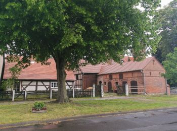
![Trail On foot Märkische Heide - Wanderweg Barbassee-Briesener See-Caminchen-Klein Leine- Klein Leiner See - Photo](https://media.geolcdn.com/t/350/260/06882102-d555-49d7-ba53-152eeec2521c.jpeg&format=jpg&maxdim=2)
![On foot On foot](https://static1.geolcdn.com/sitytour/trail-icons/100.png)
Km
On foot
![](/images/other/stat-length.png)
![](https://static1.geolcdn.com/siteimages/upload/files/1508320355ic_sort_den_pos_24dp.png)
![](https://static1.geolcdn.com/siteimages/upload/files/1508320355ic_sort_den_neg_24dp.png)
![](https://static1.geolcdn.com/siteimages/upload/files/16400158638029165_repeat_loop_refresh_sync_direction_icon.png)
• Symbol: horizontaler gelber Balken auf weißem Grund
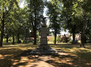
![Trail On foot Märkische Heide - Wanderweg Große Leuthen-Dollgen-Glietz - Photo](https://media.geolcdn.com/t/350/260/eb478110-0d3b-4eec-8f5d-622a161a958b.jpeg&format=jpg&maxdim=2)
![On foot On foot](https://static1.geolcdn.com/sitytour/trail-icons/100.png)
Km
On foot
![](/images/other/stat-length.png)
![](https://static1.geolcdn.com/siteimages/upload/files/1508320355ic_sort_den_pos_24dp.png)
![](https://static1.geolcdn.com/siteimages/upload/files/1508320355ic_sort_den_neg_24dp.png)
![](https://static1.geolcdn.com/siteimages/upload/files/16400158638029165_repeat_loop_refresh_sync_direction_icon.png)
• Symbol: horizontaler grüner Balken auf weißem Quadrat
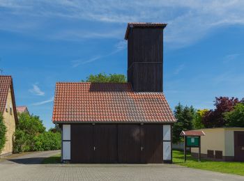
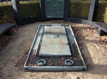
![Trail On foot Märkische Heide - Wanderweg Schlepzig-Dürrenhofe - Photo](https://media.geolcdn.com/t/350/260/60df7c16-ffdb-4c3c-813c-fdf30b48290a.jpeg&format=jpg&maxdim=2)
![On foot On foot](https://static1.geolcdn.com/sitytour/trail-icons/100.png)
Km
On foot
![](/images/other/stat-length.png)
![](https://static1.geolcdn.com/siteimages/upload/files/1508320355ic_sort_den_pos_24dp.png)
![](https://static1.geolcdn.com/siteimages/upload/files/1508320355ic_sort_den_neg_24dp.png)
![](https://static1.geolcdn.com/siteimages/upload/files/16400158638029165_repeat_loop_refresh_sync_direction_icon.png)
• Symbol: grüner Balken auf weißem Quadrat
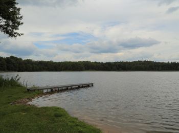
![Trail On foot Märkische Heide - Rundwanderweg Groß Leuthener See - Photo](https://media.geolcdn.com/t/350/260/a6d22ea0-3d63-40a0-89cb-451210b6b2e9.jpeg&format=jpg&maxdim=2)
![On foot On foot](https://static1.geolcdn.com/sitytour/trail-icons/100.png)
Km
On foot
![](/images/other/stat-length.png)
![](https://static1.geolcdn.com/siteimages/upload/files/1508320355ic_sort_den_pos_24dp.png)
![](https://static1.geolcdn.com/siteimages/upload/files/1508320355ic_sort_den_neg_24dp.png)
![](https://static1.geolcdn.com/siteimages/upload/files/16400158638029165_repeat_loop_refresh_sync_direction_icon.png)
• Symbol: gelber Punkt auf weißem Quadrat
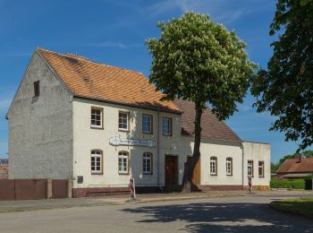
![Trail On foot Märkische Heide - Wanderweg Dürrenhofe-Krugau-Groß Leuthen - Photo](https://media.geolcdn.com/t/350/260/a7e2e944-7b68-4839-8c7c-c13ab37f9c9a.jpeg&format=jpg&maxdim=2)
![On foot On foot](https://static1.geolcdn.com/sitytour/trail-icons/100.png)
Km
On foot
![](/images/other/stat-length.png)
![](https://static1.geolcdn.com/siteimages/upload/files/1508320355ic_sort_den_pos_24dp.png)
![](https://static1.geolcdn.com/siteimages/upload/files/1508320355ic_sort_den_neg_24dp.png)
![](https://static1.geolcdn.com/siteimages/upload/files/16400158638029165_repeat_loop_refresh_sync_direction_icon.png)
![Trail On foot Märkische Heide - Wanderweg Dürrenhofe-Kuschkow-Pretschen - Photo](https://media.geolcdn.com/t/350/260/a7e2e944-7b68-4839-8c7c-c13ab37f9c9a.jpeg&format=jpg&maxdim=2)
![On foot On foot](https://static1.geolcdn.com/sitytour/trail-icons/100.png)
Km
On foot
![](/images/other/stat-length.png)
![](https://static1.geolcdn.com/siteimages/upload/files/1508320355ic_sort_den_pos_24dp.png)
![](https://static1.geolcdn.com/siteimages/upload/files/1508320355ic_sort_den_neg_24dp.png)
![](https://static1.geolcdn.com/siteimages/upload/files/16400158638029165_repeat_loop_refresh_sync_direction_icon.png)
![Trail On foot Märkische Heide - Wanderweg Schlepzig-Dürrenhofe (grüner Balken) - Photo](https://media.geolcdn.com/t/350/260/a7e2e944-7b68-4839-8c7c-c13ab37f9c9a.jpeg&format=jpg&maxdim=2)
![On foot On foot](https://static1.geolcdn.com/sitytour/trail-icons/100.png)
Km
On foot
![](/images/other/stat-length.png)
![](https://static1.geolcdn.com/siteimages/upload/files/1508320355ic_sort_den_pos_24dp.png)
![](https://static1.geolcdn.com/siteimages/upload/files/1508320355ic_sort_den_neg_24dp.png)
![](https://static1.geolcdn.com/siteimages/upload/files/16400158638029165_repeat_loop_refresh_sync_direction_icon.png)
![Trail On foot Märkische Heide - Wanderweg Richtung Dürrenhofe, Krugau - Photo](https://media.geolcdn.com/t/350/260/4d9a77d1-3c2a-490d-8410-e5f54e163424.jpeg&format=jpg&maxdim=2)
![On foot On foot](https://static1.geolcdn.com/sitytour/trail-icons/100.png)
Km
On foot
![](/images/other/stat-length.png)
![](https://static1.geolcdn.com/siteimages/upload/files/1508320355ic_sort_den_pos_24dp.png)
![](https://static1.geolcdn.com/siteimages/upload/files/1508320355ic_sort_den_neg_24dp.png)
![](https://static1.geolcdn.com/siteimages/upload/files/16400158638029165_repeat_loop_refresh_sync_direction_icon.png)
![Trail On foot Märkische Heide - Wanderweg Neuendorf-Hohenbrücker Strand-Alt Schadow - Photo](https://media.geolcdn.com/t/350/260/ext.jpg?maxdim=2&url=https%3A%2F%2Fstatic1.geolcdn.com%2Fsiteimages%2Fupload%2Ffiles%2F1545311037marcheuse_200dpi.jpg)
![On foot On foot](https://static1.geolcdn.com/sitytour/trail-icons/100.png)
Km
On foot
![](/images/other/stat-length.png)
![](https://static1.geolcdn.com/siteimages/upload/files/1508320355ic_sort_den_pos_24dp.png)
![](https://static1.geolcdn.com/siteimages/upload/files/1508320355ic_sort_den_neg_24dp.png)
![](https://static1.geolcdn.com/siteimages/upload/files/16400158638029165_repeat_loop_refresh_sync_direction_icon.png)
• Symbol: horizontaler gelber Balken auf weißem Grund
14 trails displayed on 14
FREE GPS app for hiking