![](/images/other/stat-length.png)
- Trails
- On foot
- Germany
- Baden-Württemberg
- Landkreis Ludwigsburg
- Bietigheim-Bissingen
Bietigheim-Bissingen, Landkreis Ludwigsburg, On foot: Best trails, routes and walks
Bietigheim-Bissingen: Discover the best trails: 8 on foot. All these trails, routes and outdoor activities are available in our SityTrail applications for smartphones and tablets.
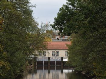
The best trails (8)
![Trail On foot Bietigheim-Bissingen - 3B-Land - Photo](https://media.geolcdn.com/t/350/260/b0eda3da-3b94-4d10-b2c2-152567bb5569.jpeg&format=jpg&maxdim=2)
![On foot On foot](https://static1.geolcdn.com/sitytour/trail-icons/100.png)
Km
On foot
![](/images/other/stat-length.png)
![](https://static1.geolcdn.com/siteimages/upload/files/1508320355ic_sort_den_pos_24dp.png)
![](https://static1.geolcdn.com/siteimages/upload/files/1508320355ic_sort_den_neg_24dp.png)
![](https://static1.geolcdn.com/siteimages/upload/files/16400158638029165_repeat_loop_refresh_sync_direction_icon.png)
• Trail created by 3B-Tourismus-Team Bietigheim-Bissingen. Symbol: grüne 3 mit blauem B auf rotem Punkt auf grünem Grund
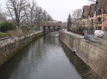
![Trail On foot Bietigheim-Bissingen - Enztal - Photo](https://media.geolcdn.com/t/350/260/dd1e2e23-3e60-4276-888c-780058dad728.jpeg&format=jpg&maxdim=2)
![On foot On foot](https://static1.geolcdn.com/sitytour/trail-icons/100.png)
Km
On foot
![](/images/other/stat-length.png)
![](https://static1.geolcdn.com/siteimages/upload/files/1508320355ic_sort_den_pos_24dp.png)
![](https://static1.geolcdn.com/siteimages/upload/files/1508320355ic_sort_den_neg_24dp.png)
![](https://static1.geolcdn.com/siteimages/upload/files/16400158638029165_repeat_loop_refresh_sync_direction_icon.png)
• Trail created by 3B-Tourismus-Team Bietigheim-Bissingen. Symbol: 2 weiße Enten auf blauem Grund
![Trail On foot Bietigheim-Bissingen - Steillagen - Photo](https://media.geolcdn.com/t/350/260/d13e7358-1d16-4f09-a6ce-003e04ef697f.jpeg&format=jpg&maxdim=2)
![On foot On foot](https://static1.geolcdn.com/sitytour/trail-icons/100.png)
Km
On foot
![](/images/other/stat-length.png)
![](https://static1.geolcdn.com/siteimages/upload/files/1508320355ic_sort_den_pos_24dp.png)
![](https://static1.geolcdn.com/siteimages/upload/files/1508320355ic_sort_den_neg_24dp.png)
![](https://static1.geolcdn.com/siteimages/upload/files/16400158638029165_repeat_loop_refresh_sync_direction_icon.png)
• Trail created by 3B-Tourismus-Team Bietigheim-Bissingen. Symbol: weißer Wanderstiefel auf grünem Grund
![Trail On foot Bietigheim-Bissingen - Besen - Photo](https://media.geolcdn.com/t/350/260/3c45a647-3063-49ce-837b-2d560935088a.jpeg&format=jpg&maxdim=2)
![On foot On foot](https://static1.geolcdn.com/sitytour/trail-icons/100.png)
Km
On foot
![](/images/other/stat-length.png)
![](https://static1.geolcdn.com/siteimages/upload/files/1508320355ic_sort_den_pos_24dp.png)
![](https://static1.geolcdn.com/siteimages/upload/files/1508320355ic_sort_den_neg_24dp.png)
![](https://static1.geolcdn.com/siteimages/upload/files/16400158638029165_repeat_loop_refresh_sync_direction_icon.png)
• Trail created by 3B-Tourismus-Team Bietigheim-Bissingen. Symbol: weißer Besen und weißes Rotweinglas auf rotem Grund
![Trail On foot Bietigheim-Bissingen - DE-SAV Blauer Balken, von-nach? - Photo](https://media.geolcdn.com/t/350/260/68bfbb0c-c7e8-4e0e-9029-fe8075bb2d6f.jpeg&format=jpg&maxdim=2)
![On foot On foot](https://static1.geolcdn.com/sitytour/trail-icons/100.png)
Km
On foot
![](/images/other/stat-length.png)
![](https://static1.geolcdn.com/siteimages/upload/files/1508320355ic_sort_den_pos_24dp.png)
![](https://static1.geolcdn.com/siteimages/upload/files/1508320355ic_sort_den_neg_24dp.png)
![](https://static1.geolcdn.com/siteimages/upload/files/16400158638029165_repeat_loop_refresh_sync_direction_icon.png)
• Trail created by Schwäbischer Albverein. SAV Blauer Balken, von-nach? Symbol: Blauer Balken auf weißem Grund
![Trail On foot Bietigheim-Bissingen - Rundwanderweg 2 - Photo](https://media.geolcdn.com/t/350/260/91cc08a3-ce89-4a86-acb8-8468a90f9431.jpeg&format=jpg&maxdim=2)
![On foot On foot](https://static1.geolcdn.com/sitytour/trail-icons/100.png)
Km
On foot
![](/images/other/stat-length.png)
![](https://static1.geolcdn.com/siteimages/upload/files/1508320355ic_sort_den_pos_24dp.png)
![](https://static1.geolcdn.com/siteimages/upload/files/1508320355ic_sort_den_neg_24dp.png)
![](https://static1.geolcdn.com/siteimages/upload/files/16400158638029165_repeat_loop_refresh_sync_direction_icon.png)
• Trail created by Schwarzwaldverein, Ortsgruppe Bietigheim-Bissingen. Website: https://schwarzwaldverein-bietigheim...
![Trail On foot Bietigheim-Bissingen - Familienmartinusweg im Bietigheimer Forst - Photo](https://media.geolcdn.com/t/350/260/7b8443a9-fb4c-43f7-88e8-925fdbc7efe4.jpeg&format=jpg&maxdim=2)
![On foot On foot](https://static1.geolcdn.com/sitytour/trail-icons/100.png)
Km
On foot
![](/images/other/stat-length.png)
![](https://static1.geolcdn.com/siteimages/upload/files/1508320355ic_sort_den_pos_24dp.png)
![](https://static1.geolcdn.com/siteimages/upload/files/1508320355ic_sort_den_neg_24dp.png)
![](https://static1.geolcdn.com/siteimages/upload/files/16400158638029165_repeat_loop_refresh_sync_direction_icon.png)
![Trail On foot Bietigheim-Bissingen - Rundwanderweg 1 - Photo](https://media.geolcdn.com/t/350/260/cae9e227-7771-484f-a57a-db57163dbdda.jpeg&format=jpg&maxdim=2)
![On foot On foot](https://static1.geolcdn.com/sitytour/trail-icons/100.png)
Km
On foot
![](/images/other/stat-length.png)
![](https://static1.geolcdn.com/siteimages/upload/files/1508320355ic_sort_den_pos_24dp.png)
![](https://static1.geolcdn.com/siteimages/upload/files/1508320355ic_sort_den_neg_24dp.png)
![](https://static1.geolcdn.com/siteimages/upload/files/16400158638029165_repeat_loop_refresh_sync_direction_icon.png)
8 trails displayed on 8
FREE GPS app for hiking